Places Foods Stories Newsletters
Loading...
Loading...
Loading...

No search results found for
“”

Make sure words are spelled correctly.

Try searching for a travel destination.

Places near me Random place

Popular Destinations

  • Paris
  • London
  • New York
  • Berlin
  • Rome
  • Los Angeles
Places Foods Stories Newsletters
Sign In Join
Places near me Random place
All the United Kingdom England Hope Valley Horse-Powered Ore Crusher

Horse-Powered Ore Crusher

These crude contraptions were used to aid in the mining of lead, silver and gold.

Hope Valley, England

Dr Alan P Newman profile photo
Added By
Alan Newman
Email
Been Here
Want to go
Added to list
CAPTION
The crushing stone   Mike Peel
Remains of the ore crusher with iron ring and iron bound crushig stone   Ashley Dace
Schematic of how the ore crusher was used   Dr Alan P Newman / Atlas Obscura User
The crusher was used in the Odin lead mine   Mike Peel
The old Odin Mine entrance and surrounding countryside   Image capture Jul 2009
Been Here
Want to go
Added to list

About

There is an old lead mine in the Peak District National Park of central England, just outside of the town of Castleton. Known as the Odin Mine, it’s surrounded by the most exquisite pastoral landscapes. Nestled in the countryside near the mine’s entrance is this contraption, known as a crushing circle.

Although the mine itself may be as old as the Roman era (opinions on its age differ), the crushing circle wasn’t constructed until 1823. These systems were commonly used in metal mining at the time, a somewhat crude—yet very effective—method of facilitating the separation of the valuable metal ores to from the rest of the junk minerals (called gangue). 

The way it worked was simple—a heavy stone was carved round, and bound in iron. It was then pulled around a ring of iron by a horse, as ore was fed under the stone. The ore was pulverized by the weight, and the pressing of iron against iron would separate the contituents of the raw material which would then be hand sorted or separated in water using differential settlement,  allowing for the smelting of the metals.

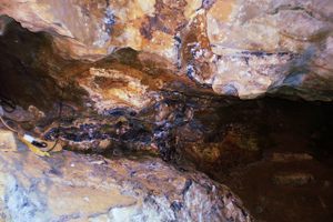
The Odin Mine is quite deep, at one time extending nearly a third of a mile into the hillside. It hasn’t been active since the early 20th century, and what remains of the cavern is now unstable and prone to dangerous collapse. You can still see the entrance, but investigating further in is not advised.   

Around the site you’ll also find a range of plants, called metallophytes, that have evolved to tolerate the lead and other heavy metals in the soil. Some metallophyes actually require the lead to flower. Talk about lemonade from lemons.  

Places

Discover your next amazing Atlas Place.

Get more unusual and extraordinary places each week with the Atlas Obscura Places newsletter.

Your newsletter subscriptions with us are subject to Atlas Obscura's Privacy Policy and Terms of Use.

Know Before You Go

The old mine and crushing circle is just outside of the village of Castleton, near Mam Tor in the High Peak of Derbyshire, England, between Sheffield and Manchester. It is currently owned by the National Trust.

To get to the circle, follow the A6187 (Buxton Road) west out of Castleton towards Chapel-en-le-Frith. Just outside of town bear right and follow what is known as the old Mam Tor Road, but is actually officially “unnamed”. In about a mile you’ll pass the turn-off for the Treak Cliff Cavern, and continue for another half mile. You’ll see the small National Trust sign for the Circle on your left. It’s easy to miss, so follow the GPS lat/long to find the spot. Parking should be easy at the pull-off along the road.

Community Contributors

Dr Alan P Newman profile photo

Added By

Dr Alan P Newman

Published

September 22, 2016

Edit this listing

Make an Edit
Add Photos
Sources
  • https://en.wikipedia.org/wiki/Odin_Mine
  • http://www.derbyshireheritage.co.uk/Menu/Archaeology/Mines/Lead/odin-mine.php
  • http://www.waymarking.com/waymarks/WMNKY4_Crushing_Circle_Odin_Mine_Castleton_Derbyshire

Related Tags

Mines Caves Mechanical Instruments Ecosystems
Horse-Powered Ore Crusher
Unnamed Road
(off Buxton Road)
Hope Valley, England
United Kingdom
53.348016, -1.79974
Visit Website
Get Directions

Nearby Places

Blue John Cavern

Hope Valley, England

miles away

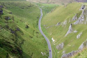
Winnats Pass

Hope Valley, England

miles away

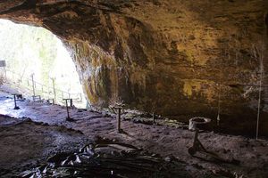
Peak Cavern's Rope Factory

Castleton, England

miles away

Explore the Destination Guide

Photo of Hope Valley

Hope Valley

England

Places 6

Nearby Places

Blue John Cavern

Hope Valley, England

miles away

Winnats Pass

Hope Valley, England

miles away

Peak Cavern's Rope Factory

Castleton, England

miles away

Explore the Destination Guide

Photo of Hope Valley

Hope Valley

England

Places 6

Related Places

  • Entrance to the ice cave at Bixby State Preserve.

    Edgewood, Iowa

    Ice Cave of Bixby State Preserve

    Chilly air billows out from the entrance of an abandoned mine on a steep hillside, providing a refuge for Ice Age fauna and flora.

  • Äventyrsgruvan Tuna-Hästberg (Tuna-Hästberg Adventure Mine)

    Borlänge V, Sweden

    Äventyrsgruvan Tuna-Hästberg (Tuna-Hästberg Adventure Mine)

    A centuries-old iron mine is now a paradise for explorers, divers, and spelunkers.

  • Tomnadashan Copper Mine.

    Ardtalnaig, Scotland

    Tomnadashan Mine

    Monty Python fans will recognize this abandoned mine as the Cave of the Killer Rabbit of Caerbannog.

  • Rope making equipment in the cave mouth, looking out.

    Castleton, England

    Peak Cavern's Rope Factory

    Some of England's last cave dwellers lived and worked within this huge cave.

  • "The Umbrella" at the base of the gorge

    Şuşa, Azerbaijan

    Hunot Gorge

    A scenic canyon with thick forests and historic ruins.

  • Pekelné Doly, or "Mines of Hell," motorcycle club.

    Cvikov, Czechia

    Pekelné Doly (Mines of Hell)

    The largest manmade caves in Europe now function as a motorbike club's headquarters.

  • Cell phone light trails illuminating the caves of Mønsted Kalkgruber.

    Stoholm, Denmark

    Mønsted Kalkgruber

    Nearly 40 miles and 1,000 years of limestone mines under Denmark.

  • Bounce Below

    Blaenau Ffestiniog, Wales

    Llechwedd Caverns Trampoline Park

    A subterranean playground in an abandoned slate mine.

Aerial image of Vietnam, displaying the picturesque rice terraces, characterized by their layered, verdant fields.
Atlas Obscura Membership

Become an Atlas Obscura Member


Join our community of curious explorers.

Become a Member

Get Our Email Newsletter

Follow Us

Facebook YouTube TikTok Instagram Pinterest RSS Feed

Get the app

Download the App
Download on the Apple App Store Get it on Google Play
  • All Places
  • Latest Places
  • Most Popular
  • Places to Eat
  • Random
  • Nearby
  • Add a Place
  • Stories
  • Food & Drink
  • Itineraries
  • Lists
  • Video
  • Podcast
  • Newsletters
  • All Trips
  • Membership
  • Feedback & Ideas
  • Community Guidelines
  • Product Blog
  • Unique Gifts
  • Work With Us
  • About
  • FAQ
  • Advertise With Us
  • Advertising Guidelines
  • Privacy Policy
  • Cookie Policy
  • Terms of Use
Atlas Obscura

© 2026 Atlas Obscura. All Rights Reserved.