


About
Erected in 1751, this stone marker indicates the surveyed east-west boundary between the colonies of Pennsylvania and Maryland. The three lower counties of Pennsylvania would eventually become Delaware.

Published
February 20, 2022


Erected in 1751, this stone marker indicates the surveyed east-west boundary between the colonies of Pennsylvania and Maryland. The three lower counties of Pennsylvania would eventually become Delaware.
February 20, 2022


Elkton, Maryland
A rural colonial settlement that contains the remains of a store and cooper.

Lancaster, Massachusetts
Mary Rowlandson's kidnapping ordeal became one of the nation's first best-selling books.

Piscataway, New Jersey
One of the last-standing and most prominent structures from a long-lost colonial port community.

Eastham, Massachusetts
This beautiful Cape Cod beach offers dazzling views and an interesting historical footnote.

Chester, Pennsylvania
Surrounded by industrial sprawl, a small monument marks the site of William Penn's first landing in Pennsylvania.
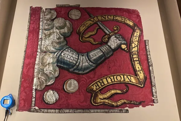
Bedford, Massachusetts
It is the oldest complete surviving flag in the United States, predating the American Revolution, and may have been taken to the Battles of Lexington and Concord.

Coventry, Rhode Island
A former Colonial home and Inn, restored and furnished in the period-style.

Philadelphia, Pennsylvania
It is the oldest remaining stairway William Penn created to give Philadelphia citizens access to the port area.


