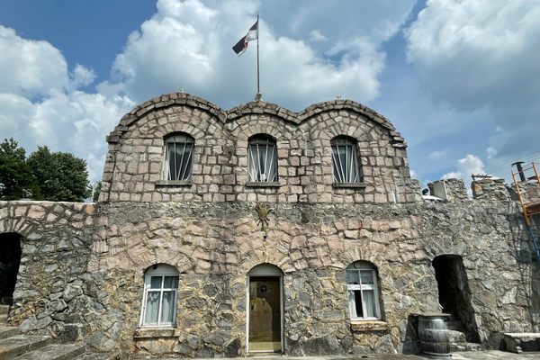
White Otter Castle
This log house sits in the remote Canadian wilderness, and holds a mysterious tale of the trapper who built it.

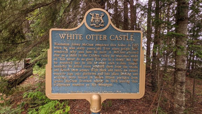

In 1903, trapper Jimmy McOuat stole away into the deep woods of White Otter Lake, some 40 kilometers from the nearest sign of society. Already in his late 40s, he had little to his name but meager earnings he had earned as a farmer—earnings he soon lost after a bad investment in a bankrupt gold mine. With few other options, he turned to trapping.
Feeling lost and having nothing, McOuat recalled an encounter he had had as a young boy, in which he apparently threw a turnip at an old man. Angered, the man cursed him, exclaiming, “Ye’ll never do no good! Ye’ll die in a shack!”
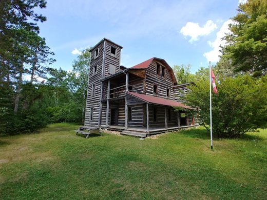
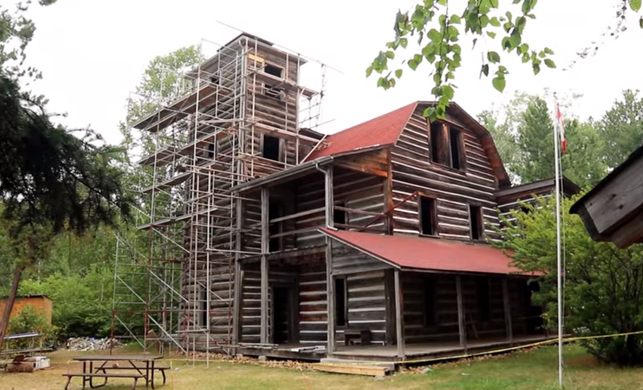
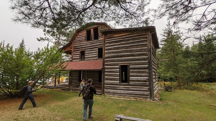
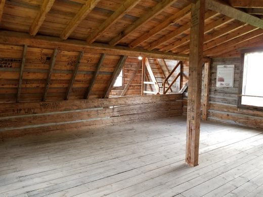
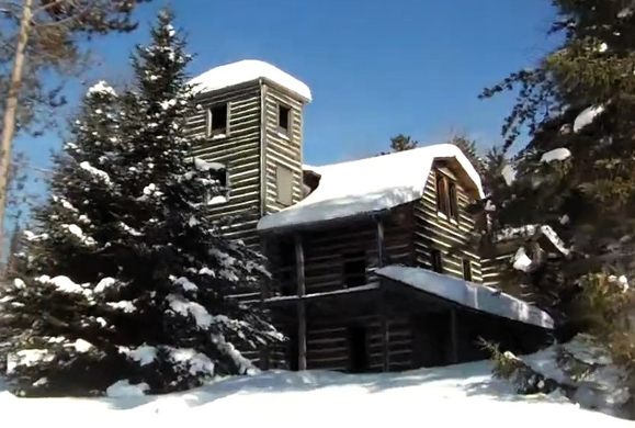
His new turn as a trapper brought him to White Otter Lake, where he soon began construction on his trapper’s lodge, which soon became White Otter Castle. It is made entirely of red pine logs fell and placed by McOuat alone, with some logs weighing as much as 1,600 pounds. The castle stands three stories tall, with a tower adding a few extra feet to its height. As well, roofing and all 26 windows were transported from nearby towns. McOuat completed the main building within a year, and construction finished in 1915.
Visitors would come to see the rumored castle, and McOuat would apparently ask them, “What do you think of my home? You’d never call that a shack, now would you?”
A few years after construction finished, in 1918, McOuat’s body was found not far from his castle. Forest rangers had come looking for the hermit after he had not been seen for the entire winter. He drowned, likely while netting fish, and laid in the cold snow until he was found in the spring of 1919. He was buried not far from his castle.
The castle has been restored twice by the Friends of White Otter Castle, most recently in 2021 which ensured the building was safe and the site was improved.
Know Before You Go
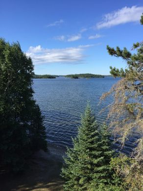
It is possible to reach the castle throughout the year, by winter on snow machines and by summer through canoeing, boating and float plane. Both Ignace and Atikokan (nearby townships) offer information on routes and both offer possible tours. The coordinates are 49°10′16″N 91°54′33″W / 49.17111°N 91.90928°W but a good map is recommended before you plan your visit as this is a very remote location and proper forest safety is key!


Plan Your Trip
The Atlas Obscura Podcast is Back!


Follow us on Twitter to get the latest on the world's hidden wonders.
Like us on Facebook to get the latest on the world's hidden wonders.
Follow us on Twitter Like us on Facebook