Most Canadians Live South of Seattle and Other Map Surprises
We’re wrong about directions and locations of many countries.
“Most Canadians live south of Seattle,” my editor Alex writes. “You probably knew this, but have you ever done a map on that?” I’m pretty sure I have, some years ago on the Strange Maps Facebook page. As I try to locate that particular post, it gets me thinking about other examples of this phenomenon.
Other examples include the counterintuitive fact that Canada extends as far south as California, and the equally unexpected fact that New York City, on the east coast of North America, is actually located to the west of Chile’s capital Santiago, on South America’s west coast.
A few articles ago, I wrote about the original sin of cartography: We expect maps to tell us the truth, but they can’t help lying to us. The examples above don’t fit in that mold. These misconceptions are not the maps’ fault—they’re on us. Why? Because we suffer from Mental Map Oversimplification (MMO). That’s not a real thing like a personality disorder; I just made it up. But it’s still true.

We don’t scrutinize maps. We skim them, remembering what is simple and useful for our understanding of the world rather than what is precise and complex.
True North, strong and free
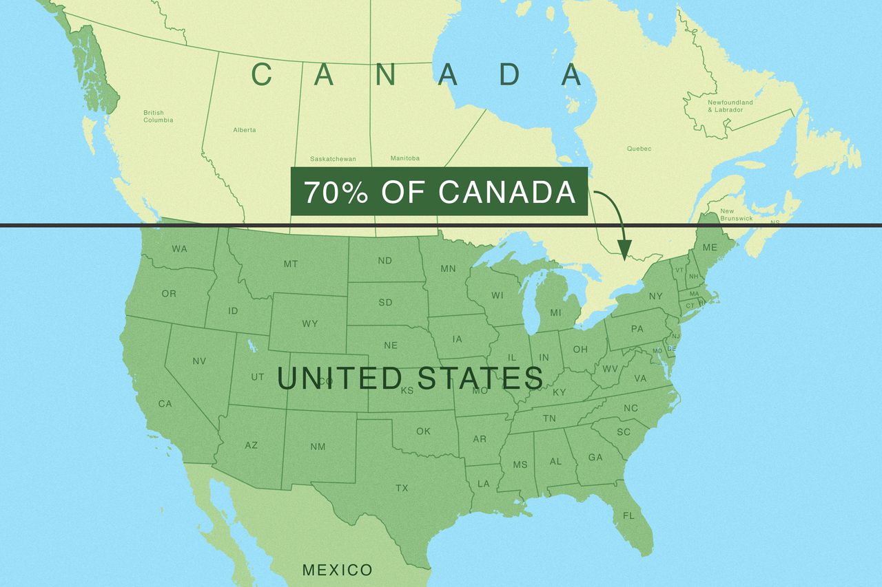
For instance, Canada, especially from an American perspective, is often used as shorthand for “north.” (It’s in their national anthem, anyway.) But upon closer inspection, that fails both geographically and demographically. Canadians are not spread out evenly across Canada. The vastness of the country’s north, and indeed of its geographic center(s), is virtually empty. If anything, Canadians are “southerners” because most of them live in their country’s “Deep South,” close to the U.S. border.
The eastern part of that border dips well below the 49th parallel, where we find large metropolises like Toronto, Ottawa, Montréal, and Québec City. Three often-cited yardsticks describe the lopsidedness of Canada’s demography:
- 90% of Canadians live within 100 miles (160 km) of the U.S. border.
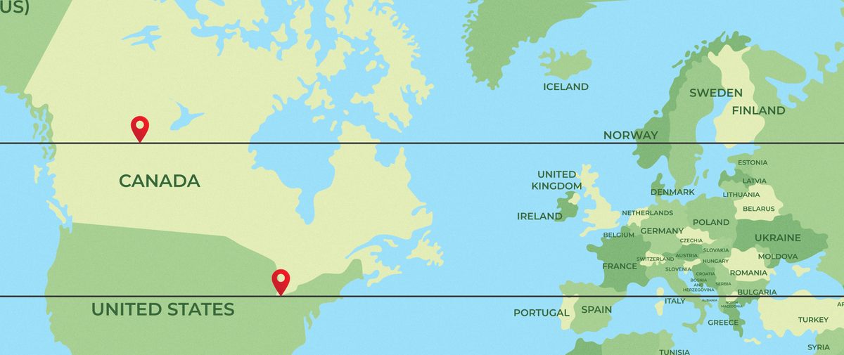
- More than 70% of Canadians live below the 49th parallel.
- More than 60% of Canadians live south of Seattle.
Using the 49th parallel as shorthand for the entire U.S.-Canada border is another MMO. Zoom in on the western part of Lake Erie, and you’ll find Canada’s southernmost speck of dry land: tiny Middle Island, just south of the larger Pelee Island, which is Canada’s southernmost inhabited place (and far enough south to produce wine).
No fewer than 13 U.S. states are entirely to the north of Middle Island, and a further 14 partially so, including Utah, Nevada, and California. Draw that parallel through Middle Island all the way across the Atlantic and we find—again, counterintuitively—that the southernmost point of Canada is roughly equilatitudinal with Barcelona and Rome.

MMOs go global
MMOs go much further than Canada’s surprising southernness. Did you know that Reno is farther west than Los Angeles? You’re surprised because Nevada is east of California. But it’s true: The border between both states only partially goes north-to-south. Just past Reno, it turns to the southeast, hence the seemingly strange positioning of both cities.
There’s a similar strangeness about the fact that Atlanta, the capital of Georgia, is in fact to the west of Detroit, Michigan. Another surprise: New York City is well to the west of Chile’s capital Santiago. Across the pond, Brits find it hard to believe that Edinburgh, Scotland is west of Bristol, in England’s southeast.
Why is that surprising? In a word: oversimplification. We think of North America as simply north of South America (and Scotland as merely north of England), glossing over the fact that they’re not just neatly stacked right on top of each other.
We’ve got you surrounded
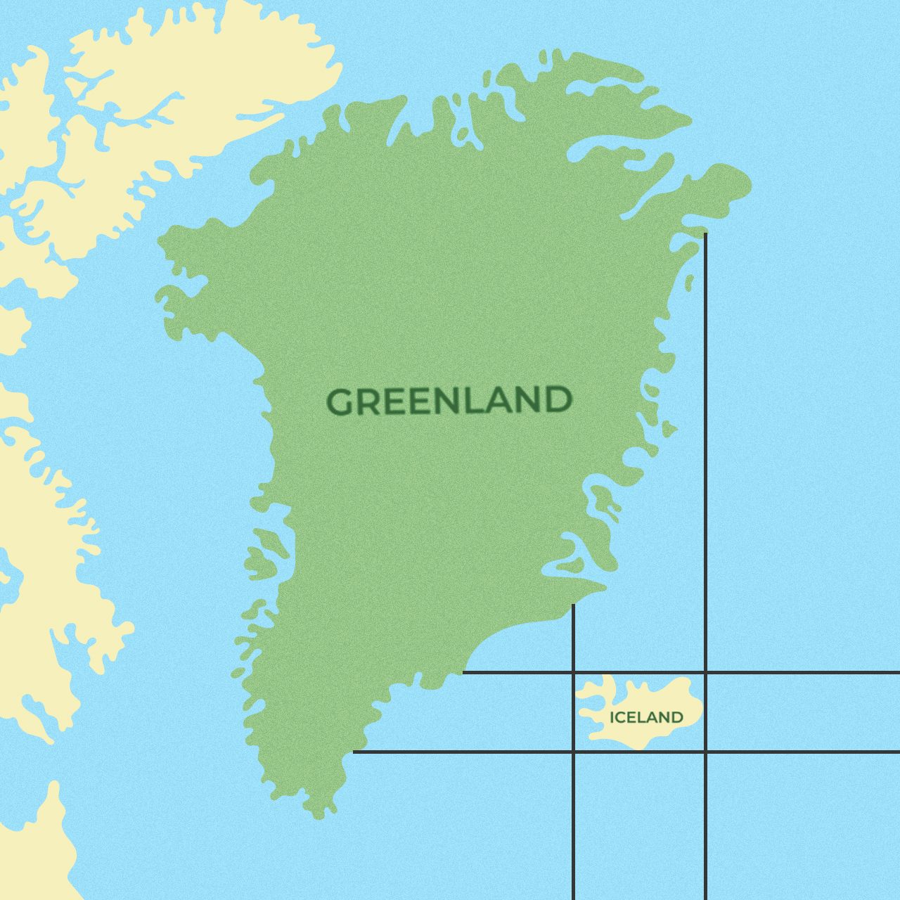
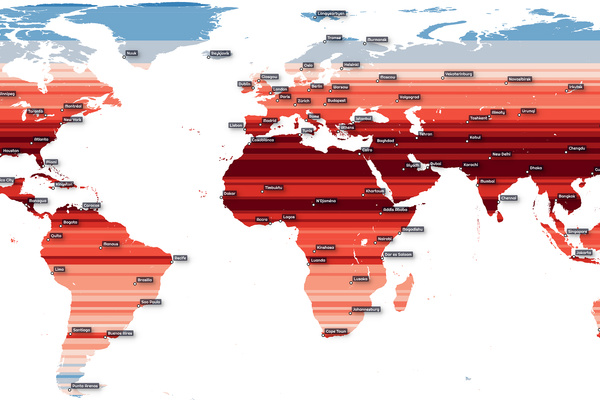
On the subject of cardinal directions, here’s another counterintuitive geographical fact: Greenland is to the north, east, west, and south of Iceland. Just reading it, that sounds impossible. Surely, when it comes to east or west (and north or south), it’s always either-or? But the above map proves at a glance that that’s an MMO. The same goes for Japan, which “surrounds” not just South but also North Korea in all four directions; China, which envelops Bangladesh; and Africa, which is all around Madagascar.
A similar MMO is West Virginia, because it’s not west of Virginia at all. The only direction in which the Mountain State extends beyond the Old Dominion is north. Actually, “North Virginia” would have been a better name for the state, seeing that it seceded in the 1860s to join the Northern cause against the South in the U.S. Civil War.
More MMOs?
- Not only is Santiago de Chile farther east than New York City, but the whole of South America is farther east than Michigan.
- 70% of Canadians live below the 49th parallel? How about the fact that more than 75% of Americans live east of the 100th meridian? (And yet the country’s most populous state is west of that line).
- The Atlantic entrance to the Panama Canal is actually farther west than its Pacific entrance.
Could we go on? We might. If you have cool examples of Mental Map Oversimplifications, let us know and we’ll post them here.
This article originally appeared on Big Think, home of the brightest minds and biggest ideas of all time. Sign up for Big Think’s newsletter.


Follow us on Twitter to get the latest on the world's hidden wonders.
Like us on Facebook to get the latest on the world's hidden wonders.
Follow us on Twitter Like us on Facebook