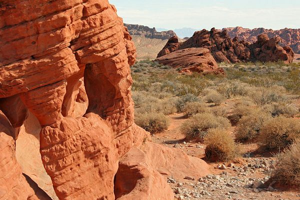
Trips Places Foods Stories Newsletters
Loading...
Loading...
Loading...
Loading...

No search results found for
“”

Make sure words are spelled correctly.

Try searching for a travel destination.

Places near me Random place

Popular Destinations

  • Paris
  • London
  • New York
  • Berlin
  • Rome
  • Los Angeles
Trips Places Foods Stories Newsletters
Sign In Join
Places near me Random place
All the United States Nevada Moapa Arrow Canyon
AO Edited

Arrow Canyon

A hidden slot canyon in the southern Nevada desert makes an unexpected oasis and scenic hike.

Moapa, Nevada

Added By
slgwv
Email
Been Here
Want to go
Added to list
CAPTION
In the lower narrows, looking downstream.   slgwv / Atlas Obscura User
Looking back to the trailhead.   slgwv / Atlas Obscura User
View to the right.   slgwv / Atlas Obscura User
Upstream view just beyond the trailhead.   slgwv / Atlas Obscura User
More cable marking the end of vehicle access.   slgwv / Atlas Obscura User
The municipal well. Passenger cars need to park here.   slgwv / Atlas Obscura User
Entrance to the access road. Note the white sign to the right.   slgwv / Atlas Obscura User
Upstream view.   slgwv / Atlas Obscura User
Tilted limestone layers.   slgwv / Atlas Obscura User
Upstream view   slgwv / Atlas Obscura User
Flotsam-wrapped bushes, from a flood.   slgwv / Atlas Obscura User
Lush vegetation–by southern Nevada standards!   slgwv / Atlas Obscura User
Upstream approach to Arrow Canyon, looking downstream.   slgwv / Atlas Obscura User
Arrow Canyon upstream entrance in the distance.   slgwv / Atlas Obscura User
The side canyon soon opens out.   slgwv / Atlas Obscura User
Arrow Canyon upstream (western) entrance.   slgwv / Atlas Obscura User
Arrow Canyon Dam from below.   slgwv / Atlas Obscura User
Standing water in upper Arrow Canyon.   slgwv / Atlas Obscura User
Arrow Canyon Dam from upstream.   slgwv / Atlas Obscura User
At the official trailhead. Note the cable blocking further vehicle travel.   slgwv / Atlas Obscura User
Upstream.   slgwv / Atlas Obscura User
View to the right.   slgwv / Atlas Obscura User
Upstream view.   slgwv / Atlas Obscura User
Wider again.   slgwv / Atlas Obscura User
The lower narrows, looking downstream.   slgwv / Atlas Obscura User
Vehicle access stops here!   slgwv / Atlas Obscura User
View back downstream.   slgwv / Atlas Obscura User
Upper narrows.   slgwv / Atlas Obscura User
Sediment apron in the lower narrows.   slgwv / Atlas Obscura User
Going downstream from the western (upstream) approach.   slgwv / Atlas Obscura User
Beavertail cactus in bloom.   slgwv / Atlas Obscura User
The lower narrows appears.   slgwv / Atlas Obscura User
The lower narrows approaches.   slgwv / Atlas Obscura User
Inside the lower narrows.   slgwv / Atlas Obscura User
The big side canyon on the left, with a sediment apron.   slgwv / Atlas Obscura User
The sediment apron from the side canyon.   slgwv / Atlas Obscura User
Above the side canyon the sediment is much finer.   slgwv / Atlas Obscura User
Upper narrows looming.   slgwv / Atlas Obscura User
Prickly pear in bloom.   slgwv / Atlas Obscura User
Exiting the lower narrows, downstream.   slgwv / Atlas Obscura User
Into the side canyon.   slgwv / Atlas Obscura User
Barrel cactus up the left slope.   slgwv / Atlas Obscura User
At the trailhead, looking back.   slgwv / Atlas Obscura User
Barrel cactus.   slgwv / Atlas Obscura User
Back into the narrows, going downstream.   slgwv / Atlas Obscura User
In the side canyon.   slgwv / Atlas Obscura User
Vegetation cover, looking back downstream,   slgwv / Atlas Obscura User
View upstream.   slgwv / Atlas Obscura User
Inside the lower narrows.   slgwv / Atlas Obscura User
Into the lower narrows.   slgwv / Atlas Obscura User
Been Here
Want to go
Added to list

About

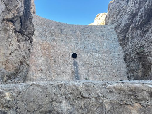
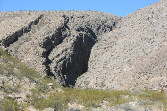
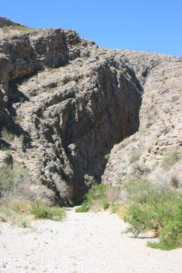
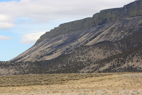
An unusual slot canyon in tilted limestone beds at a narrows on Pahranagat Wash, a normally dry tributary to the Colorado River system. It's blocked at the upstream end by Arrow Canyon Dam, a flood-control structure built in the 1930s by the Civilian Conservation Corps.

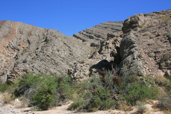
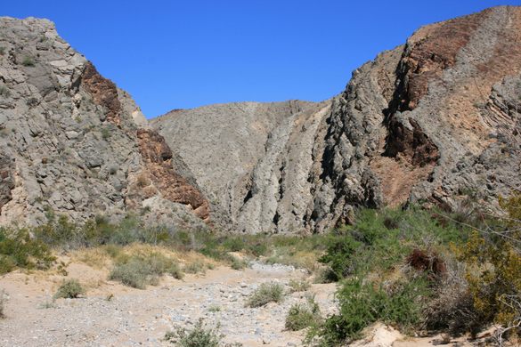
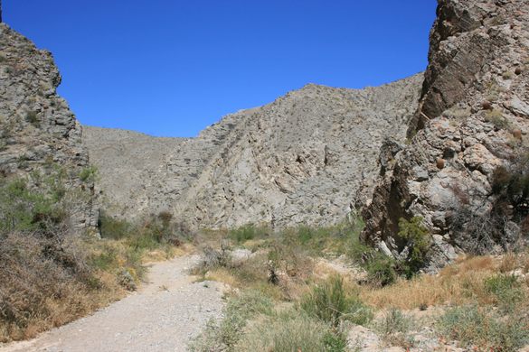
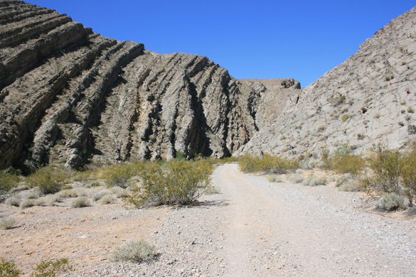
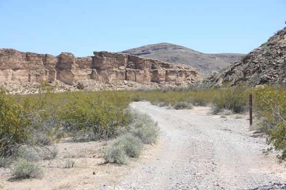
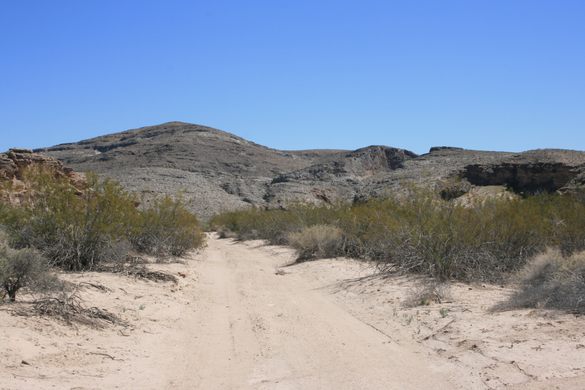
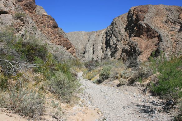
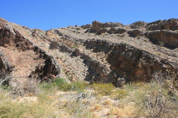
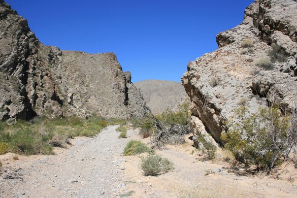
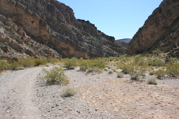
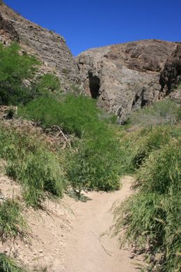
Bypassing the dam requires either a technical climb or a lengthy detour, so it's most straightforward to do an out-and-back from the downstream end. Sources vary, but it's roughly three miles from the official trailhead (marked by signs and cable barriers across the canyon) to the dam. Because the canyon is cutting through various rock layers, its character—particularly its width—changes quite a bit depending on the rock unit.
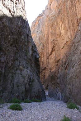
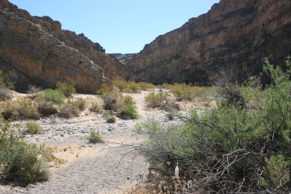
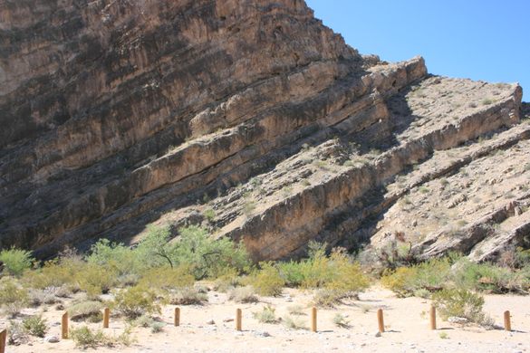
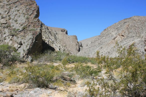
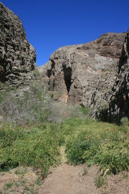
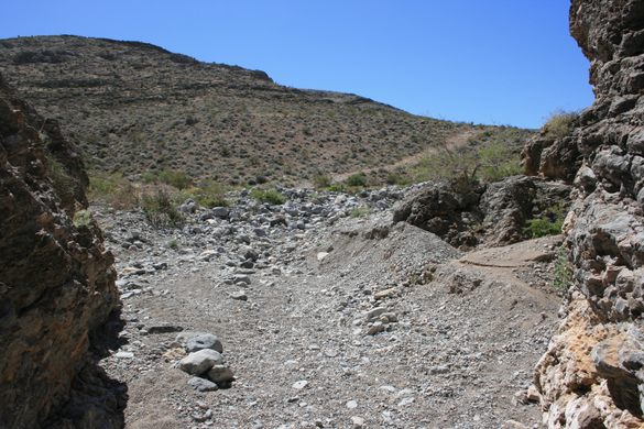
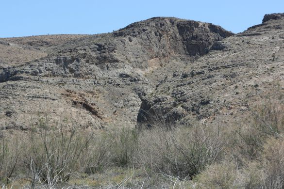
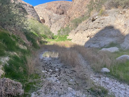
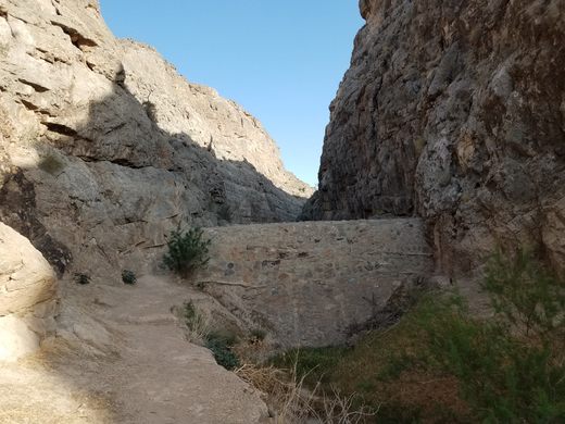
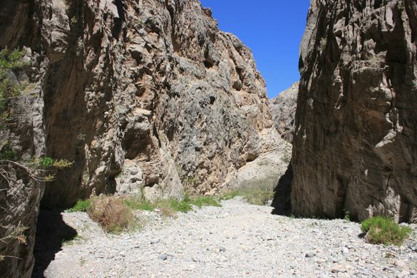
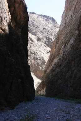
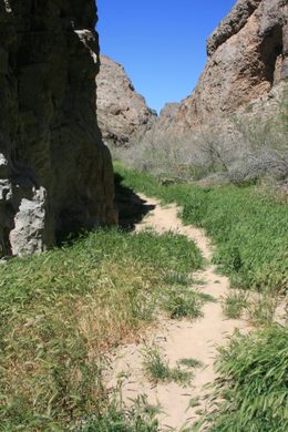
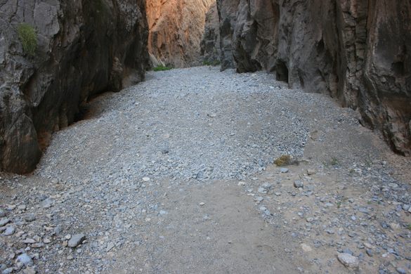
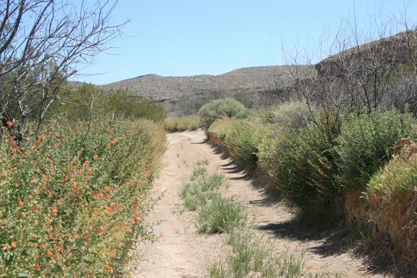
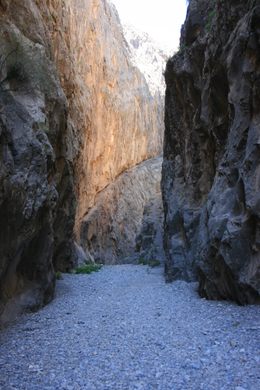
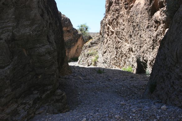
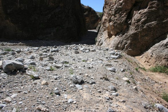
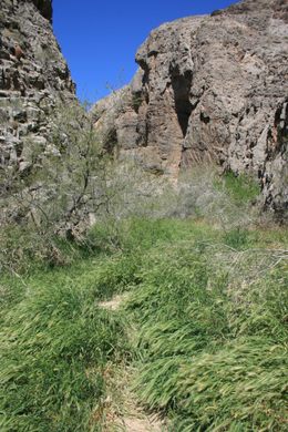
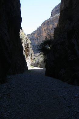
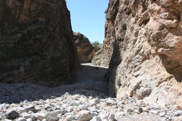
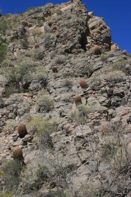
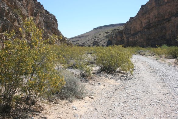
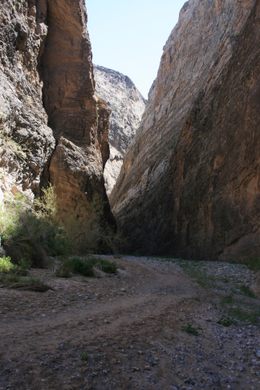
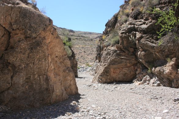
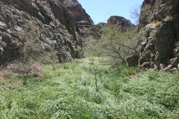
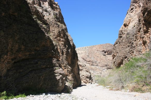
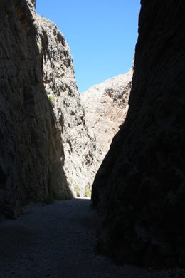
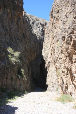
The spectacular "lower narrows" is cut into a massive limestone that in places supports cliffs about 200 feet tall, while the canyon here can be barely 20 feet wide. A prominent side canyon comes in from the left past the narrows; a side trip up it exits into the open desert in a few hundred yards or so. Back in the main canyon, as you continue upstream into the "upper narrows" the soil underfoot becomes much finer, basically dry mud, and it supports a much more luxuriant vegetation cover.

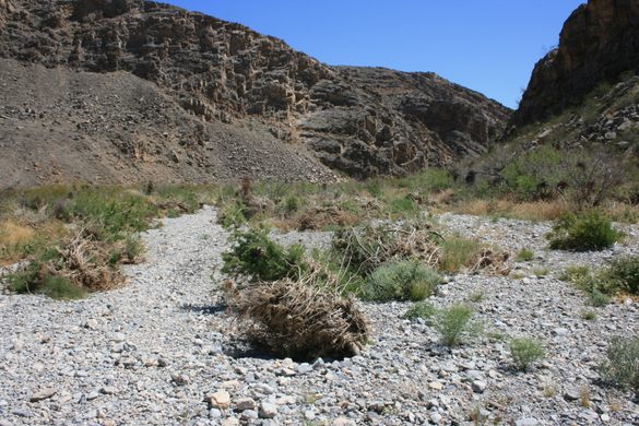
Even though Arrow Canyon Dam should block flash floods coming directly down Pahranagat Wash, it is still prudent to stay out if there are thunderstorms anywhere in the area. There are several large side canyons, like the one mentioned above, coming in below the dam that have clearly carried floods in the recent past.

Related Tags

Canyons Dams Geology Landscapes

Know Before You Go

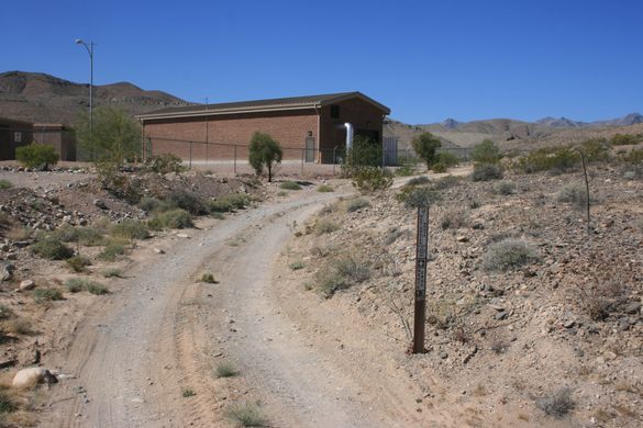
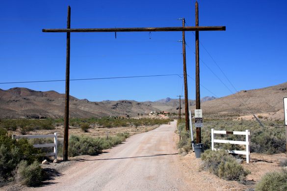
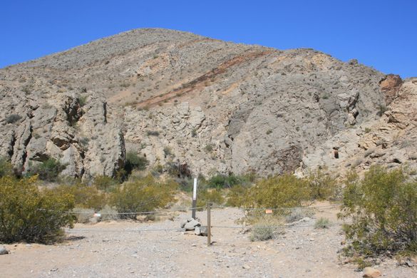
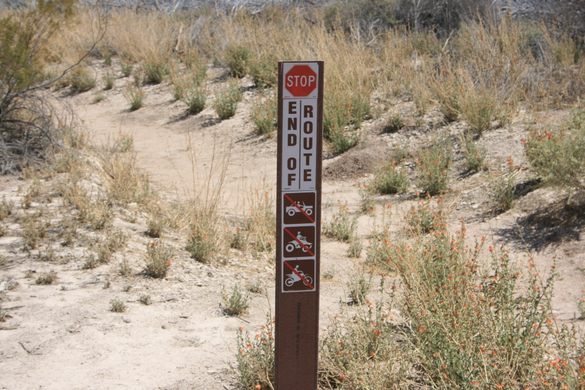
Access is off Nevada State Route 168. Access to the east (downstream) side is via a graded road that turns south about 1/4 mile west of the (paved) Warm Springs Road. This road bypasses private land before coming to a municipal well about 0.6 miles in. Please do not turn into any private driveways. Ordinary passenger cars can park by the well. High-clearance vehicles can follow the continuation of the road, where it finally drops into the main wash, and go all the way to the official trailhead, about another 1.5 miles. The trailhead is marked by cable barriers preventing further vehicle access.

On the west (upstream) side, take the Deadman Wash road south. The junction is about 4.9 miles west of Warm Springs Road.   Follow the road about 1.9 miles to the Pahranagat Wash drainage and turn left. The wash will drop toward Arrow Canyon, visible as the gap ahead, and in less than a mile there will be a barrier and a sign preventing further vehicle access.   It's then an easy walk down to the top of Arrow Canyon dam, but once again continuing requires a rappel or a big detour.

Update as of October 2022: Parking is no longer allowed by the municipal well. The BLM has constructed an unpaved parking lot about 200 yards along the track that continues to the trailhead.  With care, ordinary passenger cars should be able to access this lot. However, high clearance and 4wd are now mandatory for going all the way to the trailhead due to extensive washouts. 

Community Contributors

Added By

slgwv

Published

July 2, 2021

Edit this listing

Make an Edit
Add Photos
Sources
  • https://www.stavislost.com/hikes/trail/arrow-canyon
  • https://www.birdandhike.com/Hike/Wilderness/Arrow/Arrow_Cyn/_ArrowCyn.htm
Arrow Canyon
Arrow Canyon Access Rd
Moapa, Nevada, 89025
United States
36.732143, -114.747949
Visit Website
Get Directions

Nearby Places

Moapa Airmail Arrow

Moapa Valley, Nevada

miles away

RyanHenge

Alamo, Nevada

miles away

Lost City Museum

Overton, Nevada

miles away

Explore the Destination Guide

Photo of Nevada

Nevada

United States

Places 265
Stories 24

Nearby Places

Moapa Airmail Arrow

Moapa Valley, Nevada

miles away

RyanHenge

Alamo, Nevada

miles away

Lost City Museum

Overton, Nevada

miles away

Explore the Destination Guide

Photo of Nevada

Nevada

United States

Places 265
Stories 24

Related Places

  • View of Frank Triguero homestead site from the canyon rim.

    Bruneau, Idaho

    Bruneau Canyon

    The "Grand Canyon of Southwestern Idaho" makes a spectacular gash across the flat Snake River plain.

  • Rambla de Barrachina

    Villaspesa, Spain

    Rambla de Barrachina

    The geomorphology of the Turia Valley could easily be mistaken for Utah or Arizona.

  • Lake Forest, California

    Red Rock Canyon

    A striking geological formation in Southern California.

  • Rock formations in Kokkala Gorge.

    Shayyr, Kazakhstan

    Kokkala Gorge

    Jurassic clays where the dinosaurs once roamed.

  • The winding curves of Ybykty Canyon.

    Koyulus, Kazakhstan

    Ybykty Canyon

    This small canyon is home to a treasure trove of geological oddities.

  • Window arch in the City of Rocks.

    Almo, Idaho

    City of Rocks

    This U.S. natural reserve is an ancient spiritual place and rock climber’s paradise.

  • Healy, Alaska

    Suntrana Canyon

    This often-overlooked canyon dazzles and intrigues with its many layers of colors, shapes and odd formations.

  • Looking down the Gorge from the footbridge at its head.

    Tuttle, Idaho

    Malad Gorge

    Some 46,000 years ago, a volcanic eruption led to a flooding event that carved this short canyon with steep vertical walls.

Aerial image of Vietnam, displaying the picturesque rice terraces, characterized by their layered, verdant fields.
Atlas Obscura Membership

Become an Atlas Obscura Member


Join our community of curious explorers.

Become a Member

Get Our Email Newsletter

Follow Us

Facebook YouTube TikTok Instagram Pinterest RSS Feed

Get the app

Download the App
Download on the Apple App Store Get it on Google Play
  • All Places
  • Latest Places
  • Most Popular
  • Places to Eat
  • Random
  • Nearby
  • Add a Place
  • Stories
  • Food & Drink
  • Itineraries
  • Lists
  • Video
  • Podcast
  • Newsletters
  • All Trips
  • Family Trip
  • Food & Drink
  • History & Culture
  • Wildlife & Nature
  • FAQ
  • Membership
  • Feedback & Ideas
  • Community Guidelines
  • Product Blog
  • Unique Gifts
  • Work With Us
  • About
  • FAQ
  • Advertise With Us
  • Advertising Guidelines
  • Privacy Policy
  • Cookie Policy
  • Terms of Use
Atlas Obscura

© 2025 Atlas Obscura. All Rights Reserved.