AO Edited
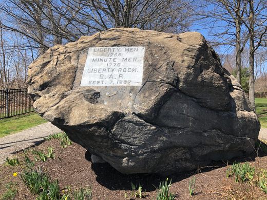
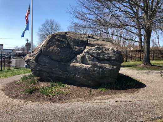
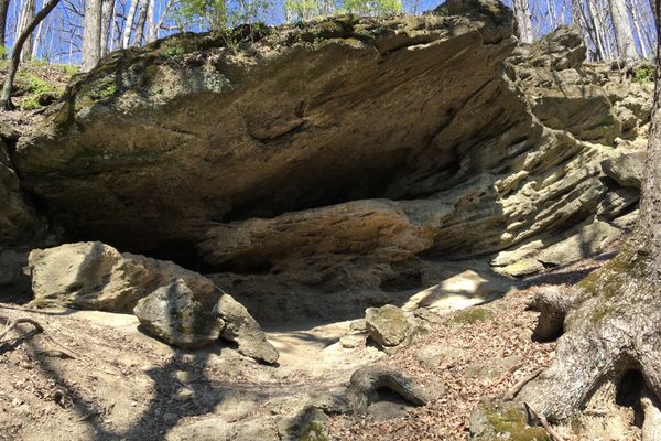
Liberty Rock
This large boulder was used as a lookout point by Revolutionary War militiamen.


During the Revolutionary War, coastal Connecticut towns such as Milford were particularly vulnerable to invasion by British troops.
To watch for redcoats, lookouts would often stand atop a 10-foot tall glacial erratic boulder that was at the time, the highest point in the town. From here, a guard could see Long Island Sound and the mouth of the nearby Housatonic River. They could also scan the nearby Boston Post Road, a major mail-delivery route that ran from New York to Boston.
Originally, the boulder was known as Hog Rock due to its resemblance to a large pig, but was given its current name in 1897 in honor of its place in local Revolutionary War history.
The letters “PP” and the date “1776” were allegedly carved into the rock by local militia leader Peter Pierett, who eventually joined the famous Minute Men.
Liberty Rock is the central focus of a small neighborhood park.
Know Before You Go
The entrance to Liberty Rock Park is in a residential area at the corner of Hackett Ave and Oldroyd St. Parking is available at nearby local businesses.


Plan Your Trip
The Atlas Obscura Podcast is Back!


Follow us on Twitter to get the latest on the world's hidden wonders.
Like us on Facebook to get the latest on the world's hidden wonders.
Follow us on Twitter Like us on Facebook