Mount Roraima Tripoint Marker
A pyramidal marker where the borders of Venezuela, Brazil, and Guyana meet on top of Mount Roraima.
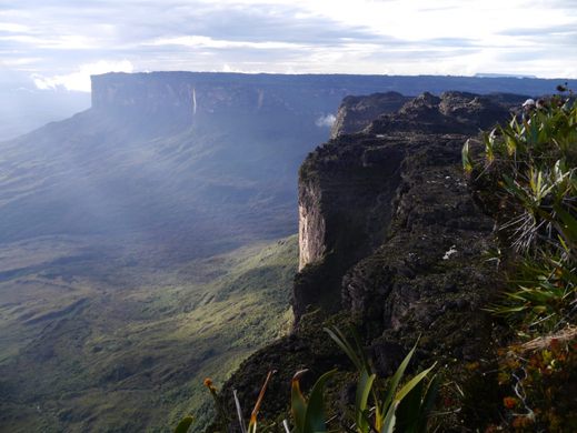

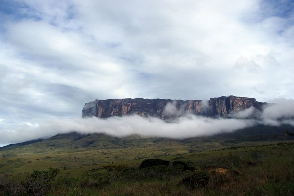
Signs of human activity are hard to come by on the plateau of Mount Roraima, a sandstone tepui, or table-top mountain, that rises out of the jungle below. But on the mesa sits a small man-made marker that marks that spot at which the borders of Venezuela, Brazil, and Guyana meet.
The 12-square-mile summit area of Mount Roraima was unexplored until 1884. What at first appeared to be a barren landscape above the teeming jungle was soon discovered to harbor many fascinating plants that had adapted to the environment, dotted with caves and canyons.
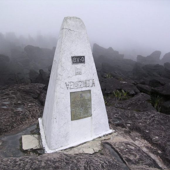
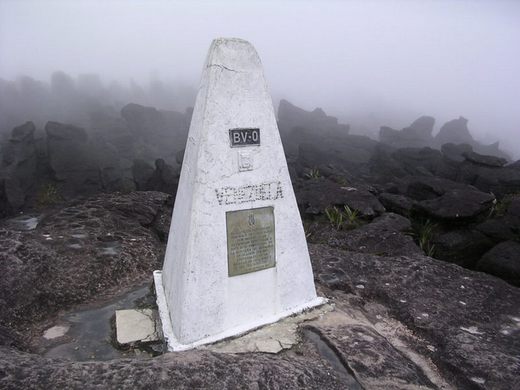
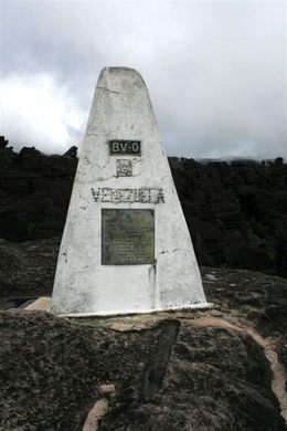
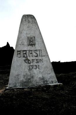
One of the rare signs of a human activity on the tepui (meaning “house of the gods” in the native Pemon language) is a whitewashed stone pyramidal structure. About seven feet tall, the marker sits on the tripoint where the borders of Venezuela, Brazil, and Guyana all meet.
The Mount Roraima tripoint marker was erected during a joint expedition between Venezuela, Brazil and British Guiana in 1931 (Guyana achieved its independence from the United Kingdom on May 26, 1966). One side of the marker is clearly marked with the word “Brasil” and the nation’s national shield, and the other with “Venezuela.” The Venezuelan side also bears a bronze plaque and the geographical marker “BV-0,” referring to the zero point between the two national boundaries (with no mention of Guyana). The Guyanese side, meanwhile, is almost blank save for some barely legible and crudely done lettering (you can see it in this 360-degree image).
Even this isolated table-top mountain couldn’t escape political squabbling. Venezuela and Guyana have been engaged in a long-running border dispute stemming from Venezuela’s claims to the western portion of Guyana, which it claims as the Venezuelan region of Guayana Esequiba (and which, if recognized internationally, would push Guyana off the top of Mount Roraima and then some). Hence the “BV-0” and Venezuela’s stanch lack of recognition of Guyana’s place on the tripiont marker.
But as things stand, any adventurous soul who manages to reach the summit area of Mount Roraima can wrap his or her arms around the tripoint marker and claim to be in three different countries at once.
Know Before You Go
The only non-technical route to the top of Mount Roraima is via the Paraitepui route from Venezuela. All other approaches involve climbing gear and a healthy dose of experience. Tour companies organize six-day guided hikes to the summit from the nearby town of Santa Elena de Uairen in Venezuela. If you hate trekking and have money to burn, it's possible to charter a helicopter up to the plateau.
Community Contributors

Edited by
Plan Your Trip
The Atlas Obscura Podcast is Back!


Follow us on Twitter to get the latest on the world's hidden wonders.
Like us on Facebook to get the latest on the world's hidden wonders.
Follow us on Twitter Like us on Facebook