Trips Places Foods Stories Newsletters
Loading...
Loading...
Loading...
Loading...

No search results found for
“”

Make sure words are spelled correctly.

Try searching for a travel destination.

Places near me Random place

Popular Destinations

  • Paris
  • London
  • New York
  • Berlin
  • Rome
  • Los Angeles
Trips Places Foods Stories Newsletters
Sign In Join
Places near me Random place
All the United States New York State New York City Dobbs Ferry Old Croton Aqueduct Trail

Old Croton Aqueduct Trail

This once-grand marvel of engineering is now 41 miles of scenic hiking trail.

Dobbs Ferry, New York

Added By
Kimberly Wadsworth
Email
Been Here
Want to go
Added to list
CAPTION
Old Croton Aqueduct Trail   Kristine Paulus via Flickr
Weir Chamber, Sleepy Hollow.   Beyond My Ken via Wikimedia Commons
Shutting Off The Croton   Harpers Weekly, 1881 via Wikimedia Commons
Inside the Weir chamber   Avoiding Regret
  Avoiding Regret
Ventilator #9   Avoiding Regret
  missingfilm / Atlas Obscura User
Been Here
Want to go
Added to list

About

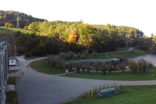
The Old Croton Aqueduct Trail is a popular destination for New York City hikers; it’s fairly straight, isn't steep, and is close by public transit. But this trail is actually the remains of one of New York’s most ambitious early engineering projects.

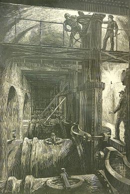
After the Revolutionary War, Manhattan Island faced a fresh water crisis as the population swelled and the streams and ponds that had previously supplied the growing city were quickly overwhelmed. In the 1830s, after fighting off epidemics of water-borne diseases like cholera, the city stepped in, building an aqueduct that drew water from the Croton River, over 40 miles to the north. Powered entirely by gravity, the aqueduct carried water in an eight-foot-wide iron pipe from the Croton River down along the Hudson, across the Harlem River, and into Manhattan, where the water was collected in a pair of reservoirs, one at 42nd Street and one at 78th, before being pumped out to an increasingly thirsty city. Over 35 million gallons flowed through the aqueduct daily, with such force that a decorative fountain fed by the aqueduct gushed water 50 feet into the air.

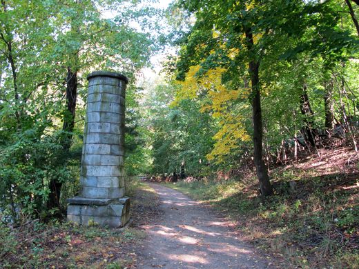
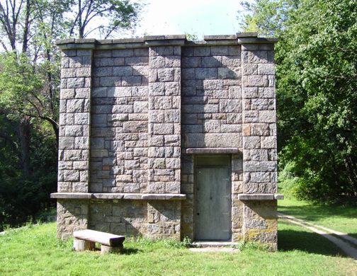
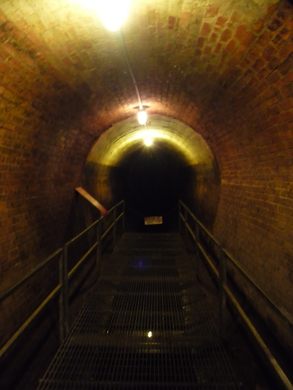
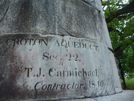
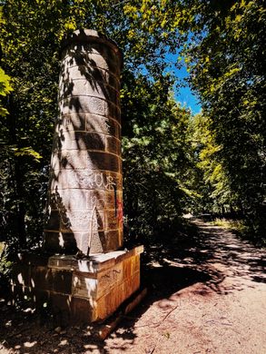
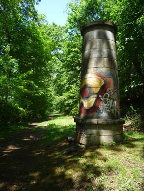
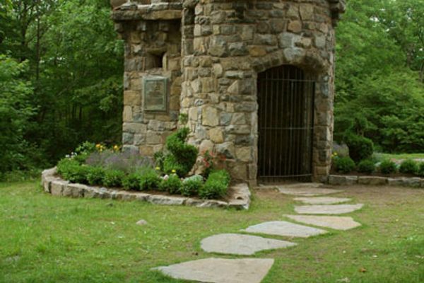
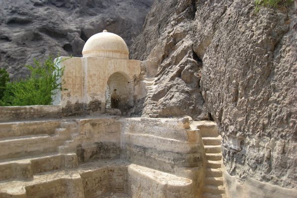
For most of its route the aqueduct pipe ran underground. Workers dug ditches along the route, carefully keeping the pipe on a gradual slope that dropped only 13 inches per mile. Every few miles they also built vents into the pipe to allow for air circulation, which alleviated excess pressure and kept the water as fresh as possible. A handful of "weir" stations also dotted the path—structures that let workers access the tunnel, to either alter the water’s flow or do other repair work.

Within only 40 years, however, the pace of the city’s growth had already outstripped the capacity of the aqueduct to adequately supply New York with drinking water, and the city added a second, even bigger aqueduct in 1890, which supplies a portion of the city’s water even today. The 42nd Street reservoir was drained in 1911 to make room for the New York Public Library's main branch, and the other was drained in 1940 and filled in to create Central Park’s Great Lawn. The aqueduct itself stayed in service another fifteen years longer before being sealed in 1955.

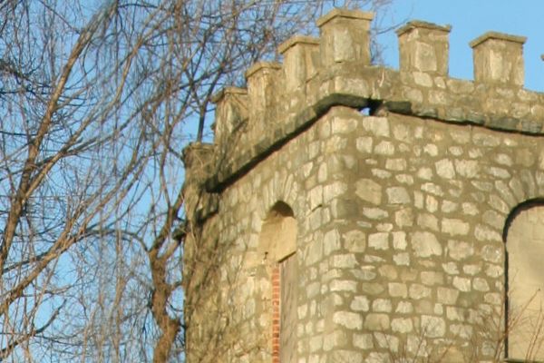
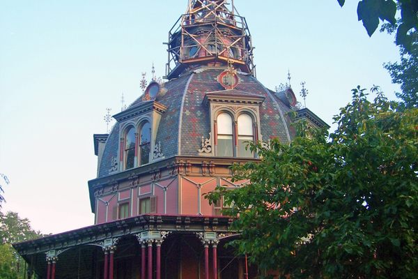
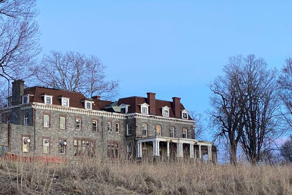
Created for hikers in 1968, the Old Croton Aqueduct Trail largely follows the path of the original aqueduct—at times even running directly on top of the underground pipe. Some of the original stone vents and weirs still loom along the trail as well, and in some locations—chiefly upstate— park rangers even offer tours of the structures.  In New York City itself, the trail runs through Van Cortlandt Park before disappearing among the city streets, where it can be hard to spot—but three gatehouses, which also offered workers access to the tunnel, are strewn along Amsterdam Avenue in Harlem, marking the path of the Old Croton Aqueduct’s final stretch.

Related Tags

Engineering Abandoned Waterworks Water

Know Before You Go

Take the Metro-North Hudson line to Hastings-on-Hudson, Dobbs Ferry, or other towns along the route and walk uphill to the trail. Maps of the trail are available from Friends of the Old Croton Aqueduct: http://aqueduct.org. The trail runs from Croton-on-Hudson in Westchester County to Van Cortlandt Park in the Bronx. A visitor's center with exhibits, a restroom, drinking fountain, and knowledgeable volunteers can be found at the restored Keeper's House in Dobbs Ferry open on Saturdays and Sundays from 1 p.m. to 4 p.m. Frequent walking tours and opportunities to descend into the Ossining Weir offered by the Friends of the Old Croton Aqueduct. Patches and certificates are awarded to those who finish the Westchester (26 miles) or the entire trail (41 miles).

Community Contributors

Added By

Kim W

Edited By

klgates, lampbane, dlc31723, kemartin2015...

  • klgates
  • lampbane
  • dlc31723
  • kemartin2015
  • Avoiding Regret
  • missingfilm

Published

September 3, 2014

Edit this listing

Make an Edit
Add Photos
Sources
  • http://nysparks.com/parks/96/details.aspx
  • http://en.wikipedia.org/wiki/Croton_Aqueduct
  • http://aqueduct.org
Old Croton Aqueduct Trail
13 Walnut St
Dobbs Ferry, New York, 10522
United States
41.01169, -73.876737
Visit Website
Get Directions

Nearby Places

St. Cabrini Novitiate

Dobbs Ferry, New York

miles away

The Armour-Stiner Octagon House

Irvington, New York

miles away

Lenoir Preserve

Yonkers, New York

miles away

Explore the Destination Guide

Photo of Dobbs Ferry

Dobbs Ferry

New York

Places 2

Nearby Places

St. Cabrini Novitiate

Dobbs Ferry, New York

miles away

The Armour-Stiner Octagon House

Irvington, New York

miles away

Lenoir Preserve

Yonkers, New York

miles away

Explore the Destination Guide

Photo of Dobbs Ferry

Dobbs Ferry

New York

Places 2

Related Places

  • Levy Mansion (La Rambla)

    Lares, Puerto Rico

    Levy Mansion (La Rambla)

    The location of Puerto Rico's first water bottling plant, thanks to a collaboration between Mother Nature and technology.

  • Bonneville Dam

    North Bonneville, Washington

    Bonneville Lock & Dam

    Boats and fish both find their way through this massive hydroelectric structure.

  • Zaragoza, Spain

    Fountain of the Unbelievers

    The engineer of the Imperial Canal of Aragon installed this fountain to show skeptics he had achieved his aim.

  • El Hamma Water Cooler

    Hammat-al-jarid, Tunisia

    El Hamma Water Cooler

    Geothermal resources are cooled in this oddly-shaped structure before being used for irrigation

  • Wachusett Dam and Reservoir

    Clinton, Massachusetts

    Wachusett Dam and Reservoir

    Once the largest gravity dam in the world.

  • The cisterns of Tawila.

    Aden, Yemen

    Cisterns of Tawila

    This impressive system of tanks was used to store drinking water as long as 2,000 years ago.

  • Washington, D.C.

    Washington Aqueduct Emergency Pumping Station

    These abandoned waterworks are crumbling into the Potomac River.

  • Washington, D.C.

    Abandoned Drawbridge Control Room

    The hidden offices underneath Memorial Bridge have been locked up since 1976.

Aerial image of Vietnam, displaying the picturesque rice terraces, characterized by their layered, verdant fields.
Atlas Obscura Membership

Become an Atlas Obscura Member


Join our community of curious explorers.

Become a Member

Get Our Email Newsletter

Follow Us

Facebook YouTube TikTok Instagram Pinterest RSS Feed

Get the app

Download the App
Download on the Apple App Store Get it on Google Play
  • All Places
  • Latest Places
  • Most Popular
  • Places to Eat
  • Random
  • Nearby
  • Add a Place
  • Stories
  • Food & Drink
  • Itineraries
  • Lists
  • Video
  • Podcast
  • Newsletters
  • All Trips
  • Family Trip
  • Food & Drink
  • History & Culture
  • Wildlife & Nature
  • FAQ
  • Membership
  • Feedback & Ideas
  • Community Guidelines
  • Product Blog
  • Unique Gifts
  • Work With Us
  • About
  • FAQ
  • Advertise With Us
  • Advertising Guidelines
  • Privacy Policy
  • Cookie Policy
  • Terms of Use
Atlas Obscura

© 2025 Atlas Obscura. All Rights Reserved.