Trips Places Foods Stories Newsletters
Loading...
Loading...
Loading...
Loading...

No search results found for
“”

Make sure words are spelled correctly.

Try searching for a travel destination.

Places near me Random place

Popular Destinations

  • Paris
  • London
  • New York
  • Berlin
  • Rome
  • Los Angeles
Trips Places Foods Stories Newsletters
Sign In Join
Places near me Random place
All the United States Michigan Cadillac Old Indian Trail

Old Indian Trail

A series of 33 stone markers maps an ancient 55-mile transportation route.

Cadillac, Michigan

Added By
Rick Brown
Email
Been Here
Want to go
Added to list
CAPTION
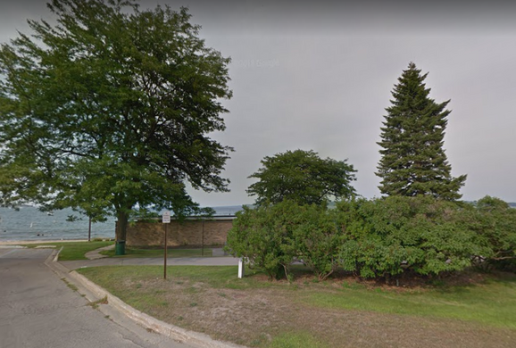
Trail marker #33 at West End Beach in Traverse City.   rickbbiking / Atlas Obscura User
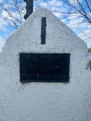
Text on Marker #31.   rickbbiking / Atlas Obscura User
The end of the trail at West End Beach.   Image capture © 2018 Google
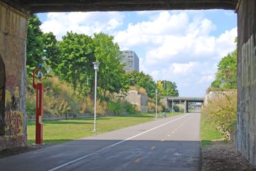
Old Indian Trail at Sleeping Bear Dunes National Lakeshore   Sleeping Bear Dunes National Lakeshore/CC BY 2.0
Marker 1, “Old Indian Trail Cadillac to Traverse City”   RealPineCone / Atlas Obscura User
The beginning of the trail in Cadillac, MI   RealPineCone / Atlas Obscura User
Been Here
Want to go
Added to list

About

Historical records indicate that the Old Indian Trail that runs from Cadillac to Traverse City in western Michigan may date back to as early as 600 B.C. The trail later became an important trade and transportation route for the Native American tribes who were the original inhabitants of this region. 

This trail was used by the Anishnaabe people in the 1200s. They later formed into the Three Fires, consisting of the Ojibwe, Odawa and Potawatomi Tribes. Today, the trail is marked by 33 numbered stone slabs. All but one are situated along modern roadways so they can be seen by driving the scenic 55-mile tour route that follows the trail. The vistas over the Manistee River valley can be particularly impressive along the way. 

These handsome stone markers present a unique and identifiable perspective on the Native American history of the region, by pinpointing a trade and transportation corridor that existed many centuries before Europeans settled in the area. It is also interesting to see how closely some parts of the trail parallel with the major roadways of today.    

Demarcation of this historic route began in the 1940s when a local farmer named Milo Petoskey Crosby placed 14 of the stone markers along the southern portion of the trail, running from Lake Mitchell in Cadillac north to the Manistee River. He spent years researching the history of the trail and walking the area in order to map it out.

Later, five more markers were added by local residents James Comp and Ed Babcock, who picked up the torch after Crosby. In 1987, the final 14 stone markers were installed northward to the trail's terminus at West End Beach in Traverse City. These were placed by the Little Traverse Bay Bands of Odawa Indians and the Grand Traverse Sesquicentennial group. 

Related Tags

Native Americans Trails History Transportation

Know Before You Go

Trespassing onto private property along the tour route is prohibited. Road conditions along the Old Indian Trail can vary, as some of the roads are unpaved. The map coordinates above point to marker #1. The full route can be seen here.

Community Contributors

Added By

rickbbiking

Edited By

Meg, michellecassidy1, RealPineCone

  • Meg
  • michellecassidy1
  • RealPineCone

Published

January 18, 2019

Edit this listing

Make an Edit
Add Photos
Sources
  • https://www.cadillacmichigan.com/member-41/old-indian-trail---cadillac-to-traverse-city-952.html
  • http://explorecadillac.org/2015/12/04/old-indian-trail-cadillac-to-traverse-city/
  • https://www.michigan.org/old-indian-trail
  • https://www.nps.gov/slbe/planyourvisit/trailoldindian.htm
Old Indian Trail
Hiawatha Drive
Cadillac, Michigan
United States
44.264169, -85.470954
Visit Website
Get Directions

Nearby Places

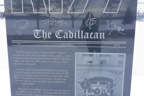
Cadillac's KISS Monument

Cadillac, Michigan

miles away

The Bottle House

Kaleva, Michigan

miles away

Idlewild

Idlewild, Michigan

miles away

Explore the Destination Guide

Photo of Cadillac

Cadillac

Michigan

Places 2

Nearby Places

Cadillac's KISS Monument

Cadillac, Michigan

miles away

The Bottle House

Kaleva, Michigan

miles away

Idlewild

Idlewild, Michigan

miles away

Explore the Destination Guide

Photo of Cadillac

Cadillac

Michigan

Places 2

Related Stories and Lists

18 Trails That Traverse History

List

By Jonathan Carey

Related Places

  • Looking up the pass. The trestle seems a lot narrower than it is.

    Winter Park, Colorado

    Devil's Slide Trestles

    These decaying bridges 1,000 feet high are a reminder of the skill it took to cross the Colorado Rockies by rail.

  • Tampa, Florida

    Princess Ulele Statues

    Tampa’s most famous native royal comes alive in a duo of arresting bronze statues.

    Sponsored by VISIT TAMPA BAY
  • One side of the Dodge Mining Camp Cabin was exposed to its original 1827 appearance.

    Dodgeville, Wisconsin

    Dodge Mining Camp Cabin

    This 200-year-old cabin was the home of some of the first Wisconsin “badgers” and the site of the broken promises that led to their arrival.

  • Three Island Crossing as seen from the embankment above the river to the south.  This is also a unit of the state park.

    Glenns Ferry, Idaho

    Three Island Crossing State Park

    At the site of the most dangerous crossings on the Oregon Trail, a museum explores the complex history of westward migration in America.

  • Norton, Massachusetts

    King Philip's Cave

    Ghostly specters are said to haunt this secluded cave where a famed Wampanoag leader spent the final days of his life.

  • The trestle from off the southeast abutment.

    Renslow, Washington

    Renslow Trestle

    A former railroad trestle over Interstate 90 has been refurbished for non-motorized traffic on the Palouse to Cascades trail.

  • Beaver Bridge, a one-lane, wooden suspension bridge, is the only one in Arkansas that you can still drive over.

    Beaver, Arkansas

    Beaver Bridge

    Sometimes called the “Little Golden Gate," this bright yellow structure is the last driveable suspension bridge in Arkansas.

  • Remains of the flume supports

    Naples, Utah

    Dry Fork Flume Site

    This hiking trail is scattered with the remains of a failed attempt to provide water to farmers in Dry Fork Canyon.

Aerial image of Vietnam, displaying the picturesque rice terraces, characterized by their layered, verdant fields.
Atlas Obscura Membership

Become an Atlas Obscura Member


Join our community of curious explorers.

Become a Member

Get Our Email Newsletter

Follow Us

Facebook YouTube TikTok Instagram Pinterest RSS Feed

Get the app

Download the App
Download on the Apple App Store Get it on Google Play
  • All Places
  • Latest Places
  • Most Popular
  • Places to Eat
  • Random
  • Nearby
  • Add a Place
  • Stories
  • Food & Drink
  • Itineraries
  • Lists
  • Video
  • Podcast
  • Newsletters
  • All Trips
  • Family Trip
  • Food & Drink
  • History & Culture
  • Wildlife & Nature
  • FAQ
  • Membership
  • Feedback & Ideas
  • Community Guidelines
  • Product Blog
  • Unique Gifts
  • Work With Us
  • About
  • FAQ
  • Advertise With Us
  • Advertising Guidelines
  • Privacy Policy
  • Cookie Policy
  • Terms of Use
Atlas Obscura

© 2025 Atlas Obscura. All Rights Reserved.