Places Foods Stories Newsletters
Loading...
Loading...
Loading...

No search results found for
“”

Make sure words are spelled correctly.

Try searching for a travel destination.

Places near me Random place

Popular Destinations

  • Paris
  • London
  • New York
  • Berlin
  • Rome
  • Los Angeles
Places Foods Stories Newsletters
Sign In Join
Places near me Random place
All the United States Nevada Goldfield Palmetto

Palmetto

Ruins of this late 19th-century mining camp are right on Nevada State Route 266

Goldfield, Nevada

slgwv profile photo
Added By
slgwv
Email
Been Here
Want to go
Added to list
CAPTION
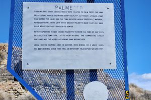
Nevada historical marker interpretive sign.   slgwv / Atlas Obscura User
The mill site as seen from the highway.   slgwv / Atlas Obscura User
The old mill.   slgwv / Atlas Obscura User
Building off the highway, said to have been a boarding house.   slgwv / Atlas Obscura User
Ruin right on the highway, probably an office.   slgwv / Atlas Obscura User
Ruin right on the highway.Ruin right on the highway, probably an office.   slgwv / Atlas Obscura User
Ruin right on the highway, probably an office.   slgwv / Atlas Obscura User
Looking down from the mill site. The stone building right on the highway was probably an office.   slgwv / Atlas Obscura User
The old mill.   slgwv / Atlas Obscura User
Building off the highway, said to have been a boarding house.   slgwv / Atlas Obscura User
Top of the mill site.   slgwv / Atlas Obscura User
The old mill.   slgwv / Atlas Obscura User
Top of the mill site.   slgwv / Atlas Obscura User
Building off the highway, said to have been a boarding house.   slgwv / Atlas Obscura User
View westward from Palmetto site. The highway is Nevada SR-266; the snowcapped range on the skyline is the White Mountains.   slgwv / Atlas Obscura User
Building off the highway, said to have been a boarding house.   slgwv / Atlas Obscura User
Been Here
Want to go
Added to list

About

Usually, ghost town ruins right on a major modern highway are either hardly recognizable, or else are all "touristy." The ruins at Palmetto, however, are perfectly obvious from the highway and have no fences, admission fees, or souvenir shops. And they don't require miles of rough 4WD road to reach.

Silver was first struck here in 1866, and in a typical burst of overoptimism, a 12-stamp mill was built. There was not enough ore to keep the mill busy, however, and Palmetto was soon abandoned. (The camp's name comes from the miners' misconception that local Joshua trees were related to palms.)

A brief revival in the 1880s also fizzled, even though the camp got a post office in 1888 that lasted until 1894.

Palmetto's biggest revival was in the early 20th century. A new townsite was set up about half a mile west of the 19th-century camp, and by 1906, the new camp sported a main street a mile long. Again, though, it didn't last; the reopened post office closed on the last day of 1907.

Ironically, much more remains of the late 19th-century camp, as no permanent structures were built in the early 20th-century revival; that settlement consisted of just tents. Mining exploration continues in the area to this day, but nothing on the scale of a century-plus ago.

Places

Discover your next amazing Atlas Place.

Get more unusual and extraordinary places each week with the Atlas Obscura Places newsletter.

Your newsletter subscriptions with us are subject to Atlas Obscura's Privacy Policy and Terms of Use.

Know Before You Go

Palmetto is right on Nevada State Route 266, 31.2 miles west of its intersection with US-95, on the north side. The site is marked with a prominent Nevada historical marker. There is parking in front of this sign, and the old mill site is on the hill behind. The ruins of a stone building, probably an office, are on the left, and another roofless stone building, said to have been a boarding house, is a couple of hundred yards to the right.

Community Contributors

slgwv profile photo

Added By

slgwv

Published

July 17, 2026

Edit this listing

Make an Edit
Add Photos
Sources
  • Paher, Stanley W. Nevada Ghost Towns and Mining Camps, Nevada Publications, 1970, p. 412.
  • Miller, Donald C. Ghost Towns of Nevada, Pruett Publishing, 1979, p. 101.
Palmetto
NV-266
Goldfield, Nevada
United States
37.444063, -117.69516
Get Directions

Nearby Places

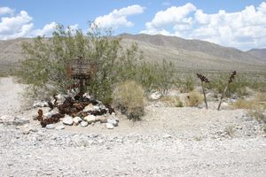
Crankshaft Crossing

Goldfield, California

miles away

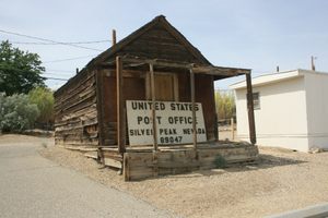
Silver Peak

Silver Peak, Nevada

miles away

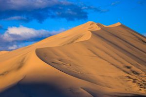
Eureka Dunes

California

miles away

Explore the Destination Guide

Photo of Goldfield

Goldfield

Nevada

Places 8
Stories 1

Nearby Places

Crankshaft Crossing

Goldfield, California

miles away

Silver Peak

Silver Peak, Nevada

miles away

Eureka Dunes

California

miles away

Explore the Destination Guide

Photo of Goldfield

Goldfield

Nevada

Places 8
Stories 1
Aerial image of Vietnam, displaying the picturesque rice terraces, characterized by their layered, verdant fields.
Atlas Obscura Membership

Become an Atlas Obscura Member


Join our community of curious explorers.

Become a Member

Get Our Email Newsletter

Follow Us

Facebook YouTube TikTok Instagram Pinterest RSS Feed

Get the app

Download the App
Download on the Apple App Store Get it on Google Play
  • All Places
  • Latest Places
  • Most Popular
  • Places to Eat
  • Random
  • Nearby
  • Add a Place
  • Stories
  • Food & Drink
  • Itineraries
  • Lists
  • Video
  • Podcast
  • Newsletters
  • All Trips
  • Membership
  • Feedback & Ideas
  • Community Guidelines
  • Product Blog
  • Unique Gifts
  • Work With Us
  • About
  • FAQ
  • Advertise With Us
  • Advertising Guidelines
  • Privacy Policy
  • Cookie Policy
  • Terms of Use
Atlas Obscura

© 2026 Atlas Obscura. All Rights Reserved.