Places Foods Stories Newsletters
Loading...
Loading...
Loading...

No search results found for
“”

Make sure words are spelled correctly.

Try searching for a travel destination.

Places near me Random place

Popular Destinations

  • Paris
  • London
  • New York
  • Berlin
  • Rome
  • Los Angeles
Places Foods Stories Newsletters
Sign In Join
Places near me Random place
All the United States Arizona Holbrook Petrified Forest National Park
AO Edited

Petrified Forest National Park

See massive fossils that are over 200 million years old in northeastern Arizona.

Holbrook, Arizona

AllisonEng profile photo
Added By
Allison Eng
Email
Been Here
Want to go
Added to list
CAPTION
Petrified Wood   JaneWeinhardt
Badlands-Petrified Forest  
  SemiruralYeti / Atlas Obscura User
  SemiruralYeti / Atlas Obscura User
  SemiruralYeti / Atlas Obscura User
  Goddard23 / Atlas Obscura User
  Goddard23 / Atlas Obscura User
  Goddard23 / Atlas Obscura User
  rakimwes / Atlas Obscura User
  rakimwes / Atlas Obscura User
Close up   evilgreentriangle / Atlas Obscura User
  Jason Michael Walker / Atlas Obscura User
  Jason Michael Walker / Atlas Obscura User
  Jason Michael Walker / Atlas Obscura User
Giant log trail  
Segmented trunk   evilgreentriangle / Atlas Obscura User
  rakimwes / Atlas Obscura User
Natural bridge   evilgreentriangle / Atlas Obscura User
Biggest tree   evilgreentriangle / Atlas Obscura User
“Old Faithful” petrified tree.   WhiskeyBristles / Atlas Obscura User
View next to Blue Mesa Trailhead   brendonstinson / Atlas Obscura User
  breaingram / Atlas Obscura User
At the gift shop 7-13-24   Darrell Powers / Atlas Obscura User
7-13-24   Darrell Powers / Atlas Obscura User
Painted Desert   nlcrocker / Atlas Obscura User
  JoeBenSimo / Atlas Obscura User
7-13-24   Darrell Powers / Atlas Obscura User
Petrified Log   nlcrocker / Atlas Obscura User
Long Logs and Agate House   nlcrocker / Atlas Obscura User
  JoeBenSimo / Atlas Obscura User
  JoeBenSimo / Atlas Obscura User
  JoeBenSimo / Atlas Obscura User
  JoeBenSimo / Atlas Obscura User
7-13-24   Darrell Powers / Atlas Obscura User
  meganoflaherty1 / Atlas Obscura User
7-13-24   Darrell Powers / Atlas Obscura User
Welcome to Petrified Forest National Park   RBAR / Atlas Obscura User
Been Here
Want to go
Added to list

About

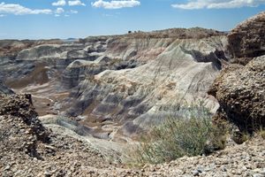
Straddling the border between Navajo County and Apache County in the far northeastern corner of Arizona, the Petrified Forest National Park is about 146 square miles in size. The northern part of this site extends into the Painted Desert; the entire thing was declared a National Park in 1962, more than five decades after it was first named a National Monument in 1906.

Known for its fossils, especially those of fallen trees that first grew during the Late Triassic period of the Mesozoic Era more than 225 million years ago, the Petrified Forest is in a region that was once near the equator on the southwestern edge of the supercontinent Pangaea. Back then, its climate was humid and sub-tropical. The sediments that contain the fossilized logs are park of the colorful and widespread Chinle Formation, from which the Painted Desert first got its name.

There are no overnight spots or campgrounds available in the park, but nearby communities offer motels and other accommodations that visitors use. Overnight parking is not allowed, either, unless you have a wilderness hiking permit and are backpacking through the park.

Sightseeing options are offered for private motorcycles, automobiles, and hikers. The park road, turn-outs, and parking lots are big enough to accommodate large recreational vehicles such as tour buses and traditional RVs.

Places

Discover your next amazing Atlas Place.

Get more unusual and extraordinary places each week with the Atlas Obscura Places newsletter.

Your newsletter subscriptions with us are subject to Atlas Obscura's Privacy Policy and Terms of Use.

Know Before You Go

For experienced backpackers, get a backcountry hiking and camping permit from the National Park Service at the ranger station, which allows parking at the trailhead and overnight tent camping at least a mile or two into the wilderness area. However, these are limited and may not be available at all times of the year. Visitors who wish to see the night sky can find opportunities to visit the park after dark by checking the website for a schedule of ranger-led astronomy programs. 

If you are traveling along Interstate 40 and wish to drive through the park in a single day, the shortest route depends on your direction of travel. Eastbound, get onto the 180 from the Flagstaff area. Then take exit 285 (which will look like an intersection) north into the park, and the road through the park will end at the 40. Traveling westbound, take exit 311 from the 40, and the road will loop north briefly before turning south. Continue west on the 180 until it returns to the 40.

Community Contributors

AllisonEng profile photo

Added By

AllisonEng

RBAR profile photo meganoflaherty1 profile photo breaingram profile photo N nlcrocker profile photo

Edited By

RBAR, meganoflaherty1, breaingram, nlcrocker...

  • RBAR profile photo RBAR
  • meganoflaherty1 profile photo meganoflaherty1
  • breaingram profile photo breaingram
  • N nlcrocker profile photo nlcrocker
  • JoeBenSimo profile photo JoeBenSimo
  • E evilgreentriangle profile photo evilgreentriangle
  • Darrell Powers profile photo Darrell Powers
  • F franknbing cadf66cb profile photo franknbing cadf66cb
  • SemiruralYeti profile photo SemiruralYeti
  • Jason Michael Walker profile photo Jason Michael Walker
  • R rakimwes profile photo rakimwes
  • brendonstinson profile photo brendonstinson
  • 8 8c4zrw45q7 profile photo 8c4zrw45q7
  • G Goddard23 profile photo Goddard23

Published

January 13, 2011
Edit this listing

Make an Edit
Add Photos
Sources
  • http://en.wikipedia.org/wiki/Petrified_Forest_National_Park

Related Tags

Route 66 Natural Wonders Nature
Petrified Forest National Park
Holbrook, Arizona, 86025
United States
35.003694, -109.788923
Visit Website
Get Directions

Nearby Places

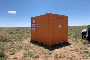
The Plotz Plot

Holbrook, Arizona

miles away

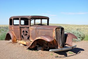
'Highway of Dreams' 1932 Studebaker

Holbrook, Arizona

miles away

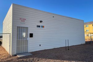
Arizona Sake

Holbrook, Arizona

miles away

Explore the Destination Guide

Photo of Holbrook

Holbrook

Arizona

Places 8
Stories 1

Nearby Places

The Plotz Plot

Holbrook, Arizona

miles away

'Highway of Dreams' 1932 Studebaker

Holbrook, Arizona

miles away

Arizona Sake

Holbrook, Arizona

miles away

Explore the Destination Guide

Photo of Holbrook

Holbrook

Arizona

Places 8
Stories 1

Related Stories and Lists

Arizona’s Petrified Forest Is Changing What We Know About the Dawn of the Dinosaurs

dinosaurs

By Shaena Montanari

Beware the Legends Behind These National Park Souvenirs

national parks

By Ellery Weil

Dear Atlas: What Parts of Route 66 Are Worth the Drive?

route 66

By Danielle Hallock

Along the Remains of Route 66, Road Trip Trash Has Become Treasure

national parks

By Jessica Leigh Hester

In Jordan, Bedouins Are Preserving Ancient Rock Art With an App

geology

By Robin George Andrews

12 National Park Trees That Are Truly Terrific

List

By Roxanne Hoorn

Related Places

  • The Walnut Canyon pueblos.

    Flagstaff, Arizona

    Walnut Canyon

    Ancient pueblos built into the base of a natural canyon wall.

  • Circular Pool

    North Walpole, Australia

    Circular Pool

    A forest pool so dark and frothy it's earned the nickname the natural cappuccino.

  • Burabay

    Burabay, Kazakhstan

    Burabay

    A pocket of pine forests, healing lakes, and legendary rocks rising from Kazakhstan’s endless steppe.

  • Kanas or Ka Nasi Lake

    Altay Prefecture, China

    Kanas Lake

    A lake that borders Kazakhstan and Russia allegedly harbors the giant "Terror Trout" or "Chinese Nessie."

  • Omarama Clay Cliffs

    Quailburn, New Zealand

    Omarama Clay Cliffs

    Towering earthen formations that rise straight out of the ground in New Zealand .

  • Sulphur Springs

    Sulphur Springs, New Mexico

    Sulphur Springs

    It’s hard to believe this hostile landscape was once a health resort.

  • Rock Falls

    Sicily Island, Louisiana

    Rock Falls

    Louisiana's tallest waterfall is only a short hike away from the middle of nowhere.

  • Tiské Stěny

    Tisá, Czechia

    Tiské Stěny

    Towering sandstone rock formations where 'The Chronicles of Narnia' was filmed.

Aerial image of Vietnam, displaying the picturesque rice terraces, characterized by their layered, verdant fields.
Atlas Obscura Membership

Become an Atlas Obscura Member


Join our community of curious explorers.

Become a Member

Get Our Email Newsletter

Follow Us

Facebook YouTube TikTok Instagram Pinterest RSS Feed

Get the app

Download the App
Download on the Apple App Store Get it on Google Play
  • All Places
  • Latest Places
  • Most Popular
  • Places to Eat
  • Random
  • Nearby
  • Add a Place
  • Stories
  • Food & Drink
  • Itineraries
  • Lists
  • Video
  • Podcast
  • Newsletters
  • All Trips
  • Membership
  • Feedback & Ideas
  • Community Guidelines
  • Product Blog
  • Unique Gifts
  • Work With Us
  • About
  • FAQ
  • Advertise With Us
  • Advertising Guidelines
  • Privacy Policy
  • Cookie Policy
  • Terms of Use
Atlas Obscura

© 2026 Atlas Obscura. All Rights Reserved.