Piazza Matteotti
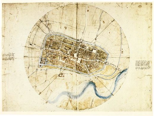
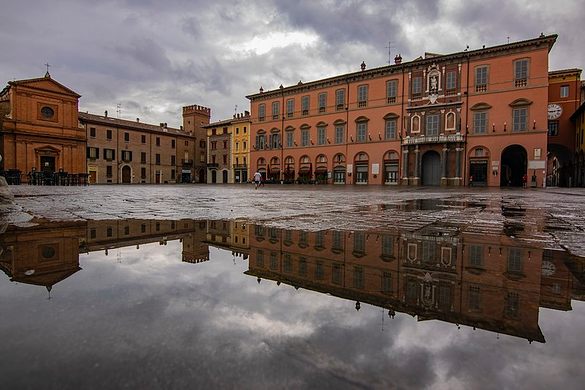
This Renaissance square was at the center of Leonardo da Vinci's map, the first ichnographic ever.
Between 1499 and 1501 Cesare Borgia, the illegitimate son of Pope Alexander IV, defeated Caterina Sforza, Lady of Imola and Countess of Forli, to conquer Romagna. After his victory, he appointed Leonardo da Vinci to the position of General Architect and Engineer. In 1502, he ordered him to study the fortification of the region. One of his first tasks was to draw a map of the city of Imola.
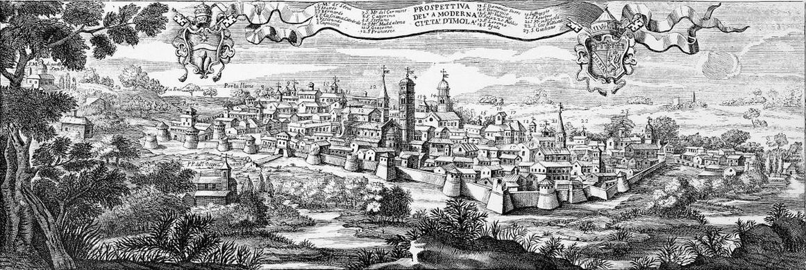
This moment would change cartography forever. Previously, maps representing the city were crafted from an artistic perspective, usually from a hillside view. Buildings often lacked details and areas were not true to scale. This kind of representation was a hindrance to military operations.
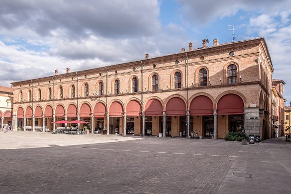
Palazzo Comunale, the place where the Roman maximum thistle (Via Appia) and maximum decumanus (Via Emilia) crossed, was chosen by da Vinci as the city’s center point. From there, the city was divided into eight sectors. Da Vinci measured various streets and landmarks using a compass and odometer. Geometry helped him complete his work and effectively created the first “flattened map” in history. A map that is still reliable more than 500 years later.
However, this historical map does include some unanswered questions. The medieval platea magna now Piazza Matteotti, has changed very little since 1474 and has a trapezoidal shape. However, the plaza on da Vinci’s map is the shape of a rectangular. It’s not clear as to why, but it may have been done to enhance the architectural proportions of the Renaissance.
Know Before You Go
The map is part of the Royal Windsor Collection of the United Kingdom. It's possible to see a big ceramic reproduction of it in the rail station of Imola.
Plan Your Trip
The Atlas Obscura Podcast is Back!








Follow us on Twitter to get the latest on the world's hidden wonders.
Like us on Facebook to get the latest on the world's hidden wonders.
Follow us on Twitter Like us on Facebook