Trips Places Foods Stories Newsletters
Loading...
Loading...
Loading...
Loading...

No search results found for
“”

Make sure words are spelled correctly.

Try searching for a travel destination.

Places near me Random place

Popular Destinations

  • Paris
  • London
  • New York
  • Berlin
  • Rome
  • Los Angeles
Trips Places Foods Stories Newsletters
Sign In Join
Places near me Random place
All the United States California Corte Madera Ring Mountain Petroglyphs

Ring Mountain Petroglyphs

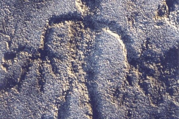
Across Ring Mountain is a vast collection of Native American petroglyphs unique to the region.

Corte Madera, California

Added By
Christy Kirwan
Email
Been Here
Want to go
Added to list
CAPTION
Ring Mountain Petroglyphs & Petroglyph Rock   ckirwan / Atlas Obscura User
  gricemyers / Atlas Obscura User
Ring Mountain Petroglyphs & Petroglyph Rock   ckirwan / Atlas Obscura User
Ring Mountain open space preserve   Eric in SF/CC BY-SA 3.0
Petroglyph Rock   Frank Schulenburg/CC BY-SA 3.0
Been Here
Want to go
Added to list

About

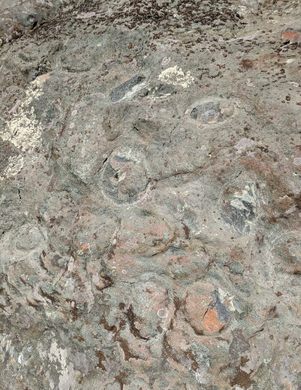
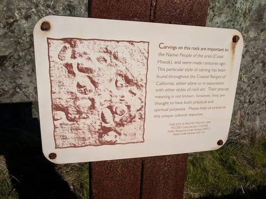
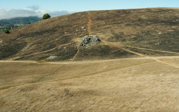
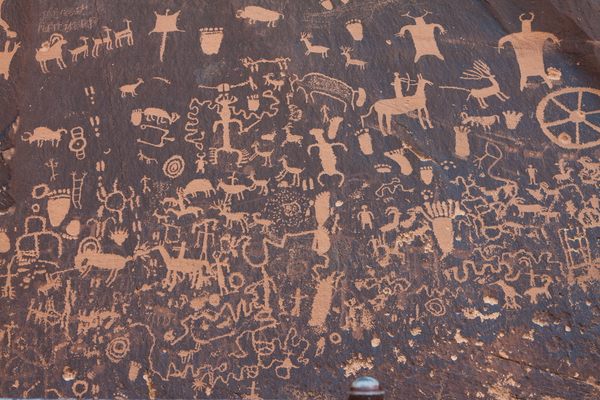
The Ring Mountain Open Space Preserve is named after New Hampshire dairyman and wealthy local landowner George E. Ring. It's a great place to see examples of pecked curvilinear nucleated petroglyphs, a style of petroglyph unique to western North America. These particular glyphs are believed to have been created by the Coast Miwok people. The creations are thought to be around 2,400 years old. 

The Coast Miwok people are the original inhabitants of what we now call Marin and southern Sonoma Counties in California. They have a rich history that dates back for thousands of years. The arrival of European settlers and eventually the California Gold Rush era devastated Miwok communities. The land and environment that had sustained the people for generations was massively altered, clearing out sources of food and other resources that the Miwok people relied on.

Around 30 of Ring Mountain's boulders contain some form of petroglyphs, but the easiest to find are those along Petroglyph Rock. Many consists of various ovals and circles, but the meaning of the circular symbols is unknown.

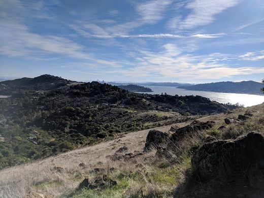
The preserve is also a good place to witness stunning views of the Bay Area, as well as the location of world-famous geological features. Across the trail, hikers will spot numerous wildflowers and other rare examples of plant life. Lucky hikers may spot the endangered Tiburon mariposa lily, found nowhere else in the world.

Related Tags

Petroglyphs Native Americans Trains Nature

Know Before You Go

The Ring Mountain Open Space Preserve is open during daylight hours. Dogs must be leashed, and visitors should stick to the trails, as the area contains sensitive and endangered wildlife.

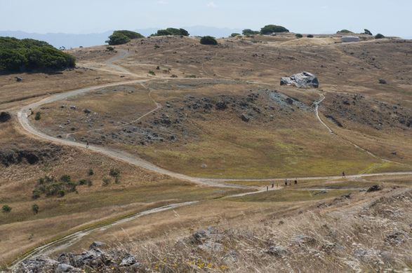
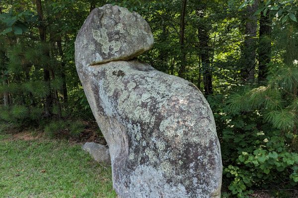
Petroglyph Rock is located near the intersection of Ring Mountain Fire Road and Reed Ranch Fire Road; follow the signs for Petroglyph Rock Or look for the rock with a small fence around it. 37°54'37.8"N 122°29'35.1"W.

Community Contributors

Added By

ckirwan

Edited By

mauricemeowtierney, michellecassidy1, gricemyers

  • mauricemeowtierney
  • michellecassidy1
  • gricemyers

Published

April 28, 2020

Edit this listing

Make an Edit
Add Photos
Sources
  • https://baynature.org/article/ring-mountain-rocks/
  • https://weekendsherpa.com/stories/hike-to-petroglyphs-on-ring-mountain/
  • https://www.marinmagazine.com/whats-in-a-name-ring-mountain/
  • https://modernhiker.com/hike/ring-mountain-preserve-loop/
  • https://mewuk.com/cultural/history/
  • https://www.nps.gov/pore/learn/historyculture/people_coastmiwok.htm
  • https://baynature.org/article/ring-mountain-rocks/
Ring Mountain Petroglyphs
Loop Trail
Corte Madera, California, 94925
United States
37.911516, -122.49106
Visit Website
Get Directions

Nearby Places

San Quentin Prison Gift Shop

San Quentin, California

miles away

Dolliver Park

Larkspur, California

miles away

Old St. Hilary's Chapel

Belvedere Tiburon, California

miles away

Explore the Destination Guide

Photo of California

California

United States

Places 1,494
Stories 135

Related Stories and Lists

8 Ways to Explore the Past Through Native American Petroglyphs

List

By Jonathan Carey

Related Places

  • The path along the Tom Moody Trail that leads to the waterfall at Picture Canyon.

    Flagstaff, Arizona

    Picture Canyon

    A nature and cultural preserve named for its multitude of petroglyphs carved by the Northern Sinagua people.

  • A wall of sandstone with a small opening

    Covington, Indiana

    Portland Arch

    One of Indiana's only natural sandstone arches is nestled between resort ruins and an old Boy Scouts camp.

  • Shenks Ferry, Pennsylvania

    The Safe Harbor Petroglyphs

    A sacred collection of indigenous rock art.

  • 8 foot tall Owl Rock

    Atlanta, Georgia

    Owl Rock

    This Native American petroglyph marks the location of an important, Creek trail.

  • Sunset on Waites Island.

    Waites Island, South Carolina

    Waites Island

    A wildlife-filled oasis just off the coast of Myrtle Beach.

  • Rock Art at Ubirr depicting a long-necked turtle.

    Kakadu, Australia

    Ubirr Rock Art

    Kakadu National Park is known for its stunning beauty and its rock art, which represents the longest historical records of any continuous civilization on Earth.

  • Big Foot petroglyph, with standing figure to right.  The Big Foot is literally a representation of a bare human footprint, not the storied cryptid.

    Clark County, Nevada

    Black Butte Petroglyph Trail

    The highest concentration of petroglyph sites in Gold Butte National Monument, plus an improbable early 20th-century dam.

  • Ute Mountain Chimney Rock

    Towaoc, Colorado

    Ute Mountain Tribal Park

    Ute tour guides have been sharing the ancient dwellings and rock art inside this large park with visitors for more than 40 years.

Aerial image of Vietnam, displaying the picturesque rice terraces, characterized by their layered, verdant fields.
Atlas Obscura Membership

Become an Atlas Obscura Member


Join our community of curious explorers.

Become a Member

Get Our Email Newsletter

Follow Us

Facebook YouTube TikTok Instagram Pinterest RSS Feed

Get the app

Download the App
Download on the Apple App Store Get it on Google Play
  • All Places
  • Latest Places
  • Most Popular
  • Places to Eat
  • Random
  • Nearby
  • Add a Place
  • Stories
  • Food & Drink
  • Itineraries
  • Lists
  • Video
  • Podcast
  • Newsletters
  • All Trips
  • Family Trip
  • Food & Drink
  • History & Culture
  • Wildlife & Nature
  • FAQ
  • Membership
  • Feedback & Ideas
  • Community Guidelines
  • Product Blog
  • Unique Gifts
  • Work With Us
  • About
  • FAQ
  • Advertise With Us
  • Advertising Guidelines
  • Privacy Policy
  • Cookie Policy
  • Terms of Use
Atlas Obscura

© 2025 Atlas Obscura. All Rights Reserved.