About
The Verde River Sheep Bridge (also known as Sheep Bridge or Red Point Sheep Bridge) is a pedestrian suspension bridge spanning the Verde River in a remote section of Tonto National Forest, Arizona. It serves as a key access point to the west side of the Mazatzal Wilderness.
The original bridge was constructed by the Flagstaff Sheep Company and the Howard Sheep Company to safely move sheep between winter and summer grazing ranges, reducing losses from hazardous river crossings. Road access to the site was prepared in early 1943, with main construction occurring primarily from March to June 1943 and concrete work on the towers completed in January 1944. The bridge cost $7,277 and incorporated salvaged materials from an Arizona mine and a railroad line, built largely with hand tools and limited resources during World War II under the engineering design of Cyril O. Gilliam and supervision of Frank Auza and George W. Smith.
Sheep drives across the bridge continued until 1978. The structure was listed on the National Register of Historic Places on November 21, 1978, recognizing its significance to Arizona's sheep-raising industry and as the last remaining suspension-type sheep bridge in the state.
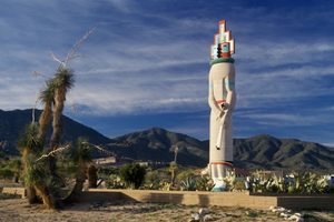
The original bridge was closed in 1987 due to deterioration from age, use, and flooding. It was largely demolished in 1988. The U.S. Forest Service constructed a replica pedestrian bridge in 1989, designed primarily for hikers and recreational users. The original west concrete tower from 1944 remains standing nearby.
Related Tags
Know Before You Go
Access and Drive Information
The site is remote and requires a high-clearance vehicle (4x4 recommended due to rocky, technical sections; off-roading experience advised). Roads are narrow, unpaved, with blind curves, potential water crossings, and minimal maintenance—FR 269 is rarely graded.
Primary routes (distances approximate; allow extra time for conditions):
- **From Carefree/Cave Creek area** (often ~45 miles total): Take Cave Creek Road north, which becomes Forest Road (FR) 24 for about 33 miles to the junction with FR 269 (near Bloody Basin-Tangle Creek area). Turn right onto FR 269 and follow it approximately 12 miles to the bridge and parking area at the Verde River.
- **From Interstate 17 (via Bloody Basin Road)**: Exit at Bloody Basin Road (FR 259), head east, and continue roughly 36–38 miles (out-and-back trail) to the parking area on the west side of the bridge. This route passes through areas like Agua Fria National Monument and can take 2+ hours one way, even in suitable vehicles.
Conditions vary seasonally—dry weather improves drivability, but flash floods or mud can make roads impassable. Check current Tonto National Forest alerts or road status before heading out, as no trailers are recommended and the drive is considered moderately challenging for off-road travel.
Community Contributors
Added By
Published
April 15, 2026