


About
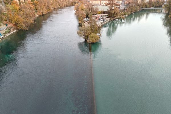
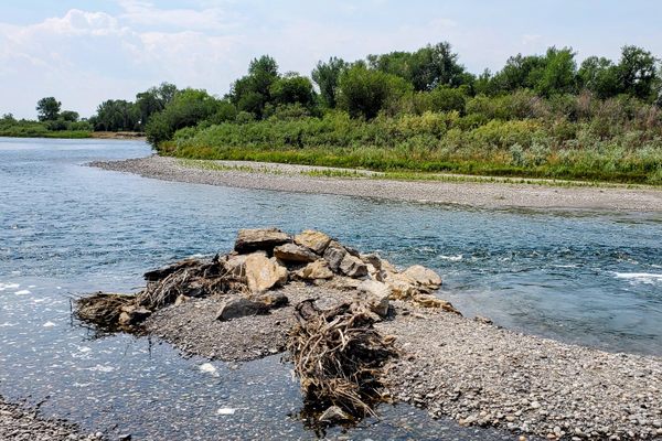
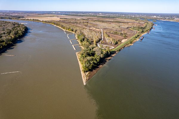
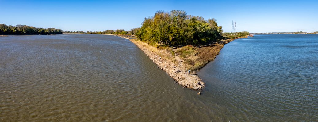
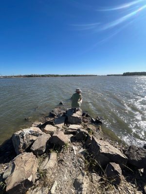
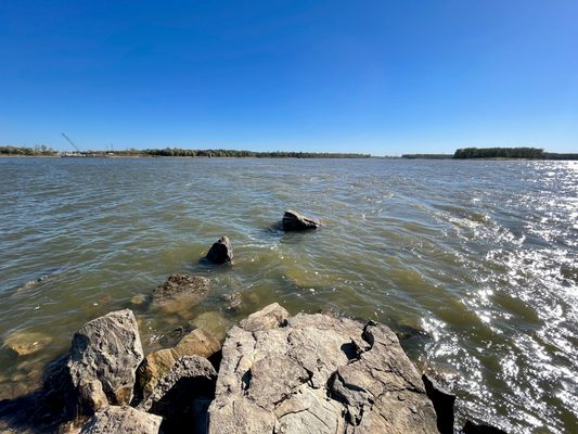
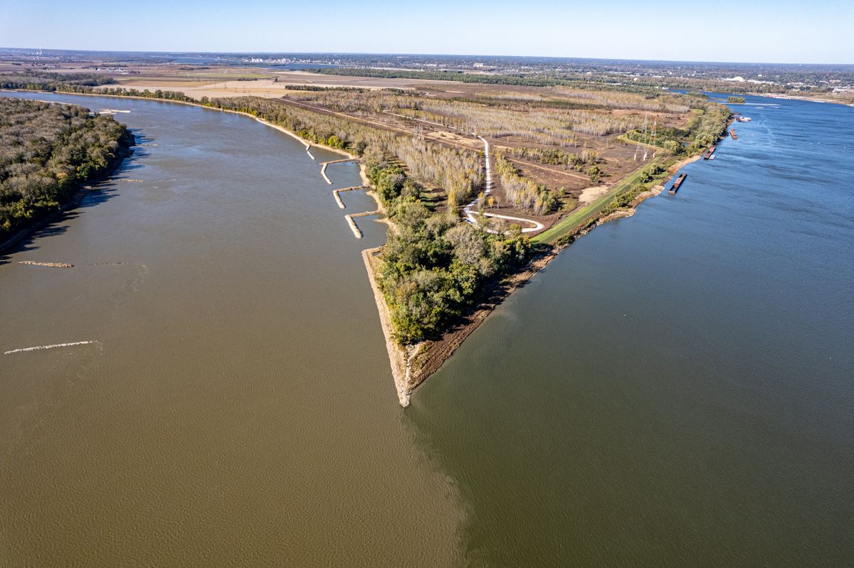
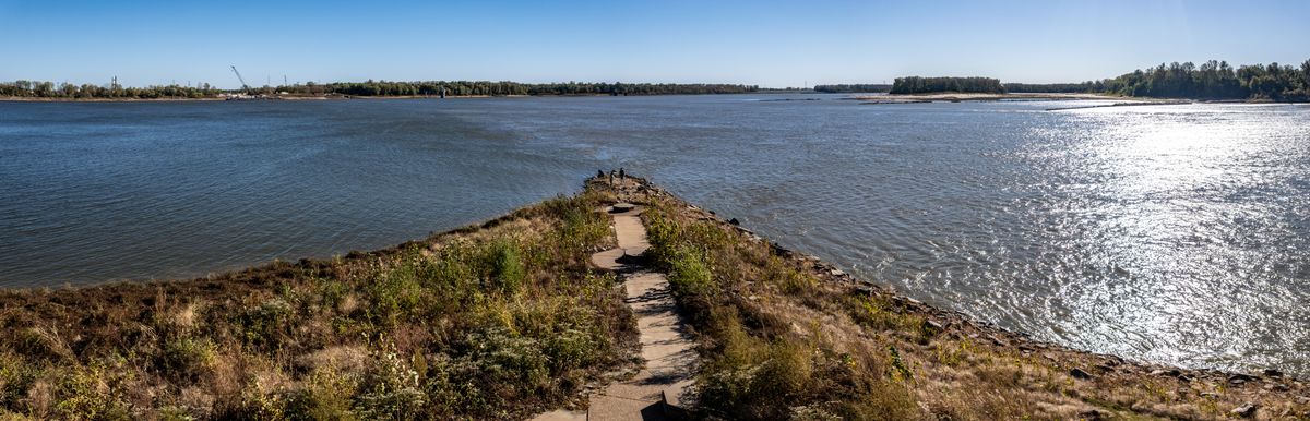
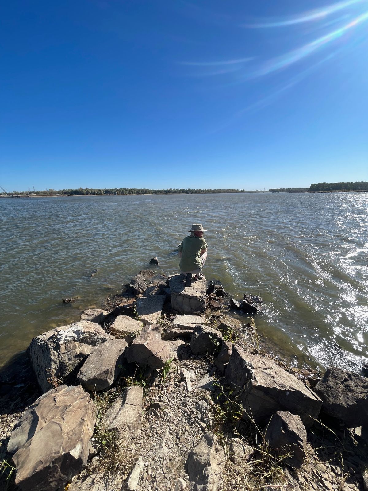
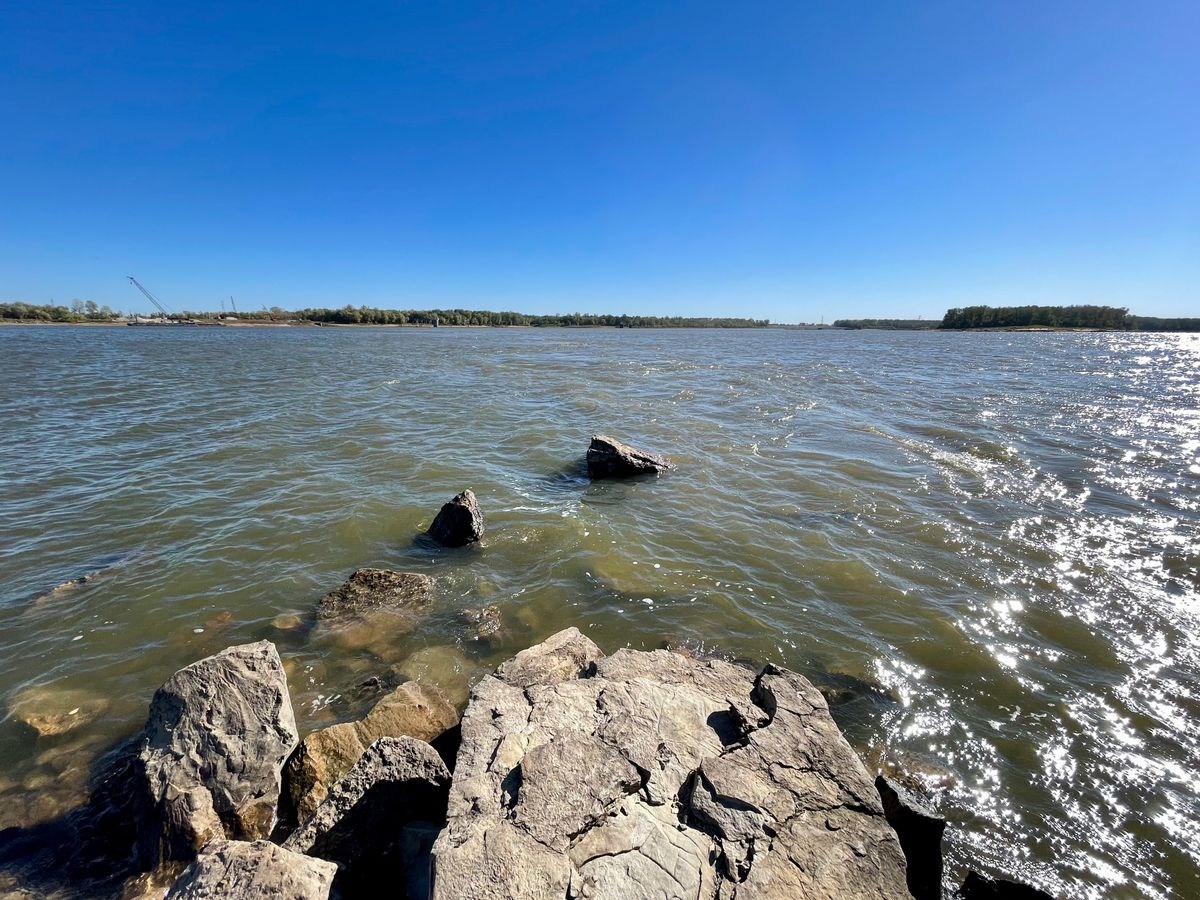
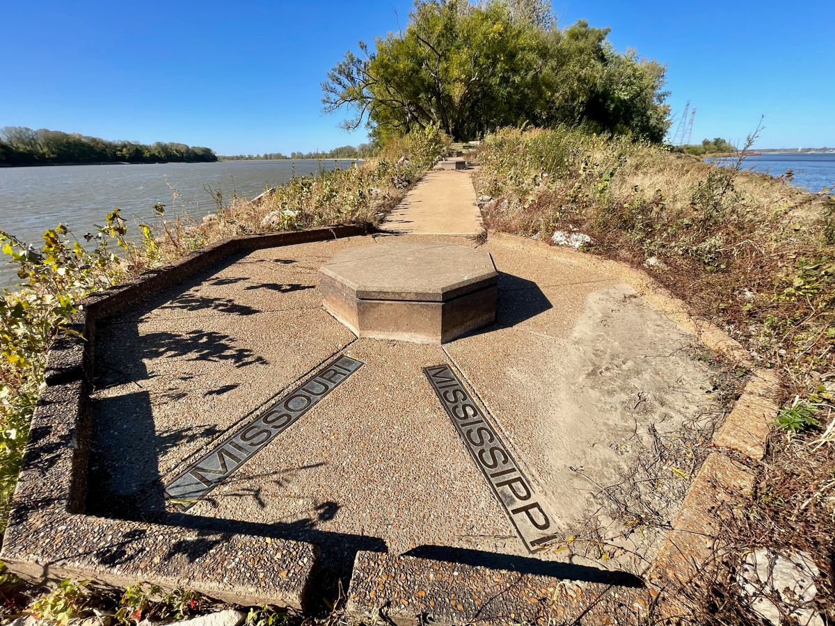
All rivers go somewhere, and these two monsters meet up right here. The Missouri River is officially 2,341 miles long and at this point, you can stand at its end and watch as its waters mingle with the mighty Mississippi. The Missouri is considered part of the Mississippi River Basin which represents over 40 percent of the drainage of the lower 48 states. It's a unique perspective and a lot of water.
Although the river beds have changed in two centuries, this is also the point where Meriwether Lewis and William Clark's Corps of Discovery took a left turn and paddled hard upstream, heading west in 1804.
The actual confluence is surrounded by protected wetlands and is great for bird watching as well, depending on the time of year, as it is part of the Mississippi Flyway. Millions of birds, representing some 60 percent of the bird species in North America, migrate along the Mississippi River corridor every spring and fall.
Related Tags
Know Before You Go
The actual point is a short and easy one-quarter mile walk from a parking lot on compacted gravel.
Don't be disappointed, check before going, especially in spring. This park is in a floodplain and may be closed during high water conditions. Also, fair warning, it's quite a site, but it's at the end of four miles of dirt roads. If it's dry weather, don't plan on leaving with a clean car.
Community Contributors
Added By
Published
November 15, 2023