Places Foods Stories Newsletters
Loading...
Loading...
Loading...

No search results found for
“”

Make sure words are spelled correctly.

Try searching for a travel destination.

Places near me Random place

Popular Destinations

  • Paris
  • London
  • New York
  • Berlin
  • Rome
  • Los Angeles
Places Foods Stories Newsletters
Sign In Join
Places near me Random place
All the United States Washington Ellensburg Umtanum Creek Footbridge

Umtanum Creek Footbridge

The last surviving footbridge in the Yakima Canyon, now a historic landmark, provides access to wilderness west of the Yakima River

Ellensburg, Washington

slgwv profile photo
Added By
slgwv
Email
Been Here
Want to go
Added to list
CAPTION
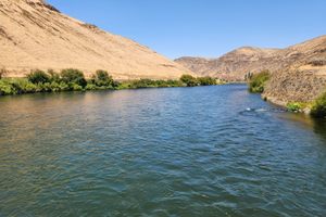
Looking upstream from the bridge, August 2024.   slgwv / Atlas Obscura User
Looking back across the Yakima.   slgwv / Atlas Obscura User
Looking west across the Yakima.   slgwv / Atlas Obscura User
The bridge in August 2024, looking west.   slgwv / Atlas Obscura User
Looking upstream from the bridge, March 2008.   slgwv / Atlas Obscura User
Looking downstream from the bridge, August 2024.   slgwv / Atlas Obscura User
Approach to the bridge in August 2024.   slgwv / Atlas Obscura User
Looking back across the Yakima in 2008.   slgwv / Atlas Obscura User
Umtanum Footbridge in 2008.   slgwv / Atlas Obscura User
History of the Umtanum Bridge   slgwv / Atlas Obscura User
Been Here
Want to go
Added to list

About

Yakima (pronounced "YAK-uh-maw") Canyon, where the Yakima River traverses a water gap through Manastash Ridge, is an obvious thoroughfare and was used by Native Americans for thousands of years, and then by Euro-American trappers and settlers into the 19th century. It was also an obvious route for a railroad, and the Northern Pacific Railway was built through it in the early 1880s, along the west bank of the river. (The railroad is still in active use and is now part of the BNSF system.)

Railroading was an extremely labor-intensive business well into the 20th century, and camps were built along the right-of-way to house the trackwalkers, signal men, section gangs, and other workers. In 1885 one such camp was built here at Umtanum Creek, where the eponymous creek joins the Yakima. The camp even boasted a school and a post office by the early 20th century.

When in 1925 the automobile highway was built through the canyon on the east shore of the river, cable suspension bridges were built across the river from the railroad camps to provide highway access. Evidently the original bridges were wide enough to be passable to Ford Model As. In the 1960s, the Washington Department of Fish and Wildlife and the Bureau of Land Management took over the day-to-day management of the bridge, but only in 1987 was the bridge deck narrowed to make it accessible to pedestrians only.

With the continuing rise of automotive travel, it proved no longer necessary to station crews on the railroad right-of-way, and by the 1970s the last of the camps had been removed.

The cable suspension bridges were also removed, with the sole exception of the Umtanum Creek bridge. It was still used by recreational users to access the west side of the river, but because of age-related deterioration concerns were being raised about its safety. Meanwhile, efforts were underway to have the bridge declared a national historic site. Finally, Umtanum Creek Bridge was restored in early 2021, with attention paid to preserving the structure's historic values.

Places

Discover your next amazing Atlas Place.

Get more unusual and extraordinary places each week with the Atlas Obscura Places newsletter.

Your newsletter subscriptions with us are subject to Atlas Obscura's Privacy Policy and Terms of Use.

Know Before You Go

As of 2024, a $5 fee is required for trailhead parking, or an America the Beautiful pass or equivalent. A self-service station that accepts credit or debit cards (but not cash) is at the trailhead. The Washington Discover Pass is not accepted.

Community Contributors

slgwv profile photo

Added By

slgwv

Published

July 20, 2026

Edit this listing

Make an Edit
Add Photos
Umtanum Creek Footbridge
16968 WA-821
Ellensburg, Washington
United States
46.855569, -120.483982
Get Directions

Nearby Places

Dick and Jane's Spot

Ellensburg, Washington

miles away

Renslow Trestle

Renslow, Washington

miles away

Wild Horse Wind Farm

Renslow, Washington

miles away

Explore the Destination Guide

Photo of Ellensburg

Ellensburg

Washington

Places 2

Nearby Places

Dick and Jane's Spot

Ellensburg, Washington

miles away

Renslow Trestle

Renslow, Washington

miles away

Wild Horse Wind Farm

Renslow, Washington

miles away

Explore the Destination Guide

Photo of Ellensburg

Ellensburg

Washington

Places 2
Aerial image of Vietnam, displaying the picturesque rice terraces, characterized by their layered, verdant fields.
Atlas Obscura Membership

Become an Atlas Obscura Member


Join our community of curious explorers.

Become a Member

Get Our Email Newsletter

Follow Us

Facebook YouTube TikTok Instagram Pinterest RSS Feed

Get the app

Download the App
Download on the Apple App Store Get it on Google Play
  • All Places
  • Latest Places
  • Most Popular
  • Places to Eat
  • Random
  • Nearby
  • Add a Place
  • Stories
  • Food & Drink
  • Itineraries
  • Lists
  • Video
  • Podcast
  • Newsletters
  • All Trips
  • Membership
  • Feedback & Ideas
  • Community Guidelines
  • Product Blog
  • Unique Gifts
  • Work With Us
  • About
  • FAQ
  • Advertise With Us
  • Advertising Guidelines
  • Privacy Policy
  • Cookie Policy
  • Terms of Use
Atlas Obscura

© 2026 Atlas Obscura. All Rights Reserved.