Trips Places Foods Stories Newsletters
Loading...
Loading...
Loading...
Loading...

No search results found for
“”

Make sure words are spelled correctly.

Try searching for a travel destination.

Places near me Random place

Popular Destinations

  • Paris
  • London
  • New York
  • Berlin
  • Rome
  • Los Angeles
Trips Places Foods Stories Newsletters
Sign In Join
Places near me Random place
All United States / Canada United States–Canada Border Slash

United States–Canada Border Slash

The entire length of the border is marked by a 20-foot-wide slash through the trees.

United States / Canada

Added By
Lew Blank
Email
Been Here
Want to go
Added to list
CAPTION
The Slash across mountains   Carolyn Cuskey / CC BY 2.0
Slash with border marker in the middle   Paul Pehrson / CC BY 2.0
Two border markers and The Slash behind it   Cohen.Canada / CC BY 2.0
Slash in North Dakota   Map Data © 2016 Google
Tiny piece of the Slash in Lake Memphremagog   Map Data © 2016 Google
Slash in Montana   Map Data © 2016 Google
The Slash taken from the Pinnacle Road in Richford, VT   pigeoncoop / Atlas Obscura User
Border marker in the slash on the monument portage in the BWCAW   johnnordling / Atlas Obscura User
Canadian Border Slash Viewed from Richford, VT (far left)   pigeoncoop / Atlas Obscura User
Been Here
Want to go
Added to list

About

The United States–Canada border is the longest in the world. It stretches 5,525 miles from Maine to Alaska, traversing land, sea, and untouched wilderness. As such, you might assume this colossal border would be left untouched by humankind, merely an invisible line on a map. But you’d be wrong.

Every year, the average American taxpayer pays half of a cent to the International Boundary Commission (IBC) for the sole purpose of deforesting every inch of the U.S.–Canada border. With an annual budget of $1,400,000, the IBC ensures that the boundary will never be just an imaginary line.

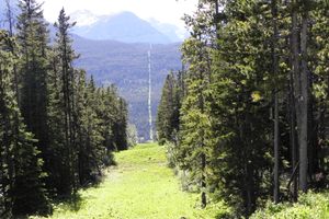
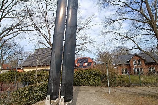
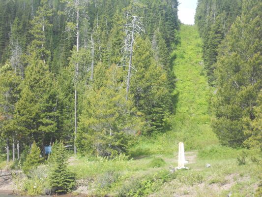
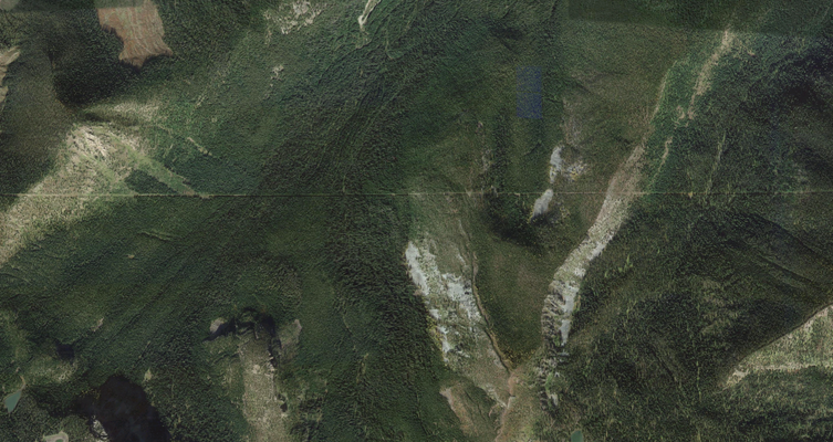
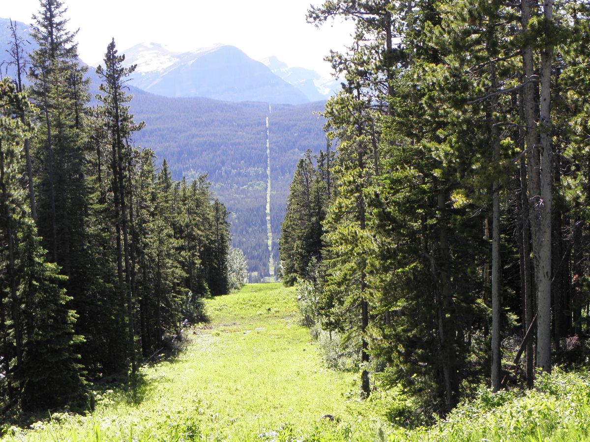
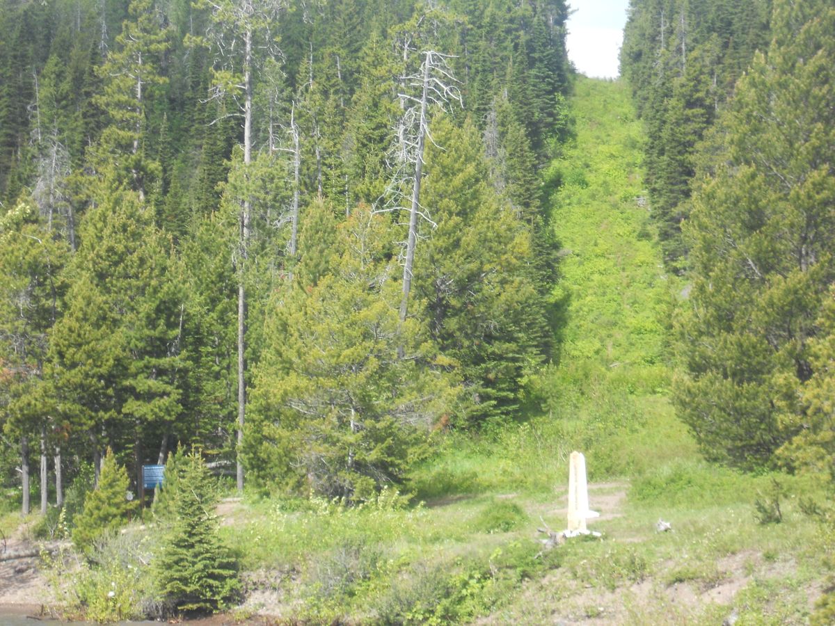
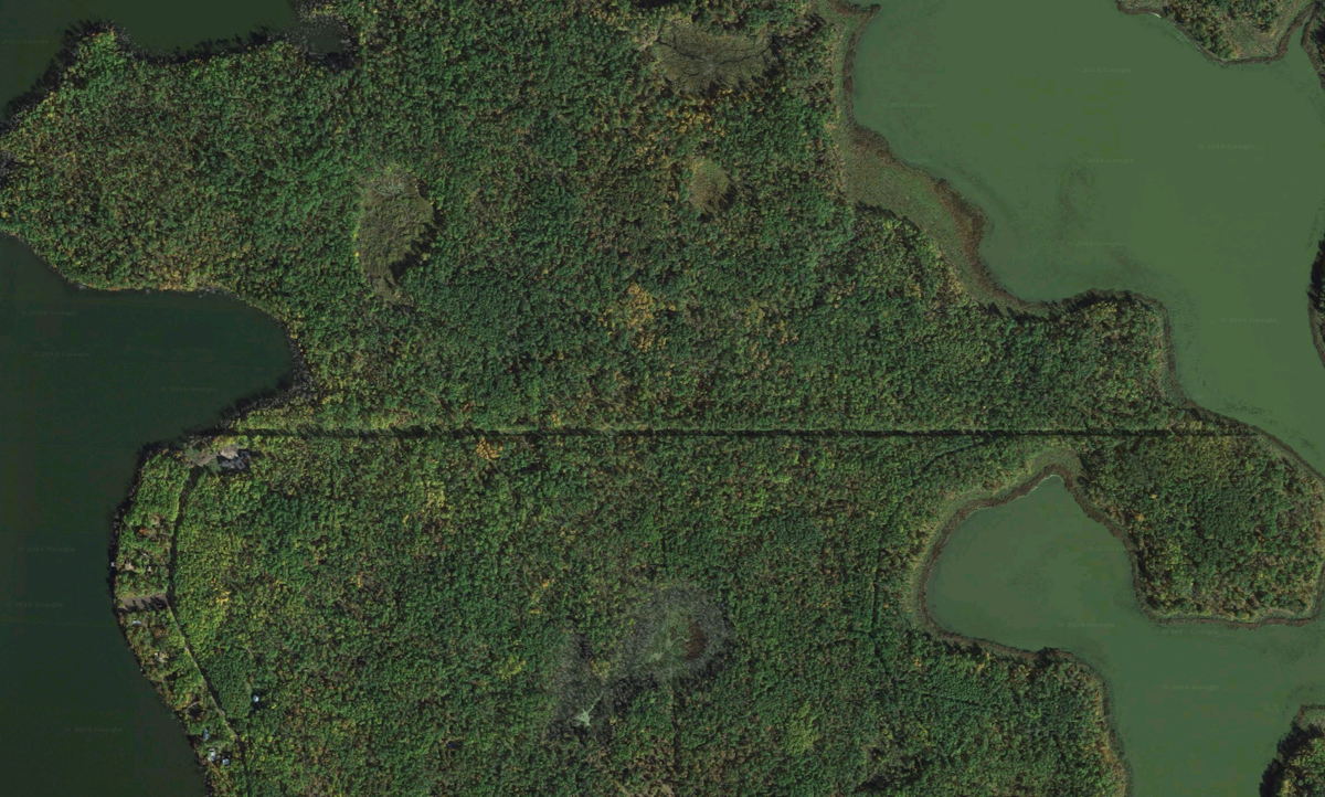
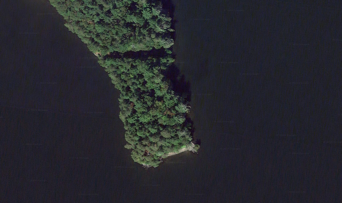
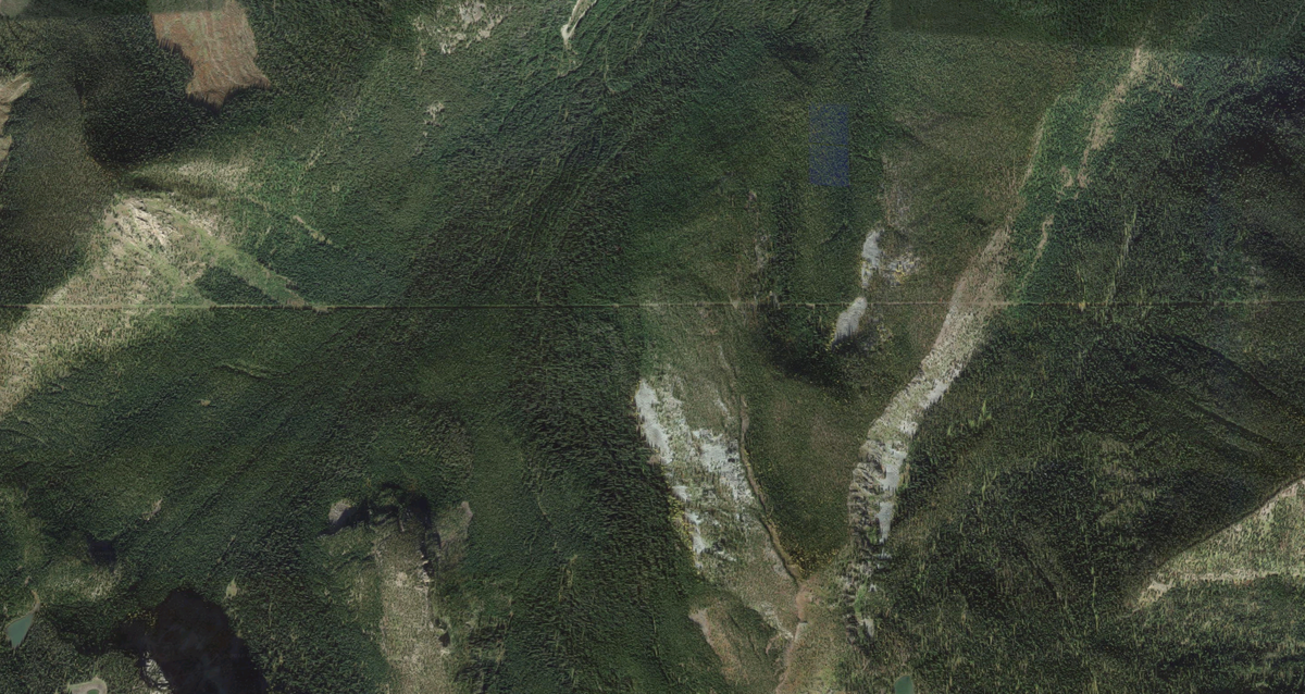
Known as “the Slash," this treeless zone is 20 feet wide and covers everything from narrow isolated islands to steep hillsides. Spanning national forests and towering mountains, the vast majority of the Slash is so remote that it will never receive any visitors (aside from a handful of bears), yet it is still painstakingly maintained every six years with grueling hours of exhausting manual labor.

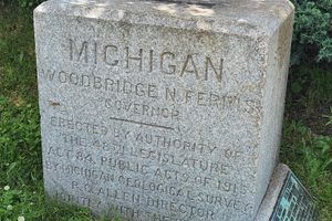
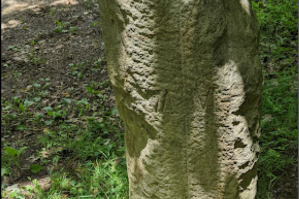
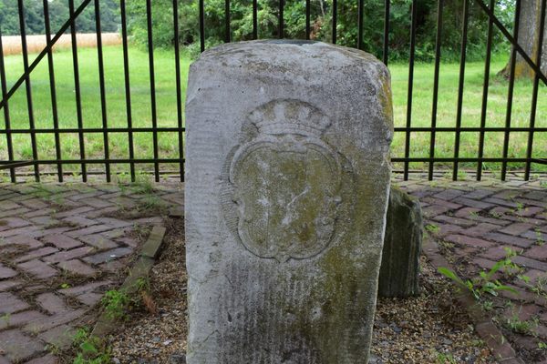
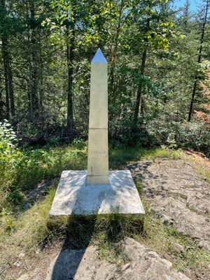
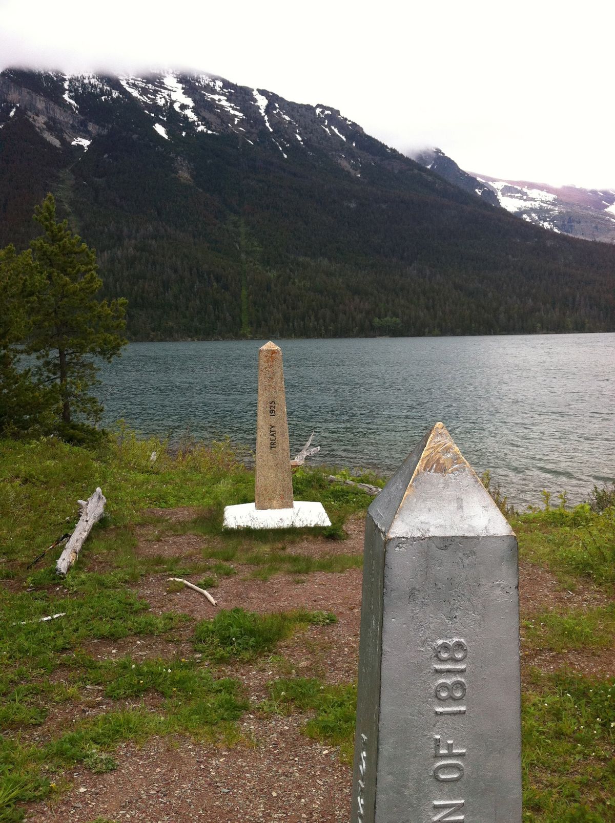
The Slash was initially deforested for the sole purpose of, according to the IBC, making sure that the “average person... knows they are on the border.” It all started in the 1800s, when the western land section of the U.S.–Canada border was set at the 49th parallel. The Slash was cut and over 8,000 original border markers were laid down, most of which are still standing along with it to this day.

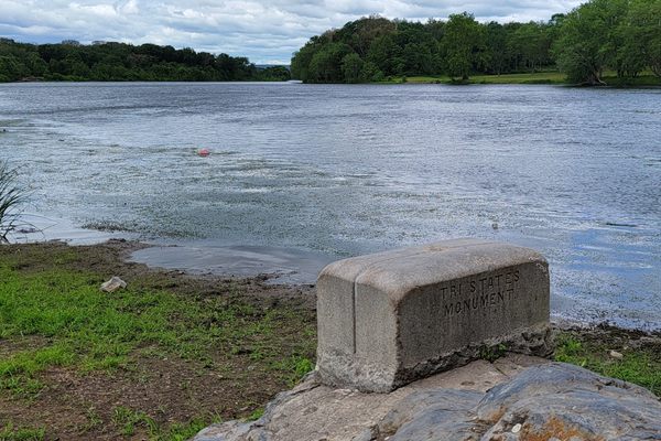
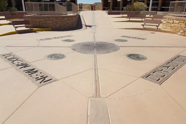
Unfortunately, there was no GPS system at the time, so the border markers were inadvertently placed in a zig-zag fashion, straying north or south of the official 49th parallel border by an average of 295 feet. The lack of sufficient cartography also led to irregular border cutoffs such as Point Roberts and the Northwest Angle.

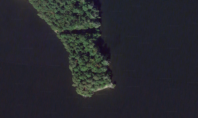
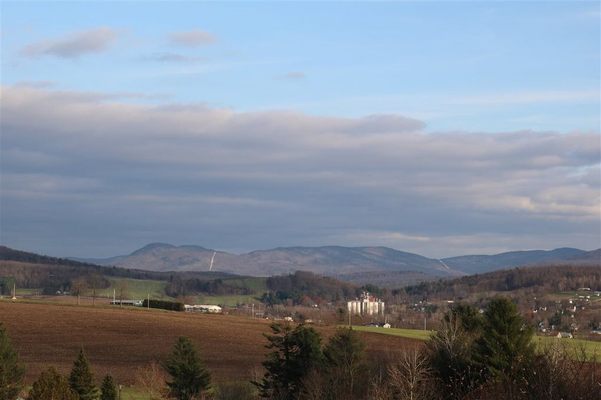
Despite its errors, witnessing the Slash is still on the bucket list of hundreds of geography nerds worldwide. Seeing the Slash can be as simple as going to Google Maps, zooming towards the U.S.–Canada border, and switching to satellite view. Those looking for a more up-close view can travel to Newport, Vermont, and hop aboard Northern Star Cruises, which will take you right alongside the Slash. 

Related Tags

Borders Geographic Markers Geographic Oddities Trees Plants

Know Before You Go

Another way to see the slash is in Waterton-Glacier International Peace Park, on the Pacific Crest Trail, the Continental Divide Trail to Canada, or the Long Trail in Vermont. The slash is also easy to spot at certain land crossings between New England and Canada such as at Canaan Vt. and along Rt 141 in St Hermeneglide QC 

Community Contributors

Added By

lewblank

Edited By

Dayne, dapolzin, jlbielli, bertcourson...

  • Dayne
  • dapolzin
  • jlbielli
  • bertcourson
  • CCG
  • ajayz
  • pigeoncoop
  • johnnordling

Published

September 19, 2016

Edit this listing

Make an Edit
Add Photos
Sources
  • https://www.youtube.com/watch?v=qMkYlIA7mgw
  • http://opinionator.blogs.nytimes.com/2011/11/28/a-not-so-straight-story/?_r=0’
  • https://en.wikipedia.org/wiki/Canada%E2%80%93United_States_border
  • https://www.google.com/webhp?sourceid=chrome-instant&ion=1&espv=2&ie=UTF-8#q=1400000%2F243000000
  • https://passportsymphony.com/weird-borders-in-the-world/
United States–Canada Border Slash
United States / Canada
45.004908, -72.23148

Nearby Places

Haskell Free Library and Opera House

Derby, Vermont

miles away

Bread and Puppet Museum and Theater

Glover, Vermont

miles away

The Museum of Everyday Life

Glover, Vermont

miles away

Explore the Destination Guide

Photo of United States / Canada

United States / Canada

Places 2

Related Stories and Lists

15 Places Where Borders Get a Little Strange

List

By Jonathan Carey

50 Obscure and Amazing Places to Visit in 2017

List

By Atlas Obscura

Related Places

  • Tri-States Monument and Delaware River

    Port Jervis, New York

    Tri-States Monument

    A pair of 19th-century granite markers symbolically record where the state boundaries of New York, New Jersey, and Pennsylvania intersect.

  • Markleysburg, Pennsylvania

    Old Tri-State Monument

    This original Mason-Dixon line cairn placed in the 1760s was put in the wrong location because of the gravitational pull of the Allegheny Mountains.

  • Berlin, Germany

    Steinstücken Exclave

    A helicopter memorial commemorating what was once the only way to access this West Berlin exclave.

  • The new tri-state marker (Camak Stone still missing)

    South Pittsburg, Tennessee

    Camak Stone

    This stone incorrectly marks the 35th parallel, causing some territorial kerfuffles.

  • Semināra iela/Sepa tänav border.

    Valga, Estonia

    Valga/Valka Border

    For the last century, this international border within a small town has appeared and disappeared various times.

  • The trees against an ominous sky.

    Slope Point, New Zealand

    Slope Point

    The most southerly spot on New Zealand's South Island is home to surreally shaped, permanently mangled trees.

  • Teec Nos Pos, Utah

    Four Corners Monument

    The marker offers a rare chance to be in four U.S. states at once, though there's some controversy over its geographic accuracy.

  • Mason-Dixon survey stone.

    Delmar, Maryland

    Transpeninsular Midpoint Marker

    The stone marker that Mason and Dixon placed at the eastern end of the famous north-south border they surveyed.

Aerial image of Vietnam, displaying the picturesque rice terraces, characterized by their layered, verdant fields.
Atlas Obscura Membership

Become an Atlas Obscura Member


Join our community of curious explorers.

Become a Member

Get Our Email Newsletter

Follow Us

Facebook YouTube TikTok Instagram Pinterest RSS Feed

Get the app

Download the App
Download on the Apple App Store Get it on Google Play
  • All Places
  • Latest Places
  • Most Popular
  • Places to Eat
  • Random
  • Nearby
  • Add a Place
  • Stories
  • Food & Drink
  • Itineraries
  • Lists
  • Video
  • Podcast
  • Newsletters
  • All Trips
  • Family Trip
  • Food & Drink
  • History & Culture
  • Wildlife & Nature
  • FAQ
  • Membership
  • Feedback & Ideas
  • Community Guidelines
  • Product Blog
  • Unique Gifts
  • Work With Us
  • About
  • FAQ
  • Advertise With Us
  • Advertising Guidelines
  • Privacy Policy
  • Cookie Policy
  • Terms of Use
Atlas Obscura

© 2025 Atlas Obscura. All Rights Reserved.