Places Foods Stories Newsletters
Top Destinations
Latest Places
Most Popular Places Random Place Lists Itineraries
Add a Place
Download the App
Top Destinations
View All Destinations »
Countries
  • Australia
  • Canada
  • China
  • France
  • Germany
  • India
  • Italy
  • Japan
Cities
  • Amsterdam
  • Barcelona
  • Beijing
  • Berlin
  • Boston
  • Budapest
  • Chicago
  • London
  • Los Angeles
  • Mexico City
  • Montreal
  • Moscow
  • New Orleans
  • New York City
  • Paris
  • Philadelphia
  • Rome
  • San Francisco
  • Seattle
  • Stockholm
  • Tokyo
  • Toronto
  • Vienna
  • Washington, D.C.
Latest Places
View All Places »
Smygehuk Lighthouse
Smygehuk Fyr
Commercial Signage on the Façade of Gruta 77
Malayan Flying Fox
Lubee Bat Conservancy
Deadtime Stories Books & Gifts
Latest Places to Eat & Drink
View All Places to Eat »
Steaming Tender Restaurant
Tiptree Jam Museum entrance.
Tiptree Jam Museum
The Reading Room blends the intimacy of an inviting bar with the inviting solace of a good bookstore.
The Reading Room
Building
The Mountain House
The pond.
Jolly's Mill Pond
Recent Stories
All Stories Video Podcast
Most Recent Stories
View All Stories »
The Hunterian Museum in London.
Where to See the World’s Most Famous Preserved Body Parts
Old Tonopah Cemetery.
Atlas Obscura’s Guide to America’s Most Haunted Cemeteries
Chattanooga Whiskey started distilling here in 2015.
It All Comes Together in Chattanooga
The Clown Motel’s “IT” room.
The Best Haunted Hotels to Book for a Spooky Getaway

No search results found for
“”

Make sure words are spelled correctly.

Try searching for a travel destination.

Places near me Random place

Popular Destinations

  • Paris
  • London
  • New York
  • Berlin
  • Rome
  • Los Angeles
Places Foods Stories Newsletters
Sign In Join
Places near me Random place
All the United States California Taylorsville Walker Mine

Walker Mine

An old copper mine in Plumas National Forest, formerly served by a tramway, seems to have been successfully remediated after years of acrimony and effort

Taylorsville, California

slgwv profile photo
Added By
slgwv
Email
Been Here
Want to go
Added to list
CAPTION
Mill foundations, pic taken before the 2021 Dixie Fire.   slgwv / Atlas Obscura User
Tailings flat in June 2020, before the Dixie Fire.   slgwv / Atlas Obscura User
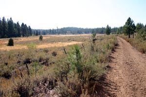
The tailings flat. Note the piles of wood chips, used for remediation. The trees were burned in the 2021 Dixie Fire.   slgwv / Atlas Obscura User
The tailings flat. The trees were burned in the 2021 Dixie Fire.   slgwv / Atlas Obscura User
View north from Grizzly Ridge more or less along the old tramway line to the tailings flat. The trees were burned in the 2021 Dixie Fire.   slgwv / Atlas Obscura User
Telephoto view of the tailings flat from Grizzly Ridge. The trees were burned in the 2021 Dixie Fire.   slgwv / Atlas Obscura User
Collapsed structure at the crest of Grizzly Ridge, probably the tramway pylon.   slgwv / Atlas Obscura User
Mill foundations, pic taken before the 2021 Dixie Fire.   slgwv / Atlas Obscura User
Wood chips spread on tailings in June 2020, before the Dixie Fire.   slgwv / Atlas Obscura User
Mill and tailings, Walker Mine, in June 2020, before the Dixie Fire. The diagonal road leads to the mine at top left.   slgwv / Atlas Obscura User
Mill foundations, pic taken before the 2021 Dixie Fire.   slgwv / Atlas Obscura User
Broken foundation, pic taken before the 2021 Dixie Fire.   slgwv / Atlas Obscura User
Been Here
Want to go
Added to list

About

Reports vary, but the deposits worked by the Walker mine are said to have been (re?)discovered in 1909 and then worked from 1911 to ca. 1943. The primary product was copper, an important industrial metal by the early 20th century. A mill on-site processed the ore into concentrates, which were then shipped out for further processing into copper metal (and byproducts such as silver). A company town, Walkermine (spelled as one word), housed the workers and their families. The concentrates were shipped to the Western Pacific Railroad, a transcontinental route on the other side of Grizzly Ridge to the south. (The railroad still exists and is now part of the Union Pacific. It is paralleled by California State Route 70.)

Transportation was not a problem in the summer months. However, heavy snow cover in the winter blocked the roads—evidently plowing the roads was uneconomic at the time—so a tramway was constructed over Grizzly Ridge to avoid having to shut down the operations completely during the snowy season.

The tramway ran from the mine to Spring Garden, about 9 miles southwesterly. The tram carried ore concentrates out, but also carried personnel and supplies both in and out. The tramway alignment is still shown on the 1972 edition of the USGS 7.5' Mt. Ingalls quad, even though the tramway had been removed long before then. The tramway towers were wooden, and some of them survived for decades, but they were largely destroyed in the 2021 Dixie Fire.

The mine was abandoned when the deposits dwindled, and unsurprisingly, there was no concern about legacy pollution in those days. The mine area was just left to its own devices with no attempt at reclamation. The usual source of pollution in these sorts of ore bodies is so-called acid mine drainage, when sulfides remaining in the rock oxidize to sulfuric acid in the presence of oxygen and water. The increased acidity, not surprisingly, can kill most aquatic life. A secondary effect is that the acidic water leaches materials from the rock, which commonly results in high dissolved concentrations of toxic heavy metals.

The mine itself is also not the only source of pollution; the mill tailings are too. "Tailings" are the crushed rock that's been through the mill. They always contain some missed ore minerals because the separation isn't perfect, as well as other minerals including worthless sulfide minerals (the "gangue") such as pyrite. Because the tailings are so fine-grained, they are even more reactive than the raw rock. The tailings also cover a large area; in fact, the tailings flat from the old mill is prominent in Google satellite photos.

Remediation efforts, therefore, had to address the tailings as well as the mine itself. Ultimately the reactive materials had to be isolated from water and oxygen, and any drainage from the mine and tailings had to be contained and/or rerouted. Unsurprisingly, there was lots of legal maneuvering over the years, focusing on who would be responsible for paying the remediation costs. According to the Central Valley Regional Water Board, the Walker Mine is now a "success story." Let's hope it stays so.

Places

Discover your next amazing Atlas Place.

Get more unusual and extraordinary places each week with the Atlas Obscura Places newsletter.

Your newsletter subscriptions with us are subject to Atlas Obscura's Privacy Policy and Terms of Use.

Know Before You Go

There are two main ways to the Walker Mine. First is from the east, up Grizzly Creek along the Beckwourth-Genessee Road (County Road 112). To get there, turn right off California SR-70 onto West Street in Portola and go 7.4 miles to the junction with Beckwourth-Genessee Road. You will have just crossed Lake Davis Dam. Turn left and go 15.6 miles. Although this is a lower route, it is still likely to be snowed in in the winter months. In dry weather it may be passable to a passenger car, but high clearance may be appreciated.

The other way is from the south over Grizzly Ridge. This route is definitely possible only when snow-free. Turn right off California SR-70 at Squirrel Creek Road (County Road 113) at about 39.91251 N, 120.80732 W. Go 1.6 miles to US Forest Service Road 25N42 on the right, at about 39.92735 N, 120.78616 W, and turn right. This road winds around for several miles and has some steep sections. It is likely to require high clearance as well. USFS 25N42 tops out on Grizzly Ridge at 39.94847 N, 120.73014 W after about 6.8 miles. The tramway crossed Grizzly Ridge about a mile down this ridge, but little remains. On the north side of Grizzly Ridge the scars from the 2021 Dixie Fire are glaringly obvious. You will be traveling mostly through burned-off forest all the way to the mine site. Stay on USFS 25N42 for about 15.4 miles as it winds down to a junction with Beckwourth-Genessee Road at about 39.96103 N, 120.69085 W. Turn right here; Walker Mine is about 1.5 miles up the road.

At the mine site, the weathered concrete foundations of the mill are prominent. The mine site itself, uphill from the mill, has been sealed off as part of the remediation efforts. The tailings flats are visible out in the valley below but are closed to public entry. They have been covered to isolate them from rainwater, and the drainages have been channeled around them.

The effects of the 2021 Dixie Fire are starkly obvious around the mine site. The fire has largely obliterated any tramway towers that may have survived, as well as vegetation by the mine site.

Community Contributors

slgwv profile photo

Added By

slgwv

Published

August 7, 2026

Edit this listing

Make an Edit
Add Photos
Sources
  • https://www.waterboards.ca.gov/centralvalley/water_issues/mining/region5_success_stories/walker_mine/
  • https://www.ghosttowns.com/states/ca/walkermine.html
  • https://www.mindat.org/loc-86673.html
Walker Mine
12000 Beckwourth-Taylorsville Rd
Taylorsville, California, 95983
United States
39.965601, -120.667155
Get Directions

Nearby Places

Clover Valley Lumber Company Railroad

Beckwourth, California

miles away

Western Pacific Railroad Museum

Portola, California

miles away

Keddie Wye

Quincy, California

miles away

Explore the Destination Guide

Photo of California

California

United States

Places 1,580
Stories 145

Nearby Places

Clover Valley Lumber Company Railroad

Beckwourth, California

miles away

Western Pacific Railroad Museum

Portola, California

miles away

Keddie Wye

Quincy, California

miles away

Explore the Destination Guide

Photo of California

California

United States

Places 1,580
Stories 145
Aerial image of Vietnam, displaying the picturesque rice terraces, characterized by their layered, verdant fields.
Atlas Obscura Membership

Become an Atlas Obscura Member


Join our community of curious explorers.

Become a Member

Get Our Email Newsletter

Follow Us

Facebook YouTube TikTok Instagram Pinterest RSS Feed

Get the app

Download the App
Download on the Apple App Store Get it on Google Play
  • All Places
  • Latest Places
  • Most Popular
  • Places to Eat
  • Random
  • Nearby
  • Add a Place
  • Stories
  • Food & Drink
  • Itineraries
  • Lists
  • Video
  • Podcast
  • Newsletters
  • All Trips
  • Membership
  • Feedback & Ideas
  • Community Guidelines
  • Product Blog
  • Unique Gifts
  • Work With Us
  • About
  • FAQ
  • Advertise With Us
  • Advertising Guidelines
  • Privacy Policy
  • Cookie Policy
  • Terms of Use
Atlas Obscura

© 2026 Atlas Obscura. All Rights Reserved.