In Jordan, Bedouins Are Preserving Ancient Rock Art With an App
Locals are using their phones to document and assess the engravings of Wadi Rum.

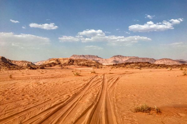
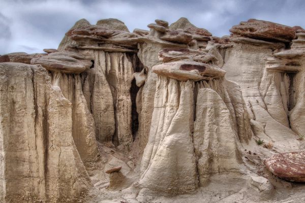
If you’ve seen The Martian, then you didn’t just see Matt Damon’s stranded astronaut trying to escape the Red Planet. You also saw the stunning backdrop that stood in for Mars: Wadi Rum, a UNESCO World Heritage Site that’s home to a citizen science experiment like few others.
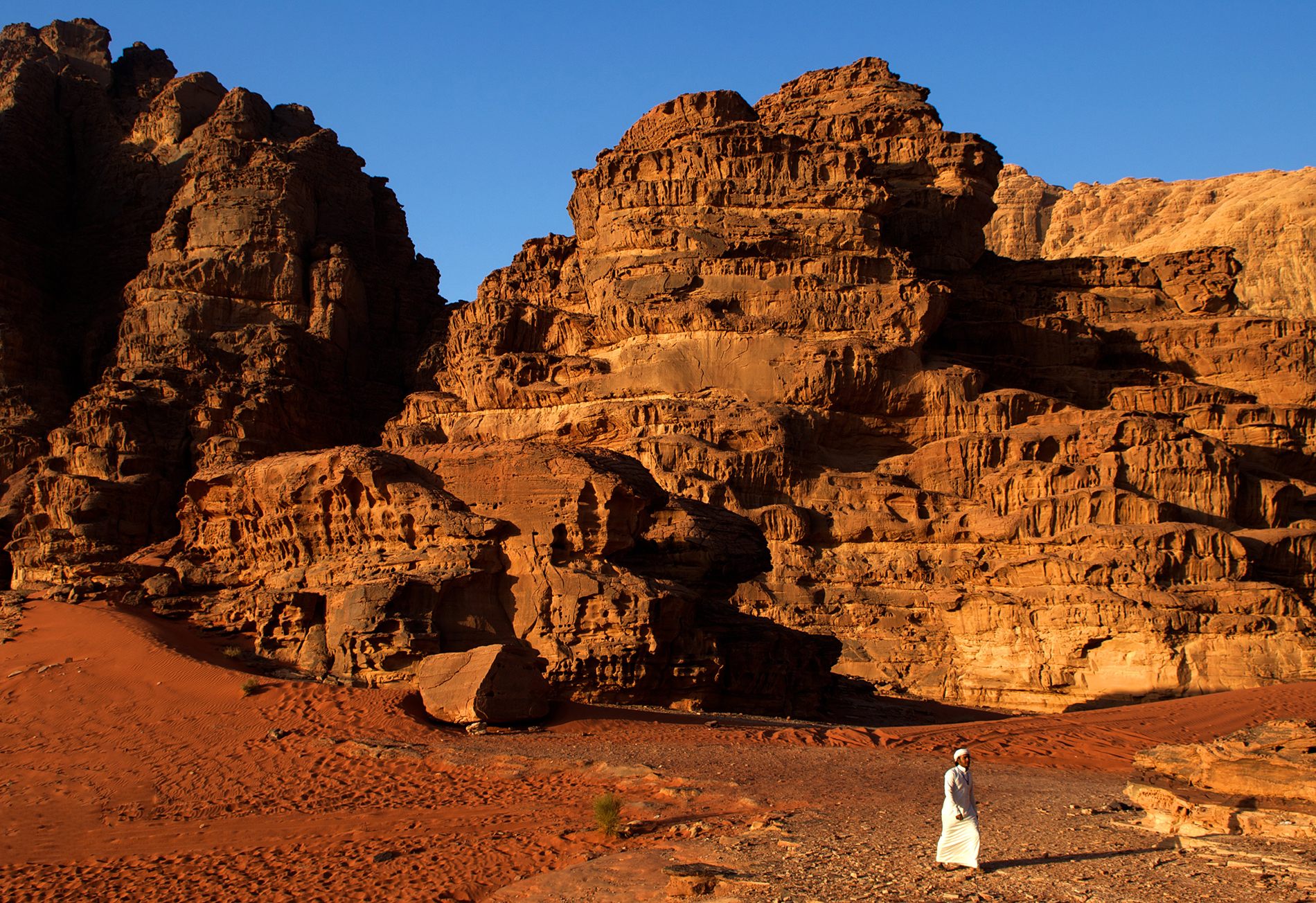
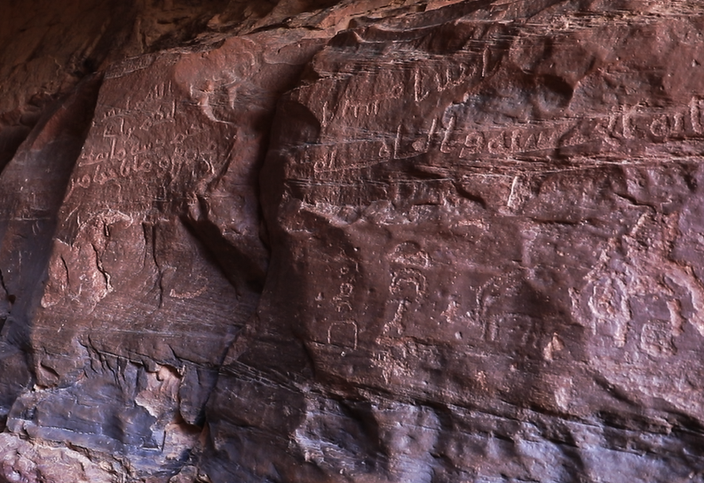
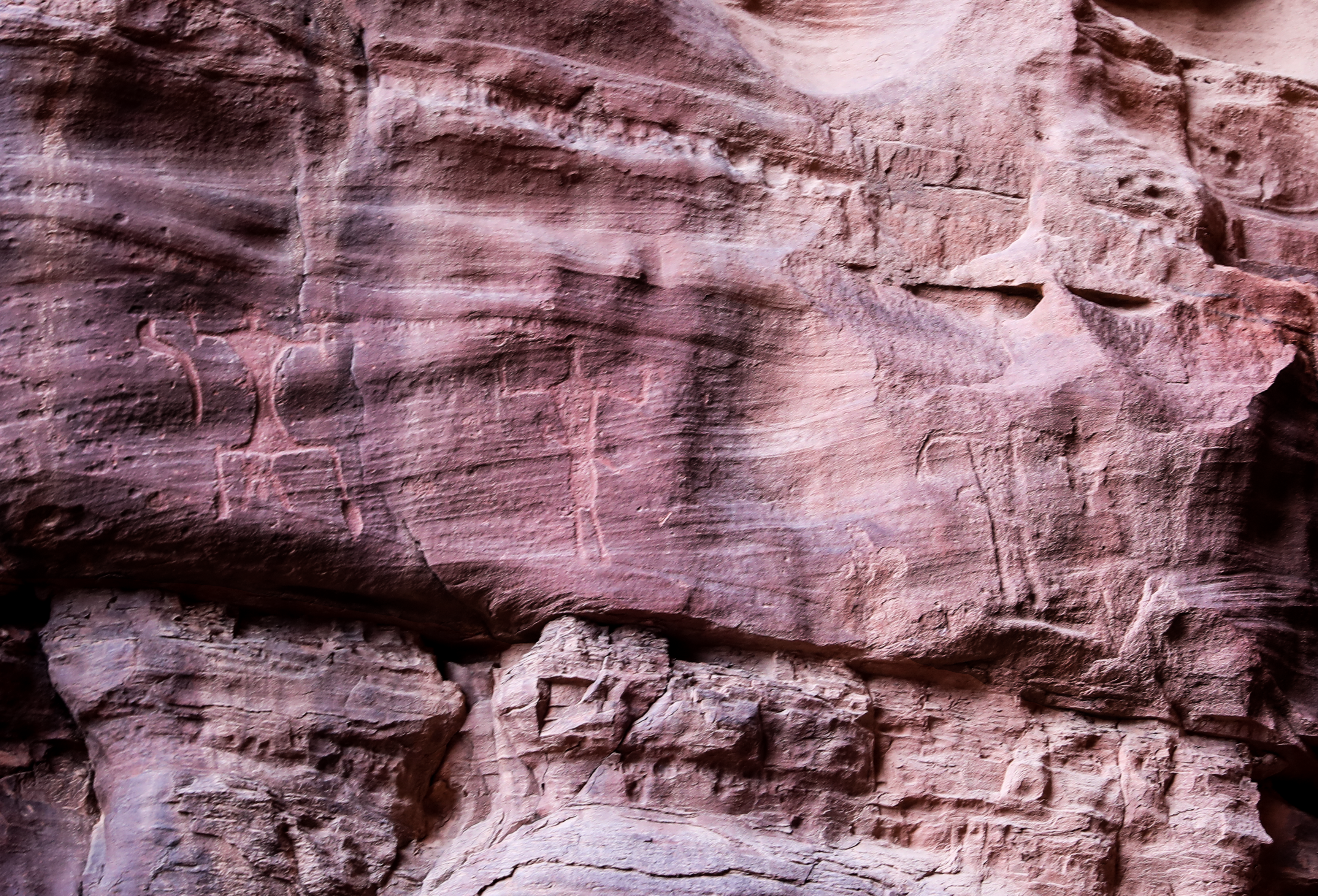
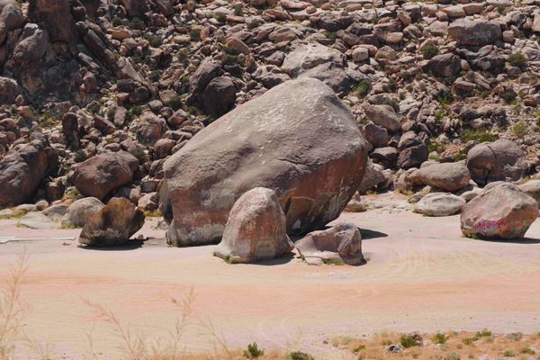
Located in southernmost Jordan, this area, sometimes known as the Valley of the Moon, contains sweeping sand dunes, burnt-red sandstone arches and canyons, and an abundance of rock art, much of which dates back several millennia. These markings were made by the ancestors of the nomadic Bedouin communities that still populate and traverse the area today.
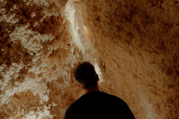
Those ancient engravings, featuring both images and text, represent the cultural heritage of the Bedouins. Sadly, such rock art has been subjected to extensive damage from a range of antagonists, including climate change, erosion, vandals, tourists, and even treasure hunters who mistakenly suspected such carvings indicated something was buried nearby. There has been no major effort to properly document this art, meaning these rich historical artifacts have been slowly fading from both the landscape and the memories of those living there.
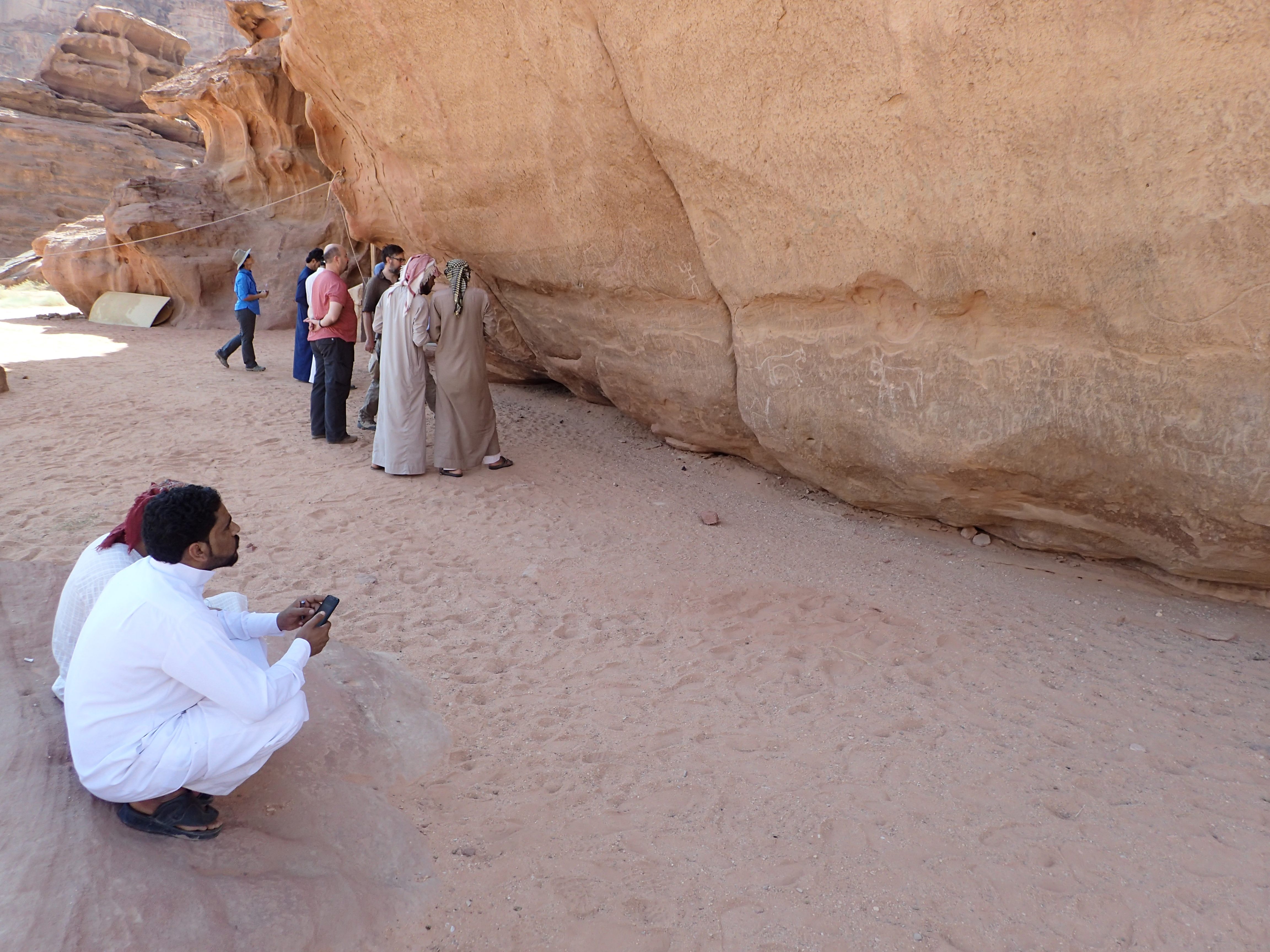
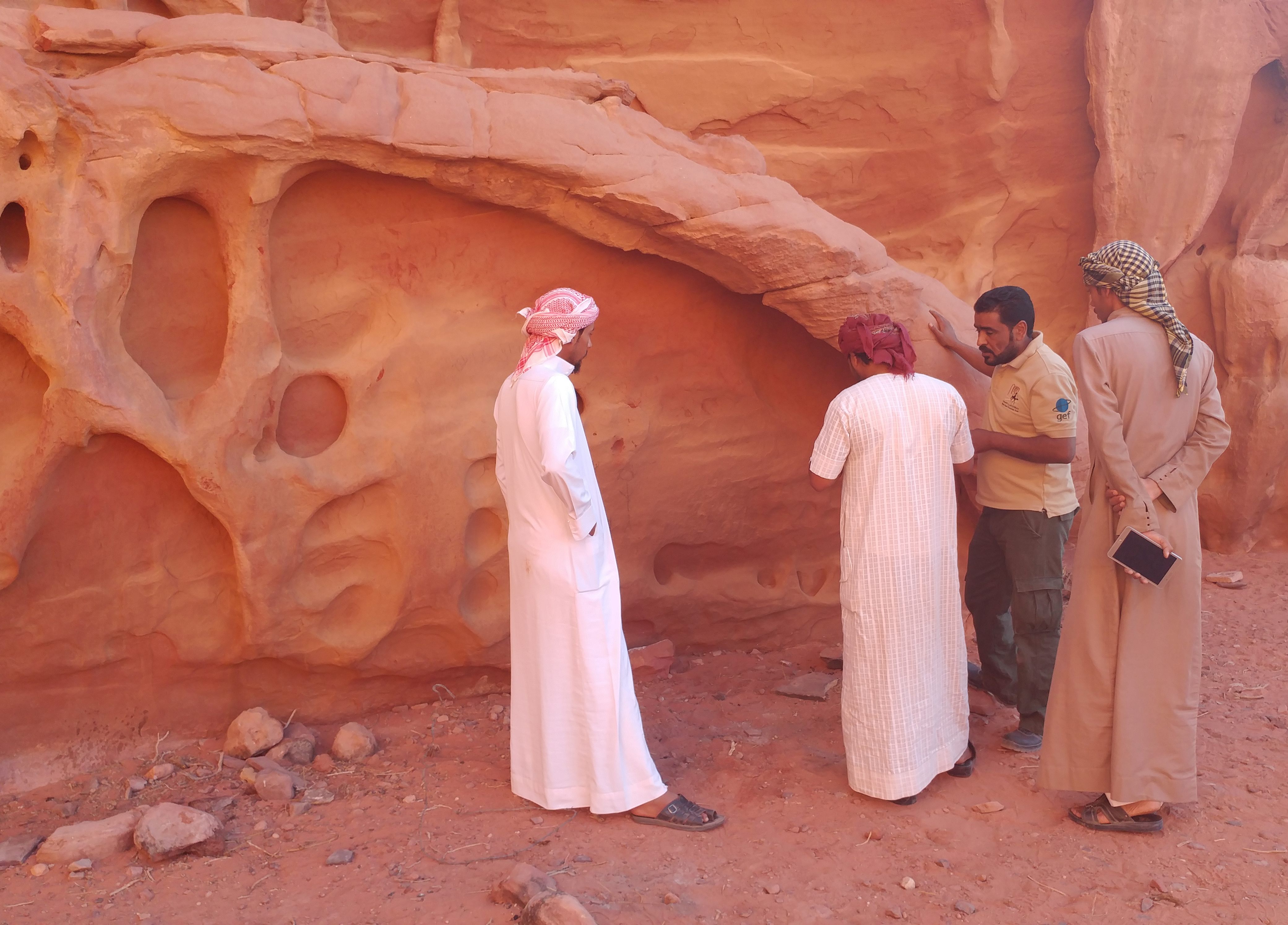
Times, finally, have changed. Today, when a Bedouin stumbles across a piece of rock art, they will instead do something their ancestors never could: Take out a smartphone and capture a geotagged photograph of it. Using a bespoke app, they will also record the quality of the rock art and its level of degradation. After uploading this file to a database full of entries just like it, they’ll carry on moving through the desert.
Although American scholars traveled to Jordan in order to provide training for the app, this was intended to be a project run by the communities living in and around Wadi Rum. That means that the Bedouins have a tool to create a digital atlas of their ancestors’ stories, empowering them to prevent their cultural heritage from disappearing into the sand.
Kaelin Groom, a geographer at Arizona State University, explains that some of the rock art in Wadi Rum is up to 5,000 years old. As well as containing Thamudic descriptions—a blanket term given to ancient regional texts that are poorly understood—these engravings frequently depict animals that no longer live in Jordan, including ostriches, lions, oryxes, ibex, and hyena.
Casey Allen, a lecturer in environmental and earth sciences at the University of the West Indies, visited the area in 2016, and found rock art to be a somewhat understated part of the landscape. He says that local guides didn’t understand why anyone would want to see it compared to ancient buildings or majestic sandstone arches. Allen recalls that tour guides knew a handful of rock art locations, but each gave their own bespoke explanations of what they represented for the delight of their audiences. As in plenty of other places around the world, these fun stories were perhaps not rooted in fact.
Groom notes that archaeological work had certainly been conducted in the area before, but the locals were rarely happy with how it panned out. Although a huge amount of knowledge exists within the local communities, the Bedouins were usually only consulted in order to help non-local researchers locate a given site. Meanwhile, those researchers conducted their work and published in journals that the Bedouins didn’t have access to.
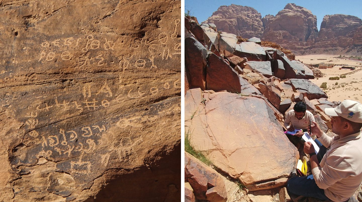
In 2005, Niccole Cerveny, now a professor of geography at Mesa Community College in Arizona, finished her doctoral degree. During her studies, she created the Rock Art Stability Index, or RASI. It was designed to be a simple, quick way to assess how damaged or eroded rock art anywhere in the world was, and thereby help local communities to understand what needed to be protected.
Here’s how it works. You find a rock art panel, and then make a sketch or take a photograph of it while noting its GPS coordinates. You then have a list of 36 different rock-decay forms you have to identify, scoring them between a zero (no damage) and a three (this type of damage dominates the rock panel). Extra detail on the quality of the panel and what it shows is permitted. In order to erase bias, you can get multiple people to judge the same rock art panel and average out their scores.
Taking surface observations and quickly converting them into an overall stability score, Groom explains, “gives you a very detailed view of what’s happening relatively quickly.” Other assessment tools are too slow, too expensive, or too technical for non-specialists. RASI can be used by anyone with basic training in what to look out for, with no specific expertise required beforehand. “That’s why it’s so effective,” Groom says.
RASI’s power was quickly recognized by other researchers, who worked with Cerveny to build on the original model. The powers-that-be also grasped the tool’s potential: Groom explains that it was given a hefty grant by the U.S. government to assess petroglyphs in Arizona’s Petrified Forest National Park in 2009. Groom, who apprenticed under Cerveny, used RASI all over, from Grenada to Colorado and New Mexico. In the southwestern U.S., this ever-growing team of rock art hunters worked with Native American communities and trained them to use RASI.
Groom eventually started talking to staff at the Sustainable Cultural Heritage Through Engagement of Local Communities Project, or SCHEP. Funded by USAID, SCHEP aims to promote, preserve, and manage cultural heritage resources in Jordan via a community-led approach. Knowing Groom had worked extensively with rock art before, representatives from SCHEP approached her in 2016 and asked if she could help out in the Wadi Rum Protected Area. Specifically, they weren’t quite sure how to best satiate UNESCO’s demands to better integrate the local community.
RASI, Groom thought, was perfect. She could travel to Wadi Rum with her colleagues and train the Bedouins to use RASI as the Native American communities had.
But as George Bevan, a digital photogrammetry expert at Queen’s University, explains, RASI needed some modifications to succeed in the Valley of the Moon. Bevan had become interested in how photographic techniques and suites of digital cartography tools, known as geographic information systems (GIS), changed how aspects of the environment were being documented.
Bevan noticed that in the world of digital cartography, everything was becoming mobile. From the U.S. to Jordan, companies engaging in any sort of mapping were choosing mobile apps rather than more traditional, analogue methods to visualize everything from water infrastructure to electrical grids. Rather than using stacks of paper, piles of photographs, and separate GPS-recording tech, he wondered if the same technical efficiency available to mapmakers could be applied to RASI in Wadi Rum.
Serendipitously, by 2015, the Bedouins all had smartphones. They “were really unwilling to give up their Nokia phones due to their extensive battery life,” Bevan explains. However, the benefits of smartphones, including social media access, won them over in the end.
This proved to be fundamental to the success of the project. Not only could an app be developed for these phones that could digitize RASI and make it more efficient, but the geotagging ability of the phones’ inbuilt cameras meant no separate GPS tech was required. As a bonus, each RASI entry could be quickly uploaded to a private database that only authorized team members and government officials could see, ensuring the rock art site locations could be kept a secret from both vandals and clumsy tourists.
After this breakthrough, development of the Wadi Rum project escalated quickly. As well as Groom, Allen, and Bevan, staff from the Wadi Rum Protected Area, SCHEP, the Aqaba Special Economic Zone Authority, the Jordanian Department of Antiquities, the American Center for Oriental Research, and two Jordanian scholars in epigraphy, Ibrahim Sadaqa and Zeyad al-Salameen, all signed up to participate.
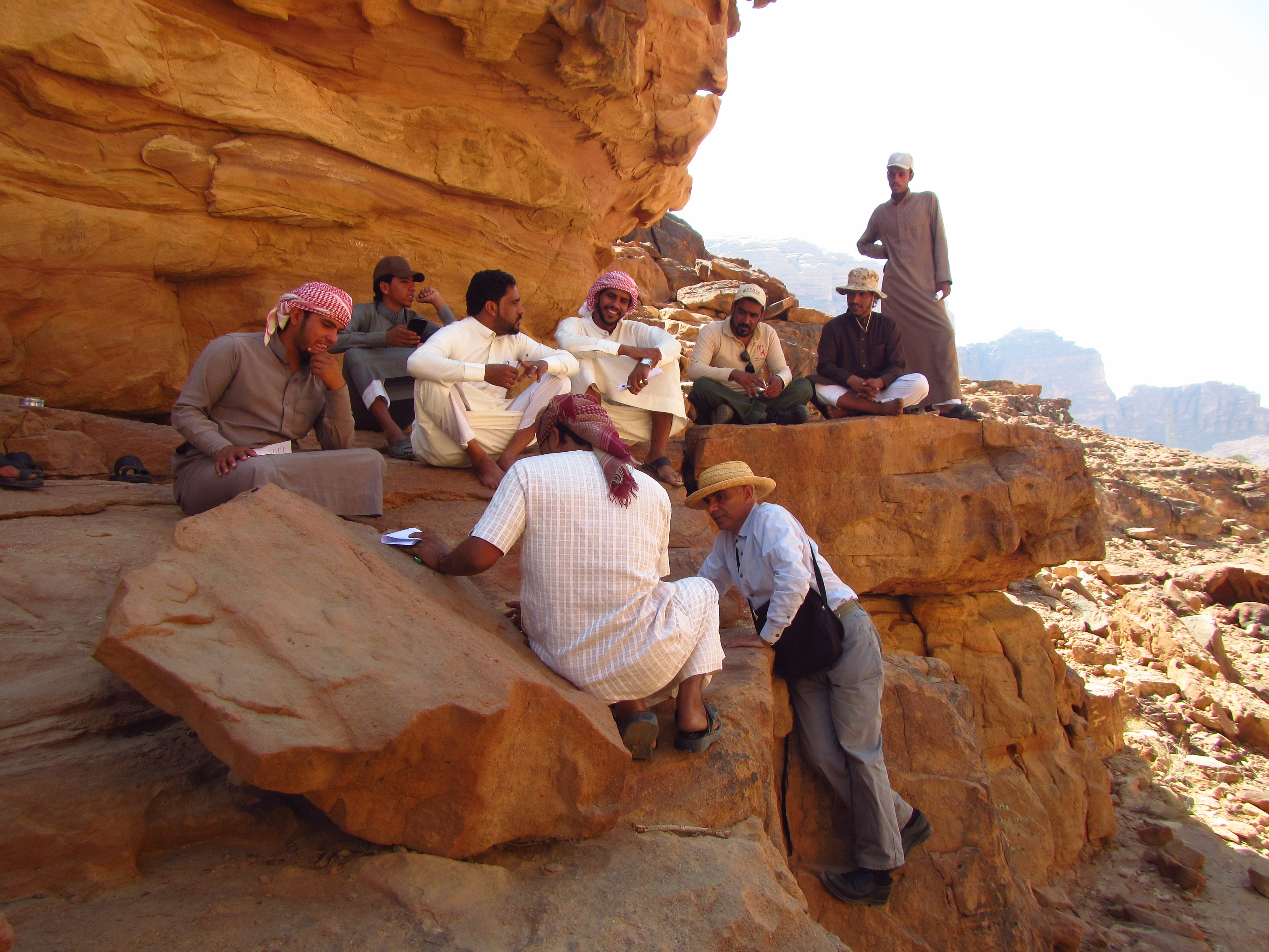
In the spring of 2017, Bevan, Groom, and Allen headed out into the field, and the Community-Based Rock Art and Epigraphic Recording project began. They coordinated the training sessions, but ultimately, they wanted to enable locals to do the job themselves as the researchers receded into the background.
“Studies have shown that when a community is invested in protected something, it’ll be more protected,” says Groom. “It’s so much easier to provide training to someone who already cares than to try and get someone who has training to get them to care about something.”
In order to make the RASI app more useful, developers made it multilingual so that local communities could refer to and understand things not just in Arabic, but in their own dialect. As Bevan explains, translating geomorphological terms was “quite the endeavor,” but Mohammad Dmeian Al Zalabieh, a Bedouin staff member working in the Wadi Rum Protected Area, was crucial to this effort. Not only did he learn English quickly and help with the translations, but he also proved to be a fantastic recruiter of other Bedouins who were keen to help with the project and become qualified “Rock Art Rangers.”
After working together on around 200 different rock art sites for a couple of months, the scholars left the locals to it. In just a few months after the researchers departed, the Bedouins documented over a thousand different rock art panels across Wadi Rum.
The initial mapping period, from 2017 to 2018, blew through all expectations, not just in terms of the archaeological data gathered, but also in how connected the local communities became to this part of their cultural history. “It raised their awareness about the importance of this place and its history,” explains Al Zalabieh.
Cerveny, who visited Wadi Rum during the project, says that “it’s thrilling to see RASI being used as intended.”
The project has just been awarded a three-year funding extension from USAID, and the team members hope to expand the scope of their work. They want to start educational programs with local schools, and get more Bedouin women involved, as long as they are comfortable doing so.
The team has already established the Stone Heritage Research Alliance LLC, a private company that provides professional certifications in RASI, as well as management and consultation services, to other communities with under-serviced rock art heritage. “We want to make stone heritage research and management accessible to everyone,” says Groom.
As well as showcasing the history of the landscape and the people in it, Allen explains that in the future, he and his colleagues hope to highlight more of the science behind rock art preservation as well.
“What we really need is not just specialized rock art guides, but also natural history guides, too,” says Nizar al Adarbeh, Chief of Party for SCHEP. These guides will ensure that communities understand the geology and the formation of Wadi Rum itself, as well as its biodiversity. “To have the first natural history guides in Wadi Rum, run by the community, would be a huge breakthrough,” says Al Adarbeh.
When enough research has been conducted, Al Adarbeh hopes to bring augmented reality to the project, to showcase the communities’ work to visitors in unprecedented detail. As an example, he suggests tourists being shown the sites can use their phones to reveal hidden information, such as translations of the scripts or how old a specific site is. Al Zalabieh, for now, says he wants to keep boosting his language skills in order to “share this heritage to a wider audience,” while working with everyone that wants to chip in to find the best way to protect the rock art for future generations.
Groom underscores that RASI was never guaranteed to work in Wadi Rum, and communities don’t always want to take part. In this case, she asserts, “the community is the success of the project.”


Follow us on Twitter to get the latest on the world's hidden wonders.
Like us on Facebook to get the latest on the world's hidden wonders.
Follow us on Twitter Like us on Facebook