Trips Places Foods Stories Newsletters
Loading...
Loading...
Loading...
Loading...

No search results found for
“”

Make sure words are spelled correctly.

Try searching for a travel destination.

Places near me Random place

Popular Destinations

  • Paris
  • London
  • New York
  • Berlin
  • Rome
  • Los Angeles
Trips Places Foods Stories Newsletters
Sign In Join
Places near me Random place
All the United States Washington Twisp Alder Mine
AO Edited

Alder Mine

Gold, silver, copper, lead, and zinc were once extracted at this abandoned mine near Lookout Mountain.

Twisp, Washington

Added By
Mike S
Email
Been Here
Want to go
Added to list
CAPTION
Remains of old Mill demolished years ago   Curious Crow / Atlas Obscura User
Mineralized hillsides of the mine   Curious Crow / Atlas Obscura User
More mineralized hillsides and remains of demolished Mill.   Curious Crow / Atlas Obscura User
Mineralized rock outcropping of iron and sulfur amongst other minerals.   Curious Crow / Atlas Obscura User
Multi colored waste rock pile   Curious Crow / Atlas Obscura User
Climb to top of hill and go down behind rock hill and this is at the very bottom there.   Curious Crow / Atlas Obscura User
Highly iron mineralized waste rocks   Curious Crow / Atlas Obscura User
Highly mineralized rock outcropping of iron and sulfur   Curious Crow / Atlas Obscura User
Remains of demolished mill.   Curious Crow / Atlas Obscura User
More remains of demolished mill.   Curious Crow / Atlas Obscura User
Huge timber’s from demolished mill.   Curious Crow / Atlas Obscura User
Massive timber from demolished mill.   Curious Crow / Atlas Obscura User
Remains from demolished mill   Curious Crow / Atlas Obscura User
Loading ore at bunker circa 1940. Photo from Methow Gold Co.   Reprinted in https://www.dnr.wa.gov/Publications/ger_ofr2004-16_iaml_alder.pdf. Original photo credited to Photo from Methow Gold Co.
Inside Alder open pit. Note footwall of Alder Creek stock and hanging wall of metavolcanics. View to the south.   Fritz E. Wolff, Donald T. McKay, Jr., and David K. Norman
Overview of the Alder mine site. Disturbed area totals about 13 acres. View to the northeast.   Fritz E. Wolff, Donald T. McKay, Jr., and David K. Norman
Been Here
Want to go
Added to list

About

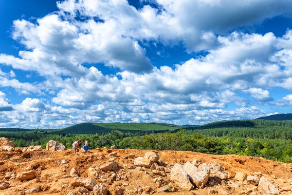
If you are into abandoned places, history, old mines, geology, or rockhounding then this is an easily-accessed location for an interesting day trip from Seattle. Historically associated with the Twisp Mining District, which is now part of the Okanogan National Forest, Alder Mine contains the remnants of a mining operation that dates back to the late 19th century.

Though the early history of this mine is not well documented, the property was acquired by the Alder Group Mining and Smelting Co. in 1903. Alder Mine was active off and on from about 1910 to 1953. During that time, miners extracted about 35,000 ounces of combined gold and silver, approximately 1.3 million pounds of copper, and 686,000 pounds of combined lead and zinc.

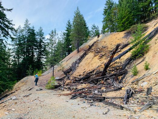
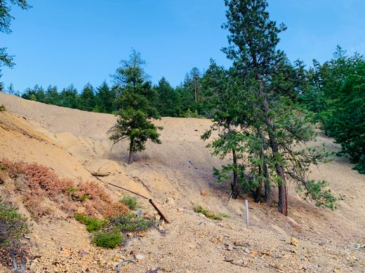
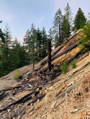
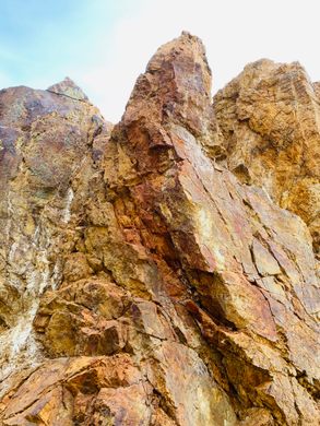
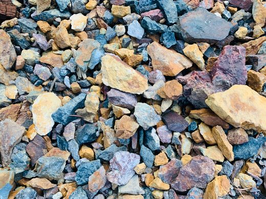
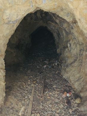
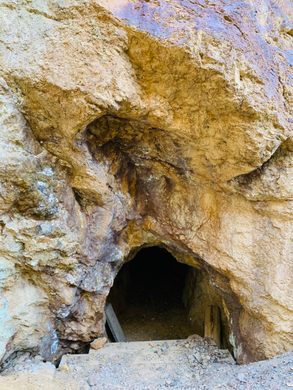
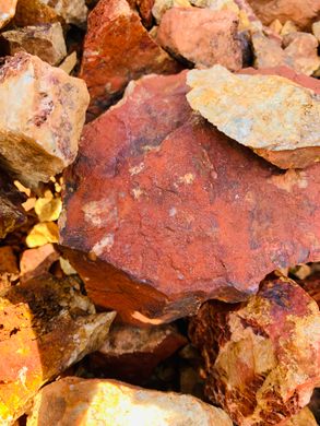
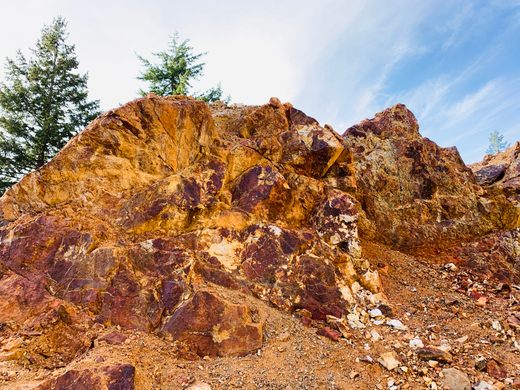
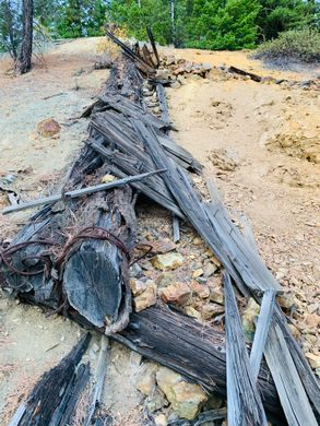
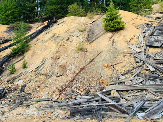
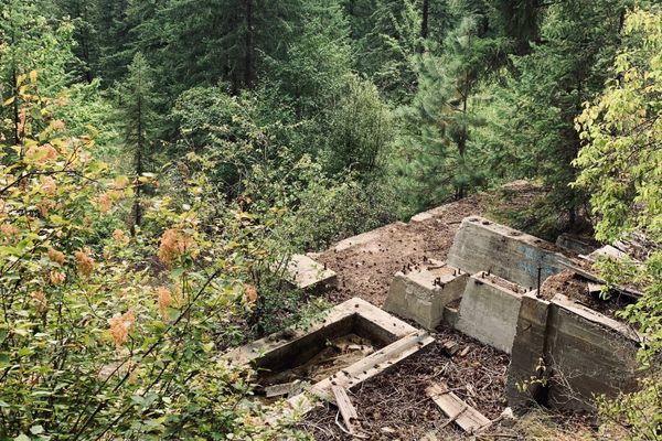
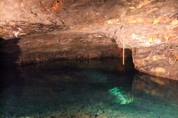
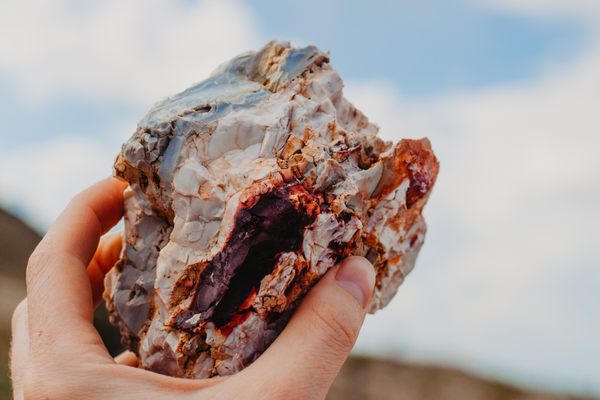
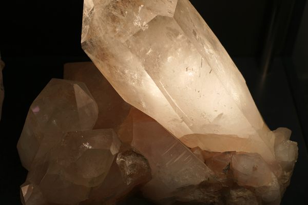
The colors of the geology in the open pit to the bottom are really interesting, especially for rockhounds. At the very top of the open pit, it's worth going up over and around the backside of the formation and down to the bottom where you will find the remnants of old adits (tunnels) that are about six to eight feet long with remaining timbering. (WARNING: Don't go in any adits (tunnels), including this one, as they can have a lack of oxygen and deep drops underfoot, both of which can be extremely dangerous.)  

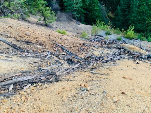
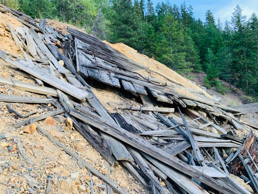
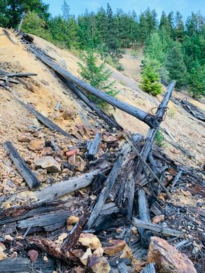
Explore using the three trails that enter from the right side when facing the mine, which allow you to access the three main levels for exploring.  There is lots of copper green staining from the water seeping out of now collapsed adits. Scattered around the site you'll find old wood, metal wiring, ore cart tracks, and more laying in the side of the steep hill.

Related Tags

Rocks Minerals Geology Abandoned Mines Mines

Know Before You Go

The mine can be reached by following the Lookout Mountain road (USFS Road 200) southwest of Twisp for about 6 miles to an elevation of 3,400 feet. The mine is visible to the east of Alder Creek from the road.

Community Contributors

Added By

Curious Crow

Published

October 19, 2021

Edit this listing

Make an Edit
Add Photos
Sources
  • https://cumulis.epa.gov/supercpad/cursites/csitinfo.cfm?id=1002142
  • https://westernmininghistory.com/mine_detail/10103874/
  • https://www.dnr.wa.gov/Publications/ger_ofr2004-16_iaml_alder.pdf
  • http://www.ghosttownsofwashington.com/alder-mine.html
  • https://thediggings.com/mines/26738
  • https://www.anyplaceamerica.com/directory/wa/okanogan-county-53047/mines/alder-mine-1515792/
  • http://www.ghosttownsusa.com/twisp.htm
  • http://northwestrocks.blogspot.com/2013/09/rockhouning-okanogan-county-washington.html
Alder Mine
Lookout Mountain Road (NF-200)
Twisp, Washington, 98856
United States
48.322367, -120.158137
Get Directions

Nearby Places

Hank's Harvest Foods

Twisp, Washington

miles away

Lake Chelan

Washington

miles away

Mazama Queen Mine

Mazama, Washington

miles away

Explore the Destination Guide

Photo of Twisp

Twisp

Washington

Places 2

Nearby Places

Hank's Harvest Foods

Twisp, Washington

miles away

Lake Chelan

Washington

miles away

Mazama Queen Mine

Mazama, Washington

miles away

Explore the Destination Guide

Photo of Twisp

Twisp

Washington

Places 2

Related Places

  • Ruggles Mine

    Grafton, New Hampshire

    Ruggles Mine

    Generations of rockhounds got their start at this beloved, historic mine.

  • Living quarters

    Aouli, Morocco

    Ahouli Mines

    Large-scale operations in these mines ceased in the 1960s, leaving behind crumbling processing facilities and deserted living quarters.

  • Cape Town, South Africa

    Scratch Patch

    An artificial cave littered with semi-precious stones waiting to be picked up.

  • Lagoon in Carnglaze Caverns

    St Neot, England

    Carnglaze Caverns

    A haunted slate mine turned concert hall and a hidden fairy garden.

  • The Coleman Mine is part of the region’s extensive “quartz belt,” a 30-40-mile wide and 170-mile-long band of quartz found in the Ouachita Mountains.

    Jessieville, Arkansas

    Coleman Mine

    Crystal hunters can dig for their own stones at this DIY mine in Arkansas’ quartz belt.

  • One of the many kinds of gemstones you’ll find at Gemfield, a wonderland for rockhounders within Nevada’s Esmeralda County.

    Goldfield, Nevada

    Gemfield

    One of the best places to dig—some say on the planet—for six different types of chalcedony.

  • Quartz from Mount Ida

    Mount Ida, Arkansas

    Avant Mining at Fisher Mountain

    You can dig up your own crystals in the quartz capital of the world.

  • Mina de Mármol

    Cuatrociénegas, Mexico

    Mina de Mármol

    A former travertine mine traces the geological history of this unique desert filled with crystalline blue pools.

Aerial image of Vietnam, displaying the picturesque rice terraces, characterized by their layered, verdant fields.
Atlas Obscura Membership

Become an Atlas Obscura Member


Join our community of curious explorers.

Become a Member

Get Our Email Newsletter

Follow Us

Facebook YouTube TikTok Instagram Pinterest RSS Feed

Get the app

Download the App
Download on the Apple App Store Get it on Google Play
  • All Places
  • Latest Places
  • Most Popular
  • Places to Eat
  • Random
  • Nearby
  • Add a Place
  • Stories
  • Food & Drink
  • Itineraries
  • Lists
  • Video
  • Podcast
  • Newsletters
  • All Trips
  • Family Trip
  • Food & Drink
  • History & Culture
  • Wildlife & Nature
  • FAQ
  • Membership
  • Feedback & Ideas
  • Community Guidelines
  • Product Blog
  • Unique Gifts
  • Work With Us
  • About
  • FAQ
  • Advertise With Us
  • Advertising Guidelines
  • Privacy Policy
  • Cookie Policy
  • Terms of Use
Atlas Obscura

© 2025 Atlas Obscura. All Rights Reserved.