Trips Places Foods Stories Newsletters
Loading...
Loading...
Loading...
Loading...

No search results found for
“”

Make sure words are spelled correctly.

Try searching for a travel destination.

Places near me Random place

Popular Destinations

  • Paris
  • London
  • New York
  • Berlin
  • Rome
  • Los Angeles
Trips Places Foods Stories Newsletters
Sign In Join
Places near me Random place
All Argentina Ushuaia Bahia Lapataia at the End of the World

Bahia Lapataia at the End of the World

The most southern point you can drive to in the Western Hemisphere.

Ushuaia, Argentina

Added By
Ken J
Email
Been Here
Want to go
Added to list
CAPTION
Marker at the end of National Route 3, Bahia Lapataia.   Karla Rosenberg / Alamy
Bahia Lapataia   Lucas Zallio/cc by-nd 2.0
Bahia Lapataia   Sebastian Werner/cc by 2.0
Bahia Lapataia boardwalk.   NTNU Vitenskapsmuseet/cc by 2.0
Marker at the end of National Route 3.   Butterfly voyages/cc by-sa 3.0
Close up of marker.   Ankara/cc by-sa 3.0
Bahia Lapataia   Liam Quinn/cc by-sa 2.0
Bahia Lapataia   Vladimir Popov
Been Here
Want to go
Added to list

About

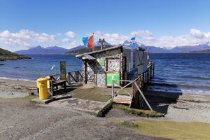
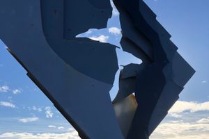
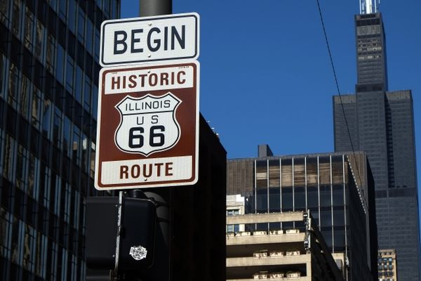
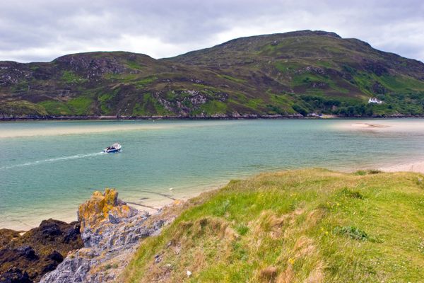
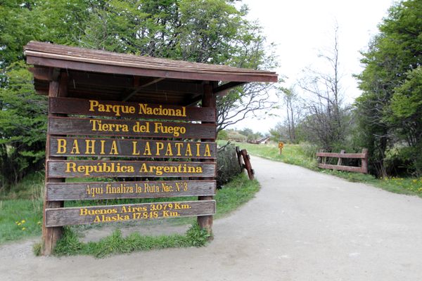
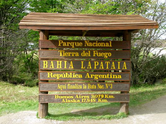
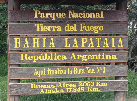
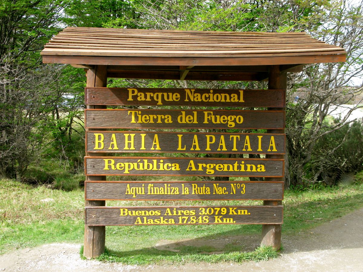
Bahia Lapataia (Lapataia Bay) is the most southern point of the longest motorway on the planet. Here you'll find a handsome sign marking the end of National Route 3, the last leg of the Pan-American Highway network. This is the farthest south you can drive in the Western Hemisphere.

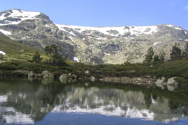
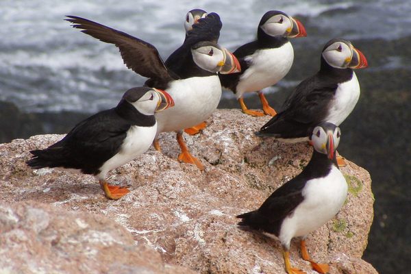
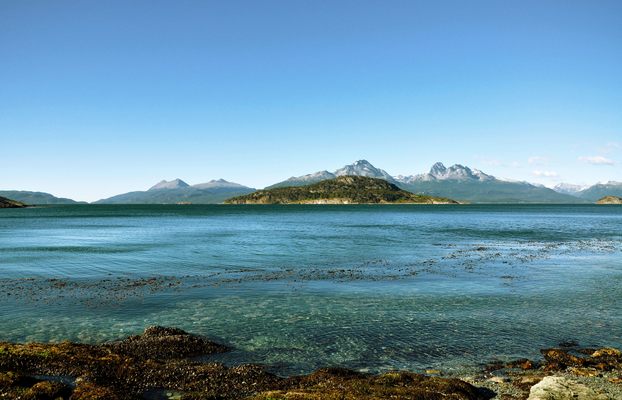
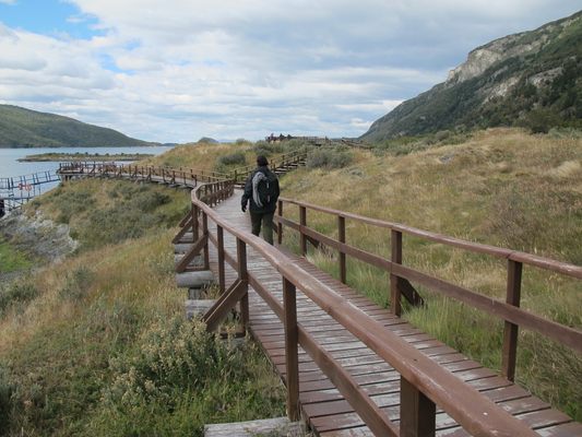
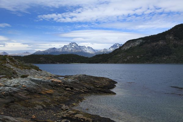
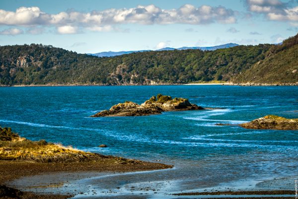
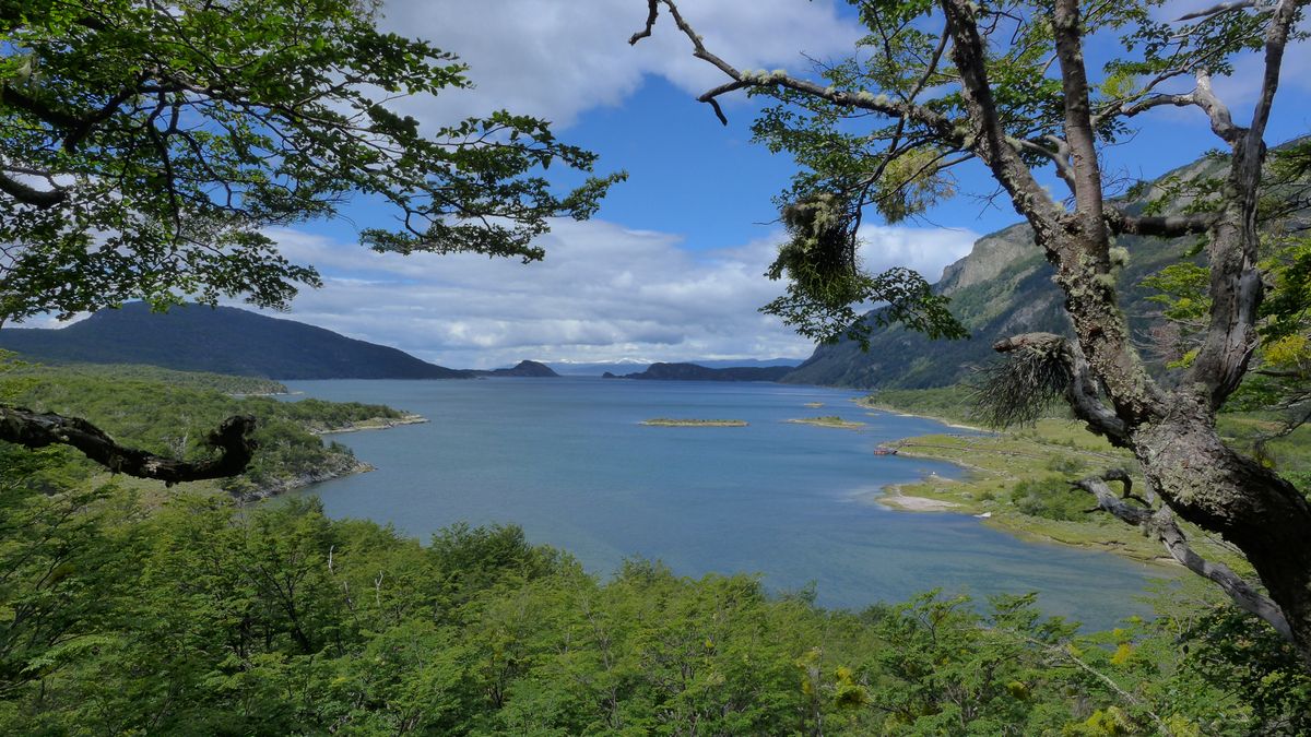
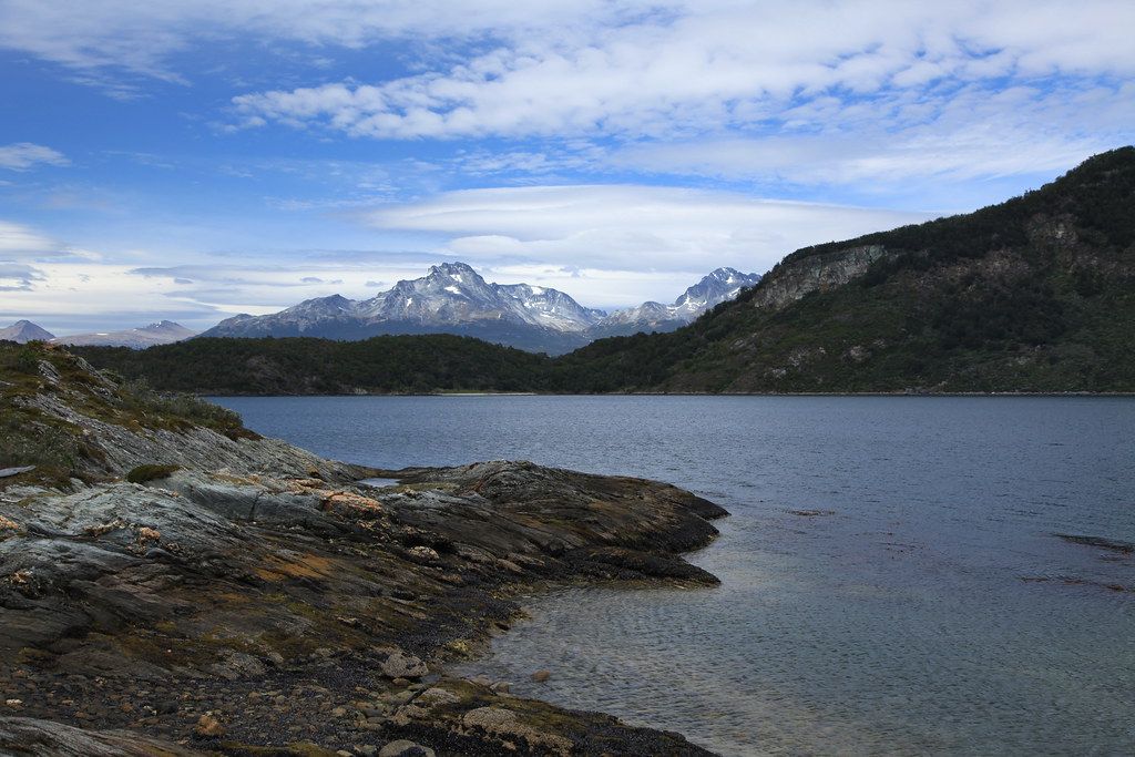
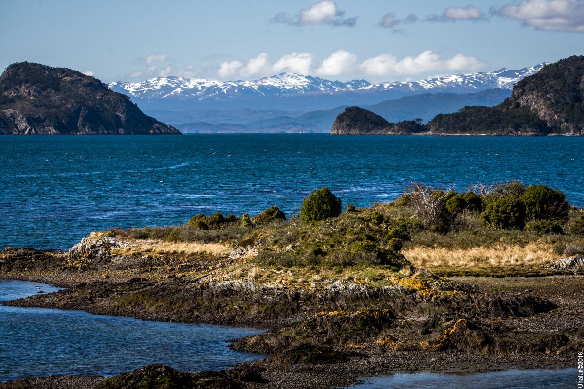
Near the sign is a boardwalk leading out to the bay, a remote fjord at the tip of Argentine Patagonia. The fjord is a branch of the Beagle Channel, which was named after the boat carrying Charles Darwin on his journey. The area is still popular among naturalists looking for sea birds, dolphins, and other cold-water animals. Most of the land around the bay is now protected.

This secluded wilderness has been inhabited for 10,000 years, recently only by the indigenous Yámana people, who gave the bay its name, which means "Bay of Forests" in the native Yámana language. They were known to build fires as a form of communication between islands, which inspired the name Tierra del Fuego, or "Land of Fire." The rough seas and sub-polar climate were scarcely seen by outsiders until the 1600s. From this bay, you would sail west and quickly be in the Pacific Ocean, or east and be in the Atlantic. 

Related Tags

Roads Geographic Markers National Parks Signs Wildlife Conservation

Know Before You Go

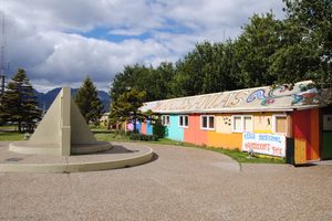
Bahia Lapataia is located within Tierra del Fuego National Park. A great place to start or end a serious road trip, the "End of the World" is about a 45-minute drive from Ushuaia (a popular destination for winter sports most the year). The road should be open year-round but remember to plan your trip for Southern Hemisphere seasons, as it rains 200 days of the year. 

Community Contributors

Added By

KenJ

Edited By

Martin, irino4ka, natefricker11, Vaquero...

  • Martin
  • irino4ka
  • natefricker11
  • Vaquero
  • Meg

Published

August 19, 2019

Edit this listing

Make an Edit
Add Photos
Sources
  • https://es.wikipedia.org/wiki/Bah%C3%ADa_Lapataia
  • https://en.wikipedia.org/wiki/Pan-American_Highway
  • https://en.wikipedia.org/wiki/Ushuaia
Bahia Lapataia at the End of the World
National Route 3
Ushuaia
Argentina
-54.85557, -68.576158
Get Directions

Nearby Places

Postal del Fin del Mundo

Ushuaia, Argentina

miles away

The Time Capsule of Ushuaia

Ushuaia, Argentina

miles away

Cape Horn Monument

Cabo de Hornos, Chile

miles away

Explore the Destination Guide

Photo of Ushuaia

Ushuaia

Argentina

Places 2

Nearby Places

Postal del Fin del Mundo

Ushuaia, Argentina

miles away

The Time Capsule of Ushuaia

Ushuaia, Argentina

miles away

Cape Horn Monument

Cabo de Hornos, Chile

miles away

Explore the Destination Guide

Photo of Ushuaia

Ushuaia

Argentina

Places 2

Related Places

  • The sign before it was covered in stickers.

    Chicago, Illinois

    Beginning (and End) of Historic Route 66

    A journey begins with a single step, and for many, the road-trip of a lifetime started at this Chicago intersection.

  • The crossing offers a safer way for animals to move across the highway.

    Improvement District No. 9, Alberta

    Banff Wildlife Crossings

    Though many were skeptical at first, these animal-specific routes across the Trans-Canada Highway have been a major conservation success.

  • An elk herd in Cataloochee.

    Maggie Valley, North Carolina

    Smoky Mountain Elk Fest

    An annual celebration of the region's successful elk reintroduction program.

  • A giant anteater in its natural habitat the Cerrado grasslands, Serra Da Canastra.

    São Roque de Minas, Brazil

    Giant Anteaters of Serra da Canastra

    This breathtaking national park is one of the best places to see the weird and wonderful giant anteater in the wild.

  • Ferry to Cape Wrath across the Kyle of Durness.

    Keoldale, Scotland

    Cape Wrath

    The farthest northwesterly point of the British mainland is one of the most remote places in the Scottish Highlands.

  • Circo lake in the park.

    Rascafría, Spain

    Peñalara National Park

    A breathtaking and biodiverse wilderness in the mountain setting of Ernest Hemingway's "For Whom the Bell Tolls."

  • Green Belt sign in Emsworth.

    Pittsburgh, Pennsylvania

    Allegheny County Belt System

    Color-coded signs direct drivers on a network of routes designed to avoid Pittsburgh traffic.

  • Puffins thrive off the coast of Maine thanks to a 1970s effort called Project Puffin.

    Rockland, Maine

    Project Puffin Visitor Center

    Learn about the history and hopeful future of Maine’s nesting birds at this interactive Audubon facility.

Aerial image of Vietnam, displaying the picturesque rice terraces, characterized by their layered, verdant fields.
Atlas Obscura Membership

Become an Atlas Obscura Member


Join our community of curious explorers.

Become a Member

Get Our Email Newsletter

Follow Us

Facebook YouTube TikTok Instagram Pinterest RSS Feed

Get the app

Download the App
Download on the Apple App Store Get it on Google Play
  • All Places
  • Latest Places
  • Most Popular
  • Places to Eat
  • Random
  • Nearby
  • Add a Place
  • Stories
  • Food & Drink
  • Itineraries
  • Lists
  • Video
  • Podcast
  • Newsletters
  • All Trips
  • Family Trip
  • Food & Drink
  • History & Culture
  • Wildlife & Nature
  • FAQ
  • Membership
  • Feedback & Ideas
  • Community Guidelines
  • Product Blog
  • Unique Gifts
  • Work With Us
  • About
  • FAQ
  • Advertise With Us
  • Advertising Guidelines
  • Privacy Policy
  • Cookie Policy
  • Terms of Use
Atlas Obscura

© 2025 Atlas Obscura. All Rights Reserved.