About
As train traffic slowed on the Bloomingdale Line in the 1990s, attention turned to how the train line might be used to increase much-needed green space. The City of Chicago brought residents together to discuss an area of particular concern – Logan Square, a neighborhood that, at the time, had the least amount of open space per capita of any in Chicago.
Despite the neighborhood’s historic boulevards, Logan Square needed an additional 99 acres of active open space just to be brought up to City minimums. The City’s proposal to convert the Bloomingdale Line to a park was included in the 2004 Logan Square Open Space Plan, which prompted the Chicago Department of Transportation to begin applying for federal transportation funding for the project.
The City’s proposal prompted neighbors to form Friends of the Bloomingdale Trail, an organization whose vision and mission were key to creating The 606. The group created a groundswell of community support not just in Logan Square, but in the other neighborhoods surrounding the rail line: Humboldt Park, Bucktown and Wicker Park. Knowing the Trust for Public Land’s work creating Haas Park in Logan Square, members of the Friends of the Bloomingdale Trail reached out to the national non-profit, which helped bring together a coalition of city and civic organizations to move the project forward. The alliance of the City of Chicago, Chicago Park District, The Trust for Public Land, and dozens of groups is turning the idea for a trail into a park and trail system to connect four Chicago neighborhoods and create innovative park space for thousands of residents and visitors alike.
Using its expertise in land conservation, creating urban parks and community collaboration, The Trust for Public Land hosted numerous community meetings, including a three-day design charrette in 2011. Community input into design and function has been a hallmark of The 606 process. Numerous public meetings brought community input into the park and trail system’s design, function, and aesthetics of the parks, trail, and event spaces. That process culminated in an unveiling of the final design plans and overarching project name in June of 2013.
The park and trail system is also the signature project of Mayor Emanuel and his push to create 800 new parks, recreation areas and green spaces throughout Chicago. The City of Chicago and The Chicago Park District, and The Trust for Public Land have provided the financial, cooperative, and logistical strength to move this public-private partnership from a dream into reality.
The 606 brings together arts, history, design, trails for bikers, runners, and walkers, event spaces, alternative transportation avenues, and green, open space for neighbors, Chicagoans, and the world. We look forward to sharing The 606 with you and your family.
------ Before it opened.....
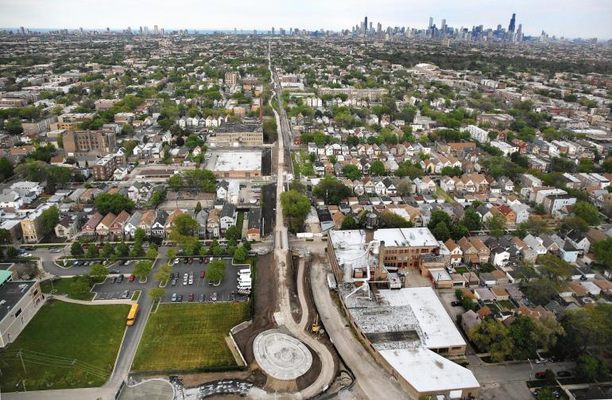
In Chicago's Bucktown/Wicker Park area, an abandoned elevated railway allows an unusual urban hiking experience on a three mile green-way.
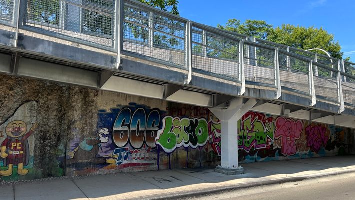
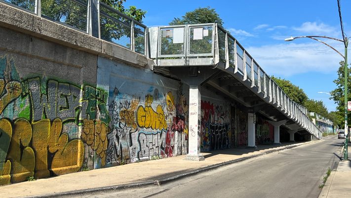
Slated to become an official city park, currently it is untended and has all the charms of an abandoned railway. What makes it unique is it's position running through and over the historic Bucktown neighborhood. Hikers who go through the trouble of accessing the trail's partly concealed entrances (see directions, and web links to map) will share overhead urban views with only a few of Chicago's more intrepid joggers and dog walkers.
Daytime jaunts are recommended as the night-time the tracks become a favorite spot of local teenagers to go drinking, and various glass bottle smashers, who have left their detritus along the way.
The easternmost entrance is at Ashland. You cannot go further east due to a fence across the greenway. The park extends West for three miles with no traffic crossings, entirely elevated and strangely isolated from the daily bustle.
Related Tags
Know Before You Go
The 606 runs along the Bloomingdale Trail (1800N) for 2.7 miles between Ashland (1600W) and Ridgeway (3750W). Walking, cycling or taking public transportation is encouraged. There are 12 access points, approximately every quarter-mile, and a total of 17 access ramps, all of which are accessible to people with disabilities.
There is no dedicated parking facility for The 606, but there is metered and street parking in the neighborhoods surrounding the trail (some areas may require resident permits to park). If not arriving on bike or foot, we recommend using public transportation to visit the park and trail system.
Easiest transit access is via the CTA Blue Line – visitors will be closest to access points at either the Western or Damen stops. Another central hub with which visitors may be familiar (also at the Damen stop) is Wicker Park’s shopping, restaurant and club district at the Damen/Milwaukee/North intersection.
On the western end of the trail, visitors also can take the Blue Line to the Logan Square stop, which features a central plaza and the Illinois Centennial Monument, as well as boutique shops, restaurants and clubs. Then they can experience Chicago’s famed boulevard system by walking down Kedzie to the trail (approximately a mile south).
The 606 can also be accessed via Metra (commuter rail) at the Healy stop on the Milwaukee District North Line (also approximately a mile walk) or the Clybourn stop on the Union Pacific North and Northwest Lines (which is about two blocks away). Bicycle use is encouraged on the multi-use path.
Community Contributors
Added By
Published
March 16, 2010


