Places Foods Stories Newsletters
Loading...
Loading...
Loading...

No search results found for
“”

Make sure words are spelled correctly.

Try searching for a travel destination.

Places near me Random place

Popular Destinations

  • Paris
  • London
  • New York
  • Berlin
  • Rome
  • Los Angeles
Places Foods Stories Newsletters
Sign In Join
Places near me Random place
All Sint Maarten Belvedere Concordia Monument

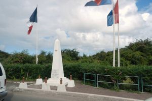
Concordia Monument

Where Saint-Martin ends and Sint Maarten begins (or vice versa).

Belvedere, Sint Maarten

I island fan profile photo
Added By
island fan
Email
Been Here
Want to go
Added to list
CAPTION
Concordia Monument   Michael A. Orlando / CC BY-SA 3.0
  Richie Diesterheft / CC BY 2.0
  island fan / Atlas Obscura User
Been Here
Want to go
Added to list

About

With an area of 34 square miles, the Caribbean island of St. Maarten / St. Martin has the unique distinction of being the smallest inhabited island that is split between two countries. The northern portion is Saint-Martin, an overseas collectivity of France, while the southern portion is Sint Maarten, a constituent country of the Kingdom of the Netherlands.

The border that runs through the middle of the island is open and has been since 1648, when the European powers signed the Treaty of Concordia, which split the island roughly in half (the French side is slightly larger). This monument marks where the autonomous Dutch side of the Caribbean island of St. Maarten / St. Martin stops and the French side (and European Union) commences—and vice versa.

In 1948, to celebrate 300 years of peaceful coexistence, a border monument was built on the main highway between the cities of Philipsburg (Sint Maarten) and Marigot (Saint-Martin). In 2008, a new border crossing monument was dedicated.

Next to the temples of Angkor Vath in Cambodia, the monument is the only building making it to a national flag (Dutch side Sint Maarten). It is also featured on the joint unity flag of the island.

Places

Discover your next amazing Atlas Place.

Get more unusual and extraordinary places each week with the Atlas Obscura Places newsletter.

Your newsletter subscriptions with us are subject to Atlas Obscura's Privacy Policy and Terms of Use.

Related Tags

Flags Geographic Markers Islands Monuments Border Crossings Borders

Community Contributors

I island fan profile photo

Added By

island fan

Michelle Cassidy profile photo

Edited By

Michelle Cassidy

  • Michelle Cassidy profile photo Michelle Cassidy

Published

January 12, 2024

Edit this listing

Make an Edit
Add Photos
Sources
  • https://www.st-martin.org/us/learn-more/must-sees/a-symbolic-border/#:~:text=On%20March%2023%2C%201648%2C%20the,the%20point%20where%20they%20met.
  • https://www.visitstmaarten.com/monuments/concordia-monument/
  • https://en.wikipedia.org/wiki/Saint_Martin%E2%80%93Sint_Maarten_border
Concordia Monument
Belvedere, 97150
Sint Maarten
18.055938, -63.040438

Nearby Places

Tata the Bus Driver

Belvedere, Sint Maarten

miles away

Yoda Guy Movie Exhibit

Philipsburg, Sint Maarten

miles away

Fort Amsterdam

Philipsburg, Sint Maarten

miles away

Explore the Destination Guide

Photo of Belvedere

Belvedere

Sint Maarten

Places 2

Nearby Places

Tata the Bus Driver

Belvedere, Sint Maarten

miles away

Yoda Guy Movie Exhibit

Philipsburg, Sint Maarten

miles away

Fort Amsterdam

Philipsburg, Sint Maarten

miles away

Explore the Destination Guide

Photo of Belvedere

Belvedere

Sint Maarten

Places 2

Related Places

  • Tri-States Monument and Delaware River

    Port Jervis, New York

    Tri-States Monument

    A pair of 19th-century granite markers symbolically record where the state boundaries of New York, New Jersey, and Pennsylvania intersect.

  • Old Tri-State Monument

    Markleysburg, Pennsylvania

    Old Tri-State Monument

    This original Mason-Dixon line cairn placed in the 1760s was put in the wrong location because of the gravitational pull of the Allegheny Mountains.

  • North face of the monument.  170 miles, 47 chains from Oregon to here.  A "chain" is 66 feet, so there are 80 chains in a mile.

    Verdi, Nevada

    Von Schmidt Monument

    An iron monument on the 120th meridian as surveyed, one of only four marking the boundary between Nevada and California north of Lake Tahoe.

  • Dreiländereck

    Basel, Switzerland

    Dreiländereck

    A futuristic rocket marks the spot where three borders meet.

  • Marco do Equador on Ilhéu das Rolas

    Ilhéu das Rolas, São Tomé and Príncipe

    Marco do Equador

    The equator passes through this tiny island in the eastern Atlantic.

  • The 3 points where Colorado, Kansas and Oklahoma come together.

    Keyes, Colorado

    3 Points Kansas, Colorado, Oklahoma

    This marker identifies the location where three states converge.

  • Semināra iela/Sepa tänav border.

    Valga, Estonia

    Valga/Valka Border

    For the last century, this international border within a small town has appeared and disappeared various times.

  • Muotkavaara.

    Inari, Finland

    Treriksrøysa

    This cairn marks the only place where Central European Time, Eastern European Time, and Further-eastern European Time meet.

Aerial image of Vietnam, displaying the picturesque rice terraces, characterized by their layered, verdant fields.
Atlas Obscura Membership

Become an Atlas Obscura Member


Join our community of curious explorers.

Become a Member

Get Our Email Newsletter

Follow Us

Facebook YouTube TikTok Instagram Pinterest RSS Feed

Get the app

Download the App
Download on the Apple App Store Get it on Google Play
  • All Places
  • Latest Places
  • Most Popular
  • Places to Eat
  • Random
  • Nearby
  • Add a Place
  • Stories
  • Food & Drink
  • Itineraries
  • Lists
  • Video
  • Podcast
  • Newsletters
  • All Trips
  • Membership
  • Feedback & Ideas
  • Community Guidelines
  • Product Blog
  • Unique Gifts
  • Work With Us
  • About
  • FAQ
  • Advertise With Us
  • Advertising Guidelines
  • Privacy Policy
  • Cookie Policy
  • Terms of Use
Atlas Obscura

© 2026 Atlas Obscura. All Rights Reserved.