Trips Places Foods Stories Newsletters

Take your next trip with Atlas Obscura!

Our small-group adventures are inspired by our Atlas of the world's most fascinating places, the stories behind them, and the people who bring them to life.

Visit Adventures
Trips Highlight
Puglia Italy - Matera
Italy • 8 days, 7 nights
Southern Italy: Castles, Caves & Coastal Treasures in Puglia
from
Turkmenistan Gates of Hell Darvaza crater
Turkmenistan • 10 days, 9 nights
Turkmenistan & the Gates of Hell
from
View all trips
Loading...
Loading...
Loading...

No search results found for
“”

Make sure words are spelled correctly.

Try searching for a travel destination.

Places near me Random place

Popular Destinations

  • Paris
  • London
  • New York
  • Berlin
  • Rome
  • Los Angeles
Trips Places Foods Stories Newsletters
Sign In Join
Places near me Random place
All the United States Nevada Von Schmidt Monument
AO Edited

Von Schmidt Monument

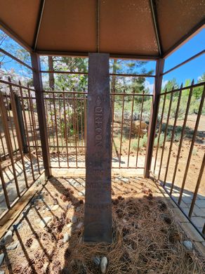
An iron monument on the 120th meridian as surveyed, one of only four marking the boundary between Nevada and California north of Lake Tahoe.

Verdi, Nevada

Added By
slgwv
Email
Been Here
Want to go
Added to list
CAPTION
North face of the monument. 170 miles, 47 chains from Oregon to here. A “chain” is 66 feet, so there are 80 chains in a mile.   slgwv / Atlas Obscura User
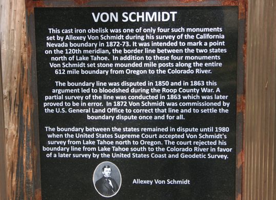
About Allexey Von Schmidt.   slgwv / Atlas Obscura User
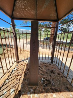
South face of the monument. 120 degrees west of Greenwich.   slgwv / Atlas Obscura User
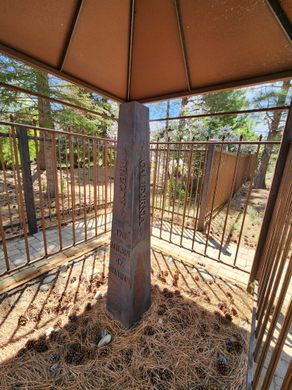
Southeast corner of the monument. 120 degrees west of Greenwich.   slgwv / Atlas Obscura User
East (Nevada) side of the monument.   slgwv / Atlas Obscura User
Monument from the northwest. 147 miles, 47 chains to the Oregon line from this point.   slgwv / Atlas Obscura User
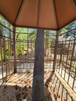
West (California) side of the monument.   slgwv / Atlas Obscura User
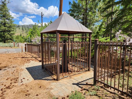
The iron monument under its shelter.   slgwv / Atlas Obscura User
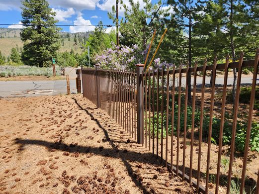
The iron fence marking the state line by the monument.   slgwv / Atlas Obscura User
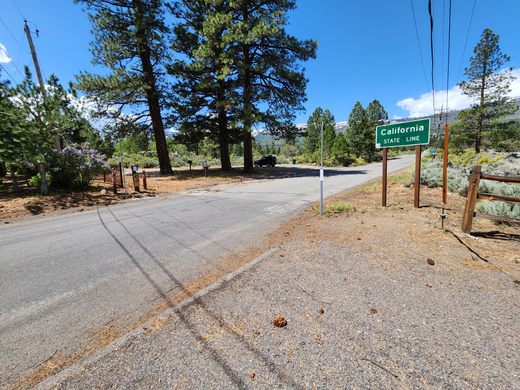
The California-Nevada line by the monument, on Dog Valley Road.   slgwv / Atlas Obscura User
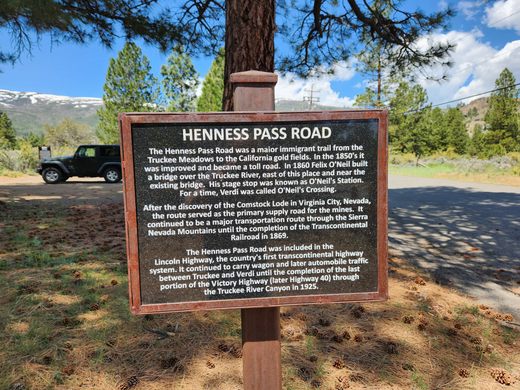
About the Henness Pass Road.   slgwv / Atlas Obscura User
Been Here
Want to go
Added to list

About

California was the first state to be carved out of the far western territories, and the question of its eastern boundary was a bit contentious—not least because so little was known about the geography east of the Sierra Nevada. A convention in 1849 finally decided on arbitrary geographic lines on the map. In the north, the eastern boundary would run along the 120th meridian of longitude from the 42nd parallel of latitude (the southern boundary of the Oregon territory) south  to the 39th parallel. Then it would run southeasterly from this point of intersection down to where the 35th parallel intersects the Colorado River.

It's one thing, though, to draw lines on a map, but quite another to actually establish them on the ground. For example, no one realized at the time that the intersection of the 120th meridian and the 39th parallel lies out in Lake Tahoe.

This merely underscores the staggering ignorance of the "ground truth" at the time. So it might have been expected, in a matter of this importance, that surveying parties would be amply funded to determine the ground locations.

But in fact for the next 20-odd years surveys were piecemeal and underfunded, with conflicting locations at one point resulting in actual violence between competing jurisdictions in California and Nevada. Belatedly, in 1872, Congress authorized a new survey of the California-Nevada line, and astronomer and surveyor Alexey Von Schmidt was hired to carry it out.

Von Schmidt built this monument at what he determined was the intersection of the 120th meridian with what was then the Henness Pass Road, at that time a busy route between California and Nevada. (It's now called the Dog Valley Road through here.) Determining longitude is especially difficult because it requires precise measurements of time. The difference between local noon (when the sun is highest in the sky) and Greenwich noon gives the longitude directly.

However, a clock that could reliably keep Greenwich time under the primitive conditions of a survey carried out on horseback was a challenge for 19th-century technology. Von Schmidt wanted to use then-new telegraph technology to precisely measure time differences, but he was overruled. The result was that controversy still simmered for over a century about the accuracy of his survey, in particular about the location of the 120th meridian.

It wasn't until 1980 that a Supreme Court decision finally affirmed the Von Schmidt line as the official boundary between California and Nevada north of Lake Tahoe. 

Related Tags

Cartography Monuments Borders Geography Geographic Markers

Know Before You Go

From Verdi, Nevada: if eastbound, take Exit 2 off Interstate 80 and follow it over the freeway to Business 80 (State Route 425/3rd Street). Turn right (north) and go 1 mile to the intersection with Bridge Street. Turn left here. Then go 0.6 miles to the intersection with Dog Valley Road and turn right. Go to the state line (0.3 miles) from here; the monument is just off the road to the left.

If westbound, turn at Exit 3 on I-80 and turn right on South Verdi Road and go 0.4 mile. Turn left on Bridge Street. It is 0.1 mile to 3rd street; continue straight across 3rd Street and proceed as above.

Community Contributors

Added By

slgwv

Published

October 5, 2023

Edit this listing

Make an Edit
Add Photos
Sources
  • https://nevadamagazine.com/issue/september-october-2018/8011/
  • The Colorful History of the California/Nevada State Boundary (in 2 parts), Professional Surveyor, Jan and Feb 2002. (Available online at https://juliacbulette.com/wp-content/uploads/2013/04/The-Colorful-History-of-the-California-Nevada-State-Boundary.pdf)
Von Schmidt Monument
690 Dog Valley Rd
Verdi, Nevada, 89439
United States
39.52445, -120.002144
Visit Website
Get Directions

Nearby Places

Airmail Arrow

Reno, Nevada

miles away

Hunter Creek Falls

Reno, Nevada

miles away

Crystal Mine

Verdi, California

miles away

Explore the Destination Guide

Photo of Nevada

Nevada

United States

Places 265
Stories 24

Nearby Places

Airmail Arrow

Reno, Nevada

miles away

Hunter Creek Falls

Reno, Nevada

miles away

Crystal Mine

Verdi, California

miles away

Explore the Destination Guide

Photo of Nevada

Nevada

United States

Places 265
Stories 24

Related Places

  • Tri-States Monument and Delaware River

    Port Jervis, New York

    Tri-States Monument

    A pair of 19th-century granite markers symbolically record where the state boundaries of New York, New Jersey, and Pennsylvania intersect.

  • Markleysburg, Pennsylvania

    Old Tri-State Monument

    This original Mason-Dixon line cairn placed in the 1760s was put in the wrong location because of the gravitational pull of the Allegheny Mountains.

  • 49th Parallel North Monument in Prešov, Slovakia

    Prešov, Slovakia

    49th Parallel North Monument

    A quirky monument to the 49th parallel in downtown Prešov, Slovakia.

  • Monument to the geographic center of Belgium

    Walhain, Belgium

    Geographic Center of Belgium

    This metal monument marking the middle of Belgium represents three regions coming together to form one country.

  • Leuven, Belgium

    Middelpunt van Leuven

    This unassuming stone bollard is a centuries-old marker denoting the center of the city.

  • Buggenhout, Belgium

    Middelpunt van Vlaanderen

    The geographic midpoint of the Dutch-speaking part of Belgium.

  • Concordia Monument

    Belvedere, Sint Maarten

    Concordia Monument

    Where Saint-Martin ends and Sint Maarten begins (or vice versa).

  • Basel, Switzerland

    Dreiländereck

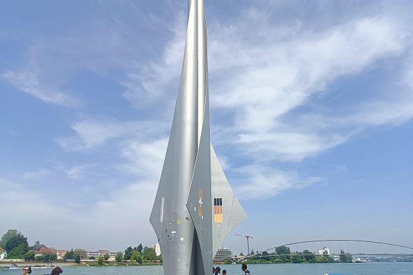
    A futuristic rocket marks the spot where three borders meet.

Aerial image of Vietnam, displaying the picturesque rice terraces, characterized by their layered, verdant fields.
Atlas Obscura Membership

Become an Atlas Obscura Member


Join our community of curious explorers.

Become a Member

Get Our Email Newsletter

Follow Us

Facebook YouTube TikTok Instagram Pinterest RSS Feed

Get the app

Download the App
Download on the Apple App Store Get it on Google Play
  • All Places
  • Latest Places
  • Most Popular
  • Places to Eat
  • Random
  • Nearby
  • Add a Place
  • Stories
  • Food & Drink
  • Itineraries
  • Lists
  • Video
  • Podcast
  • Newsletters
  • All Trips
  • Family Trip
  • Food & Drink
  • History & Culture
  • Wildlife & Nature
  • FAQ
  • Membership
  • Feedback & Ideas
  • Community Guidelines
  • Product Blog
  • Unique Gifts
  • Work With Us
  • About
  • FAQ
  • Advertise With Us
  • Advertising Guidelines
  • Privacy Policy
  • Cookie Policy
  • Terms of Use
Atlas Obscura

© 2025 Atlas Obscura. All Rights Reserved.