Places Foods Stories Newsletters
Loading...
Loading...
Loading...

No search results found for
“”

Make sure words are spelled correctly.

Try searching for a travel destination.

Places near me Random place

Popular Destinations

  • Paris
  • London
  • New York
  • Berlin
  • Rome
  • Los Angeles
Places Foods Stories Newsletters
Sign In Join
Places near me Random place
All the United Kingdom England London William Roy Memorial
AO Edited

William Roy Memorial

A tribute to an 18th-century British surveyor.

London, England

A aland1958 profile photo
Added By
Alan Delaprelle
Email
Been Here
Want to go
Added to list
CAPTION
General view of the site.   aland1958 / Atlas Obscura User
Memorial plaque.   aland1958 / Atlas Obscura User
Upturned cannon.   aland1958 / Atlas Obscura User
William Roy plaque.   aland1958 / Atlas Obscura User
Been Here
Want to go
Added to list

About

The Ordnance Survey, the national mapping agency of the United Kingdom, was created to provide the first detailed maps of the nation, to assist with military planning.

A triangulation survey commissioned by King George III and the Royal Survey between 1784 and 1790 laid the basis for what would later become the Ordnance Survey. This was motivated by a desire for accurate maps, in advance of a feared French invasion.

In the summer of 1784, Major General William Roy created a 5-mile baseline, using glass rods (to prevent expansion and contraction caused by the weather) on Hounslow Heath. The terminals at each end are marked by an upturned cannon of the period.

At the southeastern end, there are also 2 plaques, one commemorating the 200th anniversary of Roy's birth, the other giving information about the memorial.

Roy had already completed a military survey of Scotland between 1747 and 1755. The baseline laid the foundation of the trigonometrical survey of Great Britain between 1791 and 1853, which was later renamed the Ordnance Survey.

Places

Discover your next amazing Atlas Place.

Get more unusual and extraordinary places each week with the Atlas Obscura Places newsletter.

Your newsletter subscriptions with us are subject to Atlas Obscura's Privacy Policy and Terms of Use.

Community Contributors

A aland1958 profile photo

Added By

aland1958

S Steve 55 profile photo

Edited By

Steve 55

  • S Steve 55 profile photo Steve 55

Published

July 18, 2025

Edit this listing

Make an Edit
Add Photos

Related Tags

Surveyors Maps
William Roy Memorial
5 Roy Grove
London, England, TW12 3DW
United Kingdom
51.426298, -0.36582
Visit Website
Get Directions

Nearby Events

Museum Exhibit

Curtain Up

Costume, identity, and performance collide as historic and contemporary portraits reveal the many faces of the stage.

Sun, Oct 25

Dulwich Picture Gallery — London

View More Events in London

Nearby Places

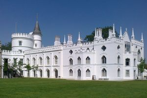
Strawberry Hill

London, England

miles away

Hampton Court Maze

East Molesey, England

miles away

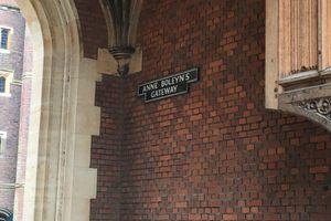
Anne Boleyn's Gateway

East Molesey, England

miles away

Explore the Destination Guide

Photo of London

London

England

Places 578
Stories 114

Nearby Places

Strawberry Hill

London, England

miles away

Hampton Court Maze

East Molesey, England

miles away

Anne Boleyn's Gateway

East Molesey, England

miles away

Explore the Destination Guide

Photo of London

London

England

Places 578
Stories 114

Related Places

  • The stone has been worn down a bit over the years.

    Washington, D.C.

    District of Columbia Center Point

    A little marble compass above George Washington's (empty) tomb in the Capitol marks where D.C.'s four quadrants intersect.

  • Captain Cook Statue

    Corner Brook, Newfoundland and Labrador

    Captain James Cook National Historic Site

    A statue of the early navigator stands overlooking the land he first surveyed.

  • Mason-Dixon survey stone.

    Delmar, Maryland

    Transpeninsular Midpoint Marker

    The stone marker that Mason and Dixon placed at the eastern end of the famous north-south border they surveyed.

  • The marker sits along Route 1 at a picnic area.

    Perry, Maine

    The Oldest 45th Parallel Marker in the U.S.

    A roadside park in eastern Maine first marked the halfway point between the equator and North Pole with a brass pin in 1896.

  • With Washington Monument in the background, looking East

    Washington, D.C.

    Jefferson Pier Marker

    A tiny monument to the unsuccessful attempt by Thomas Jefferson to place the prime meridian in Washington.

  • The First Map of the United States

    Washington, D.C.

    The First Map of the United States

    This map, on display in the Library of Congress, and one of only seven known to exist, is the very first map of the United States.

  • Saddles on display.

    Galveston, Texas

    Bryan Museum

    One of the largest historical collections on Texas and the American West.

  • Monument to the geographic center of Belgium

    Walhain, Belgium

    Geographic Center of Belgium

    This metal monument marking the middle of Belgium represents three regions coming together to form one country.

Aerial image of Vietnam, displaying the picturesque rice terraces, characterized by their layered, verdant fields.
Atlas Obscura Membership

Become an Atlas Obscura Member


Join our community of curious explorers.

Become a Member

Get Our Email Newsletter

Follow Us

Facebook YouTube TikTok Instagram Pinterest RSS Feed

Get the app

Download the App
Download on the Apple App Store Get it on Google Play
  • All Places
  • Latest Places
  • Most Popular
  • Places to Eat
  • Random
  • Nearby
  • Add a Place
  • Stories
  • Food & Drink
  • Itineraries
  • Lists
  • Video
  • Podcast
  • Newsletters
  • All Trips
  • Membership
  • Feedback & Ideas
  • Community Guidelines
  • Product Blog
  • Unique Gifts
  • Work With Us
  • About
  • FAQ
  • Advertise With Us
  • Advertising Guidelines
  • Privacy Policy
  • Cookie Policy
  • Terms of Use
Atlas Obscura

© 2026 Atlas Obscura. All Rights Reserved.