Trips Places Foods Stories Newsletters
Loading...
Loading...
Loading...
Loading...

No search results found for
“”

Make sure words are spelled correctly.

Try searching for a travel destination.

Places near me Random place

Popular Destinations

  • Paris
  • London
  • New York
  • Berlin
  • Rome
  • Los Angeles
Trips Places Foods Stories Newsletters
Sign In Join
Places near me Random place
All the United States Colorado Manitou Springs Manitou Incline

Manitou Incline

This super steep hike ascends 2,000 feet in less than a mile.

Manitou Springs, Colorado

Added By
Bri
Email
Been Here
Want to go
Added to list
CAPTION
A shot of the Manitou Incline taken looking up towards the top.   Jncraton
Looking down the Manitou Springs Incline from Barr Trail Bailout approximately two-thirds of the way up the incline.   Ixbrian
The Manitou Incline rising above Manitou Springs, CO   Ahodges7
Manitou Incline trail in Manitou Springs, Colorado.   Ahodges7
Been Here
Want to go
Added to list

About

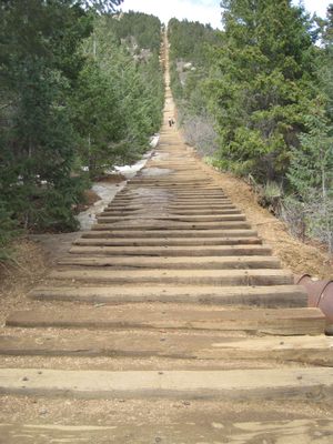
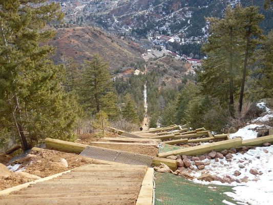
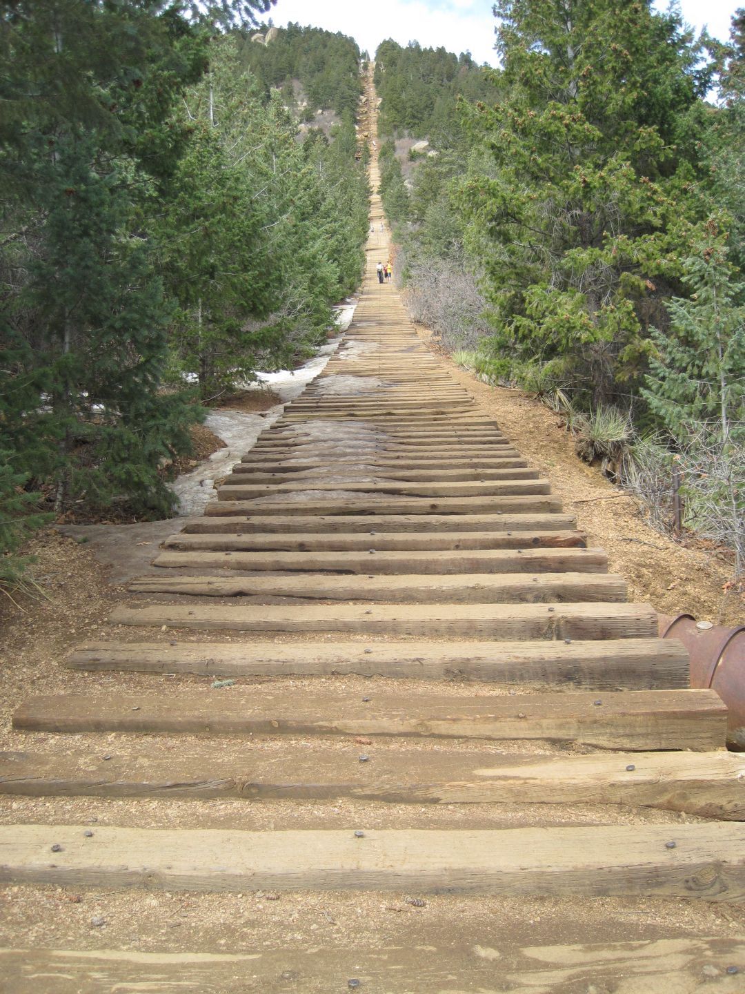
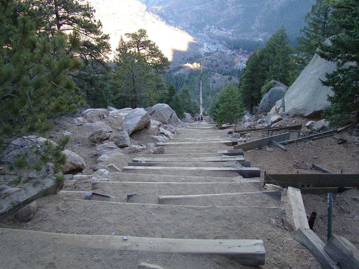
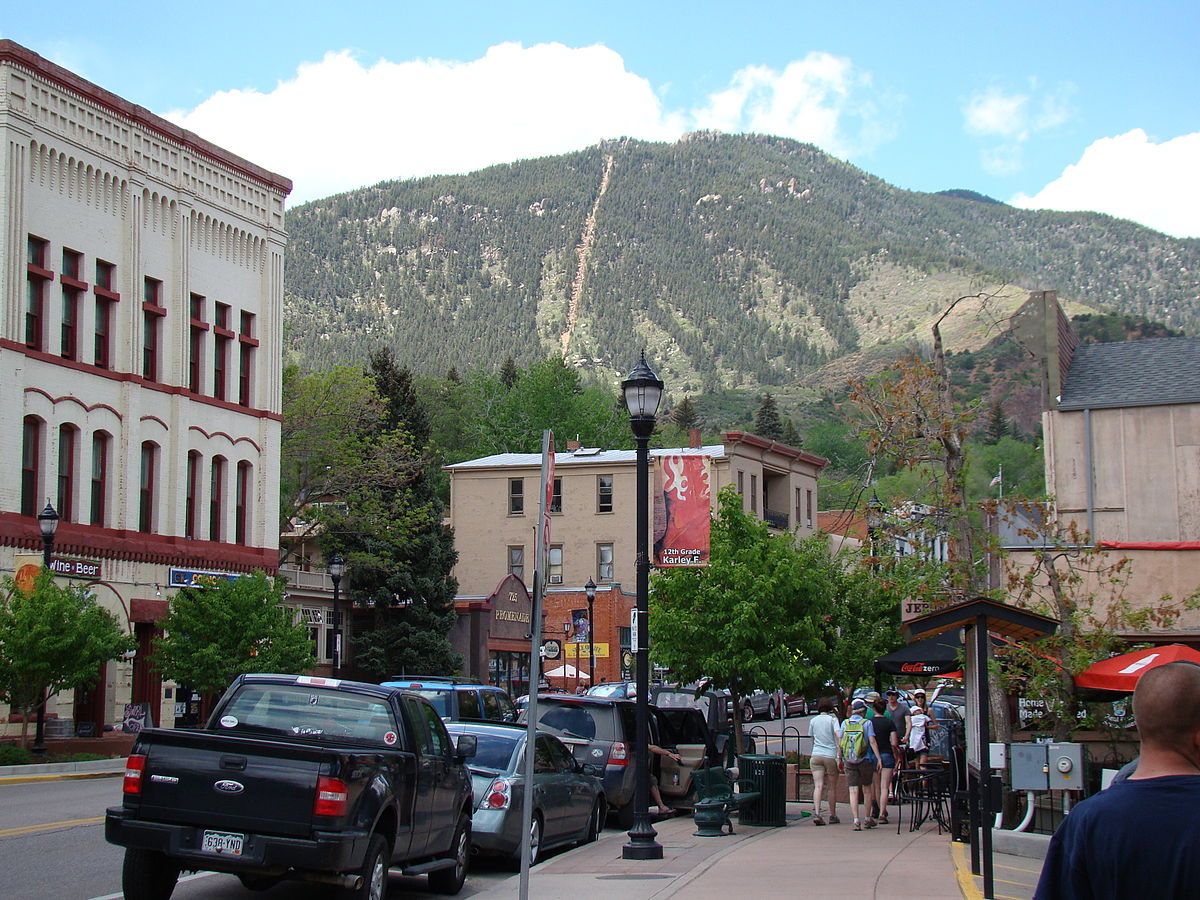
The Incline outside Manitou Springs is a one-mile vertical hike—straight up. Over the course of that mile you gain 2,000 feet in elevation. The steep climb along old cable car tracks is one of the most popular "tough" workouts in the area. Depending on your fitness level it can take between 40 minutes to 2 hours to get to the top, or longer. You can climb up on foot; no climbing equipment is necessary. However, spikes are recommended in the Winter months, especially for the descent. There is a false summit located 2/3 of the way up and the trail is visible from all around Colorado Springs. The Incline connects with Barr Trail at the summit, which will continue 10 miles to the 14,000-foot summit of Pikes Peak, or back down to Manitou Springs. Descending on Barr Trail is highly recommended as going back down the Incline is dangerous. 

Related Tags

Nature Mountains

Know Before You Go

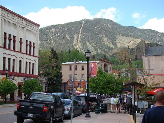
The Incline is now available by reservation only online. Located outside of Manitou Springs. Go on highway 24 West to the last Exit for Manitou Springs on Serpentine Drive. Turn left (away from Cave of the Winds) onto Serpentine Drive which will descend quickly and end at Manitou Avenue. Limited paid parking is available on a first-come-first-served basis and fills quickly. Alternatively, there is a free shuttle that runs every 20 minutes daily from 6 a.m.-8 p.m. from a free parking lot at 10 Old Mans Trail, Manitou Springs 80829. Be hydrated, take whatever you might think you need because there is nowhere on the trail to get anything. Not even a bathroom. The Incline is located in a residential area.

Community Contributors

Added By

BNever2Busy2BYoyo

Edited By

Molly McBride Jacobson, gh, nathanherbst, schultz394...

  • Molly McBride Jacobson
  • gh
  • nathanherbst
  • schultz394
  • Meg

Published

August 19, 2016

Edit this listing

Make an Edit
Add Photos
Sources
  • manitousprings.org
Manitou Incline
506 Ruxton Ave
Manitou Springs, Colorado, 80829
United States
38.856696, -104.930877
Visit Website
Get Directions

Nearby Places

Miramont Castle Museum

Manitou Springs, Colorado

miles away

Manitou Springs Penny Arcade

Manitou Springs, Colorado

miles away

Manitou Mineral Springs

Manitou Springs, Colorado

miles away

Explore the Destination Guide

Photo of Manitou Springs

Manitou Springs

Colorado

Places 8

Related Places

  • Pagosa Springs, Colorado

    Piedra Falls

    Crisp mountain water cascades over volcanic rocks at these secluded falls outside Pagosa Springs.

  • Mesetas, Colombia

    Cañon del Guejar (Güejar River Canyon)

    River raft through rural Colombia’s ancient rock formations, pristine landscapes, and towering waterfalls.

  • The cool waters of the upper pool.

    Santiago, Mexico

    Cascada Sol de Mayo

    A 40-foot waterfall hidden in a desert oasis.

  • Kanas or Ka Nasi Lake

    Altay Prefecture, China

    Kanas Lake

    A lake that borders Kazakhstan and Russia allegedly harbors the giant "Terror Trout" or "Chinese Nessie."

  • Winona, Missouri

    Rocky Falls

    A 40-foot waterfall flows into this unique natural swimming hole.

  • Gros Piton

    Soufriere, Saint Lucia

    Gros Piton

    The larger of two volcanic peaks rising out of the crystalline waters of the Caribbean.

  • Chief Joseph Mountain (9616 ft/2931 m).

    Joseph, Oregon

    Wallowa Lake Tramway

    The steepest tramway in North America provides stunning views of the out-of-the-way Wallowa Mountains in northeastern Oregon.

  • Union, West Virginia

    Hanging Rock Raptor Observatory

    This former fire tower is now a rustic observatory that offers amazing views of eagles, hawks, and the Appalachian Mountains.

Aerial image of Vietnam, displaying the picturesque rice terraces, characterized by their layered, verdant fields.
Atlas Obscura Membership

Become an Atlas Obscura Member


Join our community of curious explorers.

Become a Member

Get Our Email Newsletter

Follow Us

Facebook YouTube TikTok Instagram Pinterest RSS Feed

Get the app

Download the App
Download on the Apple App Store Get it on Google Play
  • All Places
  • Latest Places
  • Most Popular
  • Places to Eat
  • Random
  • Nearby
  • Add a Place
  • Stories
  • Food & Drink
  • Itineraries
  • Lists
  • Video
  • Podcast
  • Newsletters
  • All Trips
  • Wildlife & Nature
  • FAQ
  • Membership
  • Feedback & Ideas
  • Community Guidelines
  • Product Blog
  • Unique Gifts
  • Work With Us
  • About
  • FAQ
  • Advertise With Us
  • Advertising Guidelines
  • Privacy Policy
  • Cookie Policy
  • Terms of Use
Atlas Obscura

© 2025 Atlas Obscura. All Rights Reserved.