Old Plank Road
The remnants of an early automobile route across shifting sand dunes can still be found in the deserts of Southern California.


During the late 1800s and early 1900s, cities and towns across the United States desperately vied for modern transportation routes to connect through them. Direct access to railroads allowed local merchants to quickly stock goods and allowed local farmers, ranchers, and miners to easily ship their products to faraway economic hubs.
In many cases across the American West, one town would thrive because of access to the railroads but their neighboring communities only a few miles away would wither away into obscurity. So, when it was decided that the western terminus of the transcontinental railroad would be Los Angeles instead of San Diego, the business leaders of the latter city began brainstorming for how to keep their city economically relevant.
They figured that if they couldn’t be connected to the outside world by railroads, they would at least build up the road networks that led to San Diego. The automobile was still a relative newcomer to American roads, but the city leaders predicted their rise and wanted to be ready to welcome them.
In October of 1912, the Los Angeles Examiner sponsored a contest to determine the best route to Phoenix, Arizona from Southern California, figuring that the racers who made their way across first would have gone by the most efficient routes. San Diego businessman Ed Fletcher, who made a large portion of his money constructing highways, saw this as an opportunity to both promote his own interests, as well as those of his hometown.
While most of the cars began from Los Angeles, including a reporter from the Examiner who was given a 24-hour head start, Fletcher instead chose to head out from San Diego. Assisted by a team of horses to pull his car across the Algodones Sand Dunes, Fletcher made headlines by reaching Phoenix in a record-breaking 19 and a half hours, even beating the reporter from the Examiner to Phoenix by 10 hours.
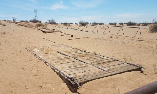
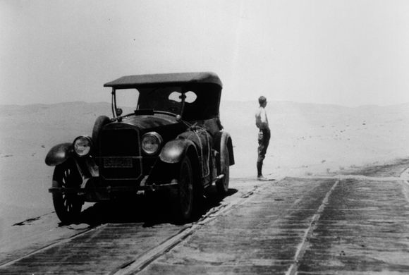
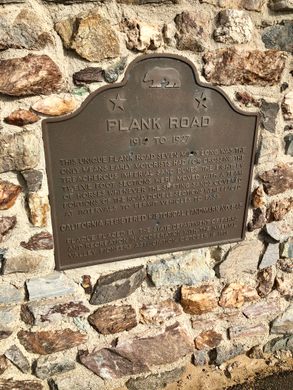
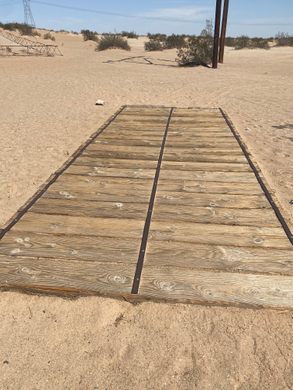
Leveraging his newfound fame and success in the race, Fletcher convinced San Diego-area businesses and local governments to invest in him in constructing a road made out of wooden planks across the treacherous Algodones Dunes. In February of 1915, 13,000 wooden planks were hauled out to the sand dunes and workers began fastening them into a driveable boardwalk across the sands. Construction lasted two months and in the end, two lanes of wooden road were laid out six and a half miles across the dunes.
The road proved too popular though. The constant vehicle traffic, along with harsh winds and constantly shifting sand dunes, wore down the wooden planks and workers struggled to keep ahead of necessary upkeep. Replacement sections that were 12 feet long and weighing 1,500 pounds were assembled in advance and hauled out by teams of horses.
In 1925, California Highway Commission engineers determined that the sand dunes only shifted rapidly below a certain point and that they could construct a paved road across as long as they surveyed a route that was high enough up the sides of the larger dunes. Construction of the new paved route was completed in August of 1926 and maintenance of the old plank road ceased, despite requests from locals to preserve it.
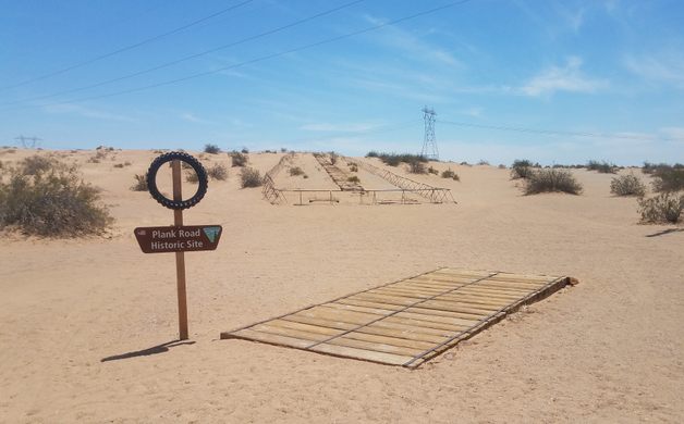
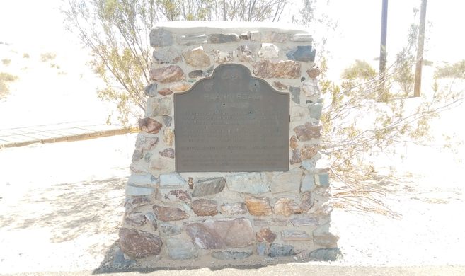
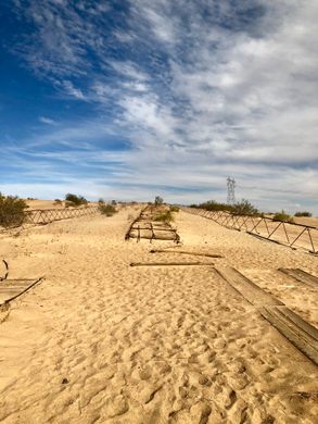
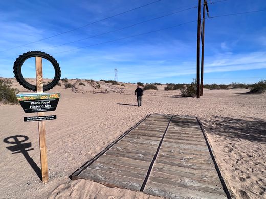
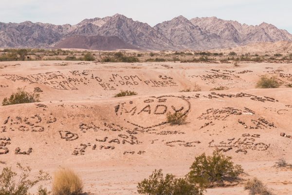
Over the years, sections were pried up and displayed in museums and visiting campers in the area tore off pieces to use as firewood. By the 1970s, only fragmented sections of the plank road remained but locals and historic societies were more determined than ever to save a small piece before it was lost forever. Over 400 volunteers collected the remaining pieces of the plank road and reassembled them into a contiguous segment. Today, visitors to the Algodones Dunes are still able to see that reconstructed segment of the old plank road, along with a historic marker and explanatory signs placed at the site.
Know Before You Go
The remaining segment of road and historic markers are within the Bureau of Land Management's Imperial Sand Dunes Recreation Area. Fees are collected from visitors between October and April, but the rest of the year it is free to visit. The dunes are a popular area to drive ATVs and other off-road vehicles, so watch for unconventional traffic while traveling through the recreation area.
Community Contributors


Plan Your Trip
The Atlas Obscura Podcast is Back!


Follow us on Twitter to get the latest on the world's hidden wonders.
Like us on Facebook to get the latest on the world's hidden wonders.
Follow us on Twitter Like us on Facebook