


About
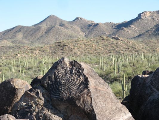
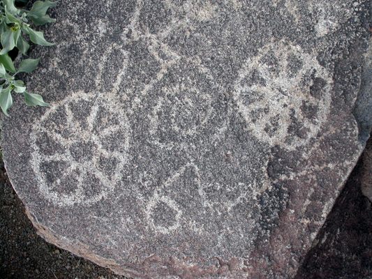
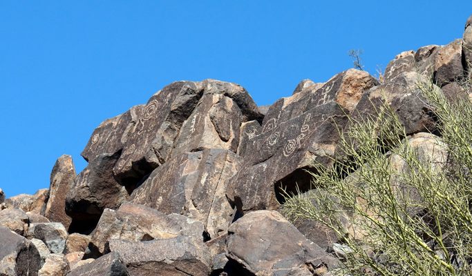
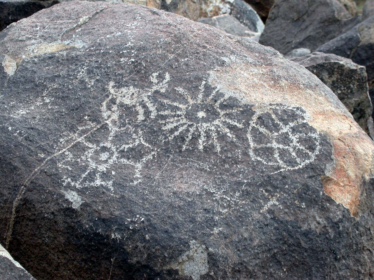
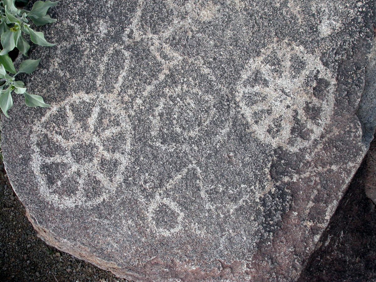
One of southern Arizona’s most prominent petroglyph sites is Signal Hill in the Tucson Mountain District of Saguaro National Park. This location features over 200 petroglyphs created by the Hohokam (the predecessors to today’s Akimel O’odham and Tohono O’odham tribes). The exact dates have been difficult to establish, but archeologists believe the petroglyphs were first etched sometime between 550 and 1550 years ago.
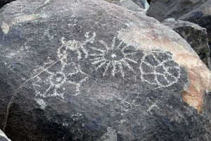
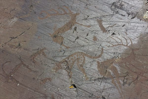
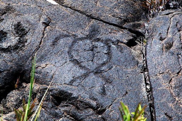
The designs, which were created by pecking into the desert varnish coating the rocks on the hills, feature depictions of people, animals including bighorn sheep, snakes, and lizards as well as many geometric symbols such as segmented circles and spirals. The most notable petroglyph at the site is a very large spiral on a rock near the hill’s summit. As with many petroglyphs, the exact purpose and meaning of the artwork has been lost to time.
In the late 19th and early 20th centuries, visitors began to travel west into the desert and over the Tucson Mountains to see the petroglyphs. In the 1930s, the Civilian Conservation Corps created both the picnic area at the base of the hill as well as the trail to the top that are now as much a part of the history of the park as the petroglyphs themselves.
The area was incorporated into Saguaro National Monument in 1961, and the monument became a park in 1994. Tourists visiting today can now follow this trail to the top to see the site’s petroglyphs and to admire the views of the surrounding Sonoran Desert wilderness.
Related Tags
Know Before You Go
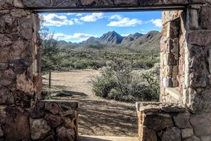
Signal Hill is located to the north of the Bajada Loop Drive in the Tuscon Mountains District of Saguaro National Park. While the loop drive itself as well as the shorter road to the trail are both gravel roads, most cars can handle the roads without difficulty, although very large vehicles (such as large motorhomes or vehicles towing trailers) might encounter some problems. Note that visitors need to buy an entrance pass even if they hike into the park from outside.
Parking is available at the trailhead, which also has picnic and bathroom facilities. The trail itself is only 0.2 miles in length, and it should take less than 10 minutes to reach the top of the hill. While the elevation change is only 50 feet, the trail is not designed for people using wheelchairs or strollers. Note that several other trails connect to the Signal Hill Trail, providing visitors with the option to see more of the park if they want.
Community Contributors
Added By
Published
February 21, 2025
Sources
- https://www.americansouthwest.net/arizona/saguaro/signal-hill-trail.html
- https://www.alltrails.com/en-gb/trail/us/arizona/signal-hill-trail
- https://hikearizona.com/decoder.php?ZTN=1921
- https://written-in-stone-seen-through-my-lens.blogspot.com/2013/12/petroglyphs-of-signal-hill-geology-and.html?m=1
- https://www.nps.gov/sagu/
- https://www.nps.gov/articles/000/signal-hill-petroglyphs.htm