AO Edited
Mannheim Quadratestadt
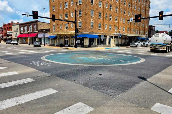
In this German city center, the streets have no names.


Most European street addresses include a street name and a building number, although which one is written first may depend on the location. For example, in Paris, you can find Shakespeare and Company located at 37 rue de la Bûcherie, while in Munich, Asamkirche is located at Sendlinger Straße 32, and in Prague, Tančící dům is located at Jiráskovo nám. 1981/6.
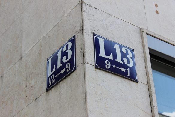
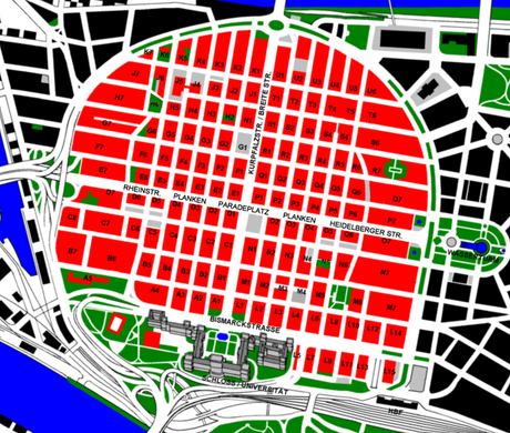
However, the center of the city of Mannheim, Germany, which is referred to as the Quadratestadt (or Quadrate in English) uses a completely different system. The streets, most of which have no name, are organized as a grid that is rotated slightly clockwise from the cardinal directions, and addresses are assigned according to the building’s location in one of the blocks within the grid. The blocks are identified by a letter, which indicates the block’s location from south to north, and a number, which indicates the block’s location away from the central street running northeast to southwest in the grid (named Kurpfalzstraße).
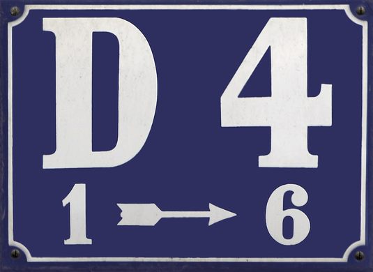
On the west side of the grid, the blocks are labeled with the letters A through K (but skipping I), while on the east side of the grid, the blocks are labeled with letters L-U. An additional number may be used to identify the building within that block. For example, the Altes Rathaus (Old City Hall) is located in block F1 near the center of the Quadratestadt and is given the building number 4A, so its address would be written as F1 4A. The shopping mall Stadthaus N1 is located in the southern central part of the Quadratestadt at N1 1, the historic Jesuitenkirche is located in the southwestern part of the city at A4 2, and Eberhard-Gothein-Schule is located in the north at U2 2-4.
This unconventional address system is linked to the city’s history. When Elector Friedrich IV of the Palatinate founded a fortress at this location in 1606, he organized the streets into a grid system, which was a novel step in urban planning at the time. Initially, the streets were given names just like in other German cities. In 1684, however, the city switched over to an earlier version of its block numbering system. People initially resisted this system but with time they grew accustomed to it. Eventually, the block numbering system needed to be updated to account for the city’s expansion beyond the original fortress walls. The current version of the address system, where each block is identified by a letter and number, was implemented in 1811.
However, the system not only confuses visitors but also causes problems with many online maps, which cannot easily adapt to handle the unorthodox system. Nonetheless, Mannheim is proud of its unique addresses and will continue to use them in the foreseeable future.
Know Before You Go
The center of Mannheim is easily reached by car and by public transit. An extensive tram system connects Mannheim with many other nearby cities, and the main train station (Mannheim Hauptbahnhof), which is located at the southeast corner of the Quadratestadt, connects Mannheim with the rest of Germany.
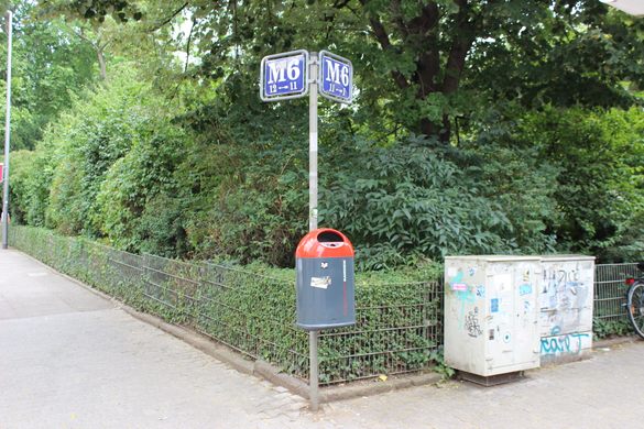
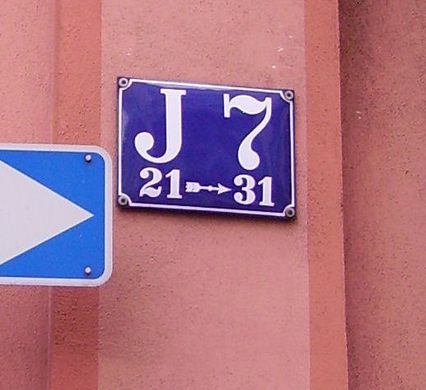
Signs listing the block letter and number have been placed on buildings at the corners of most blocks within the Quadratestadt. These signs are usually located at the top of the ground floor or at the bottom of the floor above that where they can easily be seen over people and vehicles. Additionally, many buildings and businesses may incorporate the block designations into their own names.


Plan Your Trip
The Atlas Obscura Podcast is Back!


Follow us on Twitter to get the latest on the world's hidden wonders.
Like us on Facebook to get the latest on the world's hidden wonders.
Follow us on Twitter Like us on Facebook