Places Foods Stories Newsletters
Loading...
Loading...
Loading...

No search results found for
“”

Make sure words are spelled correctly.

Try searching for a travel destination.

Places near me Random place

Popular Destinations

  • Paris
  • London
  • New York
  • Berlin
  • Rome
  • Los Angeles
Places Foods Stories Newsletters
Sign In Join
Places near me Random place
All the United States California Salt Creek and the Salt Creek Hills

Salt Creek and the Salt Creek Hills

An improbable creek near Death Valley, not far from the oldest surviving Euro-American structure in the Mojave Desert.

California

slgwv profile photo
Added By
slgwv
Email
Been Here
Want to go
Added to list
CAPTION
Above Salt Creek, looking northeast.   slgwv / Atlas Obscura User
Salt Creek Hills from near Salt Creek.   slgwv / Atlas Obscura User
Salt Creek in July 2006: tules in the desert.   slgwv / Atlas Obscura User
Adit screened off with bat-friendly grate.   slgwv / Atlas Obscura User
Ruins of stamp mill dating to the 1880s.   slgwv / Atlas Obscura User
View of the Amargosa House from above.   slgwv / Atlas Obscura User
Another shaft screened off with a bat-friendly grate.   slgwv / Atlas Obscura User
The trail down to the mine sites. Ruins of the Amargosa House are visible near the center of the picture.   slgwv / Atlas Obscura User
Amargosa House ruin, said to be the oldest Euro-American building in the Mojave.   slgwv / Atlas Obscura User
Path from the trailhead.   slgwv / Atlas Obscura User
Salt Creek channel, in January 2025.   slgwv / Atlas Obscura User
Salt Creek in January 2025.   slgwv / Atlas Obscura User
Washed-out steps on the trail down into the Salt Creek channel.   slgwv / Atlas Obscura User
Looking back at the washed-out steps.   slgwv / Atlas Obscura User
Looking downstream through the water gap in the Salt Creek Hills.   slgwv / Atlas Obscura User
Looking down Salt Creek in July 2006. The large trees are tamarisk, an exotic that’s been since removed.   slgwv / Atlas Obscura User
Looking upstream from the water gap.   slgwv / Atlas Obscura User
The trail beyond Salt Creek, heading for the mine sites.   slgwv / Atlas Obscura User
Screened-off adit with partly collapsed debris above.   slgwv / Atlas Obscura User
Shaft screened off with bat-friendly grate.   slgwv / Atlas Obscura User
Looking back at the Amargosa House.   slgwv / Atlas Obscura User
View inside the Amargosa House.   slgwv / Atlas Obscura User
Looking down at the Salt Creek Hills mines from the Amargosa House.   slgwv / Atlas Obscura User
Old path above the mines, leading down to above the stamp mill.   slgwv / Atlas Obscura User
Salt Creek Hills   slgwv / Atlas Obscura User
About Salt Creek, in July 2006.   slgwv / Atlas Obscura User
Been Here
Want to go
Added to list

About

About 30 miles north of Baker, California, on State Route 127, is an unexpected occurrence: a flowing creek. Salt Creek rises in the Silurian Valley to the south, toward Soda Lake, and flows northward into the Amargosa River as the latter makes a hairpin bend into the southern end of Death Valley. Because the area is extremely arid, both Salt Creek and the Amargosa River flow mostly underground.

Except here, where shallow bedrock forces Salt Creek to the surface, where it follows a channel carved into the bedrock. This occurrence of surface water was obviously of extreme importance to wildlife, not to mention human populations. Indeed, Salt Creek was a stop on the Old Spanish Trail, which connected Los Angeles with Santa Fe (now in New Mexico) in the early 19th century.

Although Salt Creek has the occasional huge flood along it, its channel through the bedrock of the Salt Creek Hills nonetheless seems disproportionate to the size of the creek. It seems that at some times in the Pleistocene the Mojave River flowed through here and carved the channel. At present, the Mojave River is also normally dry. It currently ends at Soda Lake south of Baker. However, exceptionally large flows down the Mojave, such as would occur during extremely wet intervals, would cause Soda Lake to overflow northward into the Salt Creek drainage, and the Mojave would then become an active tributary to the Amargosa.

Until recently tamarisk (Tamarix spp.) trees were abundant along Salt Creek through here, as can be seen in some of the 2006 pictures. This tree is an exotic that has become established throughout the arid West. Because it competes with native vegetation, it is a subject of eradication efforts, and Salt Creek was cleared of tamarisk in the 2010s.

This area also holds the remains of some of the earliest Euro-American mining activity in the Mojave. In the early 1860s gold was struck in the Salt Creek Hills about a mile east of Salt Creek, but miners were driven off and killed by the local Paiutes. Amargosa House, said to be the oldest Euro-American building in the Mojave, dates from this era. It survives as a well-defined ruin today.

Mining had resumed by the 1880s, and a stamp mill (whose ruins survive) was even built. Intermittent activity continued till the early 20th century. Open shafts and adits remain from that era; they have been screened off for safety, but they have not been filled in. Instead they have been covered with coarse steel grates. This is to allow bats access, as abandoned mines have become important habitat for bats.


Places

Discover your next amazing Atlas Place.

Get more unusual and extraordinary places each week with the Atlas Obscura Places newsletter.

Your newsletter subscriptions with us are subject to Atlas Obscura's Privacy Policy and Terms of Use.

Know Before You Go

There is a trailhead for Salt Creek off California State Route 127, on the right (east) about 29.0 miles north of Baker, California. The turnoff may not be well-marked, but it's about 35.6225 N, 116.28376 W. The trailhead includes an unpaved parking area and a pit toilet. The trail itself is very well-defined down to Salt Creek, in less than half a mile. Although the trail is seriously washed out near the creek, it is again well-defined beyond the creek. It continues to the site of the mining activity, after about another mile.

Community Contributors

slgwv profile photo

Added By

slgwv

Avoiding Regret profile photo

Edited By

Avoiding Regret

  • Avoiding Regret profile photo Avoiding Regret

Published

March 20, 2026

Edit this listing

Make an Edit
Add Photos
Sources
  • https://www.hmdb.org/m.asp?m=72928
  • https://www.amargosaconservancy.org/volunteer-project-to-trim-athel-grove-at-salt-creek-hills/

Related Tags

Deserts Trails
Salt Creek and the Salt Creek Hills
75861 CA-127
California
United States
35.62228, -116.282215
Visit Website

Nearby Places

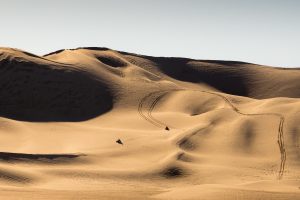
Dumont Dunes North Pole

Tecopa, California

miles away

China Ranch Date Farm

Tecopa, California

miles away

Villa Anita in Death Valley

Tecopa, California

miles away

Explore the Destination Guide

Photo of California

California

United States

Places 1,580
Stories 145

Nearby Places

Dumont Dunes North Pole

Tecopa, California

miles away

China Ranch Date Farm

Tecopa, California

miles away

Villa Anita in Death Valley

Tecopa, California

miles away

Explore the Destination Guide

Photo of California

California

United States

Places 1,580
Stories 145

Related Places

  • Mesquite Canopy

    Tucson, Arizona

    Agua Caliente Park

    Previously a hot spring, this park remains a site of unique history, wildlife, and geology.

  • Indian Canyons

    Palm Springs, California

    Indian Canyons

    Traversing these canyons, visitors can take in stunning views and glimpses of the region's history.

  • Dana Village.

    Bsaira District, Jordan

    Dana Village

    A ghost village sits atop a mountain within Jordan’s largest biosphere reserve.

  • View of the valley from the homestead.

    Tucson, Arizona

    Bowen Stone House Ruins

    The remains of this rugged homestead ranch offer a brief glimpse into a bygone era.

  • Blue Marble Bath wash.

    Inyo County, California

    Marble Bath

    This desert oddity hides in plain sight thanks to a cartographic error and a desert explorer with a punny sense of humor.

  • High Shoals Falls

    Hiawassee, Georgia

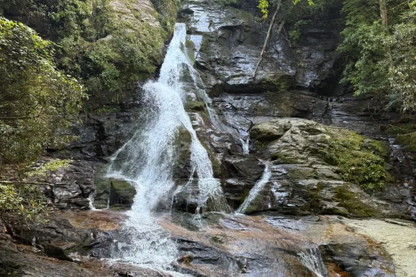
    High Shoals Falls

    This gorgeous waterfall is the perfect reward after a beautiful day hike.

  • Catwalk along the river

    Hood River, Oregon

    Hood River Pumping Station and Pipeline Trail

    Raised catwalk walk through the trees alongside a river starting from an abandoned and colorful pumping station.

  • The Red Cardinal Petroglyph

    Phippsburg, Maine

    Wild Bird Petroglyph

    A collection of modern petroglyphs by artist Kevin Sudeith. Hate them or love them, but important to experience.

Aerial image of Vietnam, displaying the picturesque rice terraces, characterized by their layered, verdant fields.
Atlas Obscura Membership

Become an Atlas Obscura Member


Join our community of curious explorers.

Become a Member

Get Our Email Newsletter

Follow Us

Facebook YouTube TikTok Instagram Pinterest RSS Feed

Get the app

Download the App
Download on the Apple App Store Get it on Google Play
  • All Places
  • Latest Places
  • Most Popular
  • Places to Eat
  • Random
  • Nearby
  • Add a Place
  • Stories
  • Food & Drink
  • Itineraries
  • Lists
  • Video
  • Podcast
  • Newsletters
  • All Trips
  • Membership
  • Feedback & Ideas
  • Community Guidelines
  • Product Blog
  • Unique Gifts
  • Work With Us
  • About
  • FAQ
  • Advertise With Us
  • Advertising Guidelines
  • Privacy Policy
  • Cookie Policy
  • Terms of Use
Atlas Obscura

© 2026 Atlas Obscura. All Rights Reserved.