Trips Places Foods Stories Newsletters
Loading...
Loading...
Loading...
Loading...

No search results found for
“”

Make sure words are spelled correctly.

Try searching for a travel destination.

Places near me Random place

Popular Destinations

  • Paris
  • London
  • New York
  • Berlin
  • Rome
  • Los Angeles
Trips Places Foods Stories Newsletters
Sign In Join
Places near me Random place
All the United States Nevada Yerington Yerington Pit (Anaconda Copper Mine)
AO Edited

Yerington Pit (Anaconda Copper Mine)

A deep toxic lake fills this abandoned open-pit copper mine, now a Superfund site.

Yerington, Nevada

Added By
slgwv
Email
Been Here
Want to go
Added to list
CAPTION
Yerington pit lake, May 2015. The road on the pit wall to the right indicates the relative depth.   slgwv / Atlas Obscura User
Yerington pit lake, April 2011. The road on the pit wall to the right indicates the relative depth.   slgwv / Atlas Obscura User
Yerington pit lake, March 1997. The road on the pit wall to the right indicates the relative depth.   slgwv / Atlas Obscura User
Yerington pit lake, February 1995. The road on the pit wall to the right indicates the relative depth.   slgwv / Atlas Obscura User
Tailings from mill, looking west. Note the vehicles on the road, and the power poles, for scale.   slgwv / Atlas Obscura User
Tailings from mill, looking west.   slgwv / Atlas Obscura User
Mill site, 1997.   slgwv / Atlas Obscura User
View east over pit lake, April 2011.   slgwv / Atlas Obscura User
Interpretive sign at overlook.   slgwv / Atlas Obscura User
Spoil heaps off highway.   slgwv / Atlas Obscura User
View northeast over pit lake, May 2015.   slgwv / Atlas Obscura User
Cut above pit lake on north side, May 2015.   slgwv / Atlas Obscura User
View northeast over pit lake, May 2015.   slgwv / Atlas Obscura User
Been Here
Want to go
Added to list

About

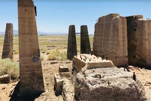
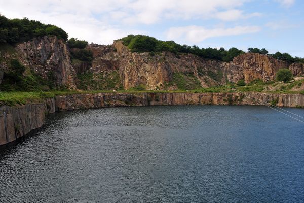
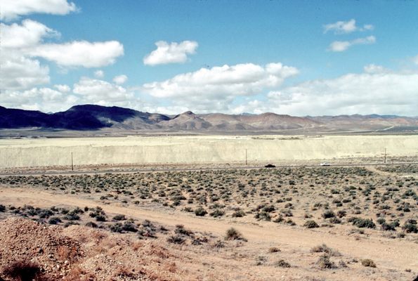
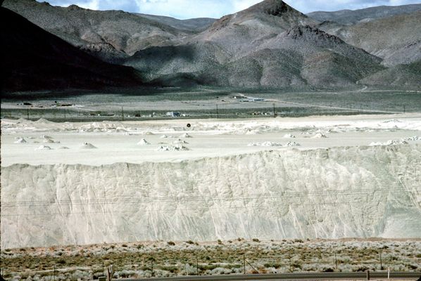
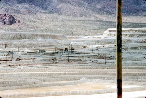
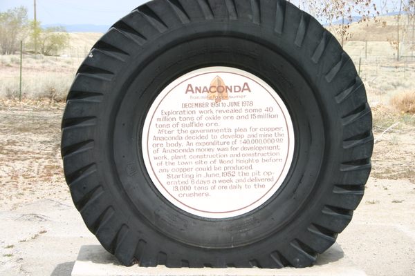
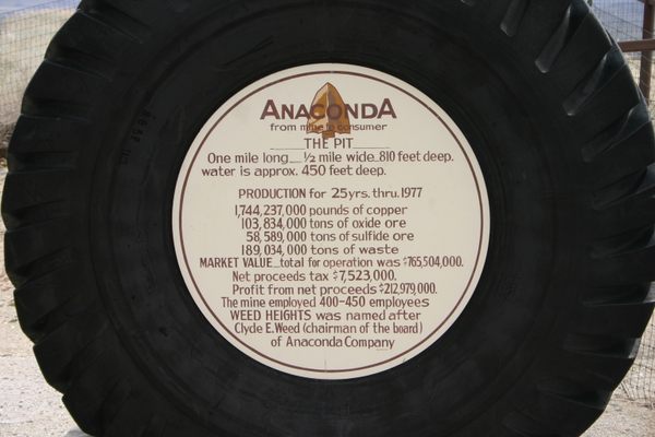
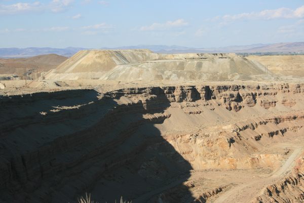
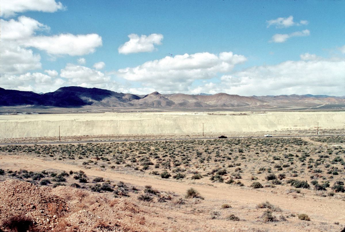
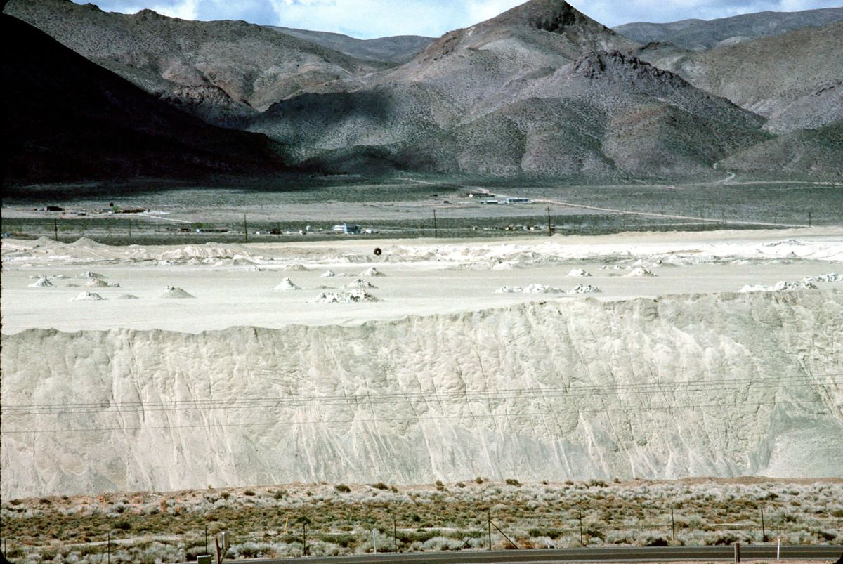
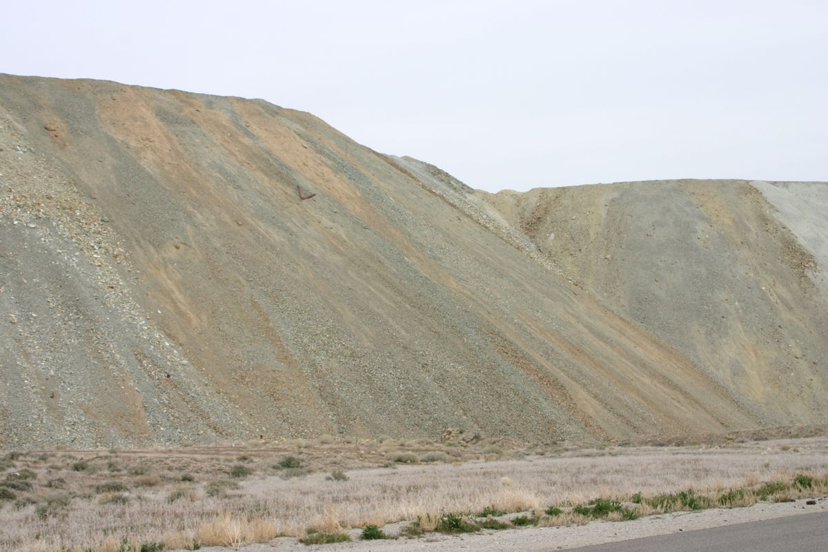
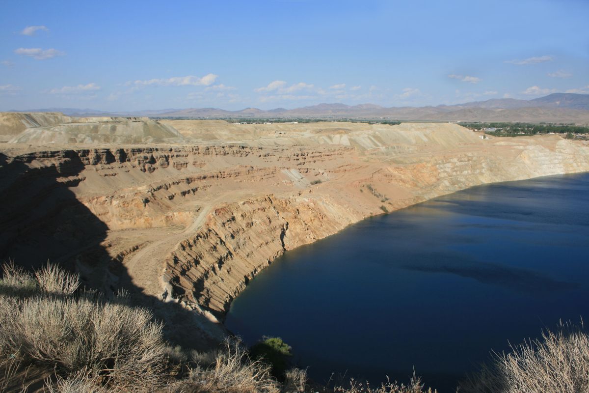
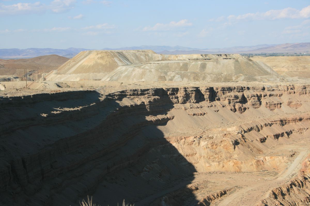
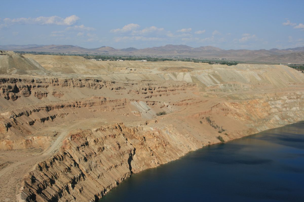
From 1952 to 1978, Anaconda Copper Company operated the open-pit Yerington Copper Mine. During that time, the mine produced approximately 165 million tons of copper. Anaconda got out of the copper-mining business, it was rumored, in part to avoid tightening environmental regulations, although falling copper prices were certainly a factor. Later, there was some small-scale mining involving reprocessing stockpiled ore and spoil with newer technology, but all that activity is also now defunct.

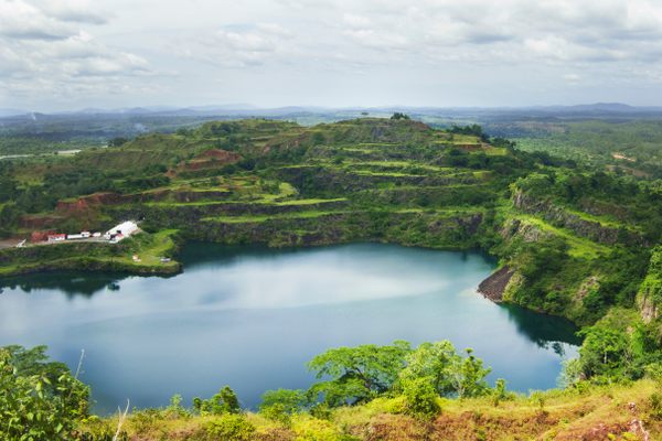
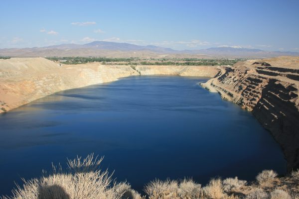
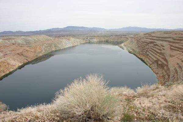
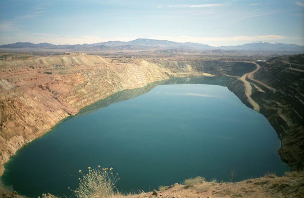
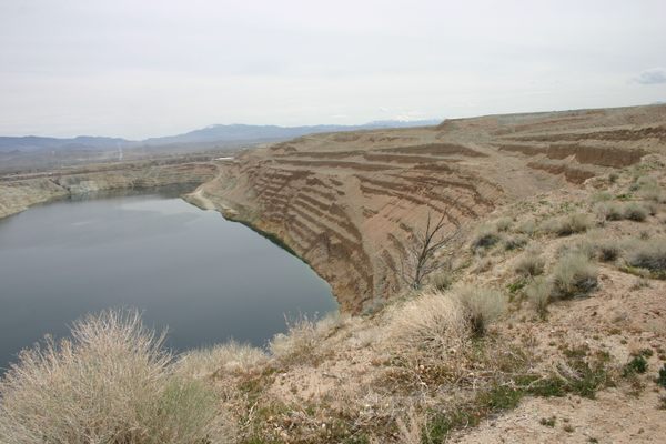
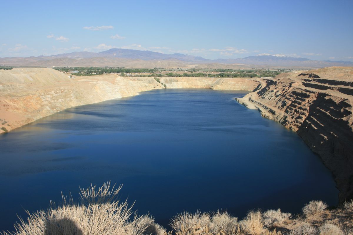
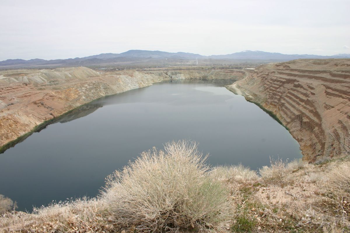
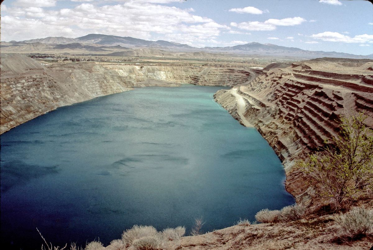
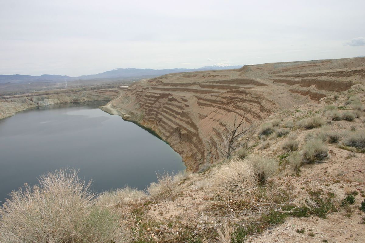
Once the mine stopped operating and pumping ceased, the open pit began filling with water as a result of groundwater seepage. Now the former mine has turned into a roughly rectangular lake that measures about a mile long and 1,600 feet wide. As of 2020, the water was about 500 feet deep and still filling at the rate of some 10 acre-feet (about 3.3 million gallons) per year. The increase will cease when the level becomes even with the water table.

Unsurprisingly, the U.S. Environmental Protection Agency has designated the area a Superfund site. At present, often-acrimonious discussions continue with regards to what remediation efforts should be undertaken and who will pay for them.

Related Tags

Copper Pollution Lakes Mines Superfund Site

Know Before You Go

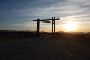
The whole site, including the surrounding spoil and tailings heaps, the old smelting facilities, and the pit itself, are fenced off and closed to public entry. However, a public viewpoint for the pit remains on the west side by the town of Weed Heights, originally Anaconda's company town.  

If coming from the north on US 95A, turn right (west) onto Burch Drive. This turnoff is about 0.4 mile north of McGowan Lane, where US 95A makes a right-angle turn to the left. (Nevada SR 339 continues straight.) Proceeed 1.8 miles to the T-junction with Austin St.; turn left here.   Go about 100 yards; the viewpoint will be obvious on your left. There is plenty of parking and even some interpretive signs (see photos).

Alternatively, if coming from the south turn west onto Weed Heights Drive. This intersection is on SR 339 about 1.9 miles south of its intersection with US-95A. After another 1.9 miles, Weed Heights Drive intersects Austin Dr. about 120 feet south of the turnoff into the overlook.

Community Contributors

Added By

slgwv

Published

April 14, 2022

Edit this listing

Make an Edit
Add Photos
Sources
  • https://www.rgj.com/story/news/2021/04/20/nevada-deferral-anaconda-superfund-site-speeds-cleanup-progress/7229508002/
  • https://www.rgj.com/story/news/2021/04/20/nevada-deferral-anaconda-superfund-site-speeds-cleanup-progress/7229508002/
Yerington Pit (Anaconda Copper Mine)
4 Austin St
Weed Heights
Yerington, Nevada, 89447
United States
38.985296, -119.205248
Visit Website
Get Directions

Nearby Places

Walker River State Recreation Area

Yerington, Nevada

miles away

Thompson Smelter

Lux, Nevada

miles away

Wilson Canyon

Smith Valley, Nevada

miles away

Explore the Destination Guide

Photo of Yerington

Yerington

Nevada

Places 4

Nearby Places

Walker River State Recreation Area

Yerington, Nevada

miles away

Thompson Smelter

Lux, Nevada

miles away

Wilson Canyon

Smith Valley, Nevada

miles away

Explore the Destination Guide

Photo of Yerington

Yerington

Nevada

Places 4

Related Places

  • Ashton’s Flash

    Wincham, England

    Ashton's and Neumann's Flashes

    Formed by the collapse of salt mines and later used for dumping industrial waste, these lakes are now part an unusual, biodiverse parkland.

  • Opalsøen (The Opal Lake)

    Allinge, Denmark

    Opalsøen (The Opal Lake)

    Once a granite mine, this beautiful lake is the perfect place to cliff jump and zipline in Denmark

  • New Idria

    Paicines, California

    New Idria Ghost Town

    After the nearby mercury mine shut down, this town was abandoned and declared a Superfund site.

  • A tunnel into the Ashio Copper Mine.

    Nikko, Japan

    Ashio Copper Mine

    The site of Japan's first major environmental disaster.

  • Aerial view of the gold and copper mining pit.

    Tembagapura, Indonesia

    Grasberg Mine

    This mile-wide crater high in the mountains of Indonesia is the largest gold mine in the world.

  • Bomi Blue Lake.

    Tubmanburg, Liberia

    Bomi Blue Lake

    An abandoned mine pit is now a beautiful, colorful attraction.

  • View of the Venus Mine looking to the south.

    Tagish, Yukon

    Venus Silver Mine

    The picturesque remains of an abandoned silver mine slope down to Tagish Lake in the Yukon.

  • The Ndola Slave Tree.

    Ndola, Zambia

    Ndola Slave Tree

    Once a meeting point for Swahili slave traders, this ancient tree is now a monument to those killed by the slave trade.

Aerial image of Vietnam, displaying the picturesque rice terraces, characterized by their layered, verdant fields.
Atlas Obscura Membership

Become an Atlas Obscura Member


Join our community of curious explorers.

Become a Member

Get Our Email Newsletter

Follow Us

Facebook YouTube TikTok Instagram Pinterest RSS Feed

Get the app

Download the App
Download on the Apple App Store Get it on Google Play
  • All Places
  • Latest Places
  • Most Popular
  • Places to Eat
  • Random
  • Nearby
  • Add a Place
  • Stories
  • Food & Drink
  • Itineraries
  • Lists
  • Video
  • Podcast
  • Newsletters
  • All Trips
  • Family Trip
  • Food & Drink
  • History & Culture
  • Wildlife & Nature
  • FAQ
  • Membership
  • Feedback & Ideas
  • Community Guidelines
  • Product Blog
  • Unique Gifts
  • Work With Us
  • About
  • FAQ
  • Advertise With Us
  • Advertising Guidelines
  • Privacy Policy
  • Cookie Policy
  • Terms of Use
Atlas Obscura

© 2025 Atlas Obscura. All Rights Reserved.