Trips Places Foods Stories Newsletters
Loading...
Loading...
Loading...
Loading...

No search results found for
“”

Make sure words are spelled correctly.

Try searching for a travel destination.

Places near me Random place

Popular Destinations

  • Paris
  • London
  • New York
  • Berlin
  • Rome
  • Los Angeles
Trips Places Foods Stories Newsletters
Sign In Join
Places near me Random place
All the United States Nevada Buffington Pockets
AO Edited

Buffington Pockets

The rocks exposed at Valley of Fire State Park also occur in a much less known but equally spectacular area a few miles to the southwest.

Moapa Valley, Nevada

Added By
slgwv
Email
Been Here
Want to go
Added to list
CAPTION
Colorful sandstone cliff just west of the Colorock Quarry.   slgwv / Atlas Obscura User
Colorful weathering in sandstone.   slgwv / Atlas Obscura User
A “pocket” holding water in the drainage below the dam.   slgwv / Atlas Obscura User
A “pocket” holding water.   slgwv / Atlas Obscura User
Red sandstone below, dark gray limestone above.   slgwv / Atlas Obscura User
Arch in sandstone off the Bitter Spring Back-Country Byway.   slgwv / Atlas Obscura User
Colorful sandstone off the Bitter Spring Back-Country Byway.   slgwv / Atlas Obscura User
The Bitter Springs Back-Country Byway, heading east into Buffington Pockets. The pockets are just beyond the gap in the dark gray limestone.   slgwv / Atlas Obscura User
Bitter Springs Back-Country Byway, looking west.   slgwv / Atlas Obscura User
Looking west off the Bitter Springs Back-Country Byway. The road is visible in the draw beyond.   slgwv / Atlas Obscura User
Looking up the main drainage to the old concrete dam, decorated with a painting of an owl in flight.   slgwv / Atlas Obscura User
Red sandstone below, dark gray limestone above.   slgwv / Atlas Obscura User
The old concrete dam, with the painted picture of an owl in flight.   slgwv / Atlas Obscura User
Colorful Aztec sandstone.   slgwv / Atlas Obscura User
This rock looks like a building from a distance, but it’s a natural outcrop.   slgwv / Atlas Obscura User
“Baby elephant” arches near the Colorock Quarry.   slgwv / Atlas Obscura User
Inside of the old stone building at the Colorock Quarry.   slgwv / Atlas Obscura User
Abandoned partly finished block from the Colorock Quarry.   slgwv / Atlas Obscura User
Old stone building at the Colorock Quarry.   slgwv / Atlas Obscura User
Close-up of the artwork on the dam.   slgwv / Atlas Obscura User
Colorful sandstone.   slgwv / Atlas Obscura User
Looking west off the Bitter Springs Back-Country Byway. The road is visible in the draw beyond.   slgwv / Atlas Obscura User
Looking west from above the dam. The gap in the middle distance is where the Bitter Springs Back-Country Byway comes into the area.   slgwv / Atlas Obscura User
The drainage below the dam, looking roughly west.   slgwv / Atlas Obscura User
Sandstone ramparts.   slgwv / Atlas Obscura User
Petroglyphs in the drainage above the dam.   slgwv / Atlas Obscura User
Old stone building at the Colorock Quarry.   slgwv / Atlas Obscura User
Abandoned partly finished blocks from the Colorock Quarry.   slgwv / Atlas Obscura User
Drainage above dam.   slgwv / Atlas Obscura User
Been Here
Want to go
Added to list

About

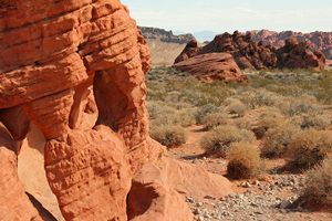
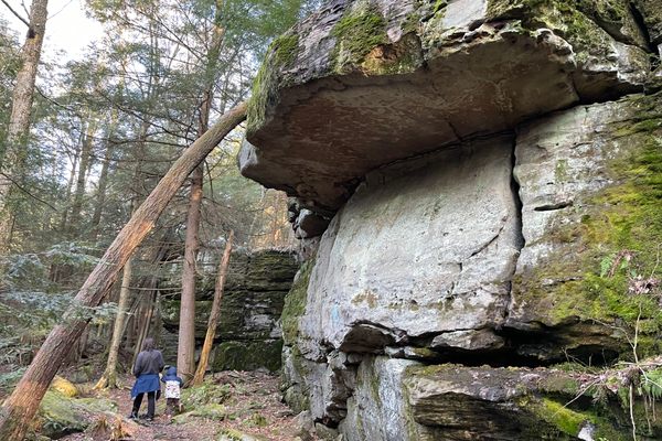
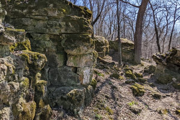
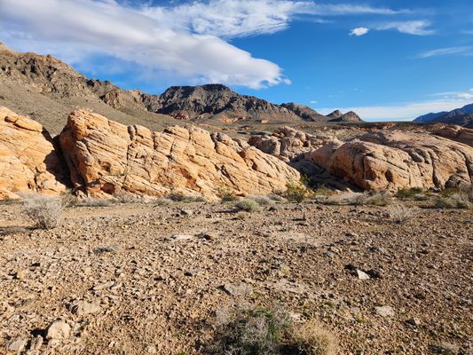
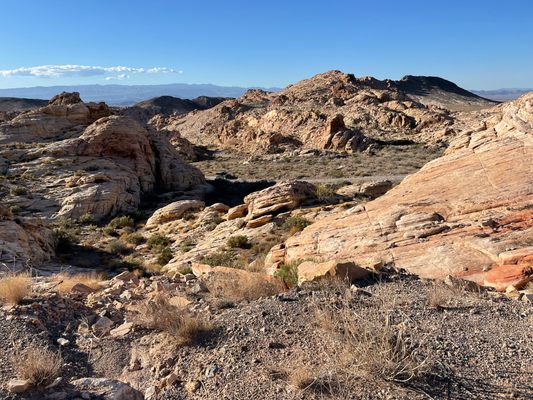
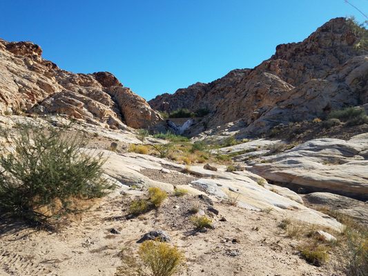
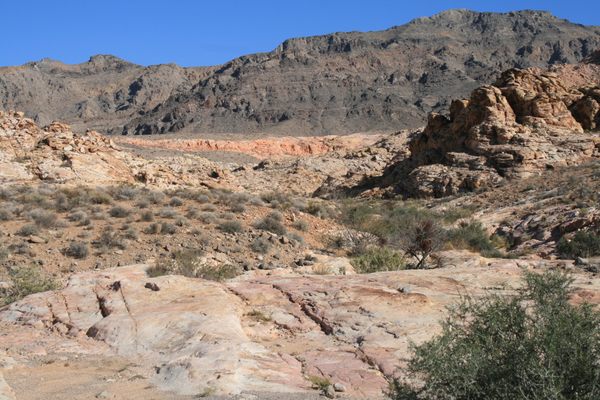
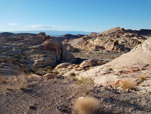
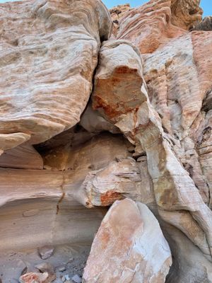
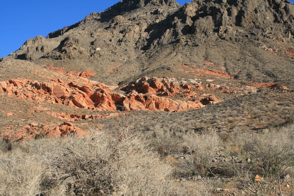
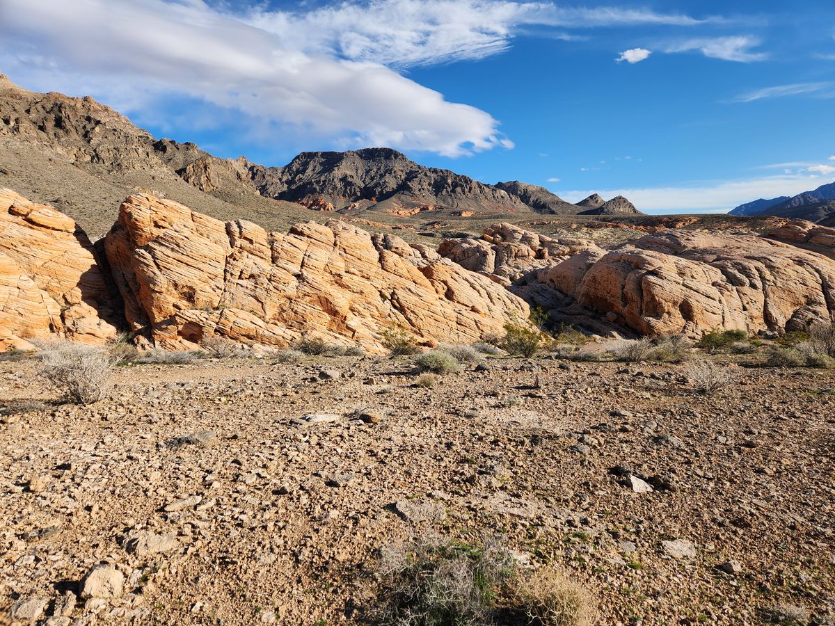
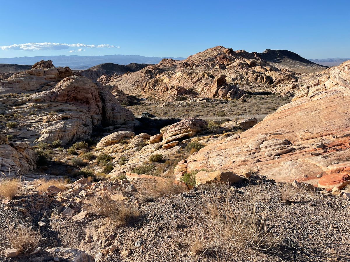
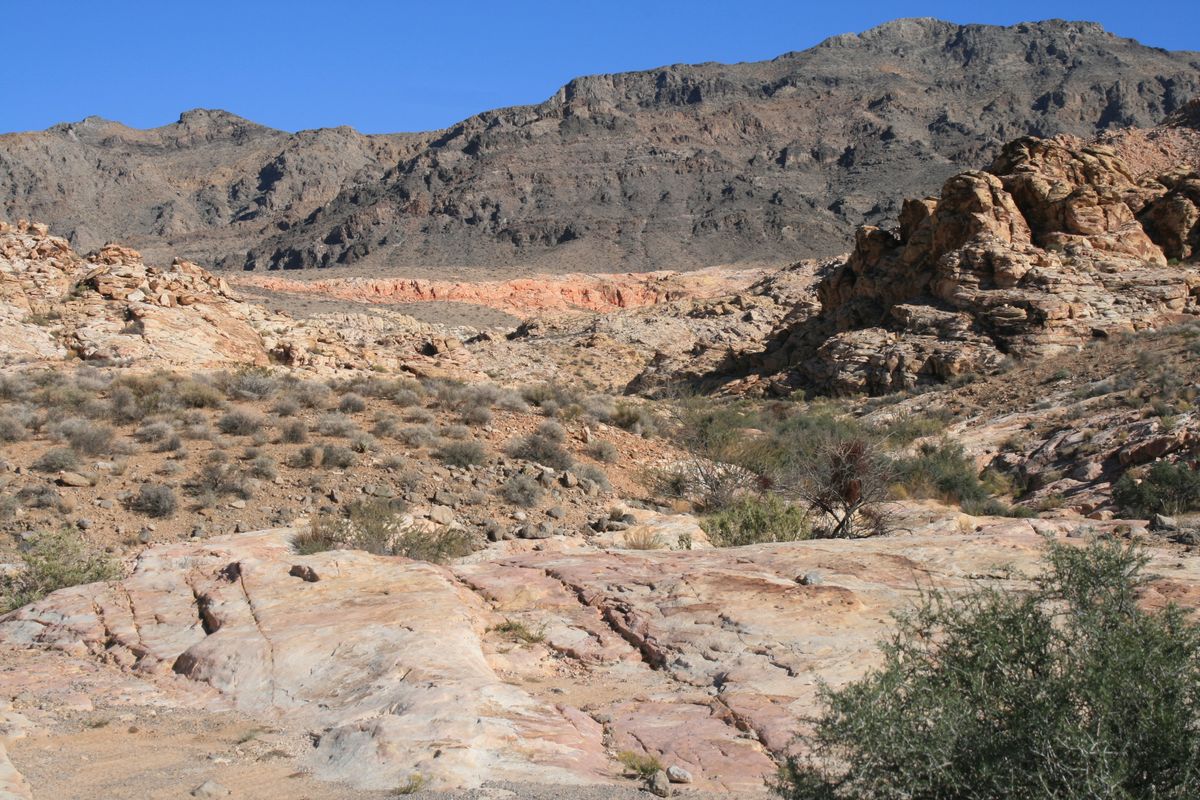
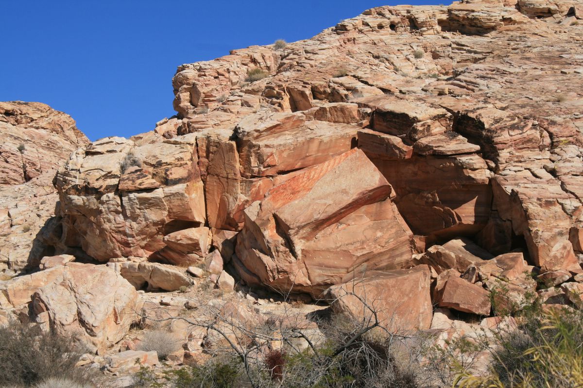
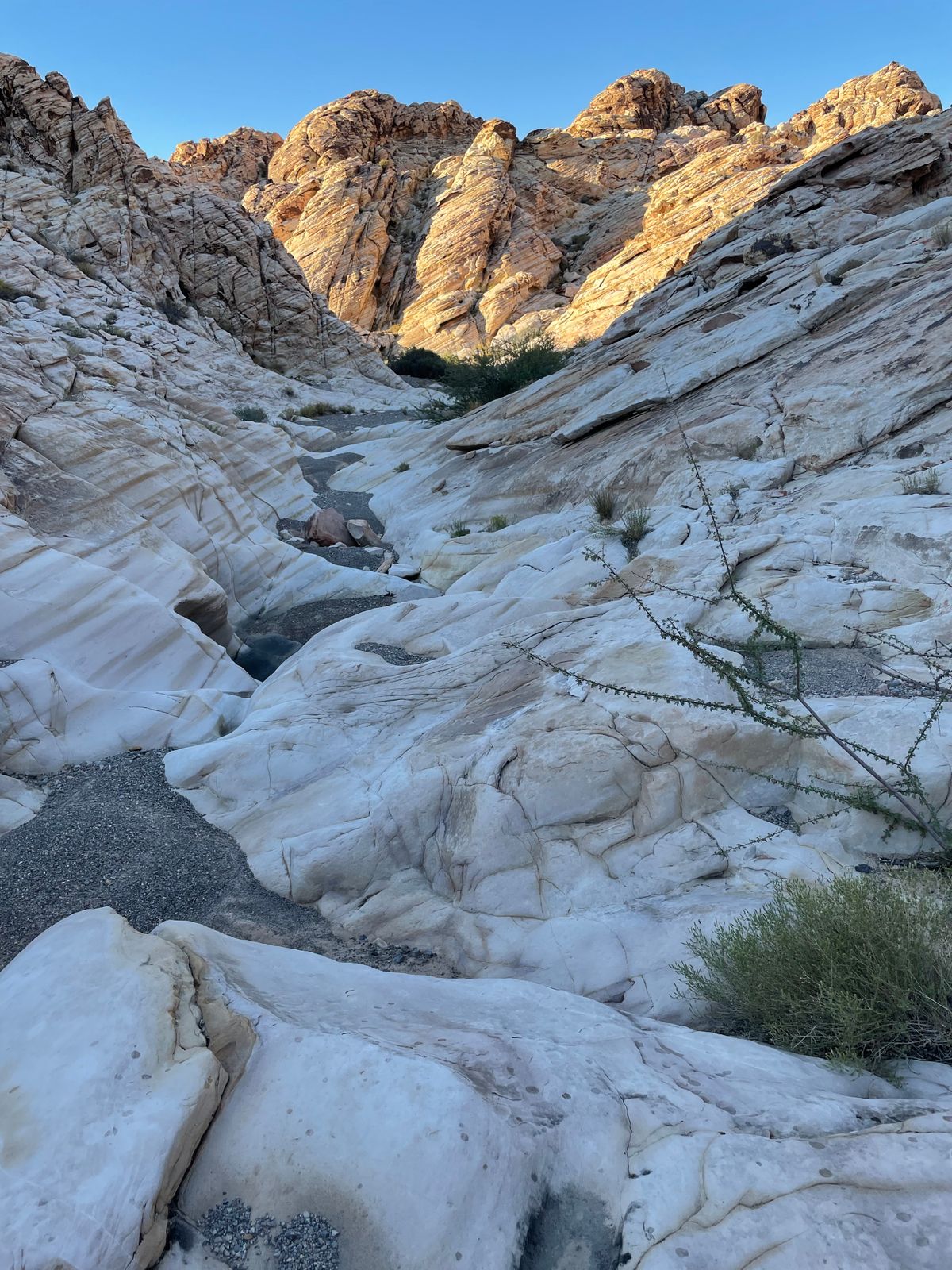
The Muddy Mountains of southern Nevada, between Lake Mead and Interstate 15, consist largely of dark limestone thrust over younger rocks, the colorful Aztec (Navajo) Sandstone of Jurassic age, on a low-angle fault. In Valley of Fire State Park, the overlying limestones have been eroded to reveal the underlying Aztec, itself eroded into spectacular and colorful landforms.

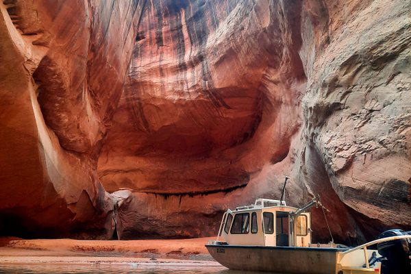
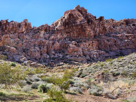
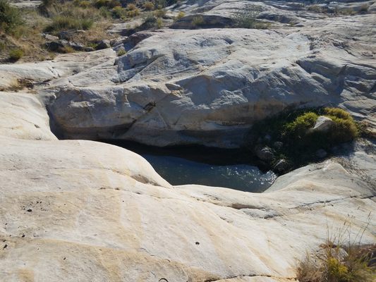
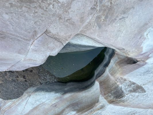
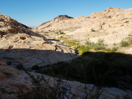
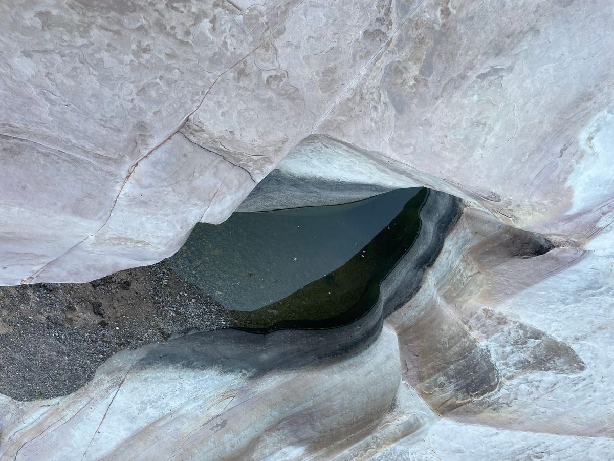
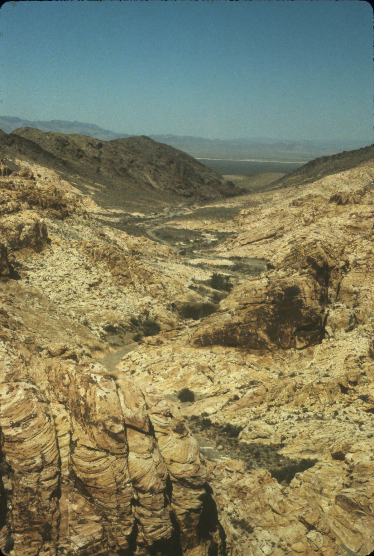
Valley of Fire, however, is not the only place like this. Some eight miles to the west-southwest the limestones have also been eroded to reveal the underlying sandstone. This area, centered on Buffington Pockets, is traversed by the Bitter Springs Back Country Byway. (A pocket is a shallow erosional basin in the sandstone that can hold rainwater. Also called tinajas, from the Spanish for "jar," such basins were of great importance both for wildlife and for human travelers.)

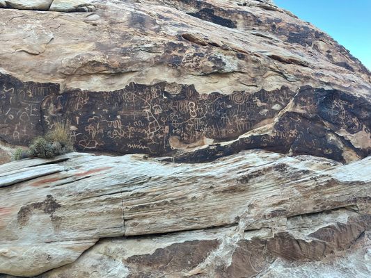
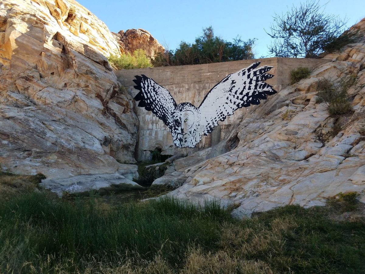
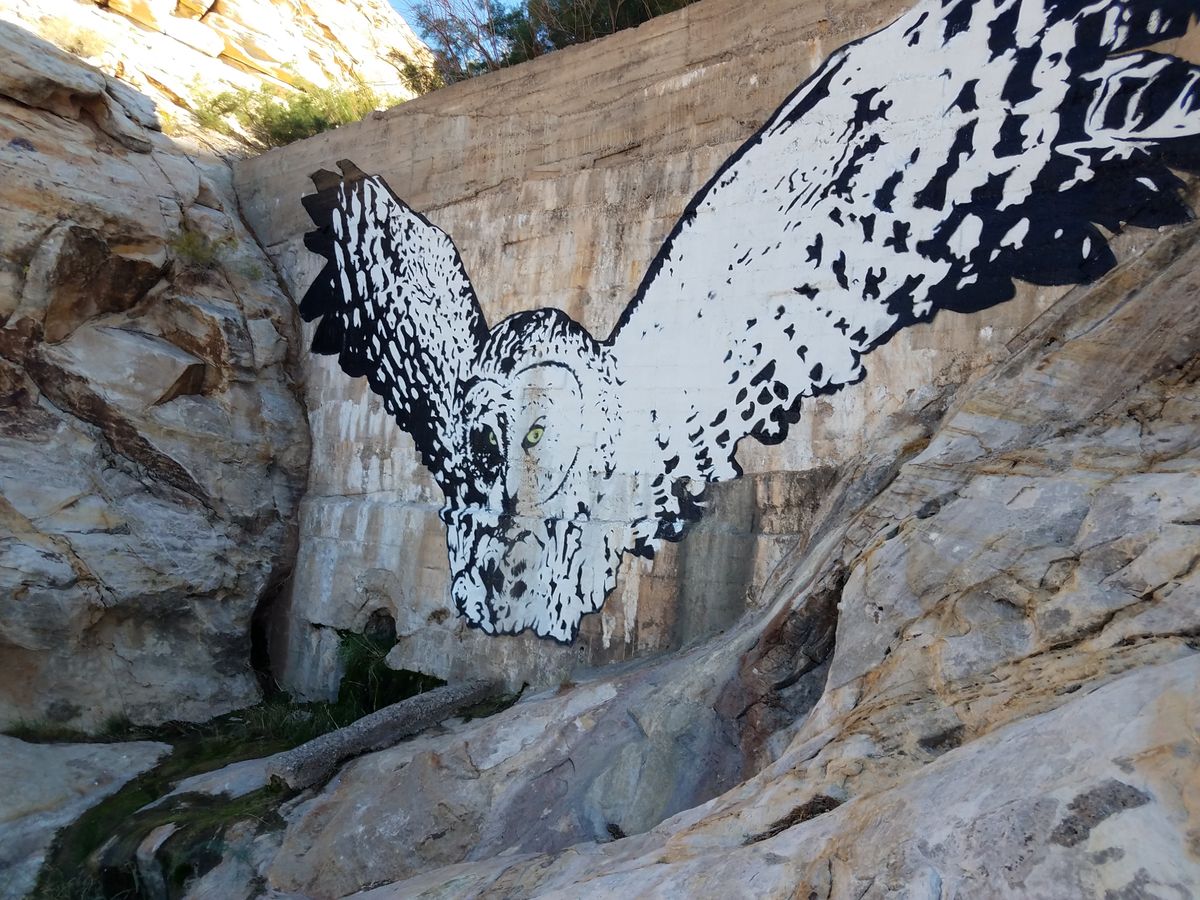
About a mile beyond where the Bitter Springs Back Country Byway first enters a rough canyon, an incongruous concrete dam, presumably for water storage, occurs a few hundred yards off the road to the left. There are lots of places to park along here. The dam presumably dates to the early 20th century. In more recent years, a large picture of an owl in flight has been painted on its downstream face. The canyon above the dam includes petroglyphs. Petroglyphs are irreplaceable; please don't touch or trace them; take photographs only.

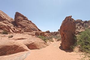
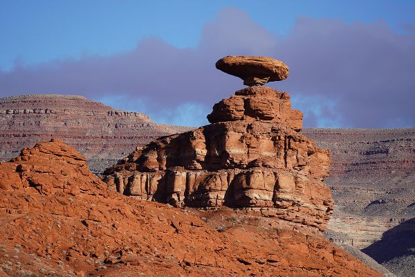
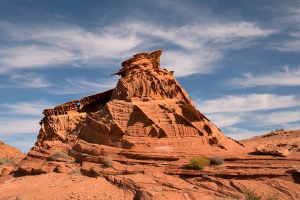
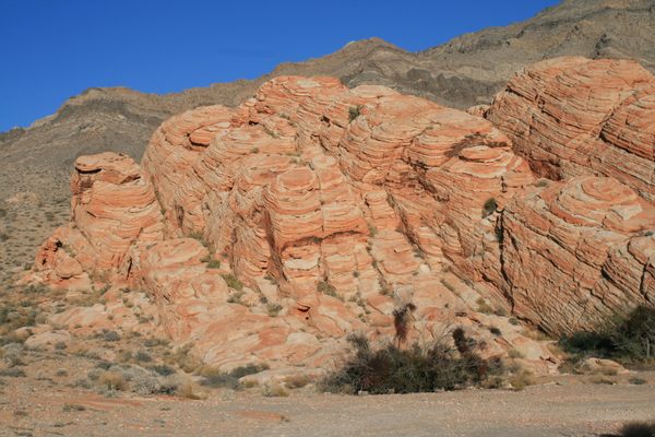
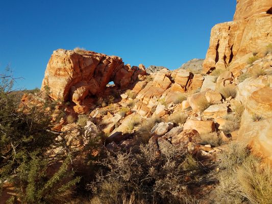
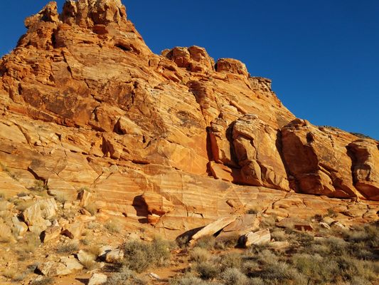
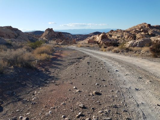
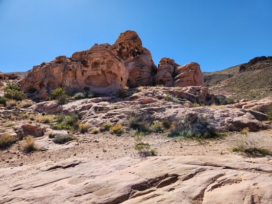
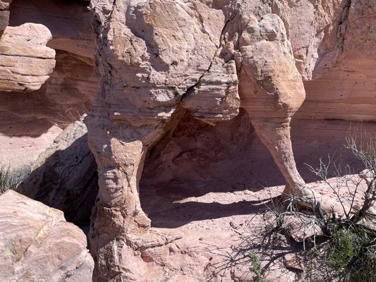
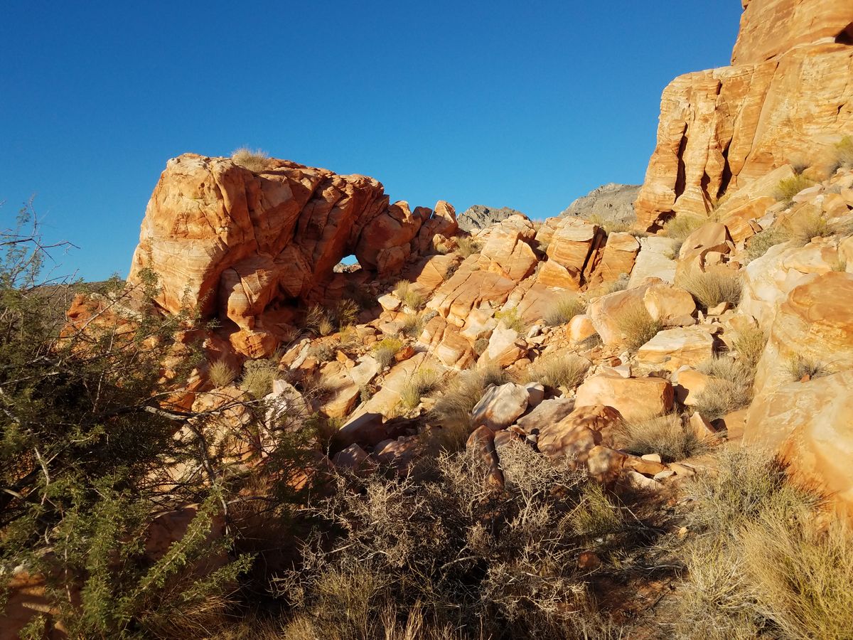
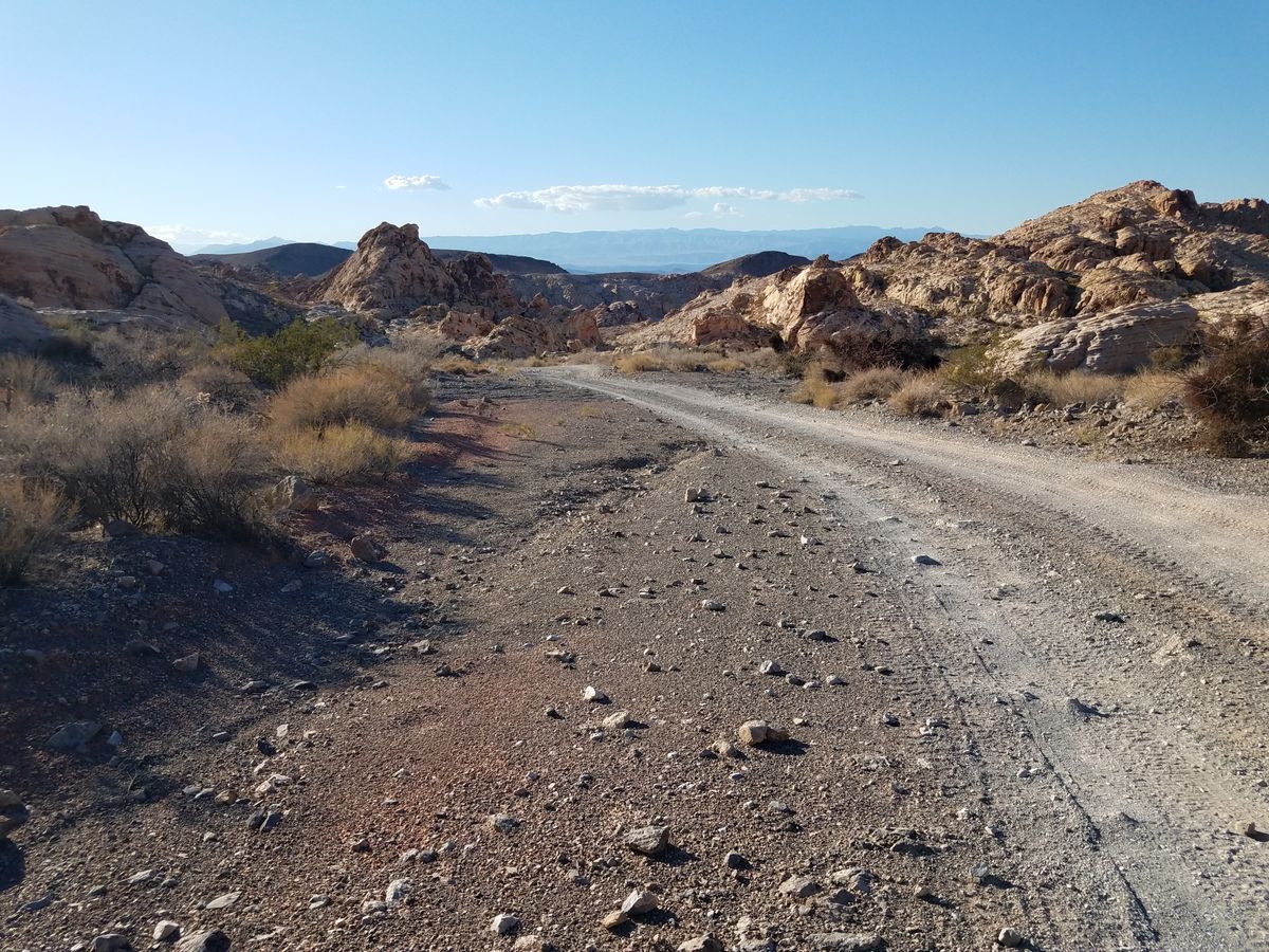
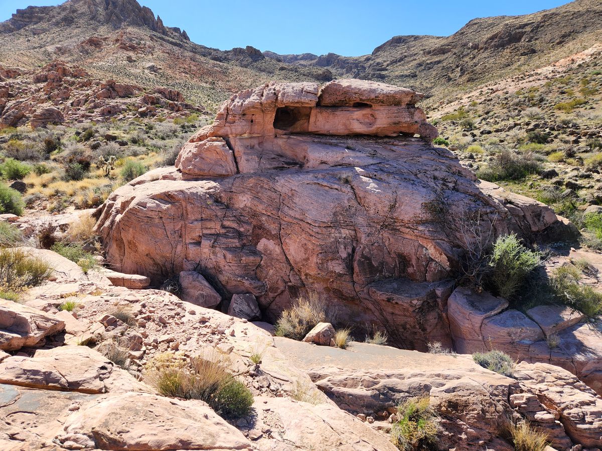
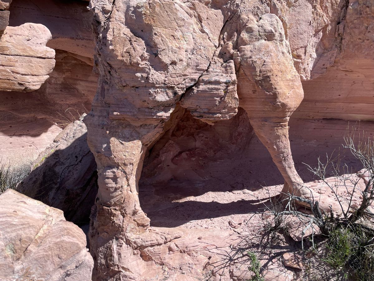
Besides many attractive red sandstone outcrops and bluffs, there are even some arches in the area.

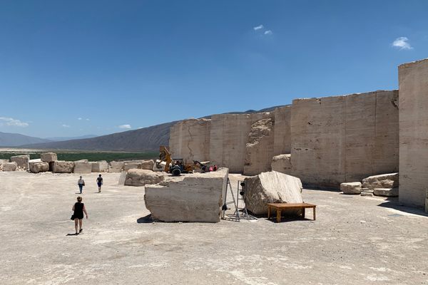
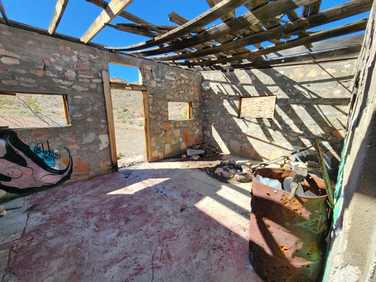
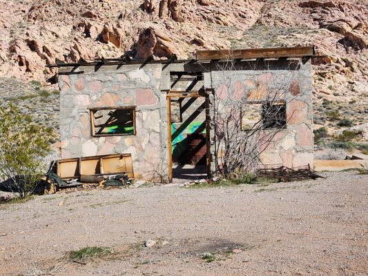
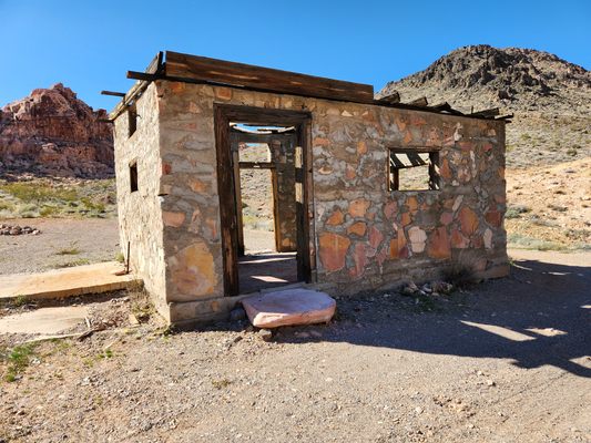
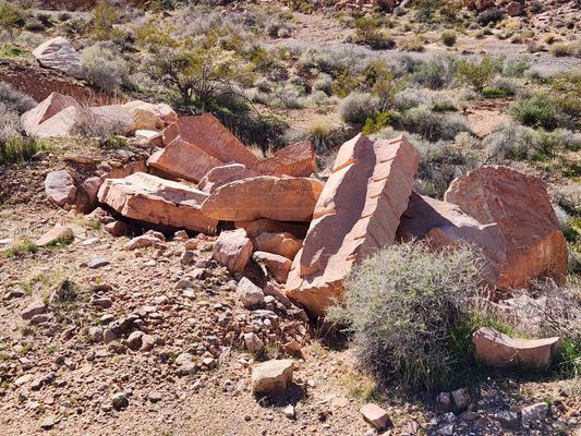
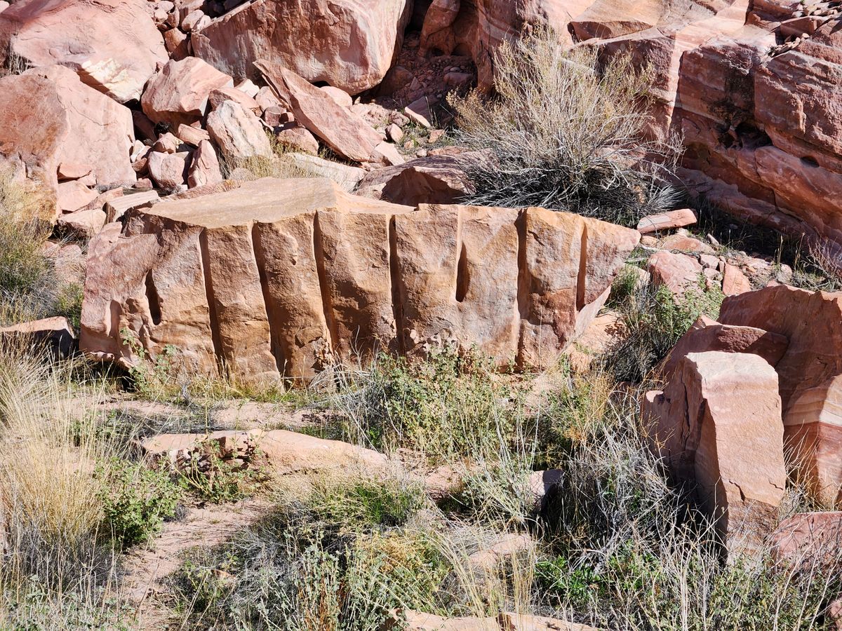
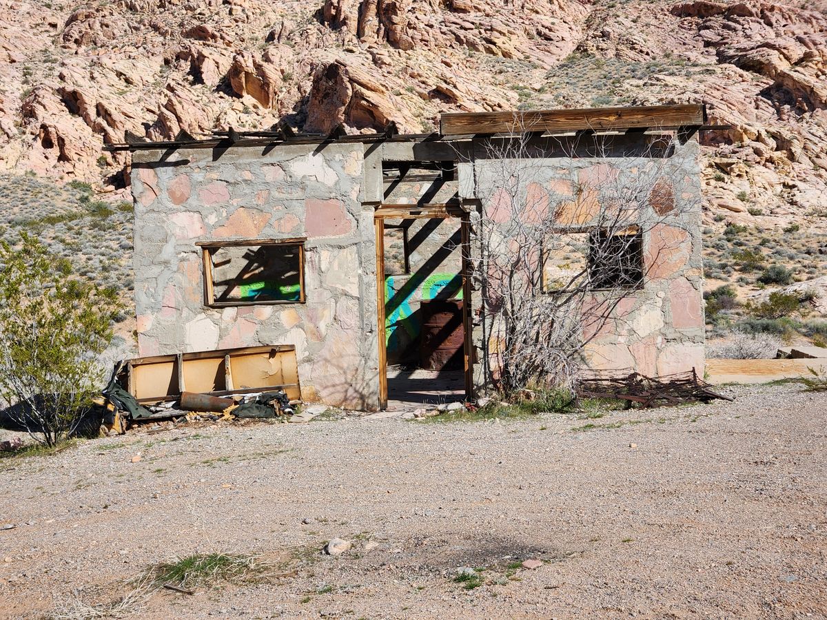
One of the most interesting areas is Colorock Quarry, where there was an attempt to quarry red sandstone for decorative stone, probably in the late 1920s. It includes the ruins of a stone cabin, as well as some drilled and partly finished blocks, and some obvious debris from the rock cutting. However, the absence of extensive spoil deposits from the quarry indicates the operation must have been very short-lived. Transportation costs would have been high, even though gasoline-powered trucks would have been available by then, and in any case, the arrival of the Great Depression would have eliminated potential markets. Colorock Quarry is reached by a road branching off the Bitter Springs Byway.

Related Tags

Canyons Geological Oddities Rock Formations Geology Rocks

Know Before You Go

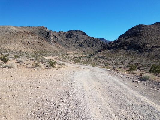
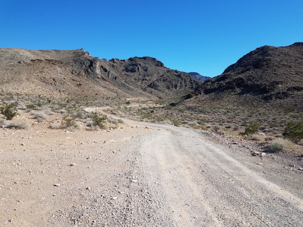
Despite its grandiose name, the Bitter Springs Back-Country Byway is a primitive road that requires high clearance through much of its length and even 4wd in spots. A passenger car might be able to reach the edge of the Pockets from the west side, but will not be able to go any farther. Of course, the difficult access is the major reason Buffington Pockets get much less usage than Valley of Fire.

To reach the Bitter Springs Back-Country Byway, take the Valley of Fire highway (Nevada State Route 169) 3.1 miles from its junction with Interstate 15 (Exit 75) to an intersection (at about 36.46101 N, 114.73602 W). Here the paved road bends to the left, while a dirt road keeps going straight. Keep going straight; this is the Bitter Springs Back-Country Byway. After about 5 miles, the road drops into a drainage and enters a canyon, where it gets much rougher. The concrete dam mentioned above is about another mile.

You can follow the Bitter Springs Back-Country Byway all the way to North Shore Road (Nevada State Route 167) by Lake Mead, but this involves about 15 miles of very rough road requiring high clearance at a minimum.

To get to Colorock Quarry, turn right off the Bitter Springs Back-Country Byway onto a primitive road at an intersection some 4.3 miles after leaving State Route 169 (at about 36.40635 N, 114.70831 W). Bear right in 0.2 miles and go 2.6 miles where the road tops out over a ridge. There are some side roads here, but to get to the Colorock Quarry keep going east 0.8 miles down the canyon ahead. Four-wheel drive is likely to be necessary on parts of the Colorock Quarry road.

The Muddy Mountains Wilderness area begins just beyond the Colorock site; please don't enter it with a motor vehicle, but non-motorized travel is encouraged. 

Community Contributors

Added By

slgwv

Published

August 6, 2024

Edit this listing

Make an Edit
Add Photos
Buffington Pockets
Bitter Springs Trail Back Country Byway
Moapa Valley, Nevada, 89040
United States
36.386604, -114.691601
Visit Website
Get Directions

Nearby Places

Valley of Fire

Clark County, Nevada

miles away

Mouse's Tank

Moapa Valley, Nevada

miles away

Anniversary Narrows

Nevada

miles away

Explore the Destination Guide

Photo of Nevada

Nevada

United States

Places 265
Stories 24

Nearby Places

Valley of Fire

Clark County, Nevada

miles away

Mouse's Tank

Moapa Valley, Nevada

miles away

Anniversary Narrows

Nevada

miles away

Explore the Destination Guide

Photo of Nevada

Nevada

United States

Places 265
Stories 24

Related Places

  • The winding curves of Ybykty Canyon.

    Koyulus, Kazakhstan

    Ybykty Canyon

    This small canyon is home to a treasure trove of geological oddities.

  • Grampian, Pennsylvania

    Bilger's Rocks

    Rocky outcrops containing overhangs, caves, fissures, clefts, and alcoves that invite exploration and scrambling.

  • Mexican Hat

    Mexican Hat, Utah

    Mexican Hat

    This balancing rock is one of Utah's most unusual geological formations.

  • Mortana, Australia

    Murphy’s Haystacks

    These oddly shaped pink granite formations got their name after being mistaken for massive piles of hay.

  • Edmaier’s Secret

    Big Water, Utah

    Edmaier's Secret

    This hidden gem in Arizona is truly worth the rugged journey.

  • Mina de Mármol

    Cuatrociénegas, Mexico

    Mina de Mármol

    A former travertine mine traces the geological history of this unique desert filled with crystalline blue pools.

  • Brady’s Rocks are the southernmost surface exposure of the massive Niagara Escarpment.

    Eagle, Wisconsin

    Brady's Rocks

    These modest Midwestern formations are kin to Niagara Falls' impressive cliffs, more than 600 miles away.

  • Lake Powell, Utah

    Cathedral in the Desert

    The damming of the Colorado River buried an iconic geologic formation before record-breaking drought brought it back.

Aerial image of Vietnam, displaying the picturesque rice terraces, characterized by their layered, verdant fields.
Atlas Obscura Membership

Become an Atlas Obscura Member


Join our community of curious explorers.

Become a Member

Get Our Email Newsletter

Follow Us

Facebook YouTube TikTok Instagram Pinterest RSS Feed

Get the app

Download the App
Download on the Apple App Store Get it on Google Play
  • All Places
  • Latest Places
  • Most Popular
  • Places to Eat
  • Random
  • Nearby
  • Add a Place
  • Stories
  • Food & Drink
  • Itineraries
  • Lists
  • Video
  • Podcast
  • Newsletters
  • All Trips
  • Family Trip
  • Food & Drink
  • History & Culture
  • Wildlife & Nature
  • FAQ
  • Membership
  • Feedback & Ideas
  • Community Guidelines
  • Product Blog
  • Unique Gifts
  • Work With Us
  • About
  • FAQ
  • Advertise With Us
  • Advertising Guidelines
  • Privacy Policy
  • Cookie Policy
  • Terms of Use
Atlas Obscura

© 2025 Atlas Obscura. All Rights Reserved.