


About
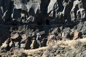
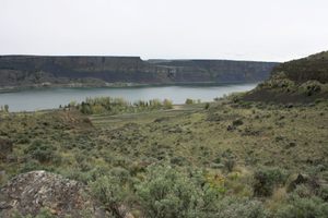
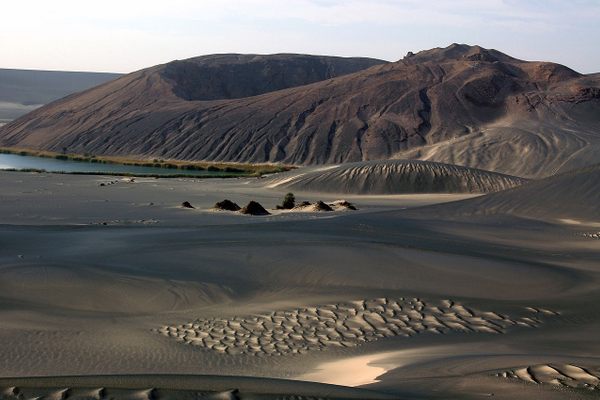
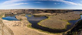
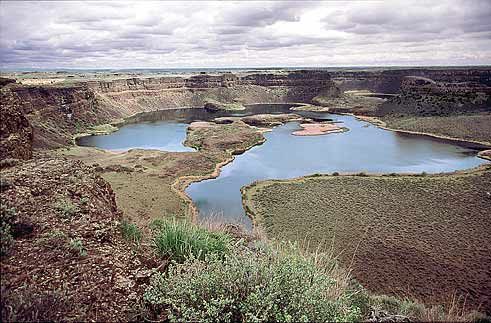
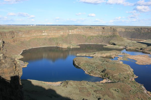
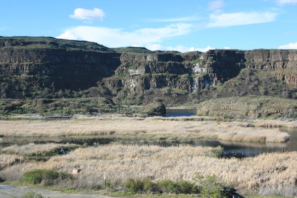
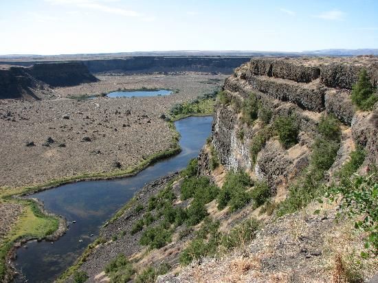
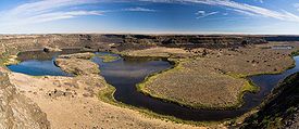
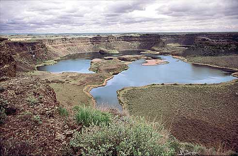
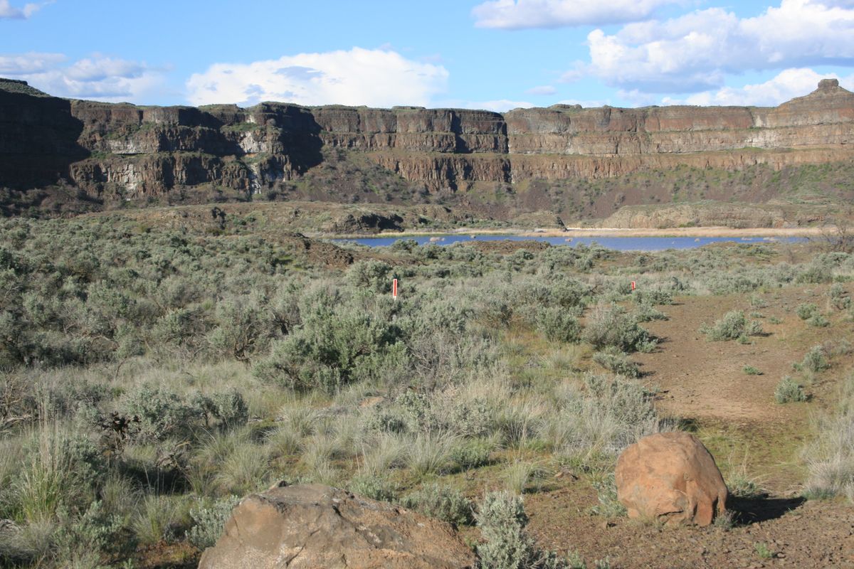
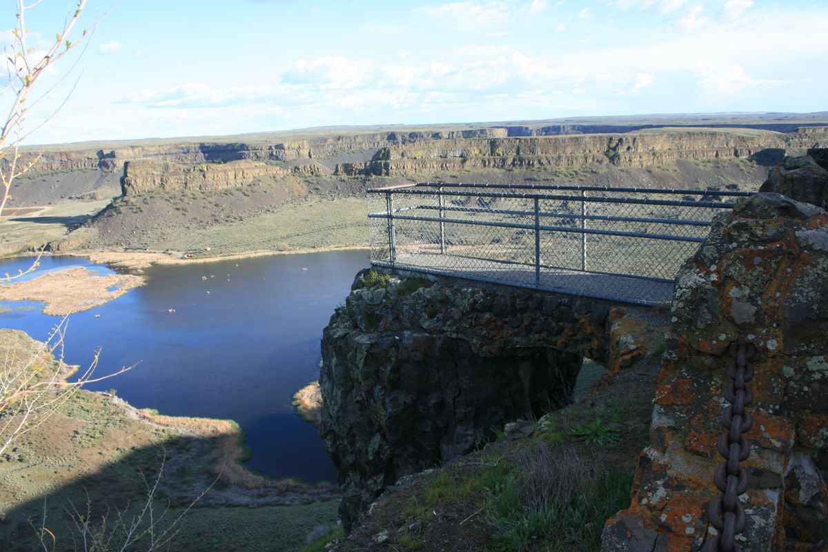
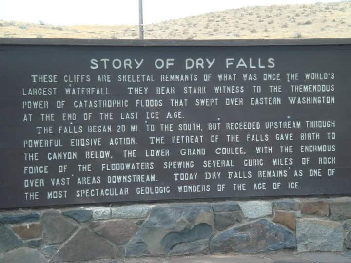
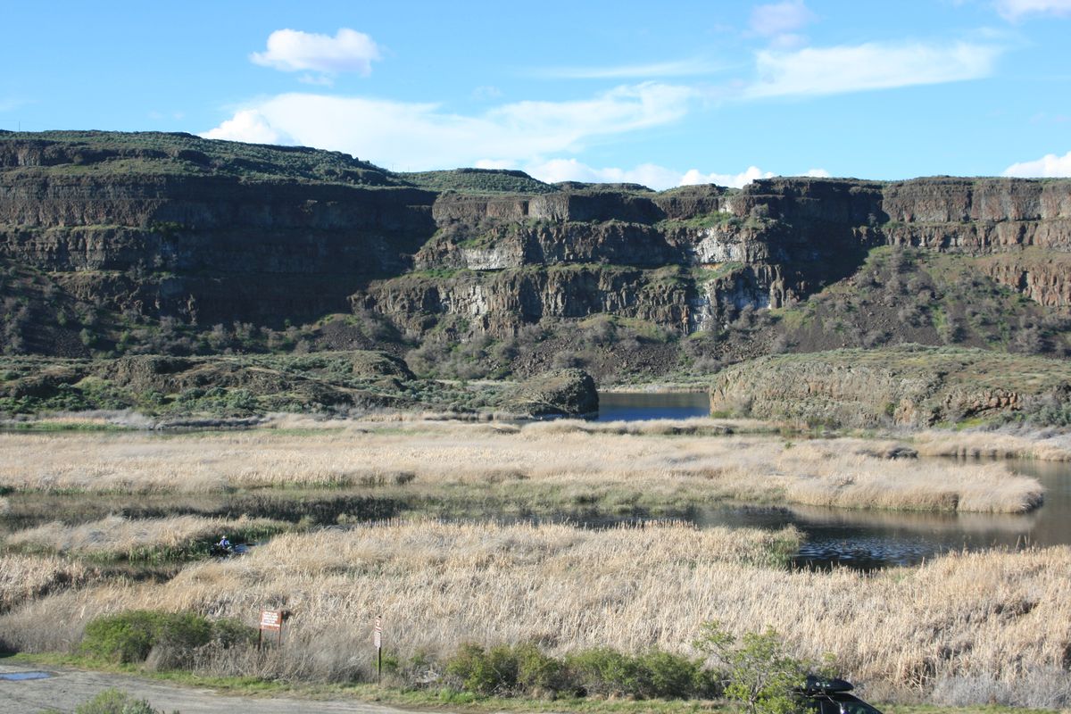
In central Washington, on the opposite side of the Upper Grand Coulee from the Columbia River, and at the head of the Lower Grand Coulee, exists a three and a half mile-long scalloped precipice known as Dry Falls.
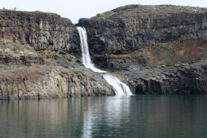
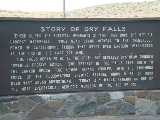
Ten times the size of Niagara, Dry Falls is thought to be the greatest known waterfall that ever existed. Geologists speculate that during the last ice age catastrophic flooding channeled water at 65 miles per hour through the Upper Grand Coulee and over this 400-foot (120 m) rock face. At this time, it is estimated that the flow of the falls was ten times the current flow of all the rivers in the world combined.
Nearly twenty thousand years ago, as glaciers moved south, one ice sheet plugged the Clark Fork of the Columbia River, which kept water from being drained from Montana. Consequently, a significant portion of western Montana flooded, forming the gigantic Lake Missoula. Eventually, enough pressure accumulated on the ice dam that it gave way. It is generally accepted that this process of ice-damming of the Clark Fork, refilling of Lake Missoula and subsequent cataclysmic flooding happened dozens of times over the years of the last Ice Age.
This sudden release put parts of Idaho, Washington, and Oregon under hundreds of feet of water in just a few days. These extraordinary floods created the Grand Coulee and Dry Falls in a short period. Similar glacial flooding on a smaller scale kept the falls flowing off and on for several thousand years.
Once the ice sheets that obstructed the Columbia melted, the river returned to its normal course leaving the Grand Coulee and the falls desiccated. Today, this massive cliff can be viewed from the Dry Falls Interpretive Center, part of Sun Lakes State Park, and located on Route 17 near the town of Coulee City.
Related Tags
Community Contributors
Added By
Published
April 26, 2010