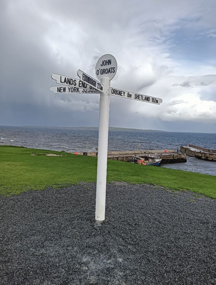
Places Foods Stories Newsletters
Loading...
Latest Places to Eat & Drink
View All Places to Eat »
Akureyri Domino’s Pizza
Site of the Original Krispy Kreme Doughnut Shop
Neuhaus Chocolate Shop
Caesar Salad being prepared table side
Caesar’s Restaurant Bar
Local favorites include chicken tacos, guacamole, and the strawberry limeade.
El Weirdo
Recent Stories
All Stories Video Podcast
Most Recent Stories
View All Stories »
Welcome to The Obscura Society
Taking advantage of Florida’s never-ending summer, Sajoma has a spacious outdoor eating area.
Pedro Rodriguez Is on a Quest for Freshness
Edison’s laboratory
Inside Thomas Edison’s Botanical Laboratory
A building and road in Fordlândia
Why Did Henry Ford Build a Midwestern Town in the Amazon Rainforest?

No search results found for
“”

Make sure words are spelled correctly.

Try searching for a travel destination.

Places near me Random place

Popular Destinations

  • Paris
  • London
  • New York
  • Berlin
  • Rome
  • Los Angeles
Places Foods Stories Newsletters
Sign In Join
Places near me Random place
All the United Kingdom Scotland John o' Groats John o' Groats Marker

John o' Groats Marker

The sign marks one of the endpoints to mainland Britain's longest overland travel route.

John o' Groats, Scotland

Added By
Ken J
Email
Been Here
Want to go
Added to list
CAPTION
The marker.   KenJ / Atlas Obscura User
Marker, hotel, ferry.   KenJ / Atlas Obscura User
  conlyn55 / Atlas Obscura User
Sticker free signpost   katielou106 / Atlas Obscura User
March 2023  
John O’Groats   RichardGrant02 / Atlas Obscura User
Panoramic of Hotel, Marker & Ferry   jct2112 / Atlas Obscura User
Marker and Ferry.   KenJ / Atlas Obscura User
  rbenn250 / Atlas Obscura User
Been Here
Want to go
Added to list

About

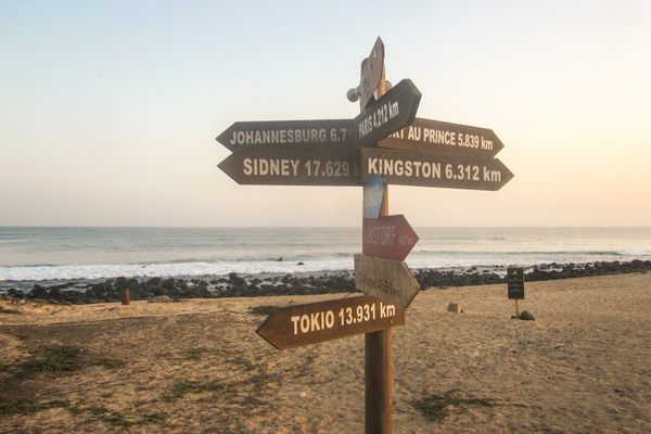
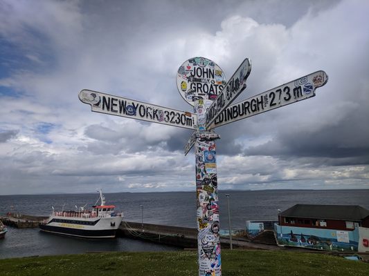
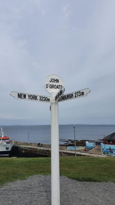
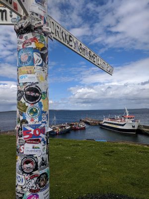
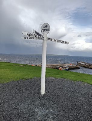
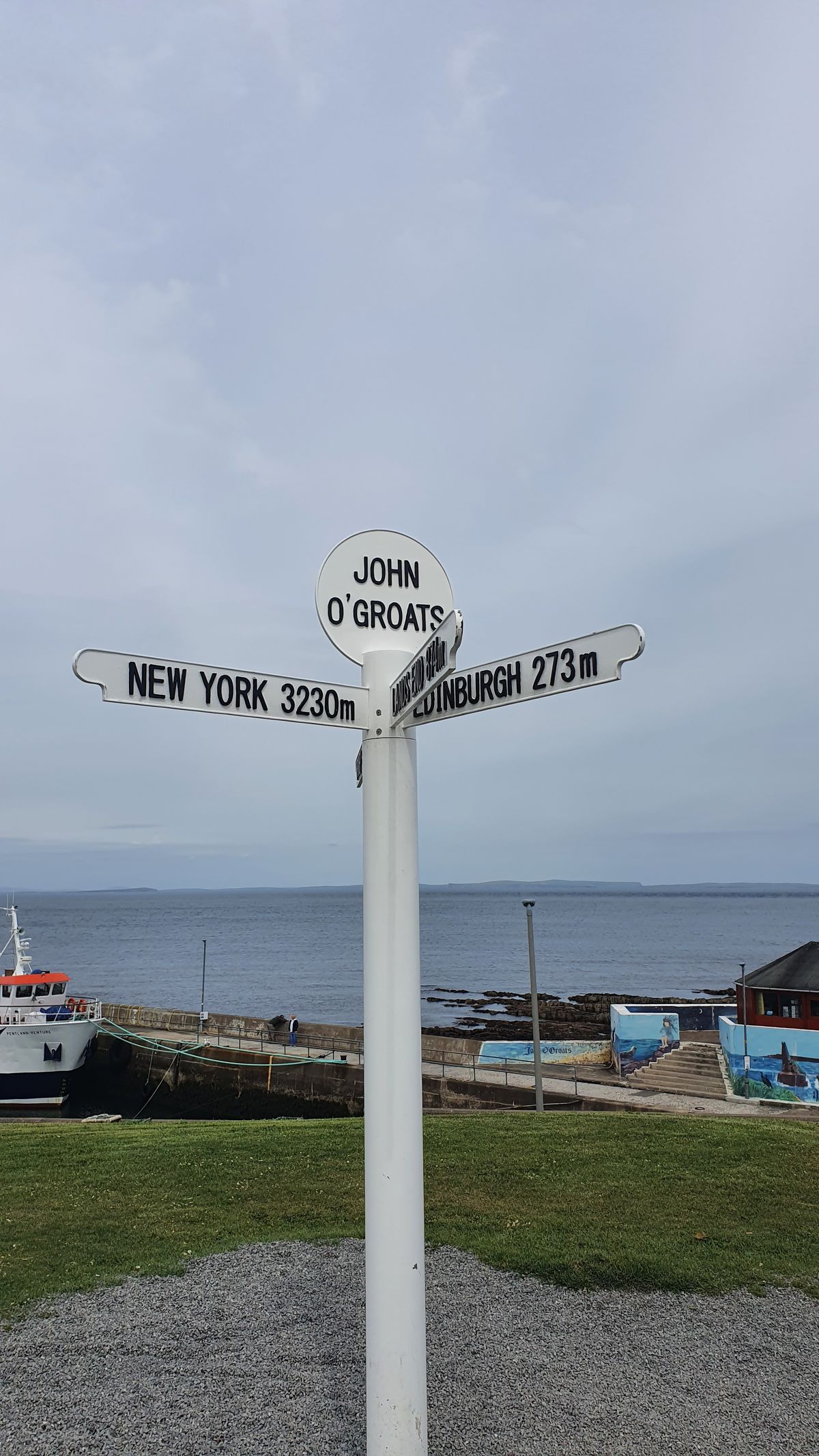
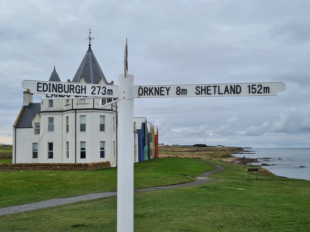
This signpost marks the northeastern point of the Land's End to John o' Groats route. The route is the longest distance a person can walk between any two towns in Britain, clocking in at 874 miles, stretching from the southwest to the northeast of the island. 

Since the 1960s, there has been a signpost at the spot, which is a favorite for bicyclists or walkers to document the completion or beginning point of their transversal either as a charity fundraiser or simply a personal endurance challenge.

The earliest known pedestrian trip was in 1871. Current walkers will usually have a much longer distance to cover than those riding on motorways, as they must traverse about 1,200 miles. If walking, it can take a couple of months to complete. The bicycle record is less than two days, but most cyclists will take a couple of weeks to finish. The Land's End—John o'Groats association offers several annual awards for certain categories based on age, mode of travel, top fundraiser, etc. One of the more eccentric un-powered trips was undertaken by David Sullivan, who hit golf balls all the way. 

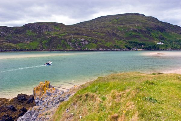
Ewan McGregor and his friend Charley Boorman kicked off their adventure travel documentary, The Long Way Down from John o' Groats marker to Cape Agulhas, the southernmost point on the African continent.

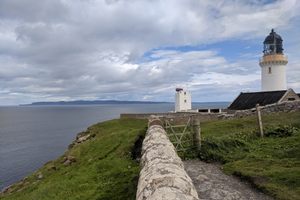
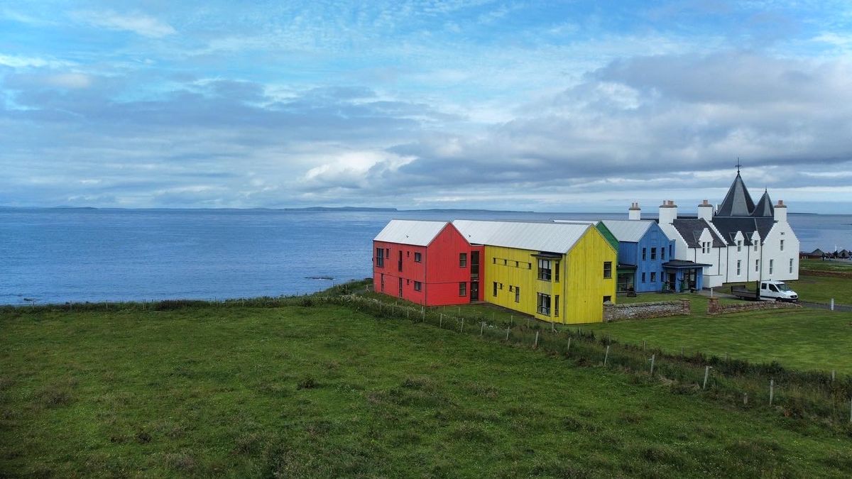
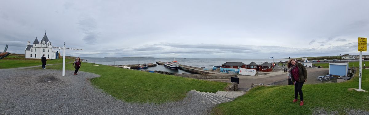
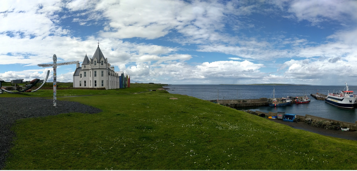
The spot is often touted as the northernmost point in mainland Britain, though that’s incorrect, as that point is a few miles west at Dunnet Head.

Places

Discover your next amazing Atlas Place.

Get more unusual and extraordinary places each week with the Atlas Obscura Places newsletter.

Your newsletter subscriptions with us are subject to Atlas Obscura's Privacy Policy and Terms of Use.

Related Tags

Signs Trails Geographic Markers

Know Before You Go

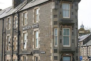
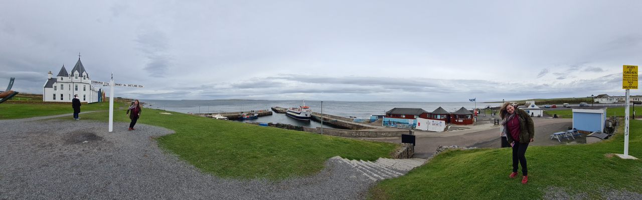
John o'Groats can be reached by public transportation and is about half an hour from Wick by car. The marker and hotel are a short walk from the A836. A ferry to the nearby islands are also available. There is a hotel, bistro and camping available.

The small harbor behind the sign is home to grey seals (year round) and harbor porpoises (July-October), while the Pentland Firth beyond can allow viewings of passing orcas (April-September) and Minke whale (June-October).

Community Contributors

Added By

KenJ

Edited By

katielou106, rbenn250, conlyn55, jct2112...

  • katielou106
  • rbenn250
  • conlyn55
  • jct2112
  • alittlebrowndog
  • RichardGrant02

Published

July 5, 2019

Edit this listing

Make an Edit
Add Photos
Sources
  • https://en.wikipedia.org/wiki/Land%27s_End_to_John_o%27_Groats
John o' Groats Marker
John o' Groats, Scotland, KW1 4YR
United Kingdom
58.643976, -3.069947

Nearby Places

Dunnet Head Lighthouse

Dunnet, Scotland

miles away

Ebenezer Place

Wick, Scotland

miles away

The Italian Chapel

Orkney, Scotland

miles away

Explore the Destination Guide

Photo of Scotland

Scotland

United Kingdom

Places 757
Stories 49

Nearby Places

Dunnet Head Lighthouse

Dunnet, Scotland

miles away

Ebenezer Place

Wick, Scotland

miles away

The Italian Chapel

Orkney, Scotland

miles away

Explore the Destination Guide

Photo of Scotland

Scotland

United Kingdom

Places 757
Stories 49

Related Places

  • Pointe de Almadies sign

    Dakar, Senegal

    Pointe de Almadies

    This beach in Senegal marks the westernmost point on the African continent.

  • Sign at the Cape of Good Hope

    Cape Town, South Africa

    The Most Southwestern Point of Africa

    The Cape of Good Hope is not quite as low as you can go on the African continent, but it's still geographically significant.

  • The sign before it was covered in stickers.

    Chicago, Illinois

    Beginning (and End) of Historic Route 66

    A journey begins with a single step, and for many, the road-trip of a lifetime started at this Chicago intersection.

  • You can’t miss the sign, flag, and pyramid.

    Torpshammar, Sweden

    Sweden's Geographical Midpoint

    The "geometrical" center of the country, as calculated in 1947.

  • Marker at the end of National Route 3, Bahia Lapataia.

    Ushuaia, Argentina

    Bahia Lapataia at the End of the World

    The most southern point you can drive to in the Western Hemisphere.

  • Ferry to Cape Wrath across the Kyle of Durness.

    Keoldale, Scotland

    Cape Wrath

    The farthest northwesterly point of the British mainland is one of the most remote places in the Scottish Highlands.

  • Historical sign in Osborne, Kansas.

    Osborne, Kansas

    Geodetic Center of North America

    This lesser-known geographic marker was the reference point for all surveys of the continent for 75 years.

  • Cape Agulhas.

    L'Agulhas, South Africa

    Cape Agulhas Marker

    This small monument marks the divide between the Atlantic and Indian Oceans at the southernmost tip of Africa.

Aerial image of Vietnam, displaying the picturesque rice terraces, characterized by their layered, verdant fields.
Atlas Obscura Membership

Become an Atlas Obscura Member


Join our community of curious explorers.

Become a Member

Get Our Email Newsletter

Follow Us

Facebook YouTube TikTok Instagram Pinterest RSS Feed

Get the app

Download the App
Download on the Apple App Store Get it on Google Play
  • All Places
  • Latest Places
  • Most Popular
  • Places to Eat
  • Random
  • Nearby
  • Add a Place
  • Stories
  • Food & Drink
  • Itineraries
  • Lists
  • Video
  • Podcast
  • Newsletters
  • All Trips
  • FAQ
  • Membership
  • Feedback & Ideas
  • Community Guidelines
  • Product Blog
  • Unique Gifts
  • Work With Us
  • About
  • FAQ
  • Advertise With Us
  • Advertising Guidelines
  • Privacy Policy
  • Cookie Policy
  • Terms of Use
Atlas Obscura

© 2026 Atlas Obscura. All Rights Reserved.