Places Foods Stories Newsletters
Loading...
Loading...
Loading...

No search results found for
“”

Make sure words are spelled correctly.

Try searching for a travel destination.

Places near me Random place

Popular Destinations

  • Paris
  • London
  • New York
  • Berlin
  • Rome
  • Los Angeles
Places Foods Stories Newsletters
Sign In Join
Places near me Random place
All the United States Nevada Boulder City Keyhole Canyon
AO Edited

Keyhole Canyon

A photogenic rock-art site that is also a popular climbing and canyoneering area.

Boulder City, Nevada

slgwv profile photo
Added By
slgwv
Email
Been Here
Want to go
Added to list
CAPTION
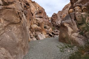
Looking up Keyhole Canyon, through the first narrows.   slgwv / Atlas Obscura User
Geometric and wavy petroglyphs.   slgwv / Atlas Obscura User
Looking out Keyhole Canyon.   slgwv / Atlas Obscura User
Geometric and wavy petroglyphs.   slgwv / Atlas Obscura User
Geometric petroglyphs.   slgwv / Atlas Obscura User
The lowermost fall on the main drainage into the canyon.   slgwv / Atlas Obscura User
Geometric petroglyphs.   slgwv / Atlas Obscura User
Approach to Keyhole Canyon.   slgwv / Atlas Obscura User
Geometric petroglyphs.   slgwv / Atlas Obscura User
Geometric and wavy petroglyphs.   slgwv / Atlas Obscura User
The lowermost fall on the main drainage into the canyon.   slgwv / Atlas Obscura User
Entrance to Keyhole Canyon.   slgwv / Atlas Obscura User
Looking toward the entrance to Keyhole Canyon.   slgwv / Atlas Obscura User
Geometric petroglyphs.   slgwv / Atlas Obscura User
Geometric and wavy petroglyphs.   slgwv / Atlas Obscura User
Close-up of the top of the lowermost fall.   slgwv / Atlas Obscura User
Box-like petroglyphs.   slgwv / Atlas Obscura User
Been Here
Want to go
Added to list

About

Keyhole Canyon is a spectacular slot canyon, eroded into granite, that is an important rock-art site. Abundant petroglyphs are found on the walls near the canyon mouth. They are unusual in that large geometric glyphs are common, while representational figures (e.g., bighorn sheep) are rare. They have been interpreted as representing the creation mythology of the local Native American groups.

Keyhole Canyon has also been a popular rock-climbing area for Las Vegas climbers for decades. It is the nearest outcrop of granite to the Las Vegas Valley that furnishes good climbing routes.

In more recent years canyoneering has become popular. The upper part of Keyhole Canyon, above the 100-foot dry waterfall that can be reached from the trailhead, can be accessed by a use path from the next canyon over. Keyhole Canyon can then be followed downstream, with several water-polished dry waterfalls that must be rappelled, of which the last and highest is the one immediately above the trailhead. It is considered a relatively easy canyoneering route.

Places

Discover your next amazing Atlas Place.

Get more unusual and extraordinary places each week with the Atlas Obscura Places newsletter.

Your newsletter subscriptions with us are subject to Atlas Obscura's Privacy Policy and Terms of Use.

Know Before You Go

Keyhole Canyon is reached on dirt roads. Some guides claim that with care passenger cars can negotiate the roads, but realistically high clearance is required.

If coming from the north, turn left (east) off US-95 on a graded dirt road (labeled Route S on Google Maps), at about 35.74399 N, 114.95530 W. Follow it 2.1 miles to the second (farther east) of two high-voltage powerline roads, at about 35.74330 N, 114.91901 W. Turn right (south) here and go 1.8 miles to a turnoff to Keyhole Canyon (at about 35.71874 N, 114.92971 W). Turn left and go 0.3 mile; Keyhole Canyon is visible ahead on the range front.

If coming from the south, turn right (east) off US-95 at about 35.69574 N, 114.96054 W onto a graded dirt road (labeled Route T on Google Maps). There is a gravel pit right at the turnoff. Go 1.2 miles to the second powerline road (farther east) and turn left. This turn, at about 35.69051 N, 114.94137 W, is more than 90 degrees. Go 2 miles, following the road as it winds around, to a turnoff at about 35.71524 N, 114.93142 W and turn right. Keyhole Canyon is visible ahead; go 0.3 miles to the trailhead.

Note that "easy" canyoneering is relative. It is a highly technical skill that should not be attempted unless you're experienced in rappelling, including the safe placement of rappel anchors.

Please don't disturb the rock art.

Community Contributors

slgwv profile photo

Added By

slgwv

Published

July 28, 2025

Edit this listing

Make an Edit
Add Photos
Sources
  • https://www.mountainproject.com/area/105941578/keyhole-canyon
  • http://www.onv-dev.duffion.com/articles/keyhole-canyon-petroglyphs-and-creation-mythology

Related Tags

Native Americans Petroglyphs Canyons
Keyhole Canyon
Boulder City, Nevada
United States
35.716274, -114.926262

Nearby Places

Nelson

Nelson, Nevada

miles away

Techatticup Mine

Nelson, Nevada

miles away

Oakland Group Mine

Searchlight, Nevada

miles away

Explore the Destination Guide

Photo of Boulder City

Boulder City

Nevada

Places 9

Nearby Places

Nelson

Nelson, Nevada

miles away

Techatticup Mine

Nelson, Nevada

miles away

Oakland Group Mine

Searchlight, Nevada

miles away

Explore the Destination Guide

Photo of Boulder City

Boulder City

Nevada

Places 9

Related Places

  • Ute Mountain Chimney Rock

    Towaoc, Colorado

    Ute Mountain Tribal Park

    Ute tour guides have been sharing the ancient dwellings and rock art inside this large park with visitors for more than 40 years.

  • Contemplative paths.

    Santa Cruz, Aruba

    Ayo Rock Formations

    The Ayo Rock Formations stand out on the island of Aruba as a unique arrangement of giant boulders with interesting crawl spaces to explore.

  • The Safe Harbor Petroglyphs

    Shenks Ferry, Pennsylvania

    The Safe Harbor Petroglyphs

    A sacred collection of indigenous rock art.

  • 8 foot tall Owl Rock

    Atlanta, Georgia

    Owl Rock

    This Native American petroglyph marks the location of an important, Creek trail.

  • Big Foot petroglyph, with standing figure to right.  The Big Foot is literally a representation of a bare human footprint, not the storied cryptid.

    Clark County, Nevada

    Black Butte Petroglyph Trail

    The highest concentration of petroglyph sites in Gold Butte National Monument, plus an improbable early 20th-century dam.

  • Canyon de Chelly

    Chinle, Arizona

    Canyon de Chelly National Monument

    Red sandstone structures dominate this landscape, which has been inhabited for some 5,000 years.

  • Indian Canyons

    Palm Springs, California

    Indian Canyons

    Traversing these canyons, visitors can take in stunning views and glimpses of the region's history.

  • Large panel of diverse figures on several basalt boulders.

    Albuquerque, New Mexico

    Petroglyph National Monument

    Thousands of pieces of art have been carved into the rock at the site of an ancient volcanic eruption.

Aerial image of Vietnam, displaying the picturesque rice terraces, characterized by their layered, verdant fields.
Atlas Obscura Membership

Become an Atlas Obscura Member


Join our community of curious explorers.

Become a Member

Get Our Email Newsletter

Follow Us

Facebook YouTube TikTok Instagram Pinterest RSS Feed

Get the app

Download the App
Download on the Apple App Store Get it on Google Play
  • All Places
  • Latest Places
  • Most Popular
  • Places to Eat
  • Random
  • Nearby
  • Add a Place
  • Stories
  • Food & Drink
  • Itineraries
  • Lists
  • Video
  • Podcast
  • Newsletters
  • All Trips
  • Membership
  • Feedback & Ideas
  • Community Guidelines
  • Product Blog
  • Unique Gifts
  • Work With Us
  • About
  • FAQ
  • Advertise With Us
  • Advertising Guidelines
  • Privacy Policy
  • Cookie Policy
  • Terms of Use
Atlas Obscura

© 2026 Atlas Obscura. All Rights Reserved.