Places Foods Stories Newsletters
Loading...
Loading...
Loading...

No search results found for
“”

Make sure words are spelled correctly.

Try searching for a travel destination.

Places near me Random place

Popular Destinations

  • Paris
  • London
  • New York
  • Berlin
  • Rome
  • Los Angeles
Places Foods Stories Newsletters
Sign In Join
Places near me Random place
All the United States North Carolina Bryson City Kuwohi
AO Edited

Kuwohi

This high point in the Great Smoky Mountains is said to be home to the chief of all bears.

Bryson City, North Carolina

mikewalker profile photo thomasharper profile photo
Added By
Mike Walker , Thomas Harper
Email
Been Here
Want to go
Added to list
CAPTION
Observation tower at the top of Kuwohi   Acroterion / CC BY-SA 4.0
  Tony Nicholls / Atlas Obscura User
The walkway to the observation tower.   Billy Hathorn
The balsam woolly adelgid.   Schzmo
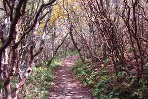
Ghost trees of Clingman’s Dome.   thomasharper / Atlas Obscura User
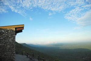
Sunset at Clingman’s Dome   Poor mans world traveler / Atlas Obscura User
  genejoke / Atlas Obscura User
  genejoke / Atlas Obscura User
Clingmans Dome   thomasharper / Atlas Obscura User
Clingmans Dome   er1ca / Atlas Obscura User
The concrete tower of Clingman’s Dome.   Scott Basford
Sunset at Clingman’s Dome   Poor mans world traveler / Atlas Obscura User
  Tony Nicholls / Atlas Obscura User
  genejoke / Atlas Obscura User
Been Here
Want to go
Added to list

About

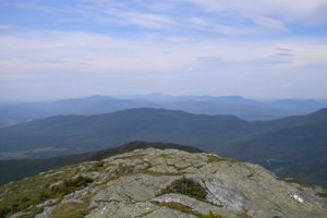
At 6,644 feet, Kuwohi towers over the Great Smoky Mountains, straddling the Tennessee-North Carolina border. The peak is renowned for its sweeping 360-degree views, accessible from a 50-foot-tall concrete observation tower built in 1959. On a clear day, you can see up to 100 miles in every direction, with rolling, misty hills of dense forest extending into both states. However, those forests have been transformed by the hemlock woolly adelgid, an invasive insect that nearly eradicated the region’s once-thriving Fraser fir trees in a 20th-century epidemic. The ghostly remnants of these trees now stand as stark reminders of the fragility of this beautiful landscape.

The name of the mountain means “mulberry place” in the Cherokee language. According to legend, the mountain was home to White Bear, the chief of all bears, and his council house. There was said to be a sacred lake in the area called Ataga'hi, where bears could go to heal their injuries. While most Cherokee were forced out of their lands by the US government in 1938, some stayed behind and became U.S. citizens. This Eastern Band, as they are called now, would later buy back some of their land and still call the Appalachians home to this day.

In 1789, North Carolina gave up their claim to the territory that would later be known as Tennessee. They delineated much of the border along the crest of the Smoky Mountains, including Kuwohi. Settlers moving into the area dubbed it “Smoky Dome.” It was later renamed "Clingman’s Dome" in honor of explorer Thomas Clingman. Clingman famously (and incorrectly) argued the case that Smoky Dome was the highest in the region, not Black Dome (today known as Mount Mitchell). Clingman would later go on to serve as a general in the Confederate Army.

In 2022, members of the Eastern Band of Cherokee Indians began an official movement to restore the original name of the mountain. The movement was supported by the Buncombe County Board of Commissioners and the National Park Service. On September 18, 2024, the U.S. Board on Geographic Names approved the change back to Kuwohi. One of the Cherokee women who proposed the name restoration, Lavita Hill, has said she hopes the change will inspire younger generations to learn more about their language and heritage, and to remind everyone that this is part of the Cherokee homeland.

Places

Discover your next amazing Atlas Place.

Get more unusual and extraordinary places each week with the Atlas Obscura Places newsletter.

Your newsletter subscriptions with us are subject to Atlas Obscura's Privacy Policy and Terms of Use.

Related Tags

Native Americans Towers National Parks State High Points

Know Before You Go

Do note that Kuwohi is often fogged out due to the high elevation. They are called the Smokies for a reason. From Newfound Gap in Smoky Mountains National Park at the Tennessee - North Carolina border, drive 7 miles down Clingmans Dome Road, park, and hike 1 mile up the paved trail to the tower. The road is closed in winter.

Community Contributors

mikewalker profile photo thomasharper profile photo

Added By

mikewalker, thomasharper

Edward Denny profile photo C Coyk profile photo Feather profile photo E eleanorcpeterson profile photo

Edited By

Edward Denny, Coyk, Feather, eleanorcpeterson...

  • Edward Denny profile photo Edward Denny
  • C Coyk profile photo Coyk
  • Feather profile photo Feather
  • E eleanorcpeterson profile photo eleanorcpeterson
  • K klbrown58 profile photo klbrown58
  • Rachel profile photo Rachel
  • Tony Nicholls profile photo Tony Nicholls
  • G genejoke profile photo genejoke
  • Michelle Cassidy profile photo Michelle Cassidy
  • er1ca profile photo er1ca
  • Poor mans world traveler profile photo Poor mans world traveler
  • B Brydagr8 profile photo Brydagr8

Published

May 23, 2013

Updated

October 23, 2024
Edit this listing

Make an Edit
Add Photos
Sources
  • https://theonefeather.com/2022/07/14/council-supports-clingmans-dome-name-change/
  • http://en.wikipedia.org/wiki/Clingmans_Dome
  • http://en.wikipedia.org/wiki/Balsam_woolly_adelgid
  • http://www.summitpost.org/clingmans-dome/150543
Kuwohi
Clingmans Dome
Great Smoky Mountains National Park
Bryson City, North Carolina, 28713
United States
35.562933, -83.49845
Get Directions

Nearby Places

LeConte Lodge

Gatlinburg, Tennessee

miles away

Mayna Treanor Avent Studio

Gatlinburg, Tennessee

miles away

The Road to Nowhere

Bryson City, North Carolina

miles away

Explore the Destination Guide

Photo of Bryson City

Bryson City

North Carolina

Places 3

Nearby Places

LeConte Lodge

Gatlinburg, Tennessee

miles away

Mayna Treanor Avent Studio

Gatlinburg, Tennessee

miles away

The Road to Nowhere

Bryson City, North Carolina

miles away

Explore the Destination Guide

Photo of Bryson City

Bryson City

North Carolina

Places 3

Related Stories and Lists

Get Lost and Find Yourself in the Great Smoky Mountains

List

Sponsored By Visit North Carolina

The Tallest of the Great Smoky Mountains Is—Officially—Kuwohi

mountains

By Seth T. Kannarr and Derek H. Alderman

25 Places to Really Bug Out

List

By Jonathan Carey

The Highest Places in America

List

By Meg Neal

The Summit Scaling Subculture of Highpointing

geographic markers

By Thomas Harper

Related Places

  • View of the Olson Tower from Below

    Hambleton, West Virginia

    Olson Observation Tower

    Climb the tallest remaining fire lookout tower in West Virginia for unparalleled views—if you dare.

  • One of the volunteers keeping the place tidy

    Hoogersmilde, Netherlands

    Zendstation Smilde Replica

    For a moment, you could think there are two identical communication towers in a row, but one of them is made out of PVC.

  • Torre Yokahú

    Puerto Rico

    Yokahú Tower

    On a clear day, you can see all the way to the Virgin Islands from the top of this observation tower built in the 1960s.

  • Bear Paw Battlefield

    Chinook, Montana

    Bear Paw Battlefield

    This remote Montana battlefield is the site of the Nez Perce Flight of 1877.

  • Comanche Lookout Tower

    San Antonio, Texas

    Comanche Lookout Park

    One of the highest points in Bexar county offers birdseye views of San Antonio and a four-story stone tower.

  • Ashizuri Underwater Observation Tower.

    Tosashimizu, Japan

    Ashizuri Underwater Observation Tower

    This retro underwater observation tower would make the perfect lair for a sea-loving villain.

  • Heart of the Monster.

    Kamiah, Idaho

    Heart of the Monster

    This landmark is a central figure in the Nez Perce origin story.

  • Scargo Tower

    Dennis, Massachusetts

    Scargo Tower

    This lakeside tower is the third attempt at getting a tourist destination to stick on the spot.

Aerial image of Vietnam, displaying the picturesque rice terraces, characterized by their layered, verdant fields.
Atlas Obscura Membership

Become an Atlas Obscura Member


Join our community of curious explorers.

Become a Member

Get Our Email Newsletter

Follow Us

Facebook YouTube TikTok Instagram Pinterest RSS Feed

Get the app

Download the App
Download on the Apple App Store Get it on Google Play
  • All Places
  • Latest Places
  • Most Popular
  • Places to Eat
  • Random
  • Nearby
  • Add a Place
  • Stories
  • Food & Drink
  • Itineraries
  • Lists
  • Video
  • Podcast
  • Newsletters
  • All Trips
  • Membership
  • Feedback & Ideas
  • Community Guidelines
  • Product Blog
  • Unique Gifts
  • Work With Us
  • About
  • FAQ
  • Advertise With Us
  • Advertising Guidelines
  • Privacy Policy
  • Cookie Policy
  • Terms of Use
Atlas Obscura

© 2026 Atlas Obscura. All Rights Reserved.