Trips Places Foods Stories Newsletters
Loading...
Loading...
Loading...
Loading...

No search results found for
“”

Make sure words are spelled correctly.

Try searching for a travel destination.

Places near me Random place

Popular Destinations

  • Paris
  • London
  • New York
  • Berlin
  • Rome
  • Los Angeles
Trips Places Foods Stories Newsletters
Sign In Join
Places near me Random place
All the United States Utah Hurricane Quail Creek Airmail Arrow
AO Edited

Quail Creek Airmail Arrow

A surviving concrete arrow from an early-20th-century airmail-navigation network overlooks a reservoir.

Hurricane, Utah

Added By
slgwv
Email
Been Here
Want to go
Added to list
CAPTION
The arrow.   slgwv / Atlas Obscura User
Middle of the arrow, now displaced.   slgwv / Atlas Obscura User
View eastward over Quail Creek Reservoir from the arrow.   slgwv / Atlas Obscura User
Looking back west down the access road.   slgwv / Atlas Obscura User
Looking back along the arrow.   slgwv / Atlas Obscura User
Looking west across the arrow, with the contemporary development in the background.   slgwv / Atlas Obscura User
Looking west across the arrow, with the contemporary development in the background. The snowclad mountains are the Pine Valley Mountains north of St. George, Utah.   slgwv / Atlas Obscura User
Looking northwest across the arrow. The snowclad mountains are the Pine Valley Mountains north of St. George, Utah.   slgwv / Atlas Obscura User
Looking northwest over the arrow. The red cliffs in the distance are in the Red Cliffs National Conservation Area.   slgwv / Atlas Obscura User
New development at the base has cut off access to the Jeep trail.   slgwv / Atlas Obscura User
The old Jeep track to the arrow.   slgwv / Atlas Obscura User
Looking west across the arrow, with the contemporary development in the background.   slgwv / Atlas Obscura User
West edge of the arrow.   slgwv / Atlas Obscura User
New development at the base has cut off access to the Jeep trail.   slgwv / Atlas Obscura User
The old Jeep track to the arrow, which is located on the high point of the ridge to the left.   slgwv / Atlas Obscura User
Looking west across the arrow, with the contemporary development in the background.   slgwv / Atlas Obscura User
View eastward over Quail Creek Reservoir from the arrow.   slgwv / Atlas Obscura User
Been Here
Want to go
Added to list

About

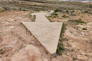
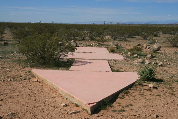
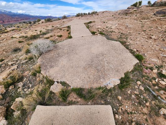
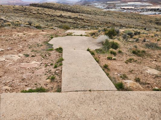
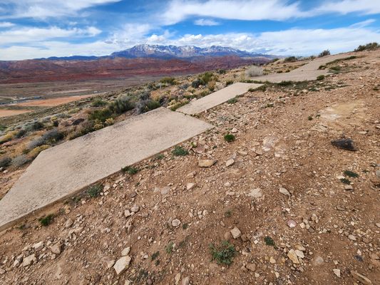
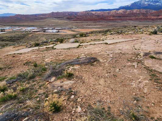
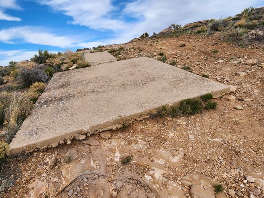
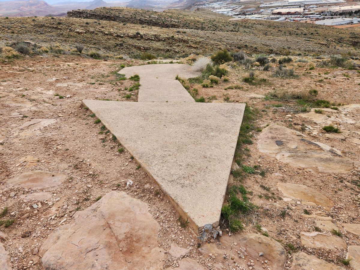
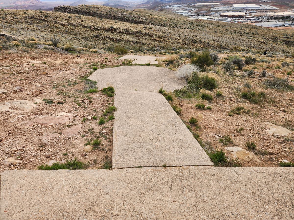
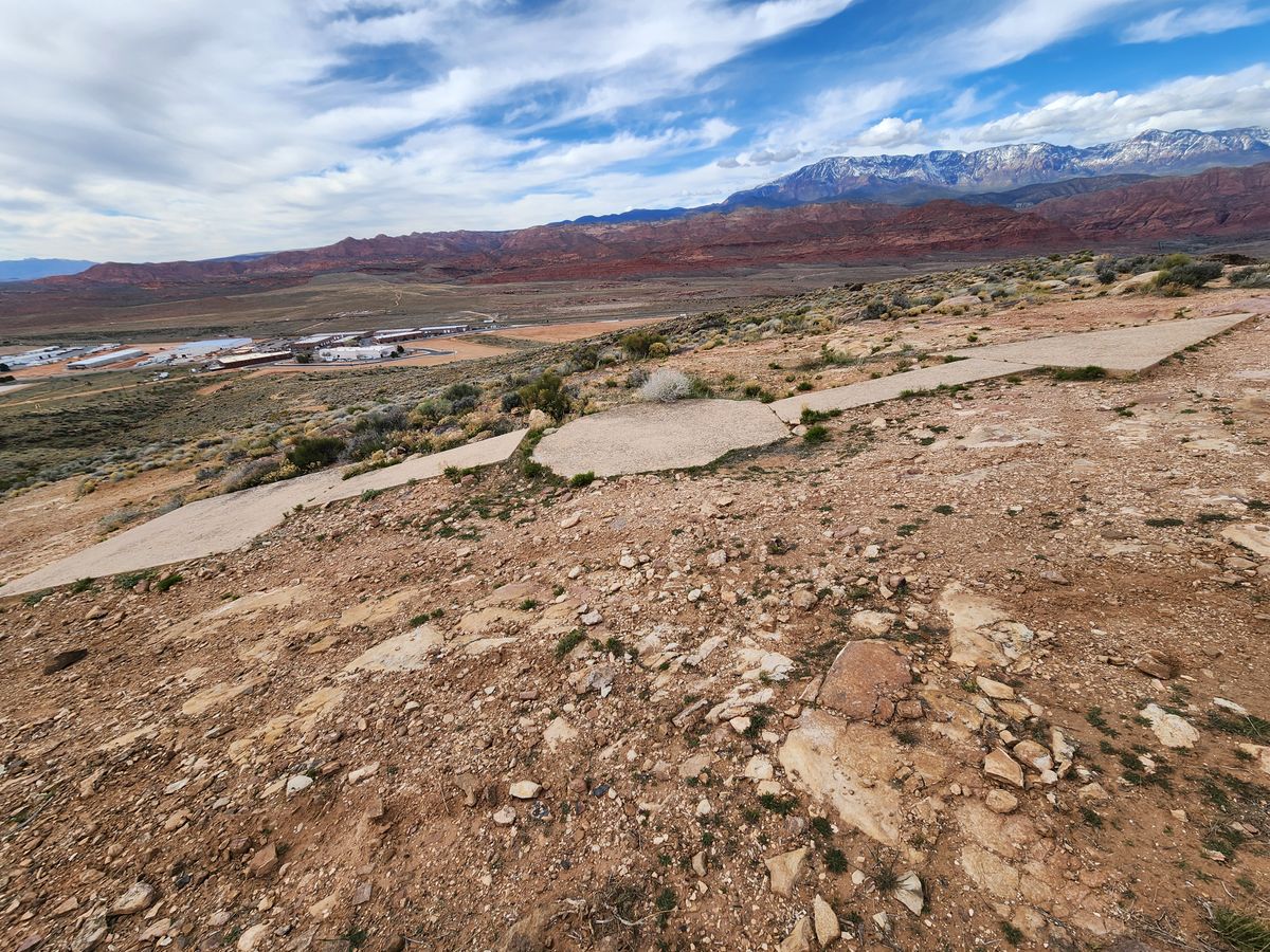
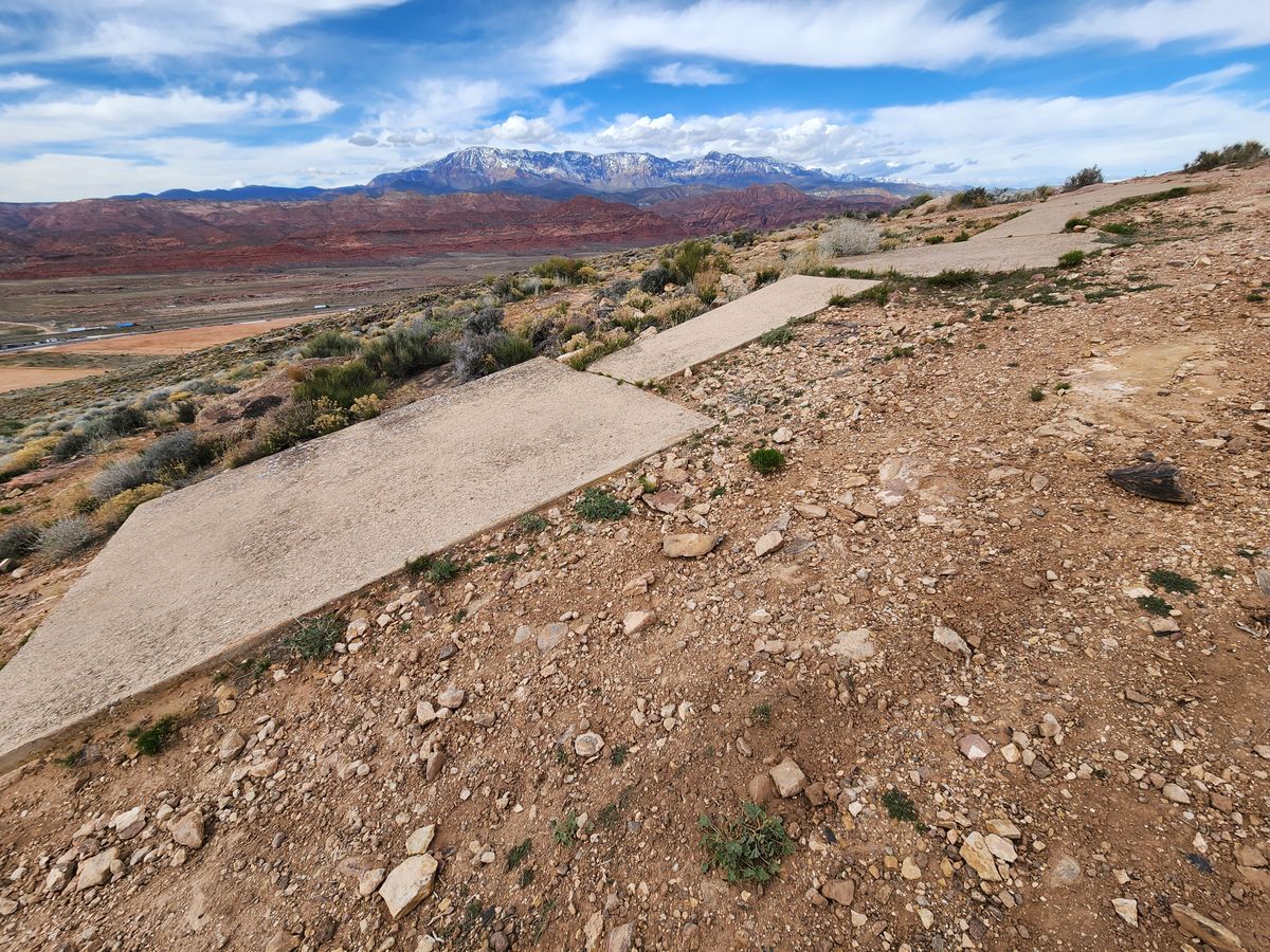
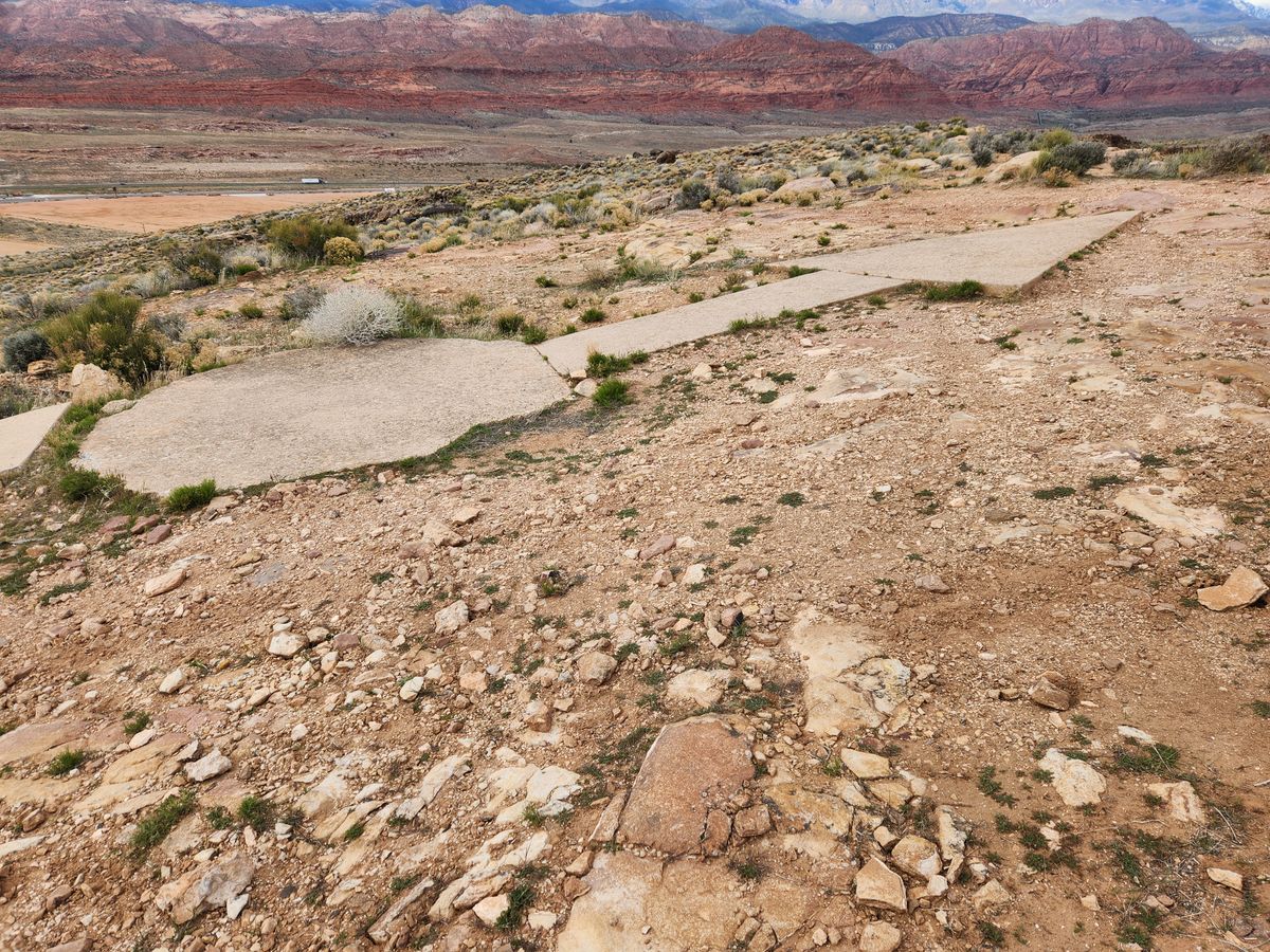
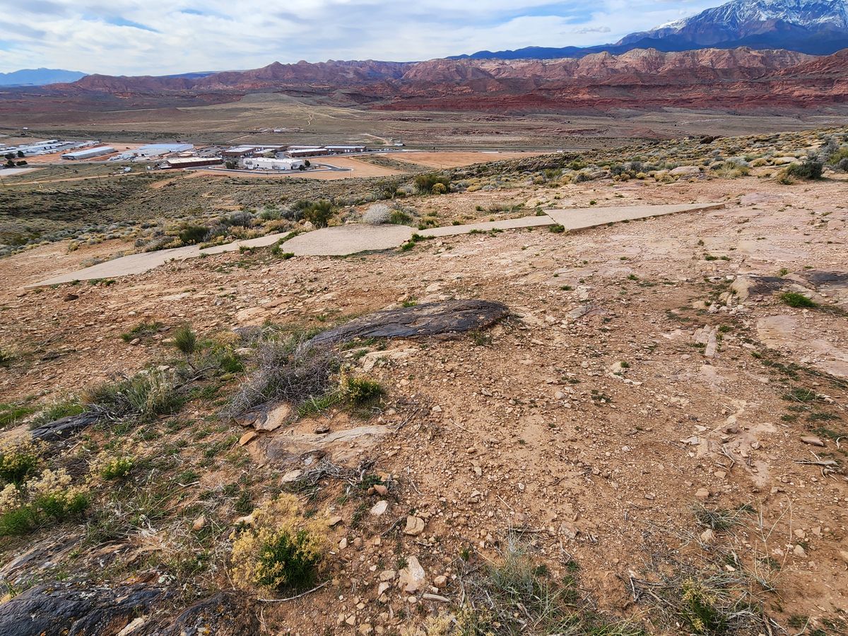
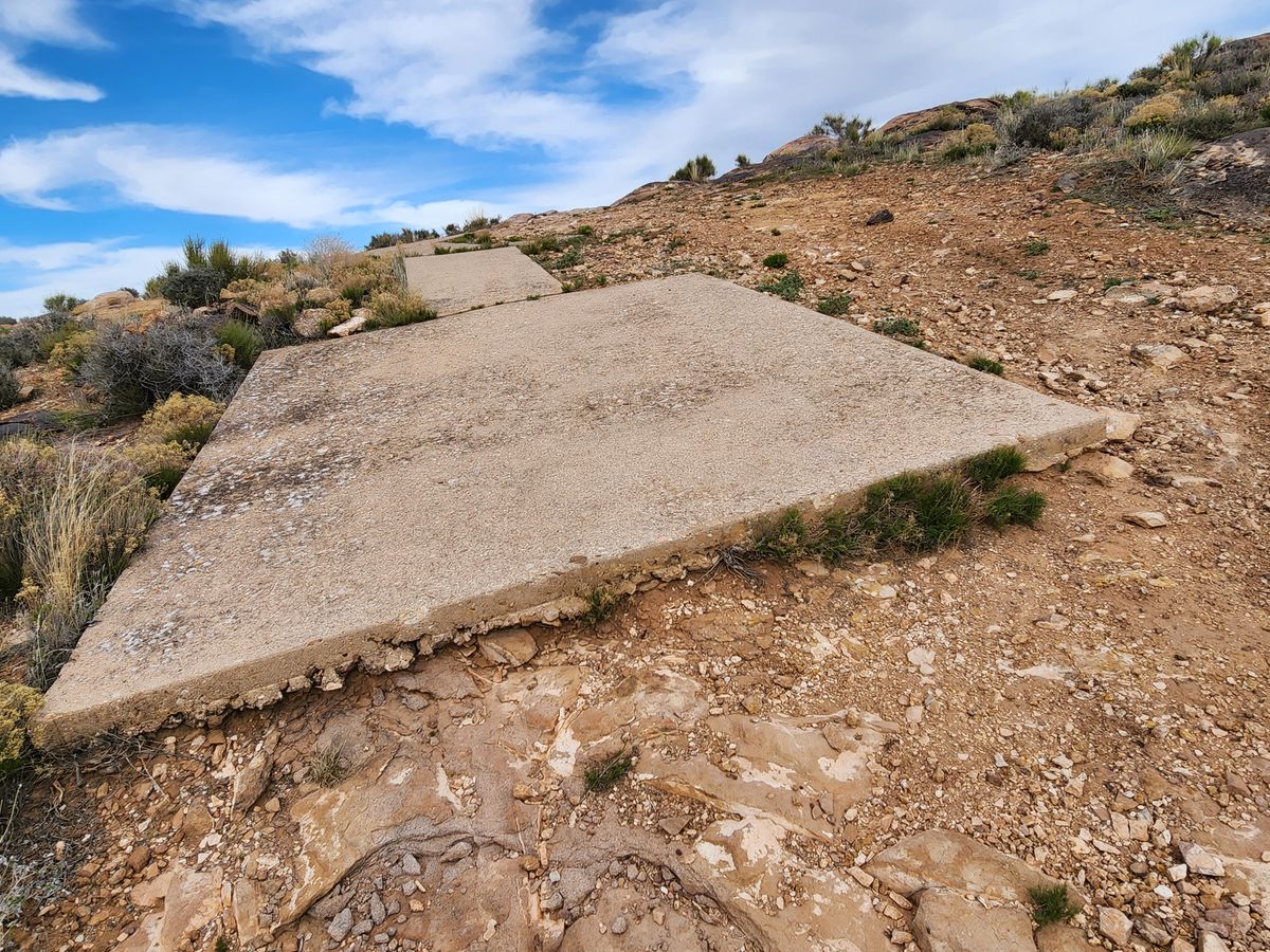
Carrying mail was the first commercial application of air travel, and in the early 1920s the federal government established a network of beacons for airmail navigation. Officially called Beacon Stations, these consisted of a concrete arrows—originally painted yellow—that pointed easterly on east-west routes and northerly on north-south routes. They also included a brilliant light on a steel tower about 50 feet high so that planes could follow a course from light to light after dark. Otherwise, in the absence radar—and with only primitive radio, at best—night flying was hazardous and could not be done routinely.

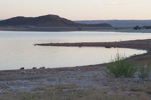
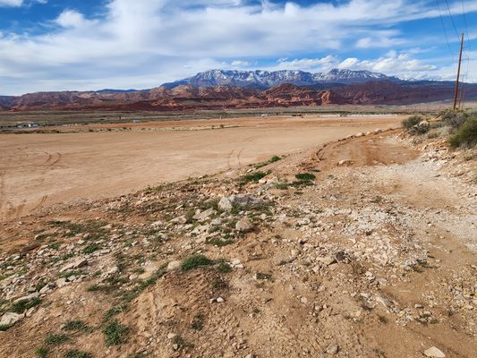
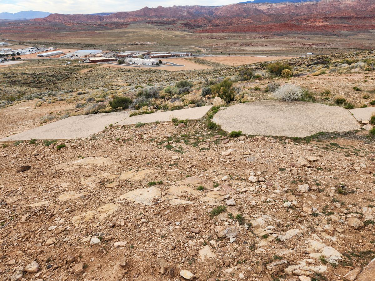
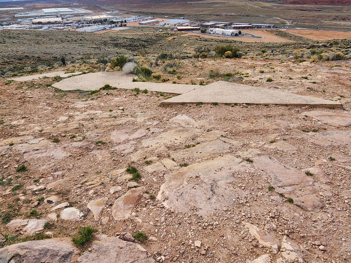
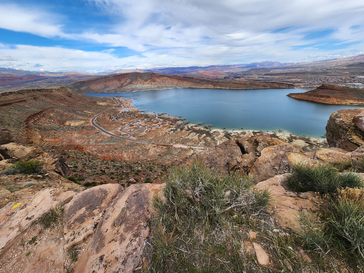
The towers are mostly gone, having been salvaged for scrap decades ago, but a number of the arrows have survived. This Beacon Station, officially #38 LA-SL (#38 on the Los Angeles to Salt Lake City route), is one of the survivors, and it can be reached by a scenic hike. The overlook by the arrow has an expansive view of Quail Creek Reservoir below and of the surrounding red-rock country.

Related Tags

Airplanes Mail

Know Before You Go

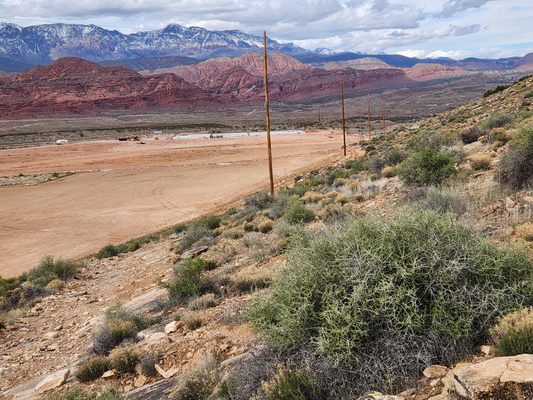
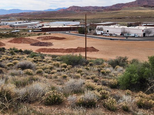
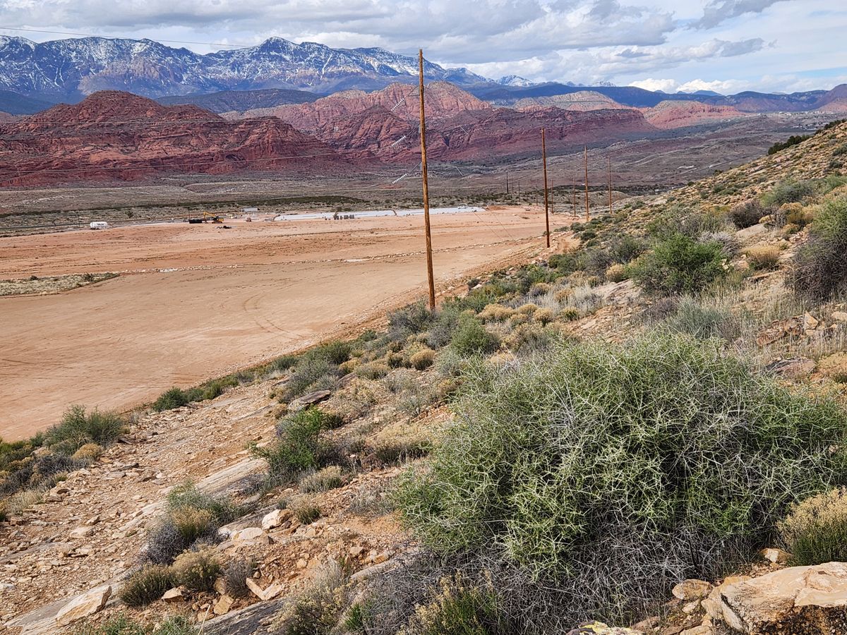
Access to the Quail Creek Airmail Arrow is becoming more difficult because of ongoing commercial development along old US-91 (now 6300 W). A Jeep trail used to run down to old US-91, and is still shown on Google Maps, but it is now blocked by construction. For now it is still possible to walk through the new development on foot, but that is subject to change.

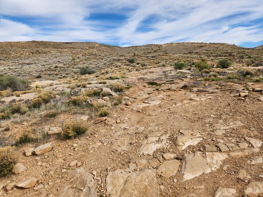
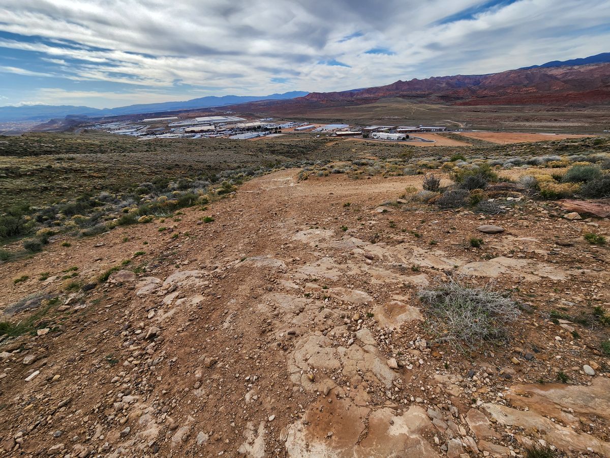
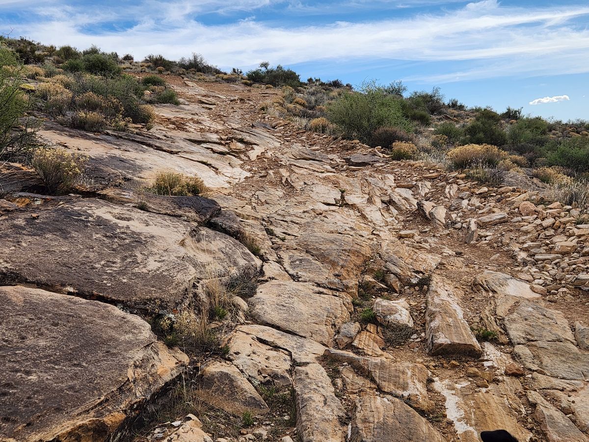
Once on the old Jeep trail, follow it as it winds uphill to the arrow. The elevation gain is several hundred feet and the footing is a bit rocky, but the route is a straightforward hike. The distance overall is about half a mile.

If it becomes necessary to bypass the commercial development, a powerline running roughly north-south immediately behind the newly developed area intersects old US-91 at about 37.19340 N, 113.40419 W, roughly 0.6 miles north of the suggested parking point. You could follow the trail along this powerline back south to its intersection with the Jeep trail, at about 37.1866 N, 113.40593 W.

Old US-91/6300 W intersects Utah State Route 9 about 0.9 miles west of where SR-9 intersects Interstate 15, at exit 16. Follow old US-91/6300 W roughly 2.3 miles and park. This point is about where the Jeep trail from the arrow used to come out.

Community Contributors

Added By

slgwv

Published

January 10, 2025

Edit this listing

Make an Edit
Add Photos
Sources
  • https://www.dreamsmithphotos.com/arrow/
Quail Creek Airmail Arrow
Hurricane, Utah, 84737
United States
37.180527, -113.400493

Nearby Places

Quail Creek Reservoir

Hurricane, Utah

miles away

Silver Reef

Leeds, Utah

miles away

Pioneer Heritage Museum

Hurricane, Utah

miles away

Explore the Destination Guide

Photo of Hurricane

Hurricane

Utah

Places 3

Nearby Places

Quail Creek Reservoir

Hurricane, Utah

miles away

Silver Reef

Leeds, Utah

miles away

Pioneer Heritage Museum

Hurricane, Utah

miles away

Explore the Destination Guide

Photo of Hurricane

Hurricane

Utah

Places 3

Related Places

  • The Lytham St. Annes Spitfire.

    Lytham, England

    Lytham St Annes Spitfire Memorial

    During World War II, locals rallied together to buy this plane to support the war effort.

  • The arrow, looking back toward arrow #31 by Moapa.

    Mesquite, Nevada

    Airmail Arrow #32 LA-SL

    A concrete arrow from a 1920s airmail navigation network.

  • A cafe in a full-size A330.

    Chiang Mai, Thailand

    Air Diamond Cafe

    In a strip mall parking lot, an airplane with a cafe inside, flanked by a giant statue of Fred Flintstone.

  • The First Flight Monument hints at a darker time.

    Tokyo, Japan

    First Flight Monument

    A monument marking the first airplane flights in Japan hints at the dark history behind its peaceful park setting.

  • Ford TriMotor Plane

    Port Clinton, Ohio

    Liberty Aviation Museum

    Inside an airport, visitors can explore this museum where history takes flight.

  • Toronto, Ontario

    First Toronto Post Office

    The first post office in Toronto still operates today, complete with quill pens and ink for writing letters.

  • Pangborn-Herndon Memorial.

    East Wenatchee, Washington

    Pangborn-Herndon Memorial

    A monument tucked within a suburban neighborhood commemorates the first nonstop flight across the Pacific Ocean.

  • Just a few of the quirky mailboxes along Wilmot’s letterbox trail.

    Wilmot, Australia

    Wilmot Novelty Letterbox Trail

    In Tasmania's "Valley of Views," dozens of novelty mailboxes add a quirky element to the landscape.

Aerial image of Vietnam, displaying the picturesque rice terraces, characterized by their layered, verdant fields.
Atlas Obscura Membership

Become an Atlas Obscura Member


Join our community of curious explorers.

Become a Member

Get Our Email Newsletter

Follow Us

Facebook YouTube TikTok Instagram Pinterest RSS Feed

Get the app

Download the App
Download on the Apple App Store Get it on Google Play
  • All Places
  • Latest Places
  • Most Popular
  • Places to Eat
  • Random
  • Nearby
  • Add a Place
  • Stories
  • Food & Drink
  • Itineraries
  • Lists
  • Video
  • Podcast
  • Newsletters
  • All Trips
  • Family Trip
  • Food & Drink
  • History & Culture
  • Wildlife & Nature
  • FAQ
  • Membership
  • Feedback & Ideas
  • Community Guidelines
  • Product Blog
  • Unique Gifts
  • Work With Us
  • About
  • FAQ
  • Advertise With Us
  • Advertising Guidelines
  • Privacy Policy
  • Cookie Policy
  • Terms of Use
Atlas Obscura

© 2025 Atlas Obscura. All Rights Reserved.