Places Foods Stories Newsletters
Loading...
Loading...
Loading...

No search results found for
“”

Make sure words are spelled correctly.

Try searching for a travel destination.

Places near me Random place

Popular Destinations

  • Paris
  • London
  • New York
  • Berlin
  • Rome
  • Los Angeles
Places Foods Stories Newsletters
Sign In Join
Places near me Random place
All the United States Colorado Aspen Conundrum Hot Springs
AO Edited

Conundrum Hot Springs

It takes a nine-mile hike to reach these hot springs, but weary hikers are rewarded with stunning views and a warm soak.

Aspen, Colorado

sonyarose93 profile photo
Added By
Sonya Stephen
Email
Been Here
Want to go
Added to list
CAPTION
Flowers on the hike to the springs   Zach Dischner/CC BY 2.0
  sonyarose93 / Atlas Obscura User
Conundrum Hot Springs in the winter   Pierce Martin/CC BY 2.0
  ArthurGartner / Atlas Obscura User
  ArthurGartner / Atlas Obscura User
  ArthurGartner / Atlas Obscura User
  ArthurGartner / Atlas Obscura User
  ArthurGartner / Atlas Obscura User
Been Here
Want to go
Added to list

About

Hiking to Conundrum Hot Springs might look like an impossible feat (the hike is 18 miles round trip), but don't be put off just yet by the distance. Some avid hikers will complete the trek in one day, but it is by far more enjoyable and rewarding to spread the hike out over at least two days. This is the perfect overnight hike for backpacking beginners!

Less than a 20-minute drive from downtown Aspen, the trailhead to get to Conundrum Hot Springs is easily accessible. The hike carves a path through the Maroon Bells-Snowmass Wilderness, part of the White River National Forest. Following the creek nearly the entire way up, you will never be without fresh water (just be sure to bring a filter). If you're lucky, you may spot a moose, deer or even a bear so be sure to pack some bear spray. What you will definitely see is an abundance of wildflowers, breathtaking mountain views, and quaint, high-alpine streams. 

Although getting to the hot springs is not easy, it is incredibly rewarding. They are located at an elevation of 11,200 feet, making them some of the highest hot springs in the country. It's common to see snow in the surrounding area up until early July.

When your legs start to feel like jelly, it's a good sign that you're getting close to the springs. Though the water can come out of the ground as hot as 120 degrees Fahrenheit, the average temperature of the pools clocks in at about 104 degrees Fahrenheit. Be prepared to see some bare bodies—many ladies will go topless and men will often wear little to nothing. But hey, that adds to the thrill! Be sure to pack some tasty post-hike snacks and set up camp for the night at one of the nearby camping spots. Then, great ready to stargaze like never before, and do it all again tomorrow. 

Places

Discover your next amazing Atlas Place.

Get more unusual and extraordinary places each week with the Atlas Obscura Places newsletter.

Your newsletter subscriptions with us are subject to Atlas Obscura's Privacy Policy and Terms of Use.

Know Before You Go

You will need to book a campsite and permit in advance. They fill up quickly, so get in early! Early means, late winter, early spring (if you are looking to do this in the summer).

Community Contributors

sonyarose93 profile photo

Added By

sonyarose93

ArthurGartner profile photo Michelle Cassidy profile photo

Edited By

ArthurGartner, Michelle Cassidy

  • ArthurGartner profile photo ArthurGartner
  • Michelle Cassidy profile photo Michelle Cassidy

Published

August 19, 2021

Edit this listing

Make an Edit
Add Photos
Sources
  • https://www.alltrails.com/trail/us/colorado/conundrum-creek-trail-to-conundrum-hot-springs
  • https://www.fs.usda.gov/wps/portal/fsinternet/cs/recarea?ss=110308&navtype=BROWSEBYSUBJECT&cid=FSE_003738&navid=110240000000000&pnavid=110000000000000&position=generalinfo&recid=33168&ttype=recarea&pname=Conundrum%20
  • https://www.uncovercolorado.com/hot-springs/conundrum-hot-springs/
Related Tags

Hot Springs Hiking Trails Water Mountains Geology
Conundrum Hot Springs
Conundrum Creek Rd
Aspen, Colorado, 81611
United States
39.011549, -106.891289
Visit Website
Get Directions

Nearby Places

Ashcroft Townsite

Aspen, Colorado

miles away

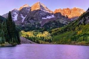
Maroon Bells

Aspen, Colorado

miles away

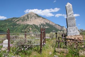
Crested Butte Cemetery

Crested Butte, Colorado

miles away

Explore the Destination Guide

Photo of Aspen

Aspen

Colorado

Places 6

Nearby Places

Ashcroft Townsite

Aspen, Colorado

miles away

Maroon Bells

Aspen, Colorado

miles away

Crested Butte Cemetery

Crested Butte, Colorado

miles away

Explore the Destination Guide

Photo of Aspen

Aspen

Colorado

Places 6

Related Stories and Lists

The United States of Camping

List

By Michelle Cassidy

21 Hot Springs to Escape Winter's Chill

List

By Jonathan Carey

Related Places

  • Cascade Falls.

    Duck Creek Village, Utah

    Cascade Falls

    An improbable waterfall springs from an orange-white cliff face, tumbling into the headwaters of the Virgin River above Zion National Park.

  • Old San Agustin Aqueduct

    San Agustín Etla, Mexico

    Old San Agustin Aqueduct

    Amid lush greenery, a man-made channel peppered with graffiti that dates back to 1881.

  • Chapel Rock on the shore of the Pictured Rocks National Lakeshore.

    Shingleton, Michigan

    Chapel Rock

    This lone tree and dramatic sandstone outcropping are so beloved by Michiganders they can be found on one of the state’s coins.

  • Puente del Inca

    Luján de Cuyo, Argentina

    Puente del Inca

    A brightly colored natural bridge formed by mineral-rich hot springs high up in the Andes.

  • A pony along the trail on Mount Rogers.

    Mouth of Wilson, Virginia

    Mount Rogers

    The highest point in Virginia can only be reached by passing through ponies and flowers.

  • In total, Adam’s Gulch contains roughly 33 miles of trails.

    Ketchum, Idaho

    Adam’s Gulch

    A busy trail network outside Ketchum, Idaho, hides a small piece of early Forest Service history.

    Sponsored By Visit Sun Valley
  • Top of the Rings Loop Trail, above Banshee Canyon.

    Essex, California

    Rings Loop Trail

    Steel rings embedded in rock enable hikers to ascend a picturesque slot canyon in the Mojave Preserve.

  • Monkey Rock

    Incline Village, Nevada

    Monkey Rock

    A granite primate with a view.

Aerial image of Vietnam, displaying the picturesque rice terraces, characterized by their layered, verdant fields.
Atlas Obscura Membership

Become an Atlas Obscura Member


Join our community of curious explorers.

Become a Member

Get Our Email Newsletter

Follow Us

Facebook YouTube TikTok Instagram Pinterest RSS Feed

Get the app

Download the App
Download on the Apple App Store Get it on Google Play
  • All Places
  • Latest Places
  • Most Popular
  • Places to Eat
  • Random
  • Nearby
  • Add a Place
  • Stories
  • Food & Drink
  • Itineraries
  • Lists
  • Video
  • Podcast
  • Newsletters
  • All Trips
  • Membership
  • Feedback & Ideas
  • Community Guidelines
  • Product Blog
  • Unique Gifts
  • Work With Us
  • About
  • FAQ
  • Advertise With Us
  • Advertising Guidelines
  • Privacy Policy
  • Cookie Policy
  • Terms of Use
Atlas Obscura

© 2026 Atlas Obscura. All Rights Reserved.