Trips Places Foods Stories Newsletters
Loading...
Loading...
Loading...
Loading...

No search results found for
“”

Make sure words are spelled correctly.

Try searching for a travel destination.

Places near me Random place

Popular Destinations

  • Paris
  • London
  • New York
  • Berlin
  • Rome
  • Los Angeles
Trips Places Foods Stories Newsletters
Sign In Join
Places near me Random place
All the United States Virginia Mouth of Wilson Mount Rogers

Mount Rogers

The highest point in Virginia can only be reached by passing through ponies and flowers.

Mouth of Wilson, Virginia

Added By
Thomas Harper
Email
Been Here
Want to go
Added to list
CAPTION
A pony along the trail on Mount Rogers.   Brett Maurer/Getty
Mount Rogers feral pony.   Virginia State Parks/cc by 2.0
Forest at the top of Mount Rogers.   thomasharper / Atlas Obscura User
Mount Rogers   thomasharper / Atlas Obscura User
View from Rhododendron Gap.   thomasharper / Atlas Obscura User
Wild ponies in Massie Gap.   thomasharper / Atlas Obscura User
Appalachian Trail passing through crevice   cl94 / Atlas Obscura User
Ponies near Pine Mountain   cl94 / Atlas Obscura User
View from Wilburn Ridge   cl94 / Atlas Obscura User
Actual summit   cl94 / Atlas Obscura User
  apbreuhan / Atlas Obscura User
Been Here
Want to go
Added to list

About

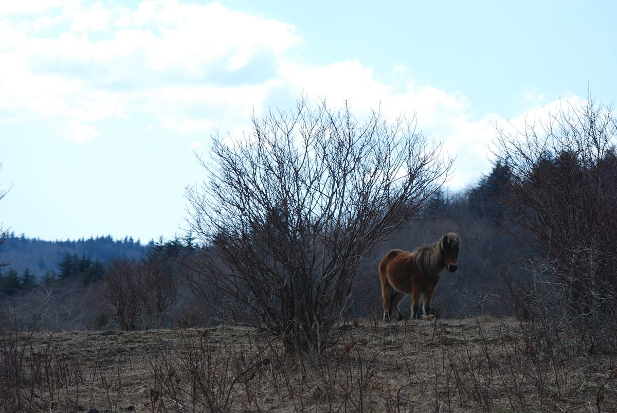
Feral ponies and an immaculate forest await hikers atop Mount Rogers, the highest point in Virginia at 5,729 feet above sea level.

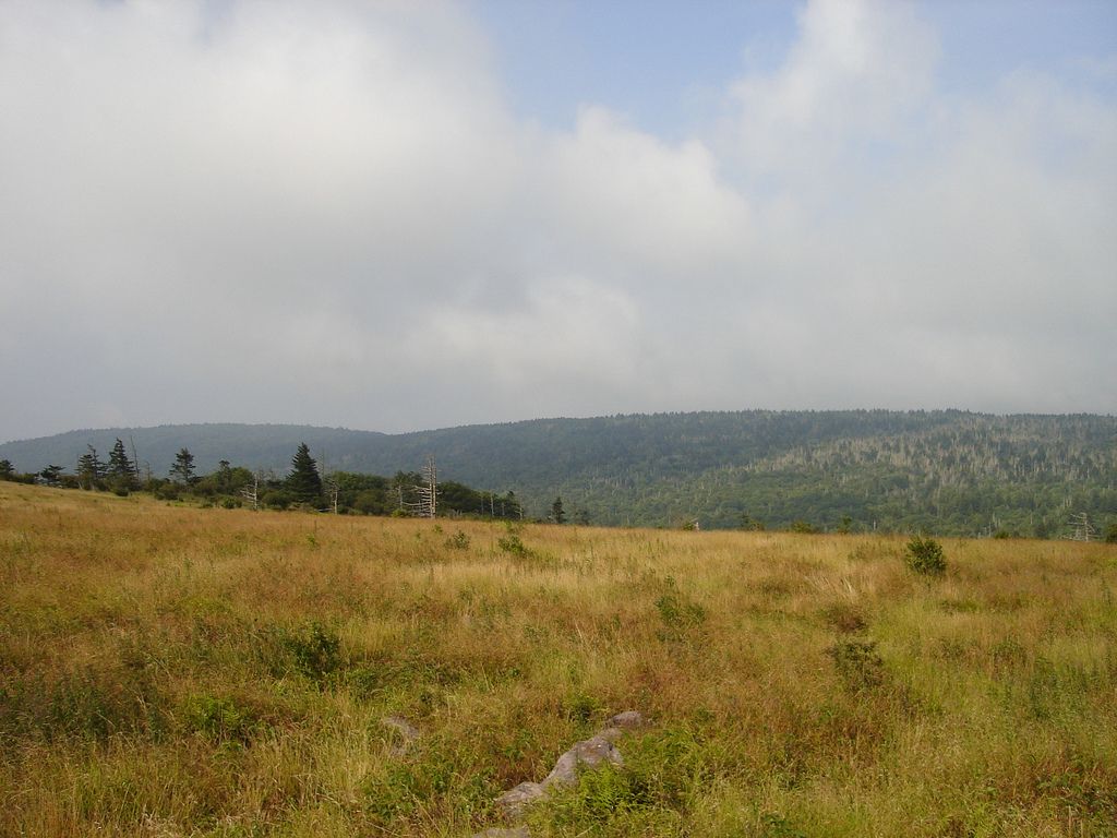
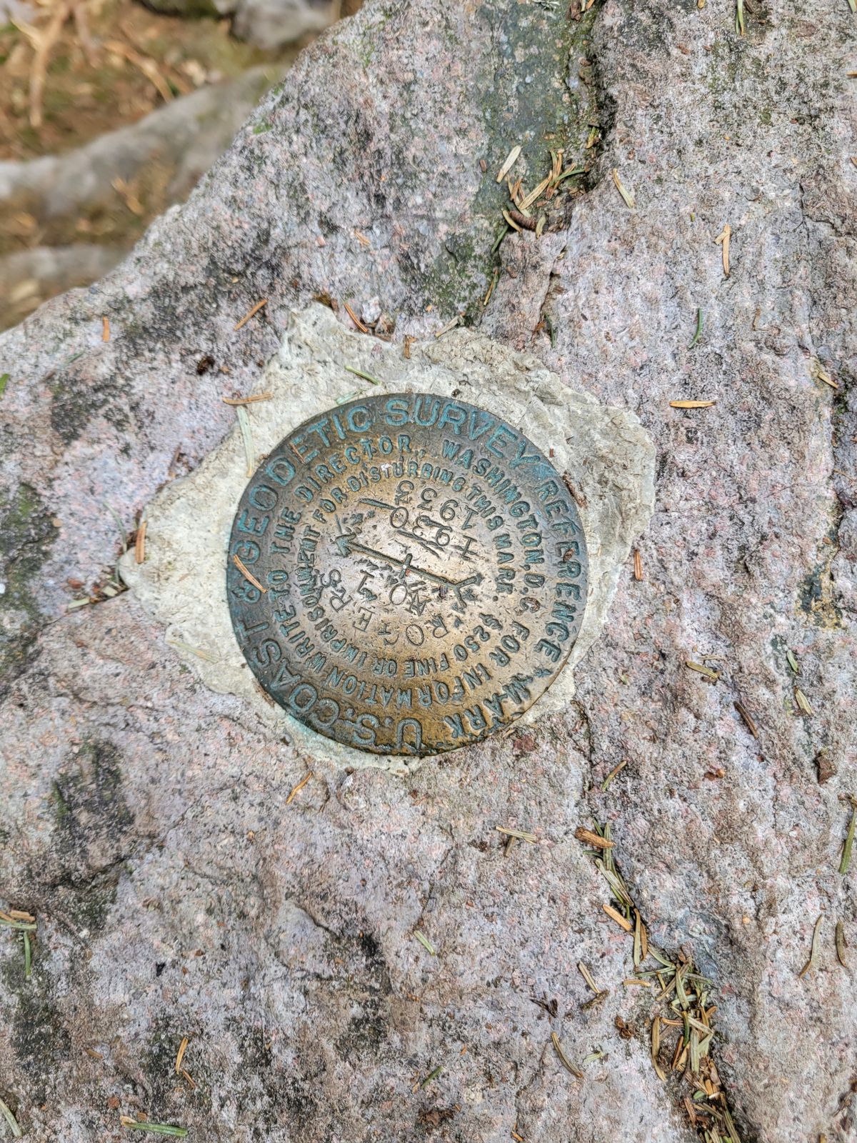
The mountain itself is named after William Barton Rogers, Virginia's first State Geologist and later, the founder of MIT. The standard route to the summit starts from the parking lot in Massie Gap in Grayson Highlands State Park, and winds four miles up, mostly using the Appalachian Trail.

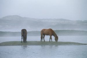
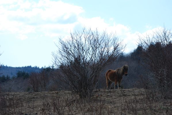
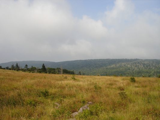
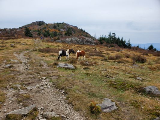
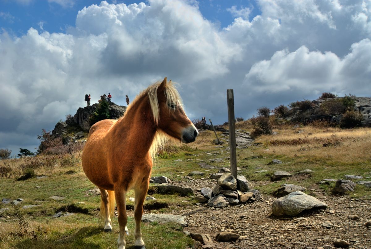
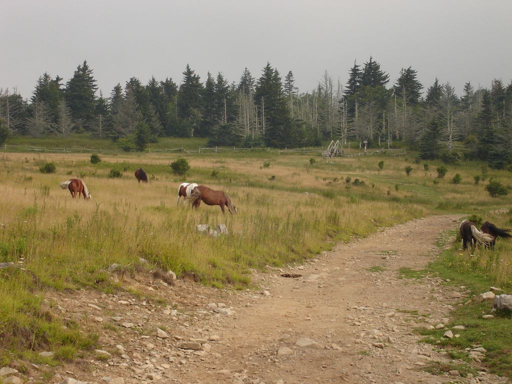
On the first part of the hike visitors have a good chance to see the famous ponies that were introduced to the park. This community of feral ponies, which is kept to a reasonable number of 120, keep the wild grasses manageable. To prevent overcrowding and grass depletion, each September excess ponies are rounded up and auctioned off at the Grayson Highland Fall Fest. The ponies are comfortable around humans and may even approach them, but if one has a foal nearby they may be protective.

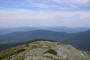
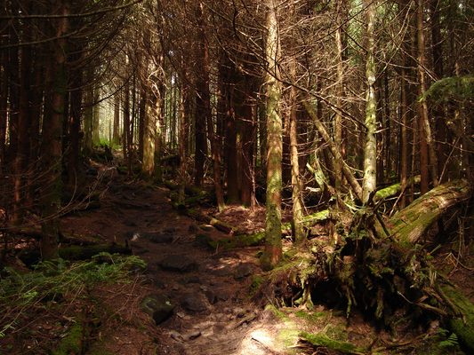
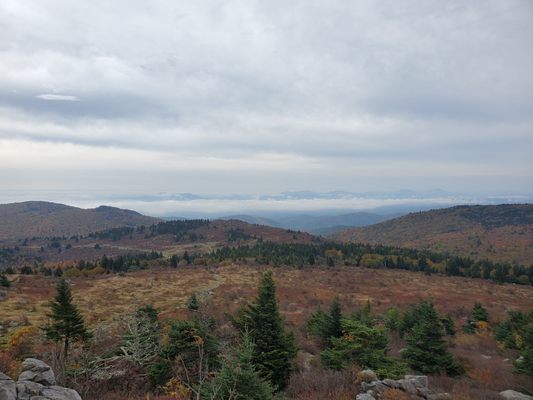
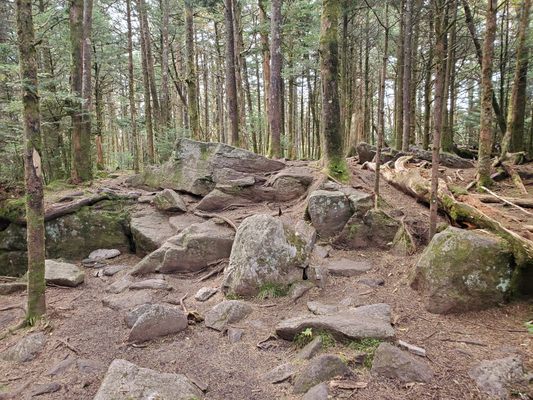
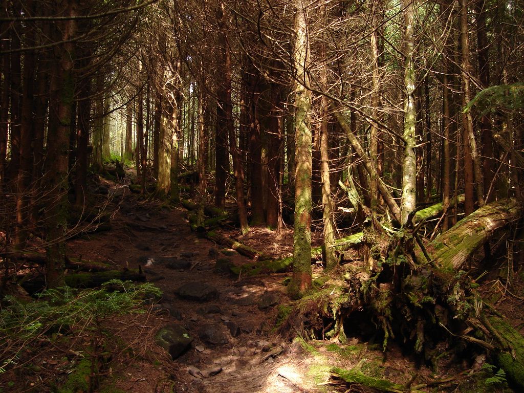
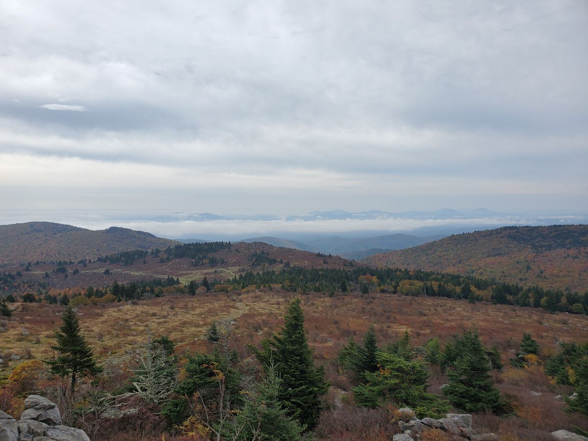
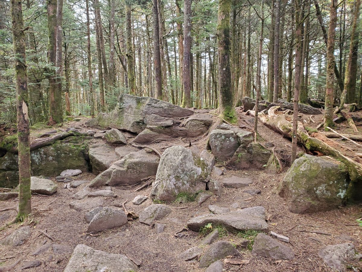
The Appalachian Trail that leads to the high point also runs through Rhododendron Gap with some great views of dense flowering bushes before meeting the Mount Rogers Trail to the summit. A dense spruce-fir forest, the northernmost of its kind, surrounds the summit with moss-covered trees. Some Fraser fir also grows here and while the balsam woolly adelphid has infested the area, the dead trees aren't there to the degree that they are ar Clingmans Dome further south. The dense forest obscures any view from the summit, but the peak is a magnificent end to a long hike.

Related Tags

State High Points Geological Oddities Mountains Horses Trails Hiking Geology

Know Before You Go

From the parking area in Massie Gap in Grayson Highlands State Park, hike up the Rhododendron Trail, then the Appalachian Trail, then the Mount Rogers Trail to the summit. Total distance is 4 miles one-way.

Community Contributors

Added By

thomasharper

Edited By

Kerry Wolfe, cl94, apbreuhan

  • Kerry Wolfe
  • cl94
  • apbreuhan

Published

June 4, 2014

Edit this listing

Make an Edit
Add Photos
Sources
  • http://en.wikipedia.org/wiki/Mount_Rogers
  • http://www.summitpost.org/mount-rogers/150778
  • http://www.dcr.virginia.gov/state-parks/grayson-highlands.shtml
Mount Rogers
Mount Rogers
Mouth of Wilson, Virginia, 24363
United States
36.659841, -81.544558
Get Directions

Nearby Places

The Octagon House

Marion, Virginia

miles away

Church of the Frescoes

Glendale Springs, North Carolina

miles away

Barter Theatre

Abingdon, Virginia

miles away

Explore the Destination Guide

Photo of Virginia

Virginia

United States

Places 315
Stories 34

Nearby Places

The Octagon House

Marion, Virginia

miles away

Church of the Frescoes

Glendale Springs, North Carolina

miles away

Barter Theatre

Abingdon, Virginia

miles away

Explore the Destination Guide

Photo of Virginia

Virginia

United States

Places 315
Stories 34

Related Stories and Lists

13 Unique Places to Indulge Your Inner Horse Lover

List

By Kerry Wolfe

The Highest Places in America

List

By Meg Neal

The Summit Scaling Subculture of Highpointing

geographic markers

By Thomas Harper

The Summit Scaling Subculture of Highpointing

geographic markers

By Thomas Harper

Related Places

  • Healy, Alaska

    Suntrana Canyon

    This often-overlooked canyon dazzles and intrigues with its many layers of colors, shapes and odd formations.

  • Mexican Hat

    Mexican Hat, Utah

    Mexican Hat

    This balancing rock is one of Utah's most unusual geological formations.

  • Flowers on the hike to the springs

    Aspen, Colorado

    Conundrum Hot Springs

    It takes a nine-mile hike to reach these hot springs, but weary hikers are rewarded with stunning views and a warm soak.

  • Red Mountain during winter.

    Flagstaff, Arizona

    Red Mountain

    The eroded core of an ancient volcano is now accessible by a short hike.

  • Cabezon Peak

    New Mexico

    Cabezon Peak

    This towering volcanic plug stands out among the dramatic formations that dot this otherworldly desert valley.

  • The “buttertubs” on Buttertubs Pass.

    North Yorkshire, England

    Buttertubs Pass

    A steep and winding road in the Yorkshire Dales passes by these deep natural potholes.

  • The view of the Blue Ridge Mountains here is spectacular.

    Canton, North Carolina

    Black Balsam Knob

    On a clear afternoon, you can see mountain peaks more than 40 miles away from this clearing in the Pisgah National Forest.

  • Russia

    Ulakhan-Sis Range

    A remote Arctic mountain range is home to "granite cities" found almost nowhere else.

Aerial image of Vietnam, displaying the picturesque rice terraces, characterized by their layered, verdant fields.
Atlas Obscura Membership

Become an Atlas Obscura Member


Join our community of curious explorers.

Become a Member

Get Our Email Newsletter

Follow Us

Facebook YouTube TikTok Instagram Pinterest RSS Feed

Get the app

Download the App
Download on the Apple App Store Get it on Google Play
  • All Places
  • Latest Places
  • Most Popular
  • Places to Eat
  • Random
  • Nearby
  • Add a Place
  • Stories
  • Food & Drink
  • Itineraries
  • Lists
  • Video
  • Podcast
  • Newsletters
  • All Trips
  • Family Trip
  • Food & Drink
  • History & Culture
  • Wildlife & Nature
  • FAQ
  • Membership
  • Feedback & Ideas
  • Community Guidelines
  • Product Blog
  • Unique Gifts
  • Work With Us
  • About
  • FAQ
  • Advertise With Us
  • Advertising Guidelines
  • Privacy Policy
  • Cookie Policy
  • Terms of Use
Atlas Obscura

© 2025 Atlas Obscura. All Rights Reserved.