


About
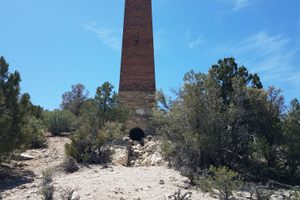
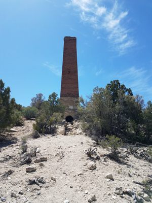
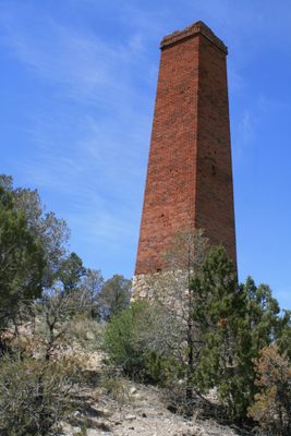
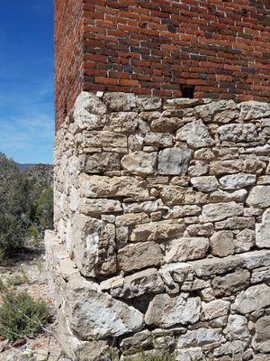
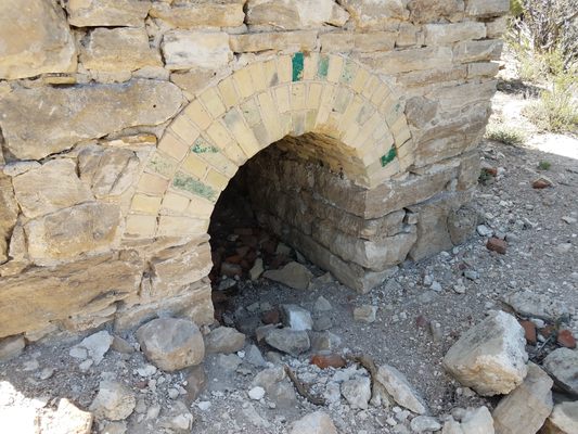
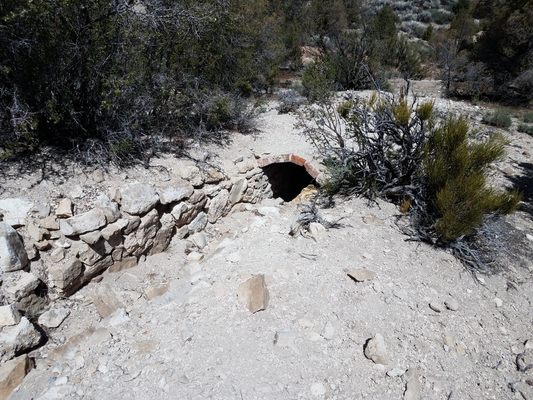
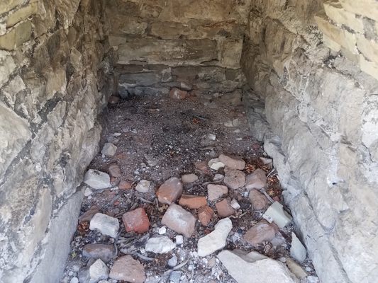
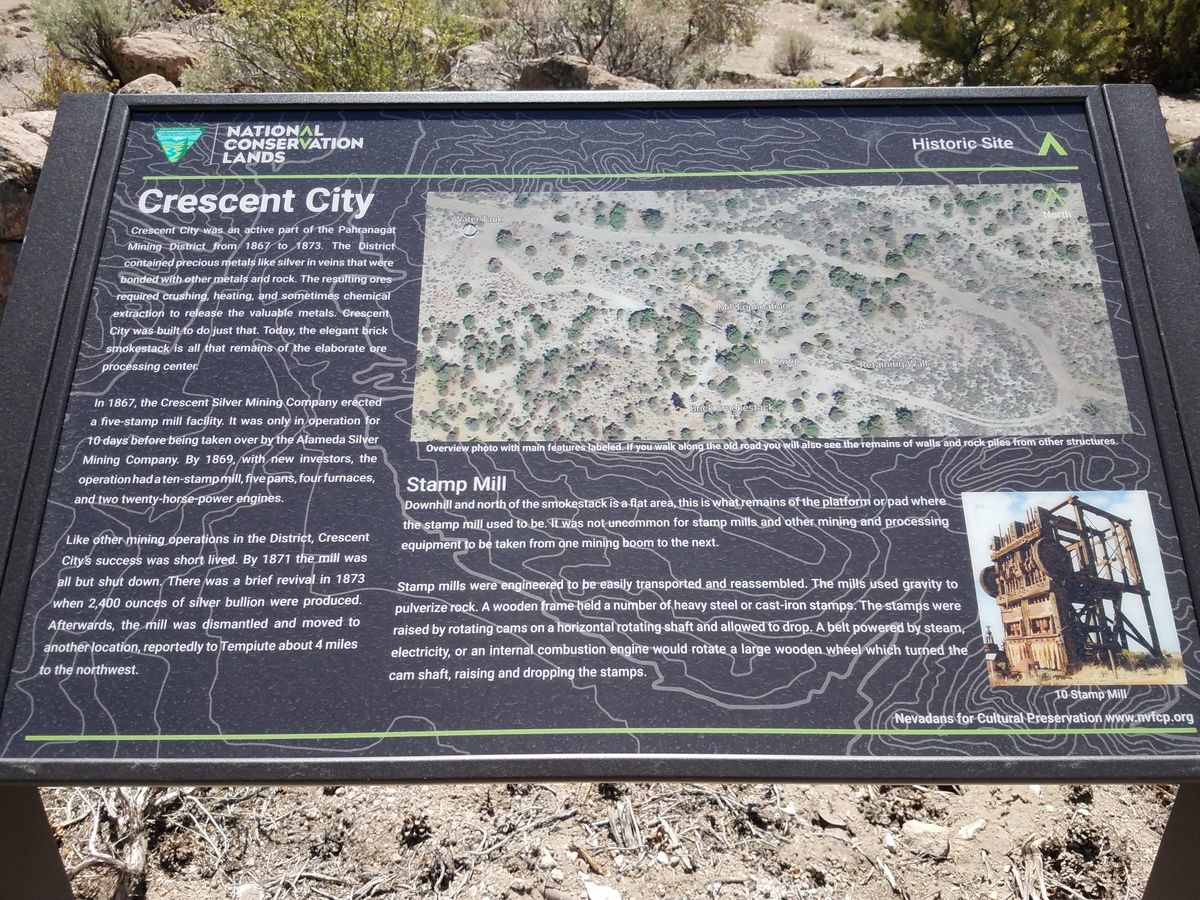
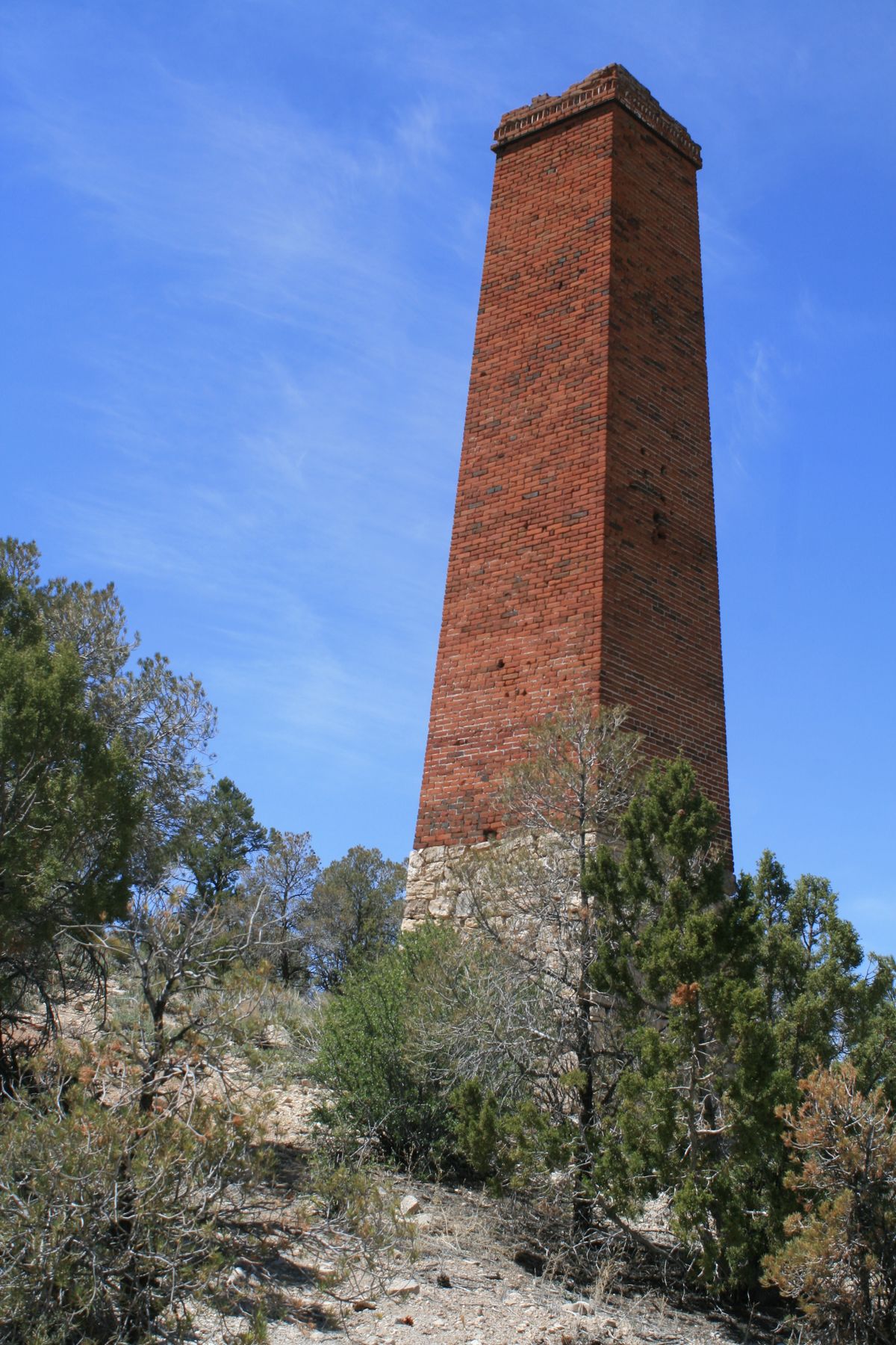
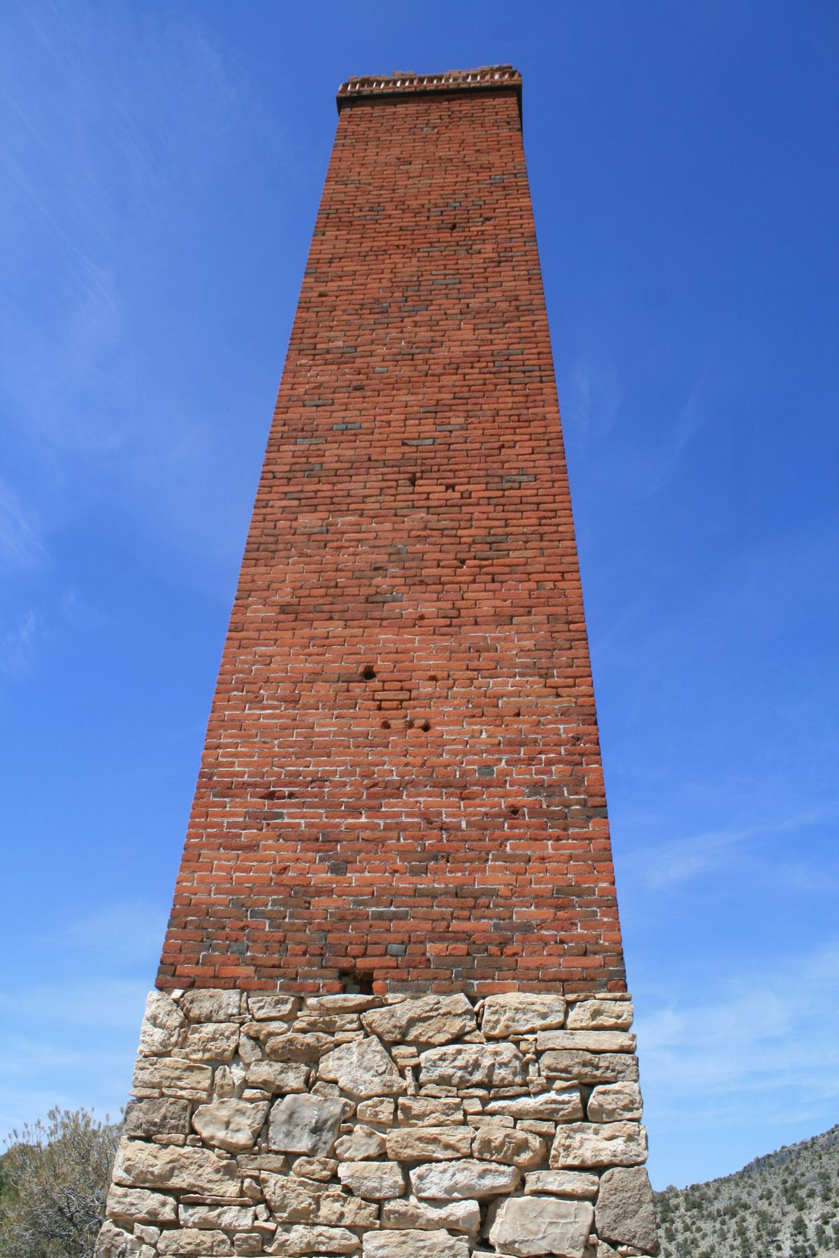
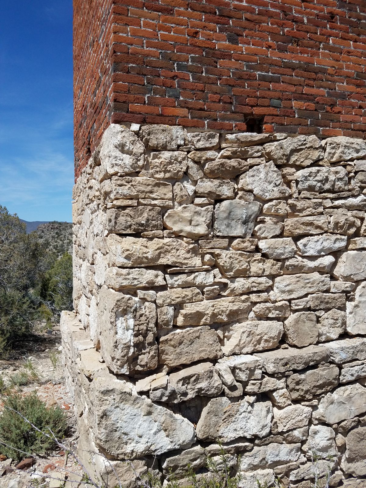
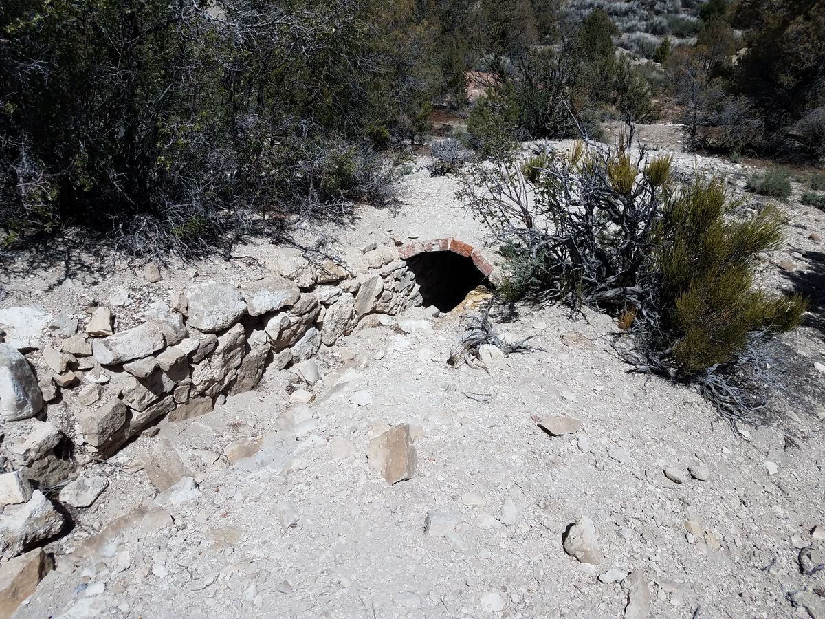
Crescent Mill was probably the earliest mining infrastructure built in this part of Nevada, in the late 1860s. It was possibly located here due to water availability from Crescent Spring, and this spring still fills a water tank at the site.
The mill was intended to process ore from local silver strikes, but it initially shut down in 1867 after only 10 days of operation. With new financial backing, it re-opened and ran from 1869 to 1871, with some desultory activity thereafter, but as was so often the case the grade and volume of ore was inadequate to repay the investment.
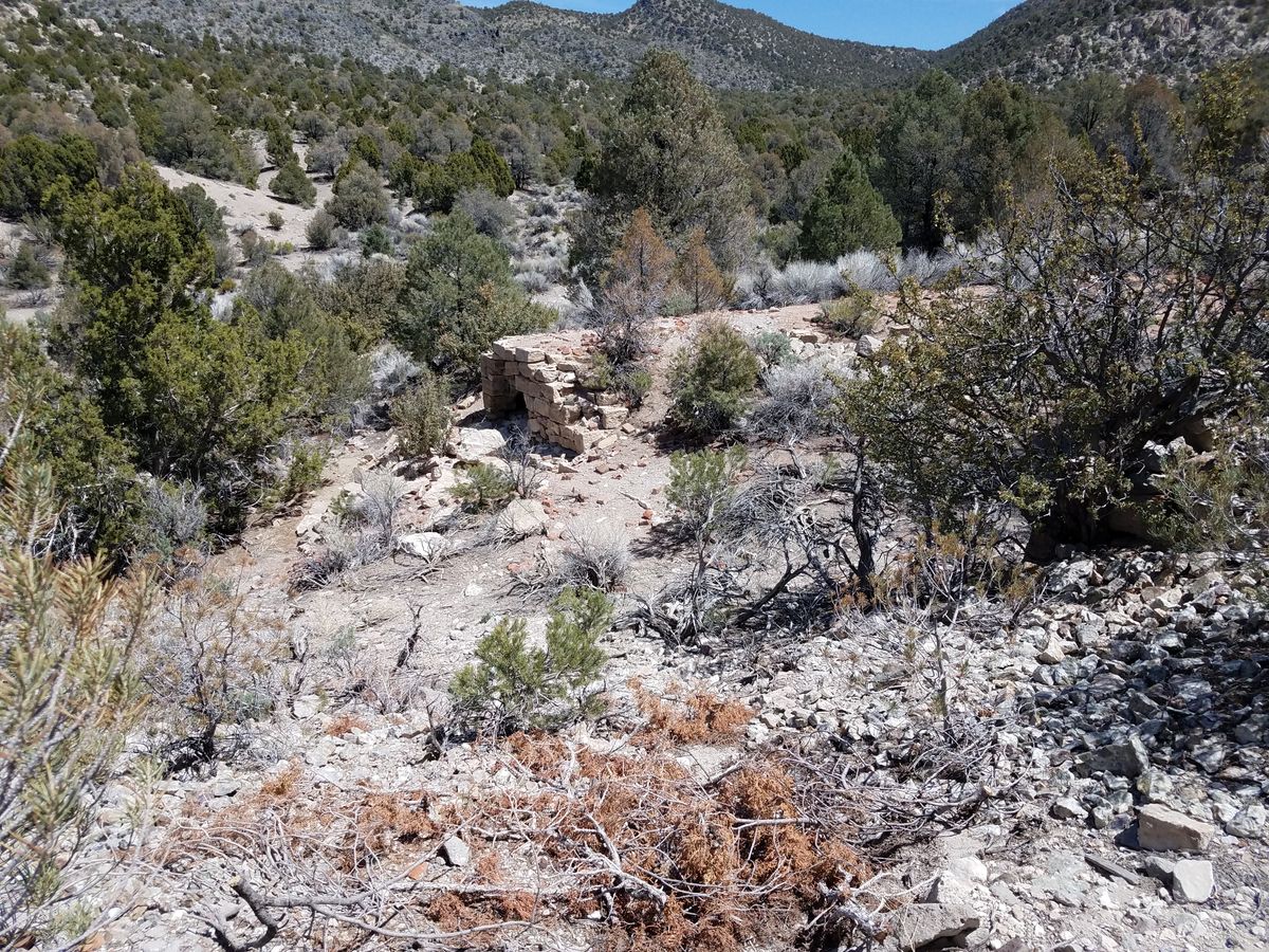
The most prominent remnant is the chimney for the smelter, but there are fragments of other ruins in the vicinity. The area now lies at the extreme southwestern corner of Basin and Range National Monument. Please take only pictures and leave only footprints.
Related Tags
Know Before You Go
The most direct way in is to proceed 22 miles on NV-375 (the "Extraterrestrial Highway") from its junction with US-93 to a graded road that comes in from the right. Turn right here and proceed north 10.5 miles to the spur road that goes to Crescent City. At this road turn right and go 1.9 miles. This section will require high clearance and 4wd is desirable.
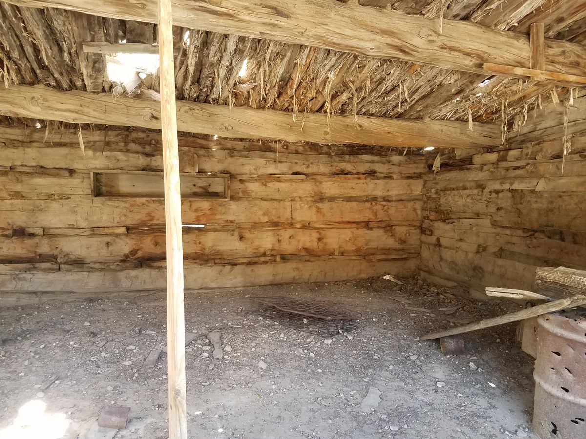
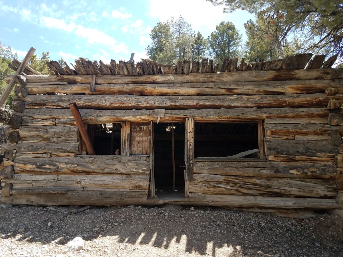
To get to the Rosario Mine, one of the mines reported to have produced ore processed here, backtrack to the original turnoff into Crescent City and go right (north) on Cold Spring Road 0.2 mile. Then take the shallow right onto Mt. Irish Road and go 2.9 miles toward Logan Pass. The old building on the right was probably a bunkhouse for the Rosario Mine; the turnoff to the mine itself is another 0.1 miles up the road on the left. Four-wheel drive would most likely be required to drive in, but it's an easy walk as it's only about 200 yards.
You could alternatively come into this area from the east over Logan Pass, which would be scenic but significantly more difficult. The road is steep and rough coming up to the pass and becomes a narrow shelf road in the vicinity of the pass on which there is limited clearance for oncoming traffic. High clearance will be required and 4wd is strongly recommended.
To come into Logan Pass from the east, follow State Route 318 2.4 miles north from its junction with SR-375. At this point turn left onto the Logan Canyon road. Follow it 7.1 miles to the Mt. Irish road (don't turn right but continue straight at the T junction). It is 4.5 miles till the road tops out on Logan Pass, and it will become much steeper and rougher past the site of Logan City.
It's another 0.9 miles to the old bunkhouse described above, and another 2.9 miles beyond that to the junction with Cold Spring Road. Turn left (south) on Cold Spring Road, and go 0.2 miles to the turnoff to Crescent Mill. Turn left here and proceed as above.
Community Contributors
Added By
Published
June 29, 2023