Places Foods Stories Newsletters
Loading...
Loading...
Loading...

No search results found for
“”

Make sure words are spelled correctly.

Try searching for a travel destination.

Places near me Random place

Popular Destinations

  • Paris
  • London
  • New York
  • Berlin
  • Rome
  • Los Angeles
Places Foods Stories Newsletters
Sign In Join
Places near me Random place
All the United States Nevada Mesquite Davidson Family Gravesite
AO Edited

Davidson Family Gravesite

The remote graves of a Scottish family who died of thirst while attempting to reach St. George.

Mesquite, Nevada

slgwv profile photo
Added By
slgwv
Email
Been Here
Want to go
Added to list
CAPTION
The gravesite.   slgwv / Atlas Obscura User
The graves and flag.   slgwv / Atlas Obscura User
The grave, with the flagstaff.   slgwv / Atlas Obscura User
Close-up of the gravestone.   slgwv / Atlas Obscura User
The gravesite. A Scottish flag is often flying over the graves, presumably in recognition of their country of origin.   slgwv / Atlas Obscura User
Gravestone, with tributes left.   slgwv / Atlas Obscura User
View north over the graves, with the Scottish flag. The high point in the mountain range on the skyline is now called Davidson Peak in their honor.   slgwv / Atlas Obscura User
Turnoff to the Davidson gravesite.   slgwv / Atlas Obscura User
Been Here
Want to go
Added to list

About

James Davidson and his wife Maria joined the Church of Jesus Christ of Latter-Day Saints in Scotland, and emigrated to Utah with their son Joseph in about 1866. James was a skilled machinist who was heavily involved with the attempts to spin cotton into cloth in southern Utah, as part of the efforts by the LDS church to make their community self-sufficient. He and his family had gone to St. Thomas, about 60 miles southwest of St. George, presumably in an effort to persuade the church members there to grow more cotton for the mill.

On their return, they were to accompany a group back to St. George, but lost a tire between St. Thomas and St. Joseph (now Logandale). (A "tire" in the 19th century was the metal band that encircled the wheel.) Because of the ensuing delay, they evidently missed connections with their party and headed back to St. George on their own.

There were two routes to St. George, one along the Virgin River and a newer one that cut across Mormon Mesa to a well in Beaver Dam Wash, then continued on to St. George more or less along the route much later followed by US-91. The Virgin River route had the advantage of ample water, but also many treacherous fords with quicksand. The Mormon Mesa route was shorter and firmer, but the stretch to Beaver Dam Wash, some 30 miles, was completely waterless. Bringing plenty of water was imperative, particularly because the horses would need it too, and parties were advised not to attempt the route alone.

For some reason, however, the Davidsons chose the Mormon Mesa route, possibly because they thought it would be quicker. They did not bring anywhere near enough water, probably through being unfamiliar with conditions in the southern Nevada desert in June, where temperatures routinely exceed 100 degrees Fahrenheit (38 degrees Celsius) and relative humidity can drop into single digits. In a catastrophic misjudgment, they may even have skimped on water to save weight.

Even so, they might have made it, except the carriage broke a wheel. Evidently, Joseph set out with the horse and remaining water to find help, and almost succeeded. A group working on Beaver Dam Well found a thirst-crazed horse on June 12th. They watered the horse and kept it, assuming its owner would show up. When no one did, they went searching and found Joseph's body about half a mile away. They then mounted a search for his parents, who were found to have died under a jury-rigged blanket shelter to keep off the sun.

James and Maria were buried where they were found, and Joseph was later re-interred alongside his parents. Their grave has been marked to this day and is maintained by volunteers. A Scottish flag often flies over the site, in recognition of their homeland.

Places

Discover your next amazing Atlas Place.

Get more unusual and extraordinary places each week with the Atlas Obscura Places newsletter.

Your newsletter subscriptions with us are subject to Atlas Obscura's Privacy Policy and Terms of Use.

Related Tags

Desert Graves Mormons

Know Before You Go

Follow Interstate 15 1.9 miles west from the intersection with State Route 170 (the Riverside Road, exit 112) to the truck parking area where the freeway tops out onto Mormon Mesa. Exit right into the parking area, where there is a gate through the fence giving access to the frontage road on the north. Follow the frontage road west 1.4 miles where it makes a right-angle bend northward. Here it becomes Halfway Wash Road. Follow it 6.8 miles north; the road will wind around some but always trends northerly. At this point (about 36.86253 N, 114.30368 W) there is an intersection with an installation off the road to the left. Keep right here and proceed 2.5 miles to a intersection (at about 36.88487, 114.27156 W) with a primitive road on the right. Follow the primitive road a bit less than half a mile to the gravesite. It should be visible from a distance because a Scottish flag will probably be flying.

These roads will require high clearance but probably not 4wd, at least in dry weather.

Community Contributors

slgwv profile photo

Added By

slgwv

Published

July 12, 2024

Edit this listing

Make an Edit
Add Photos
Sources
  • Larson, Andrew Karl. The Red Hills of November: A Pioneer Biography of Utah's Cotton Town, Deseret News Press, 1957.
Davidson Family Gravesite
Mesquite, Nevada
United States
36.88731, -114.264679

Nearby Places

Airmail Arrow #32 LA-SL

Mesquite, Nevada

miles away

AZ-NV-UT Tri-State Monument

Mesquite, Nevada

miles away

Double Negative

Clark County, Nevada

miles away

Explore the Destination Guide

Photo of Mesquite

Mesquite

Nevada

Places 3

Nearby Places

Airmail Arrow #32 LA-SL

Mesquite, Nevada

miles away

AZ-NV-UT Tri-State Monument

Mesquite, Nevada

miles away

Double Negative

Clark County, Nevada

miles away

Explore the Destination Guide

Photo of Mesquite

Mesquite

Nevada

Places 3

Related Places

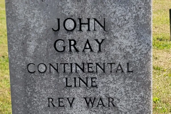
  • Grave of John Gray

    Hiramsburg, Ohio

    Grave of John Gray

    The last living verified Revolutionary War veteran was buried here nearly 100 years after American independence.

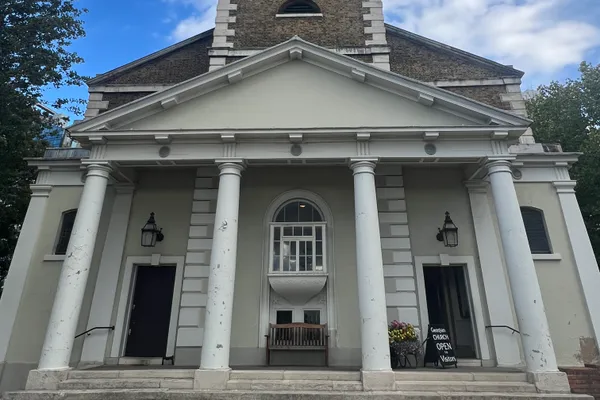
  • St. Mary's Church

    London, England

    Benedict Arnold's Grave at St. Mary’s Battersea

    A beautiful Georgian church alongside the Thames has a crypt in the basement, in which are buried the bodies of the infamous American traitor Benedict Arnold, his wife Peggy, and their daughter Sophia.

  • Grave of Justice William Cushing

    Scituate, Massachusetts

    Gravesite of Justice Willam Cushing

    Cushing was one of the founders of the United States and his grave is located in a tiny, odd, tucked-away state park with very little signage.

  • Senna's grave marker "Nada pode me separar do amor de Deus”

    Paraíso do Morumbi, Brazil

    Grave of Ayrton Senna

    Formula 1 legend Ayrton Senna is buried under a flowing tree in the middle of São Paulo surrounded by the city he loves.

  • NO HOPE OF HEAVEN NOR FEAR OF HELL

    Columbus, Texas

    Ike Towell’s Grave

    A self-proclaimed infidel who had no hope of heaven nor fear of hell, Towell was free of superstition.

  • The Grave of Dušan Vasiljev

    Kikinda, Serbia

    The Grave of Dušan Vasiljev

    The modest grave of Dušan Vasiljev in Kikinda's historic Melino Cemetery marks the resting place of one of Serbia's most important expressionist poets.

  • Close up of Gordy and Joyce Burdick's expired parking meter gravestone

    Florida, Massachusetts

    Expired Parking Meter Gravestone

    Time has expired for eternity at this gravesite with a sense of humor.

  • Gravesite of Dixville’s First Settlers

    Dixville, New Hampshire

    Gravesite of Dixville’s First Settlers

    The first inhabitants of this remote town faced a grisly death.

Aerial image of Vietnam, displaying the picturesque rice terraces, characterized by their layered, verdant fields.
Atlas Obscura Membership

Become an Atlas Obscura Member


Join our community of curious explorers.

Become a Member

Get Our Email Newsletter

Follow Us

Facebook YouTube TikTok Instagram Pinterest RSS Feed

Get the app

Download the App
Download on the Apple App Store Get it on Google Play
  • All Places
  • Latest Places
  • Most Popular
  • Places to Eat
  • Random
  • Nearby
  • Add a Place
  • Stories
  • Food & Drink
  • Itineraries
  • Lists
  • Video
  • Podcast
  • Newsletters
  • All Trips
  • Membership
  • Feedback & Ideas
  • Community Guidelines
  • Product Blog
  • Unique Gifts
  • Work With Us
  • About
  • FAQ
  • Advertise With Us
  • Advertising Guidelines
  • Privacy Policy
  • Cookie Policy
  • Terms of Use
Atlas Obscura

© 2026 Atlas Obscura. All Rights Reserved.