Places Foods Stories Newsletters
Loading...
Loading...
Loading...

No search results found for
“”

Make sure words are spelled correctly.

Try searching for a travel destination.

Places near me Random place

Popular Destinations

  • Paris
  • London
  • New York
  • Berlin
  • Rome
  • Los Angeles
Places Foods Stories Newsletters
Sign In Join
Places near me Random place
All the United States Nevada Baker Lexington Arch
AO Edited

Lexington Arch

The limestone composition of this spectacular arch makes it unique to the region.

Baker, Nevada

slgwv profile photo
Added By
slgwv
Email
Been Here
Want to go
Added to list
CAPTION
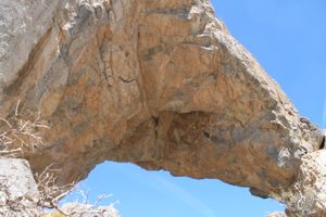
Looking up at the span.   slgwv / Atlas Obscura User
The eastern abutment of the arch.   slgwv / Atlas Obscura User
The span coming into view from below.   slgwv / Atlas Obscura User
Lexington Arch from the view bench, on the way up.   slgwv / Atlas Obscura User
The view bench on the trail, where it tops out on the ridge.   slgwv / Atlas Obscura User
Lexington Arch on the way back, from the bench. Note the change in the shadows.   slgwv / Atlas Obscura User
Lexington Arch, approaching on the trail.   slgwv / Atlas Obscura User
The sign at the current trailhead in context.   slgwv / Atlas Obscura User
The original trailhead register. Only the steel posts survived the fire. Note the flash-flood debris.   slgwv / Atlas Obscura User
The steel supports for the original trailhead register.   slgwv / Atlas Obscura User
Debris covering the original road.   slgwv / Atlas Obscura User
Sign at the current trailhead.   slgwv / Atlas Obscura User
Lexington Arch, telephoto view from the trail.   slgwv / Atlas Obscura User
View back down the canyon from under the span of the arch.   slgwv / Atlas Obscura User
View northeasterly, toward Utah, from under the arch.   slgwv / Atlas Obscura User
Looking up at the arch from the switchbacks up the south side.   slgwv / Atlas Obscura User
Telephoto view of Lexington Arch from near the beginning of the trail.   slgwv / Atlas Obscura User
Been Here
Want to go
Added to list

About

The Lexington Arch is both large, with a span of about 60 feet and a height of about 50 feet, and unusual.

Unlike most of the iconic arches in the Southwest, it's composed of limestone rather than sandstone. It's believed that the arch is all that remains of a collapsed cave. This is suggested by reports of cave deposits (flowstone) still preserved within the arch. In addition, limestone bedrock is ubiquitous in the area and hosts several caves. Lehman Caves in the main part of Great Basin National Park is the most famous example

The 2016 Strawberry wildfire destroyed the forest cover in the vicinity of the arch, and debris flows from subsequent flash floods obliterated the original trailhead, such that the hike starts about a mile farther than in the past.

The area is still well worth a visit, however, and in fact, the absence of the forest cover gives views of the arch while still far away on the trail.

Places

Discover your next amazing Atlas Place.

Get more unusual and extraordinary places each week with the Atlas Obscura Places newsletter.

Your newsletter subscriptions with us are subject to Atlas Obscura's Privacy Policy and Terms of Use.

Know Before You Go

To get there, turn off Utah State Route 21 about six miles south of the Nevada line at a well-marked graded road.

This road enters Nevada about 3.1 miles in; turn left about 11 miles in onto the South Fork Lexington Creek road, which should be signed for Lexington Arch.

It's about 12.2 miles overall to the present trailhead. A rough road continues beyond the trailhead parking, the remnant of the original road, and a high-clearance vehicle with 4wd can probably proceed another half-mile or so. However, the original trailhead is now completely inaccessible to wheeled vehicles.

Unusually for a national park, dogs are allowed on the trail, probably because only the arch itself is in the national park. Most of the trail is on Bureau of Land Management land. The trail climbs to a ridge that gives spectacular views of the arch; there's even a park bench at a view site.

The trail does continue all the way to the arch itself, climbing up the back (south) side of the arch via a set of narrow and steep switchbacks to end up below the span. This part of the path, however, is likely to be snowed in till late April.

Community Contributors

slgwv profile photo

Added By

slgwv

Published

April 4, 2023

Edit this listing

Make an Edit
Add Photos

Related Tags

Rock Formations Natural Wonders Arch
Lexington Arch
Baker, Nevada
United States
38.84422, -114.208331
Visit Website

Nearby Places

Lehman Caves

Baker, Nevada

miles away

The Bristlecone Pines of the Great Basin

Baker, Nevada

miles away

Permanent Wave Society

Baker, Nevada

miles away

Explore the Destination Guide

Photo of Baker

Baker

Nevada

Places 6

Nearby Places

Lehman Caves

Baker, Nevada

miles away

The Bristlecone Pines of the Great Basin

Baker, Nevada

miles away

Permanent Wave Society

Baker, Nevada

miles away

Explore the Destination Guide

Photo of Baker

Baker

Nevada

Places 6

Related Places

  • Limestone formations

    Tatev, Armenia

    Satani Kamurj (Devil’s Bridge)

    A natural bridge formed by limestone travertines in Armenia's Vorotan River Canyon.

  • Water moves through the arch

    Doagh Beg, Ireland

    Great Pollet Sea Arch

    An incredible natural formation along the Wild Atlantic Way.

  • Rock-Splitting Cherry Tree

    Morioka, Japan

    Rock-Splitting Cherry Tree

    A 360-year-old cherry tree grows out of a granite boulder.

  • Elephant Rock

    Samuel Mphepo, Malawi

    Elephant Rock

    A prodigious pachyderm lurks among Malawi’s inselbergs.

  • Al Naslaa Rock in 2021.

    Tayma, Saudi Arabia

    Al Naslaa

    In the Arabian Desert, a surreal rock formation stands cut clean in half.

  • Pyramids of Euseigne

    Hérémence, Switzerland

    Pyramides d'Euseigne

    These spindly, stone-capped formations are the product of glacial deposits and thousands of years of erosion.

  • Tiské Stěny

    Tisá, Czechia

    Tiské Stěny

    Towering sandstone rock formations where 'The Chronicles of Narnia' was filmed.

  • Red Wave Valley Danxia Landform

    Yulin, China

    Red Wave Valley Danxia Landform

    A fascinating example of the Danxia landform is characterized by its striking red sandstone formations.

Aerial image of Vietnam, displaying the picturesque rice terraces, characterized by their layered, verdant fields.
Atlas Obscura Membership

Become an Atlas Obscura Member


Join our community of curious explorers.

Become a Member

Get Our Email Newsletter

Follow Us

Facebook YouTube TikTok Instagram Pinterest RSS Feed

Get the app

Download the App
Download on the Apple App Store Get it on Google Play
  • All Places
  • Latest Places
  • Most Popular
  • Places to Eat
  • Random
  • Nearby
  • Add a Place
  • Stories
  • Food & Drink
  • Itineraries
  • Lists
  • Video
  • Podcast
  • Newsletters
  • All Trips
  • Membership
  • Feedback & Ideas
  • Community Guidelines
  • Product Blog
  • Unique Gifts
  • Work With Us
  • About
  • FAQ
  • Advertise With Us
  • Advertising Guidelines
  • Privacy Policy
  • Cookie Policy
  • Terms of Use
Atlas Obscura

© 2026 Atlas Obscura. All Rights Reserved.