Places Foods Stories Newsletters
Loading...
Loading...
Loading...

No search results found for
“”

Make sure words are spelled correctly.

Try searching for a travel destination.

Places near me Random place

Popular Destinations

  • Paris
  • London
  • New York
  • Berlin
  • Rome
  • Los Angeles
Places Foods Stories Newsletters
Sign In Join
Places near me Random place
All the United States Vermont Stowe Smugglers’ Notch
AO Edited

Smugglers’ Notch

A mountain pass used by Prohibition-era bootleggers to facilitate traffic into and out of Canada from Vermont.

Stowe, Vermont

B brandonarcari profile photo
Added By
Brandon Arcari
Email
Been Here
Want to go
Added to list
CAPTION
Smugglers’ Notch Fall Foliage   Anthony Quintano / CC BY 2.0
Smugglers’ Notch   Bre LaRow / CC BY 2.0
Fall Foliage Climbs Up The Imposing Cliffs At Smugglers’ Notch   Anthony Quintano / CC BY 2.0
Road Leading Into The Notch In The Fall   Anthony Quintano / CC BY 2.0
Vintage Smugglers’ Notch Postcard   Boston Public Library Tichnor Brothers Collection
Been Here
Want to go
Added to list

About

Smugglers' Notch is a mountain pass that runs through the Green Mountains, as part of the Mount Mansfield State Forest. At 4,393 ft, Mount Mansfield is the tallest mountain in Vermont.

The Notch is a very steep and winding 3.5-mile long highway that squeezes down to one lane to pass between two boulders. At points, the cliffs on either side of the road stand at 1,000 feet, towering over drivers below. The road is closed in winter due to the perilous driving conditions - closures usually occur as soon as the first time it snows in late October and do not reopen until sometimes as late as mid-May.

This meandering road is not just a stunning sight, but also has a fascinating history. Hidden from view by the monumental cliffs on either side, Smugglers' Notch was historically used for various secretive enterprises. When President Thomas Jefferson placed an embargo on all trade with Great Britain and Canada in the early 1800s, Vermonters who depended on business with Montreal for their livelihoods used the Notch to smuggle goods across the border. The Notch was also frequently used by fugitive slaves who were escaping the United States searching for freedom in Canada. Finally, during Prohibition, bootleggers used the Notch as a way to smuggle liquor from their northern neighbors into the country. 

The area was designated as a Vermont State Park in the 1930s and now includes a campground, a day-use area, and various hiking trails. Due to both the steepness of the road and tightness of the turns and passage between the two boulders, the road is only open to passenger vehicles, and tractor-trailers and commercial vehicles are barred. RVs are highly discouraged, but not technically disallowed, due to the likelihood they get stuck. The campground is relatively modern, with flush toilets, hot and cold running water, coin-operated hot showers, and firewood and ice available for sale. Hikes include the Long Trail that passes through the Green Mountains, the Hell Brook Trail, and the Sterling Pond Trail.

Places

Discover your next amazing Atlas Place.

Get more unusual and extraordinary places each week with the Atlas Obscura Places newsletter.

Your newsletter subscriptions with us are subject to Atlas Obscura's Privacy Policy and Terms of Use.

Related Tags

History Mountains State Parks Roads

Know Before You Go

The road is only open from mid-May to mid-October most years, and is only open to passenger vehicles. RV drivers and commercial vehicles should not attempt to pass through the Notch.

Community Contributors

B brandonarcari profile photo

Added By

brandonarcari

E emmazumbo profile photo

Edited By

emmazumbo

  • E emmazumbo profile photo emmazumbo

Published

November 6, 2025

Edit this listing

Make an Edit
Add Photos
Sources
  • https://gostowe.com/blog-reaching-heights-top-mt-mansfield-stowe/
  • https://vtstateparks.com/smugglers.html
Smugglers’ Notch
6443 Mountain Road
Stowe, Vermont, 05672
United States
44.52097, -72.774155
Visit Website
Get Directions

Nearby Places

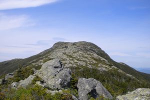
Mount Mansfield

Stowe, Vermont

miles away

Wampahoofus Trail

Underhill, Vermont

miles away

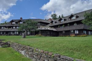
Trapp Family Lodge

Stowe, Vermont

miles away

Explore the Destination Guide

Photo of Stowe

Stowe

Vermont

Places 4

Nearby Places

Mount Mansfield

Stowe, Vermont

miles away

Wampahoofus Trail

Underhill, Vermont

miles away

Trapp Family Lodge

Stowe, Vermont

miles away

Explore the Destination Guide

Photo of Stowe

Stowe

Vermont

Places 4

Related Places

  • Tuhinj Valley

    Laze v Tuhinju, Slovenia

    Tuhinj Valley

    A beautiful drive through the foot of the Alps traces the path of 15th-century Turkish raids.

  • The ruins of the Ritter Lumber Company's sawmill at Hazel Creek near Proctor.

    Bryson City, North Carolina

    The Lost Town of Proctor

    The scant remains of this flooded historic village can be explored in one of the most remote areas of the Great Smokies.

  • The Roundhouse sits at an elevation of 7,700 feet on Bald Mountain.

    Ketchum, Idaho

    The Roundhouse

    Ride a gondola up to this historic mountainside eatery.

  • Serra da Leba Pass

    Leba, Angola

    Serra da Leba Pass

    One of Africa's windiest and most scenic roads is a national symbol of Angola.

  • The main gate of Chōshō-ji Temple, built in 1629.

    Hirosaki, Japan

    Zenringai (Zen Temple Street)

    These 33 Zen Buddhist temples were built to protect the nearby castle.

  • Monuments benefit from the mountain backdrop.

    Crested Butte, Colorado

    Crested Butte Cemetery

    A testament to Colorado’s rugged mining history sits against a backdrop of striking mountain scenery.

  • Heritage Street.

    Henderson, Nevada

    Heritage Street

    Clark County Museum has created an entire street of historically important buildings relocated from various other locations within the county.

  • Looking down Lake Como road at sunset

    Blanca, Colorado

    Lake Como Road

    The worst road in Colorado is the main gateway to some of its highest peaks.

Aerial image of Vietnam, displaying the picturesque rice terraces, characterized by their layered, verdant fields.
Atlas Obscura Membership

Become an Atlas Obscura Member


Join our community of curious explorers.

Become a Member

Get Our Email Newsletter

Follow Us

Facebook YouTube TikTok Instagram Pinterest RSS Feed

Get the app

Download the App
Download on the Apple App Store Get it on Google Play
  • All Places
  • Latest Places
  • Most Popular
  • Places to Eat
  • Random
  • Nearby
  • Add a Place
  • Stories
  • Food & Drink
  • Itineraries
  • Lists
  • Video
  • Podcast
  • Newsletters
  • All Trips
  • Membership
  • Feedback & Ideas
  • Community Guidelines
  • Product Blog
  • Unique Gifts
  • Work With Us
  • About
  • FAQ
  • Advertise With Us
  • Advertising Guidelines
  • Privacy Policy
  • Cookie Policy
  • Terms of Use
Atlas Obscura

© 2026 Atlas Obscura. All Rights Reserved.