Places Foods Stories Newsletters
Loading...
Loading...
Loading...

No search results found for
“”

Make sure words are spelled correctly.

Try searching for a travel destination.

Places near me Random place

Popular Destinations

  • Paris
  • London
  • New York
  • Berlin
  • Rome
  • Los Angeles
Places Foods Stories Newsletters
Sign In Join
Places near me Random place
All the United States Washington, D.C. Inaugural Parade Center Line

Inaugural Parade Center Line

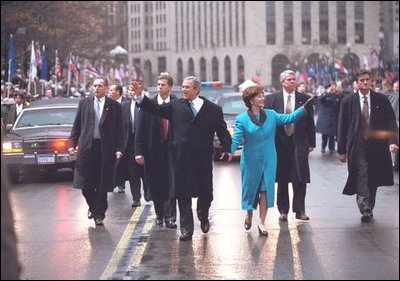
A line of blue paint marks the route of the inaugural parade.

Washington, D.C.

Elliot Carter profile photo
Added By
Elliot Carter
Email
Been Here
Want to go
Added to list
CAPTION
  Elliot Carter
  Elliot Carter
  Elliot Carter
  Elliot Carter
Been Here
Want to go
Added to list

About

Every four years the President of the United States drives (and sometimes walks) 1.5 miles from the U.S. Capitol to the White House as a part of the inaugural fanfare. The president is accompanied by an entourage of hundreds of towncars, limousines and motorcycle police, all arranged in tight V formations.

To accommodate this procession, the National Park Service gets to work weeks ahead of time clearing the path. Normal streetscape obstructions like bike lane bollards are unscrewed from the asphalt and put into temporary storage. In recent years, to keep the parade lined up, a thin blue line was painted down the center of Pennsylvania Avenue. During the parade, the lead vehicle tries to keep centered on this target.

The temporary paint will wear away in a few months after inauguration, but it’s still visible into the springtime. The practice appears to have started with President Obama; George W. Bush didn’t have a line.

Places

Discover your next amazing Atlas Place.

Get more unusual and extraordinary places each week with the Atlas Obscura Places newsletter.

Your newsletter subscriptions with us are subject to Atlas Obscura's Privacy Policy and Terms of Use.

Know Before You Go

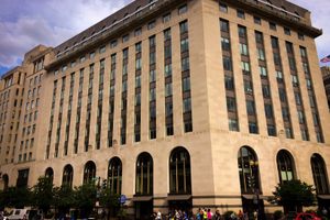
The above coordinates marks the end point of the line, in front of the Treasury Department.

Community Contributors

Elliot Carter profile photo

Added By

Elliot Carter

Published

March 28, 2017

Edit this listing

Make an Edit
Add Photos

Related Tags

Parades Government Roads Paintings
Inaugural Parade Center Line
1500 Pennsylvania Avenue NW
Washington, District of Columbia
United States
38.89877, -77.033878
Get Directions

Nearby Events

Museum Exhibit

We Make History

We Make History at the Anacostia Community Museum in Washington, DC, invites visitors to discover how everyday people...

Thu, Nov 5 · +340 more

Anacostia Community Museum — Washington

View More Events in Washington, D.C.

Nearby Places

Washington Stock Exchange Building

Washington, D.C.

miles away

Treasury Department Cash Vault

Washington, D.C.

miles away

Secret Entrance to the White House

Washington, D.C.

miles away

Explore the Destination Guide

Photo of Washington, D.C.

Washington, D.C.

United States

Places 302
Stories 53

Related Places

  • Pleasantville Curve

    Whitchurch-Stouffville, Ontario

    Pleasantville Curve

    The roadway bend where highway painters practice their craft looks like expressionist art.

  • Cherrybell Stravenue

    Tucson, Arizona

    Cherrybell Stravenue

    A rare wayfinding portmanteau of “Street” and “Avenue.”

  • Mural alongside Alfonso Wells Memorial Playground

    Detroit, Michigan

    Eight Mile Wall

    A painted-over wall in Detroit originally built to segregate a black community from an adjacent white development.

  • Giant Puppet Parade

    Siem Reap, Cambodia

    Giant Puppet Parade

    See the streets of Siem Reap light up with themed paper puppets.

  • The crossing in summertime

    Tajikistan

    Longest Road Through No Man’s Land

    The Pamir Highway between Tajikistan and Kyrgyzstan takes a mere hour driving through a stretch of No Man’s Land.

  • New mural on street

    Bellefontaine, Ohio

    Shortest Street in America

    Blink and you’ll miss it—the tiniest street in America packs a lot of charm into just a few steps.

  • Hill Road Taxi

    Hong Kong

    Hill Road Flyover

    This striking high elevated road snakes downhill between densely packed buildings.

  • Freedmen’s Town Bricks

    Houston, Texas

    Freedmen’s Town Bricks

    After emancipation, former slaves paved the roads of their newly built settlement with these bricks.

Aerial image of Vietnam, displaying the picturesque rice terraces, characterized by their layered, verdant fields.
Atlas Obscura Membership

Become an Atlas Obscura Member


Join our community of curious explorers.

Become a Member

Get Our Email Newsletter

Follow Us

Facebook YouTube TikTok Instagram Pinterest RSS Feed

Get the app

Download the App
Download on the Apple App Store Get it on Google Play
  • All Places
  • Latest Places
  • Most Popular
  • Places to Eat
  • Random
  • Nearby
  • Add a Place
  • Stories
  • Food & Drink
  • Itineraries
  • Lists
  • Video
  • Podcast
  • Newsletters
  • All Trips
  • Membership
  • Feedback & Ideas
  • Community Guidelines
  • Product Blog
  • Unique Gifts
  • Work With Us
  • About
  • FAQ
  • Advertise With Us
  • Advertising Guidelines
  • Privacy Policy
  • Cookie Policy
  • Terms of Use
Atlas Obscura

© 2026 Atlas Obscura. All Rights Reserved.